Autumn is many a hillwalker’s favourite time of year to be outdoors. There’s no better or more vibrant time to watch the seasons change. On a crisp day, the temperature can hit that sweet spot between summer heat and the nip of winter. The sights of leafs bursting with colour coupled with the sounds of their crinkle under-boot and the smells of fresh earth combine to alight all our senses. While many of the fells and mountaintops of Britain are woefully devoid of trees, there are some spots that remain classic autumn walks here on our shores.
Main image: Pap of Glencoe | Credit: Alex Roddie
Here, our expert contributors have collated and mapped out some of their favourite autumnal rambles – not too long to lose daylight in these shorter hours under the weak sun but with plenty of natural interest to keep putting you through your paces.
We hope you manage to get outside and enjoy some autumn walks. Be prepared for the conditions by investing in a good waterproof jacket, a decent pair of trail shoes or hiking boots, and ensuring your navigation skills are up to scratch during this changeable season.
Autumn walks up and down Britain
- Meall a’ Bhuachaille, Cairngorms
- Pap of Glencoe (Sgòrr na Cìche), Glen Coe
- Loch Trool, Galloway Forest Park
- Merrick, Galloway Forest Park
- Broughton Heights and Trahenna Hill, Southern Uplands
- Blanchland and Birkside Fell, Northumberland
- Whinlatter tops, Lake District
- Buttermere and Fleetwith Pike, Lake District
- Lingmoor Fell, Cathedral Cave and Blea Tarn, Lake District
- Holwick Scar and High Force, North Pennines
- Redmire Force and Penhill, Wensleydale
- Roystone Rocks, Peak District
- Aber Falls, Eryri/Snowdonia
- Gwydyr Forest, Eryri/Snowdonia
- Cnicht, Eryri/Snowdonia
- Devil’s Tor and Wistman’s Woods, Dartmoor
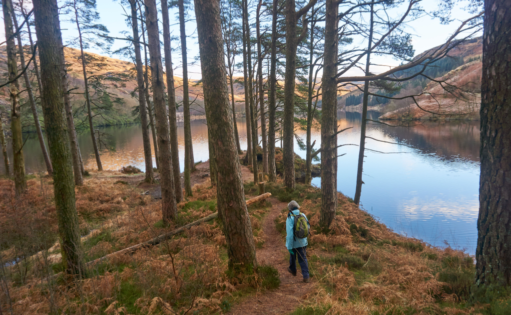
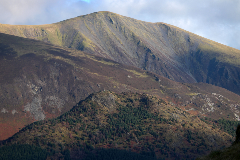
Meall a’ Bhuachaille, Cairngorms
One of the most accessible mountains in the Northern Cairngorms, Meall a’ Bhuachaille, makes one of the finest short autumn walks, says Alex Roddie.
START/FINISH: NH978097, car park at Glenmore Visitor Centre. Further parking available just along the road | MAPS: OS 1:25,000 Explorer sheet OL57 (Cairn Gorm & Aviemore), OS 1:50,000 Landranger sheet 36 (Grantown & Aviemore), Harvey 1:40,000 British Mountain Map (Cairngorms & Lochnagar) | DISTANCE: 8.9km / 5.5 miles | ASCENT: 505m / 1,657ft | DURATION: 3 to 4 hours
The Cairngorms form a vast landscape of rolling plateaus, remote corries, rugged crags, and deep glens. It’s also a subtle place, and many find that only after repeated visits do they start to get a real feel for it.
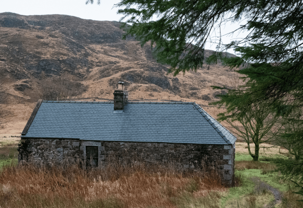
While many of these mountains are big days out and require a good degree of fitness and experience, Meall a’ Bhuachaille, a Corbett rising north of Glenmore, is an exception. Although there is some steep walking on the way up, this is a relatively short hike by Cairngorms standards and far more accessible than, say, Braeriach. With parking and accommodation options at Glenmore, this hill is feasible in half a day – and the walk is truly varied, with beautiful forest views, a stunning lochan, and even a bothy.
Meall a’ Bhuachaille’s position as an outlier from the main Cairngorms gives it an uninterrupted panorama of the Northern Corries from the top. It’s a popular hill for ski touring in the winter, although it’s perhaps at its best in autumn, when the forest colours come to life.
Here is the detailed route description for Meall a’ Bhuachaille in the Cairngorms.
Pap of Glencoe, Glen Coe
Glencoe is packed with famous mountains. The Pap of Glencoe (Sgòrr na Cìche), a pint-sized peak standing guard over its entrance, is one of the best autumn walks here, says Alex Roddie.
START/FINISH: NN107588, car park on minor road between Glencoe Village and Clachaig Inn | MAPS: OS 1:25,000 Explorer sheet 384 (Glen Coe & Glen Etive), OS 1:50,000 Landranger sheet 41 (Ben Nevis), Harvey 1:40,000 British Mountain Map (Ben Nevis & Glen Coe) | DISTANCE: 6.9km / 4.3 miles | ASCENT: 685m / 2,247ft | DURATION: 3 to 4 hours
When I first started visiting the West Highlands, the Pap of Glencoe (Sgòrr na Cìche) was high on my list of mountains to climb, and for good reason: it’s genuinely iconic. And I’m not just saying that. Approaching Glencoe from the west, the Pap stands proud above the village, just begging to be climbed. The peak’s elevation is 742m (2,434ft) – not particularly high by Scottish standards, but it is isolated at the end of a long ridge and rises directly above a sea loch, lending its summit exceptional views.
The out-and-back climb is short but surprisingly sharp. Steep and eroded paths, and some boggy sections, are soon overcome, however. Although a degree of fitness is needed for this hike, it’s one of the easiest in Glencoe, and certainly offers some of the most impressive views for the effort required to climb it.
Here is the detailed route description for Pap of Glencoe (Sgòrr na Cìche) in Glen Coe.
Loch Trool, Galloway Hills
For an easy autumn walk in tough Galloway country, Ronald Turnbull suggests the path around its loveliest loch, Loch Trool.
START/FINISH: Walkers’ car park at Caldons (can be busy at holiday times) NX396790 | MAPS: OS Explorer 319 (1:25k), OS Landranger 77 (1:50k), Harvey Superwalker Galloway Hills (1:25k) | DISTANCE: 10km / 6.5 miles [longer version 16.5km/10.5 miles] | ASCENT: 100m / 300ft [longer version 300m / 1000ft] | DURATION: 2 – 2.5 hours [longer version 4 – 4.5 hours]
With granite slabs, grassy tussocks and deep black peat, the Galloway Hills are lovable but tough. There is one really easy walk, however; and it’s a good ‘un. A smooth and well made path runs around beautiful Loch Trool, through ancient oakwood as well as young, regenerating birch trees which open wide views across the water to the Merrick range. Everyone enjoys this walk – well, almost everyone. A bloke called Aymer de Valence had a bad time on it, back in 1307. Chasing Robert the Bruce and his band of guerilla fighters into the hills, he got ambushed on this very path, granite boulders rolled down between the trees, and wild men with swords coming right down behind them.
For your own closer encounter with rugged Galloway, there’s an option at waypoint three to head up into the hills, still on a comfortable gravel track, to the Axe Head Stane overlooking Loch Dee below the crags of Curleywee.
Here is the detailed route description for Loch Trool in the Galloway Hills.
Merrick, Forest of Galloway
Andrew Galloway visits Merrick via the Culsharg bothy and explores the chain of lochs to the east of the big hill.
Start/Finish: Car Park just to the west of Bruce’s Stone. There is no charge for parking but in busy times it can be busy. | Maps: Ordnance Survey 1:50,000 Landranger nbr 77 Dalmellington & New Galloway | Distance: 15 km (10 miles) | Ascent: 900m | Duration: 6 hours
Despite the ostensible ancestral connections (my father’s family actually came from the North-East of England), I don’t visit Galloway nearly as much as I should. More often than not the rolling hills of the Southern Uplands are passed in the blink of an eye as I speed along the M74 on my way to big Highland names. More fool me. For, as I was recently reminded, the forests of Dumfries & Galloway have much to offer, not least some rugged wilderness with remarkably low footfall. At 843m, Merrick is the highest point on the mainland south of the Central Belt.
The walk to the summit via the Culsharg bothy makes for a fair challenge, particularly in the winter months. For added spice, I elected to head out from the summit into that wilderness to explore the chain of lochs to the east of the big hill. As the light began to fade and the heavens opened I had cause to question my judgment and was reminded to never underestimate the brutal beauty of the Scottish hills, no matter how far south they may be.
Here is the detailed route description for Merrick in the Forest of Galloway.
Broughton Heights and Trahenna Hill: route description
Vivienne Crow gazes coast to coast from Broughton Heights and Trahenna Hill in the Southern Uplands on an autumn walk.
START/FINISH: Broughton Village Hall car park on northern edge of village, (GR: NT111367) | MAPS: OS Explorer 336 (1:25k), OS Landranger 72 (1:50k) | DISTANCE: 15km/9.3 miles | ASCENT: 718m/2354ft | DURATION: 5-5½ hours
To stand in the centre of an island and gaze from one coast to another is always uplifting, but when that island is Britain and you’re standing on a stretch that is 160km wide, then that moment is as special as it is rare. So it was when I climbed Broughton Heights in Tweeddale and discovered that, not only could I see the Firth of Forth, the mountains of Arran were also visible on the distant, western horizon. Broughton Heights consists of a series of rounded summits along a spine of high ground, culminating in the trig pillar on Pyked Stane Hill (571m).
Starting from the village of Broughton, this walk approaches the easy-going ridge via a good track beside Hollows Burn, following the waymarked John Buchan Way up into the pretty glen. After heading out and back along the Heights it tackles another group of hills to the south, climbing a steep, heather-clad ridge on to Hammer Head and over Trahenna Hill before crossing open pastureland to drop back to the valley.
Here is the detailed route description for Broughton Heights in the Southern Uplands.
Birkside Fell, Blanchland
Vivienne Crow takes in the open and varied moorland of the North Pennines on a walking route up Birkside Fell from Blanchland.
START/FINISH: Car park on northern edge of Blanchland, GR NY965504 | MAPS: OS Explorer OL43 and 307 (1:25k), OS Landranger 87 (1:50k) | DISTANCE: 14.3km/8.9 miles | ASCENT: 271m/890ft | DURATION: 4 hours
The conservation village of Blanchland sits in a woody hollow just west of Derwent Reservoir. It owes its existence partly to the white-robed Premonstratensian monks who built their abbey here in 1169 and partly to the Bishop of Durham who bought the village in 1708. When he died, it became part of a charitable trust established by his will and, to this day, remains the centrepiece of the estate conserved by that charity.
This is an area loved by walkers for its variety. For those days when the cloud sits low on the hills, there are miles of riverside and woodland paths; on better days, head for the wide, open spaces of Bulbeck Common’s heather moorland. This walk combines the best of both worlds, first heading on to the high ground where it joins an ancient route used in the days when lead was king in the North Pennines. Another old track then eases its way through the valley of Beldon Burn before we join a wooded riverside path for the final kilometre.
Here is the detailed route description for Blanchland and Birkside Fell in the north of England.
The Whinlatter Tops, Lake District
Vivienne Crow turns her back on the icons of the Lake District and enjoys the relative solitude on some less-frequented fells on the Whinlatter tops.
START/FINISH: Spout Force car park; GR NY181255. This is 2.9km west of the main Whinlatter car park, up a track to the right of the B5292 | MAPS: OS Explorer OL4 (1:25k), OS Landranger 89 (1:50k), Harvey 1:25,000 Superwalker Lake District North | DISTANCE: 11.8km / 7.3 miles | ASCENT: 665m / 2,180ft | DURATION: 4 hours
Don’t let anyone tell you it’s impossible to find a bit of peace and quiet in the Lake District. Okay, so you’re unlikely to have the summits of Scafell Pike or Helvellyn to yourself very often, but Graystones? Or Broom Fell? Both of these Whinlatter tops lie to the north of the Forest Park and, when combined with Lord’s Seat and Barf, provide a few hours of good ridge walking.
Far-reaching views across the Solway Firth dominate much of the first part of the walk, while the Skiddaw massif will have you hooked later on, particularly from Lord’s Seat which, at 552m, is the highest point on the hike. The return route takes to forest tracks and trails. You’ll probably encounter a few more people now, including the two-wheeled variety, but we stick largely to the higher, quieter paths – far from the visitor centre – where your companions are more likely to be birds.
Here is the detailed route description for Whinlatter Tops in the Lake District.
Fleetwith Pike and Buttermere, Lake District
Francesca Donovan revels in a waterside wooded classic around Buttermere and up to Fleetwith Pike on a crisp day for one of the finest autumn walks in Lakeland.
Start/finish: The Court Hotel bus stop, Buttermere (GR: NY 175 170) | Ascent: 2,205ft / 672m | Duration: 4 to 5 hours | Distance: 6.5 miles / 11km | Maps: OS Explorer sheet OL4 – The Lake District: North-western area Keswick, Cockermouth & Wigton (1:25k)
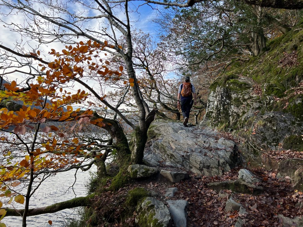
If there’s ever an excuse to stay low in Lakeland to admire the autumnal burst of colour, it can be found below the Western Fells at Buttermere. Our bare upland areas, once cloaked in forestry, don’t offer much in the way of the crunch of fallen leaves under boot many of us crave post-summer. So, for a woodland walk, there can be no more picturesque option than the bustling shores of Buttermere. It’s popular for a reason, after all.
This walk has the benefit of being quite accessible with well-kept paths along the eastern shore. While the walk up Fleetwith Pike is steep, it’s also short and very sweet. You’ll no doubt want to take it slow and stop every few steps to enjoy the view down to Buttermere and Crummock Water hugged on both sides by the surrounding fells. You’ll be glad you slowed the pace should the cloud come in and shroud the false summits of Fleetwith Pike, potentially demoralising you on the ascent. But fear not navigationally. Get your head down and follow the clear path, suitable for even the clumsiest of dogs.
Here is the detailed route description for Buttermere and Fleetwith Pike in the Lake District.
Lingmoor Fell, Cathedral Cave and Blea Tarn
Facing an uncertain forecast for her choice of autumn walks, Francesca Donovan heads for a low-level exploration of Lingmoor Fell and the iconic scenes in its small shadow.
Start/finish: Blea Tarn National Trust car park (GR: NY295043) | Distance: 9km/5.6 miles | Ascent: 381m/1,250ft | Duration: 3 to 4 hours | Maps: OS Maps Explorer (1:25k) OL6 English Lakes South-Western Area & OL7 English Lakes South-Eastern Area
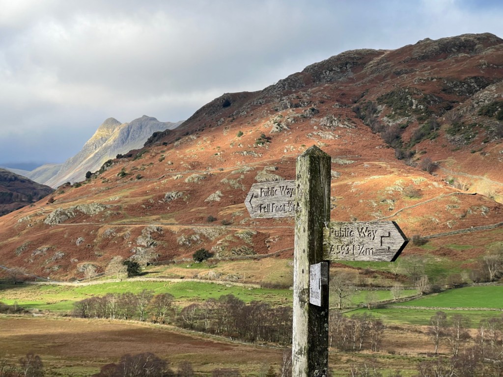
On a blustery and wet day in the central fells, when your heart is set on scrambles, a cautious but pleasing diversion might send you to Lingmoor Fell (1,530ft/466m) for a low-level, low-stakes adventure. The compact circular makes up in iconic Lakeland scenery what it lacks in elevation. Thanks to Lingmoor’s topographical isolation, your moderate effort will be rewarded with views of the Langdale Pikes. At times, they loom large in the landscape. When they are out of sight, the rolling fields punctuated by pretty tarns and views as far as Windermere will ensure you are not preoccupied with distractions.
The green slate quarrying history here adds a little magic to the route, too. You can stride along the Great Wall of Lingmoor – as the ridge wall is affectionately named – and marvel at Cathedral Caves, the majestic main chamber of the old interlinked quarries looking down over Little Langdale. If you get thirsty on route, the Three Shires Inn is just off course. But continue on, and beyond the small waterfalls along Bleamoss Beck, you can come to rest at the Blea Tarn viewing point. Here, Side Pike and Rakerigg offer a picture-perfect natural frame for the Langdale Pikes. Alternatively, The Old Dungeon Ghyll isn’t far away for a post-walk pint – and Hardknott Pass is something to behold (in low gear). With all this on offer, it’s an undeniably popular area for walkers and photographers alike. You may not find solitude but you will have a spectacularly varied ramble.
Here is the detailed route description for Lingmoor Fell, Cathedral Cave and Blea Tarn in the Lake District.
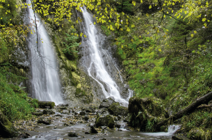
Holwick Scar and High Force, Middleton-in-Teesdale
Ian Battersby tackles a route to the mighty High Force waterfall – and its little brother – in search of unburied family jewels.
Start/Finish: Bridge over the River Tees at Middleton-in-Teesdale (GR: NY947253) | Maps: OS Landranger 92 (1:50k) | Distance: 21.3 km / 13.3 miles | Ascent: 565m / 1853ft | Duration: 6 hours
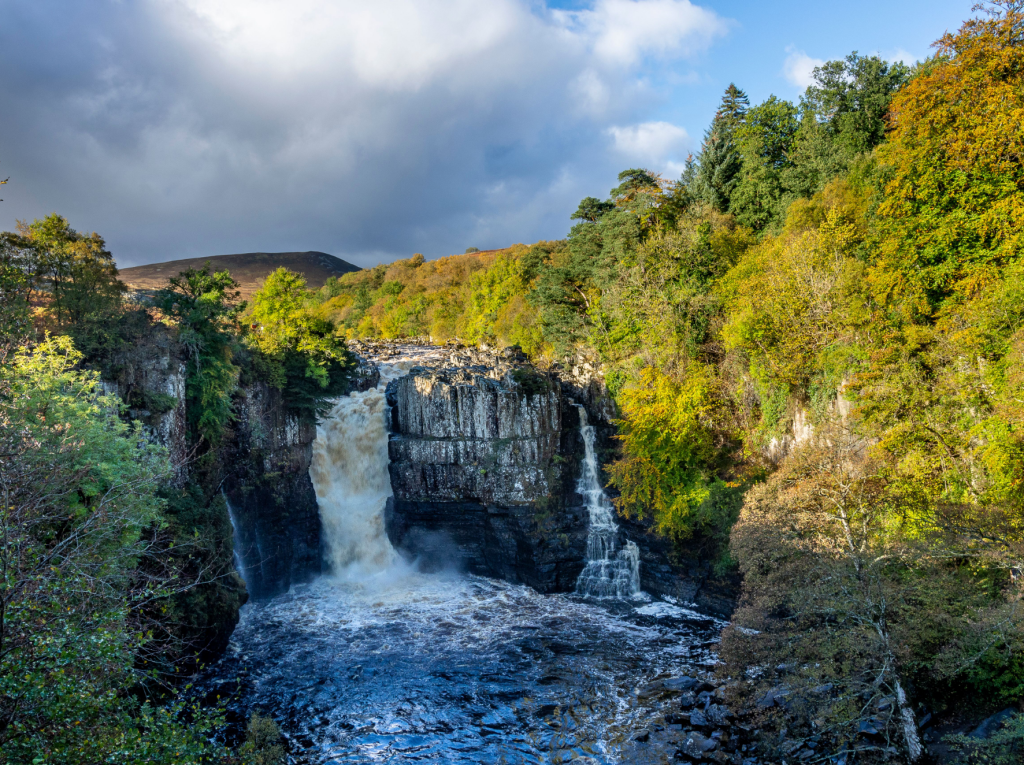
The River Tees cuts a sweeping path down a dale that has been shaped by glacial carving and meltwater scouring. The erosive conclusion has uncovered riches laid down many millions of years before the glacier was even a twinkle in the Pole’s eye. It was then that the planet’s crust yielded to pressure, leaking golden molten rock into subsequent underground voids.
There it cooled into the solid Whin Sill fault line until the glacier stripped away feeble capping layers only being halted by this durable dolerite, which now shapes the most prized diamonds of the vale. The river would be another steady stream of rippling precious stones but for this resolute band of confrontation. Instead, it is interrupted by violent torrents bellowing over Low Force – and if you think that’s good wait until you meet big brother High Force. Then you really should visit the dramatic Holwick Scar to extend this autumn walk.
Here is the detailed route description for Holwick Scar and High Force in the North Pennines.
Redmire Force and Penhill, Wensleydale
Wensleydale is a grand location for the spectacle of Autumn, argues Ian Battersby. Here’s one of his favourite autumn walks.
START/FINISH: Layby at Wensley Bridge; SE092894 | MAPS: OS Explorer OL30 (1:25k), Harvey Superwalker XT25 Yorkshire Dales North East (1:25k) | DISTANCE: 18.75km / 11.7 miles | ASCENT: 445m / 1,460ft | DURATION: 5 hours

Hills deliver the thrills most of the time, but in autumn the lowlands carry the flame. Leaves are the magical food factories for plants, capturing sunlight to make sugar, but after the summer, when they have reached their ragged end, their green colour breaks down yielding regal reds, oranges and yellows. It’s a popular time of year as the effect upon the landscape is truly inspirational.
Wensleydale in North Yorkshire excels in this season. The River Ure meanders, hidden between the boughs of flourishing trees and rivers are fine locations for the autumn flush. Stop at Redmire Force where the river thunders over a series of open rocky shelves, and downstream bubbles collect in dark, hypnotic swirls. But, this vale offers so much more. Glacial deposits abound, with compelling oval hillocks flattering much of the valley floor. This rolling landform has thrown a life line for trees that might otherwise have been farmed away. These alluring curves contrast with the stepped terraces above, whose straight lines are also bolstered with the presence of trees. Walk along them to discover a stage overlooking arboreal delight on this autumn walk.
Here is the detailed route description for Redmire Force and Penhill in Wensleydale.
Roystone Rocks & Minninglow, Peak District
Roger Butler discovers hills and history at Roystone Rocks and Minninglow in the pastoral White Peak.
Start/Finish: Lay-by parking on A515, 1km south of Newhaven, grid ref SK165592 | Map: OS Explorer OL24 (1:25k); OS Landranger 119 (1:50k) | Distance: 13.5km / 8½ miles | Ascent: 280m / 920 feet | Duration: 5 hours
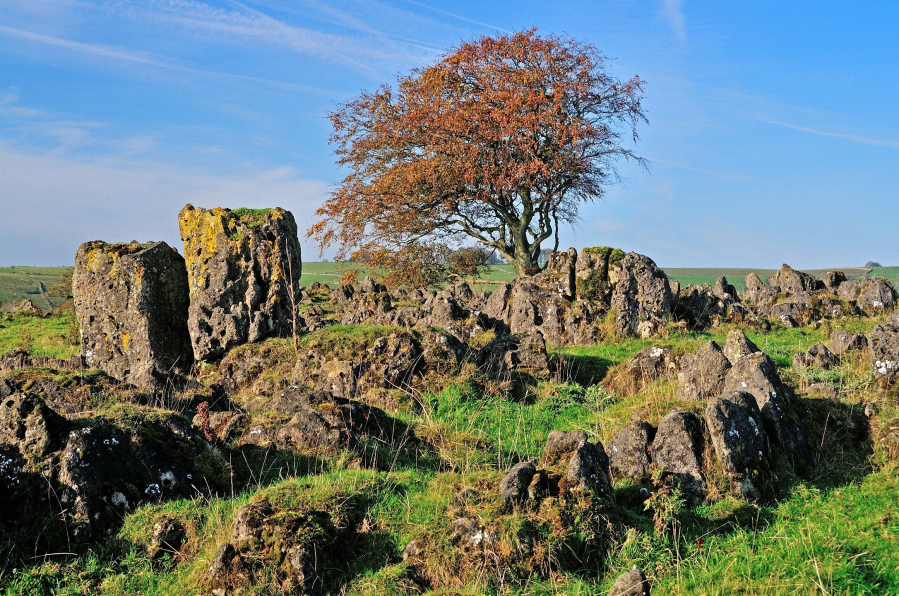
Our hills and dales never fail to surprise and the unexpected stone-splattered top known as Roystone Rocks is unlike anywhere else in the White Peak. This is the sort of place where you are allowed to use your imagination: it’s a ruined village; it’s a mini-Utah; it’s the cover of a famous Pink Floyd LP; it’s a jumble of boulders that must have been melted and moulded by a malevolent wizard. Chequerboard walls and crumpled shallow valleys stretch in every direction but, from the low ragged summit, the real eye-catcher is the distant clump of trees on top of Minninglow Hill.
This resembles a crown topped with half a dozen jewels – the result of new planting which encloses tall over-mature beech trees – and it marks the location of important tombs which date back to 4,000BC. Take the path to the top and you’ll soon be asking yourself questions. Who was buried here? Was there a grand ceremonial march up the hillside? And did those Neolithic peoples appreciate the distant views and ever-changing horizons? You certainly will!
Read more: the full route description for Roystone Rocks and Minninglow
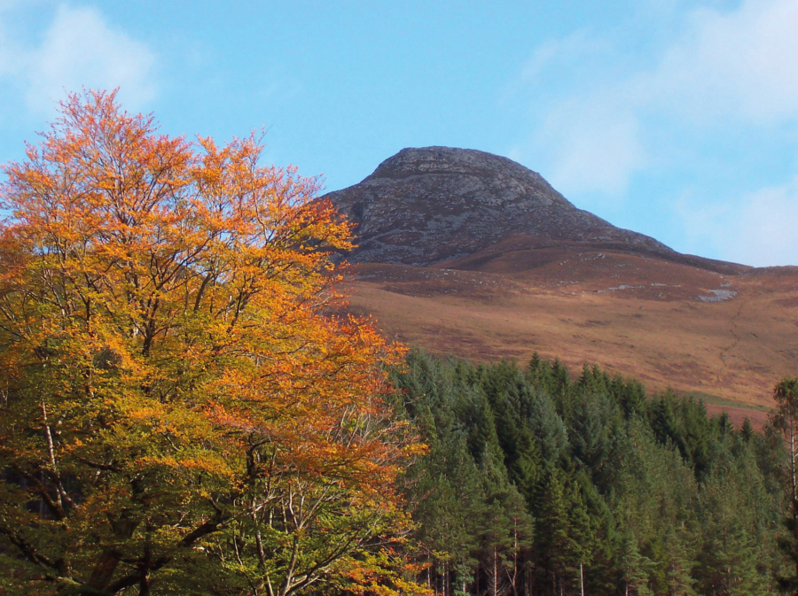
Aber Falls, Eryri/Snowdonia
Andrew Galloway escapes on an easily accessible sea-to-summit Snowdonian route past Aber Falls and into the hills overlooking the Menai Strait.
Start/Finish: Parking at Bont Newydd Abergwyngregyn (GR: SH662720) | Maps: OS Explorer (1:25,000) OL17 | Distance: 14.5km/9 miles | Ascent: 500m/1640ft | Duration: 5 hours

Situated just a mile south of the village of Abergwyngregyn, and easily accessible from the A55 North Wales Expressway, the Coedydd Aber Nature Reserve is one of my favourite locations in Snowdonia. This beautiful glacial valley looks out from the foothills of the Carneddau Mountains over the waxing and waining waters of the Menai Strait, offering a truly sea-to-summit experience of Snowdonia and its Aber Falls.
At the head of the valley stands the craggy peak of Bera Mawr, a challenge for even the most experienced of walkers. Wild ponies roam free on the slopes of these hills, from where the ebullient waters of Afon Goch rise before tumbling one hundred and twenty feet into the valley floor. Rhaeadr Fawr, known as Aber Falls in English, is certainly the star attraction, but there are other treasures here. The extensive woodlands of ash and oak are a haven for a variety of birds and other wildlife. In winter dippers and grey wagtails can be seen hopping from rock to rock beneath the falls. In spring wood warblers, redstarts and crossbills make their home among the coppiced alder trees. It also makes a fine autumn walk.
Here is the detailed route description for Aber Falls in Eryri/Snowdonia.
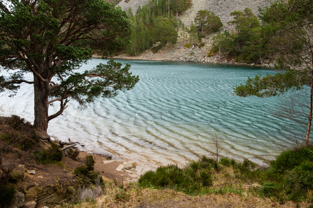
Gwydyr Forest, Eryri/Snowdonia
In Gwydyr Forest Andrew Galloway finds water wherever he goes.
Start/Finish: Gwydyr Car Park located on the B5106 close to the Llanrwst sports fields | Distance: 20 km (12 miles) | Ascent: 626m (2,050 feet) | Time: 5 hours | Maps: Ordnance Survey 1:25,000 Yr Wyddfa/Snowdon Dyffryn Conwy Valley OL17
Whether in the stillness of Llyn Crafnant & Llyn Geirionydd, crashing through the Llugwy river gorge, or tumbling over the leafy crags of Coed Felin Blwm, water forms an integral part of the Gwydyr Forest landscape. The ample supply of this natural resource made these wooded foothills of the Carneddau attractive to the 19th century mining industry. The area is dotted with reservoirs, criss-crossed with meandering leats, built to feed the water wheels that powered the machinery of the metal mines, from which lead and zinc were extracted. Llyn Geirionydd is popular with water sports enthusiasts. The village of Llanrhychwyn is less than a mile away. Anyone who knows anything about the Welsh language will know that “llan” often refers to the location of a church. Rhychwyn is believed to have been one of twelve sons of Helig ap Glannog, a 6th century prince who, according to legend, lived on the isle of Llys Helig, until it was submerged by the waters of the Menai Straight in a violent storm. Established by Rhychwyn in honour of his father, this church is believed to be the oldest extant site of Christian worship in Wales.
Here is the detailed route description for Gwydyr Forest in Eryri/Snowdonia.
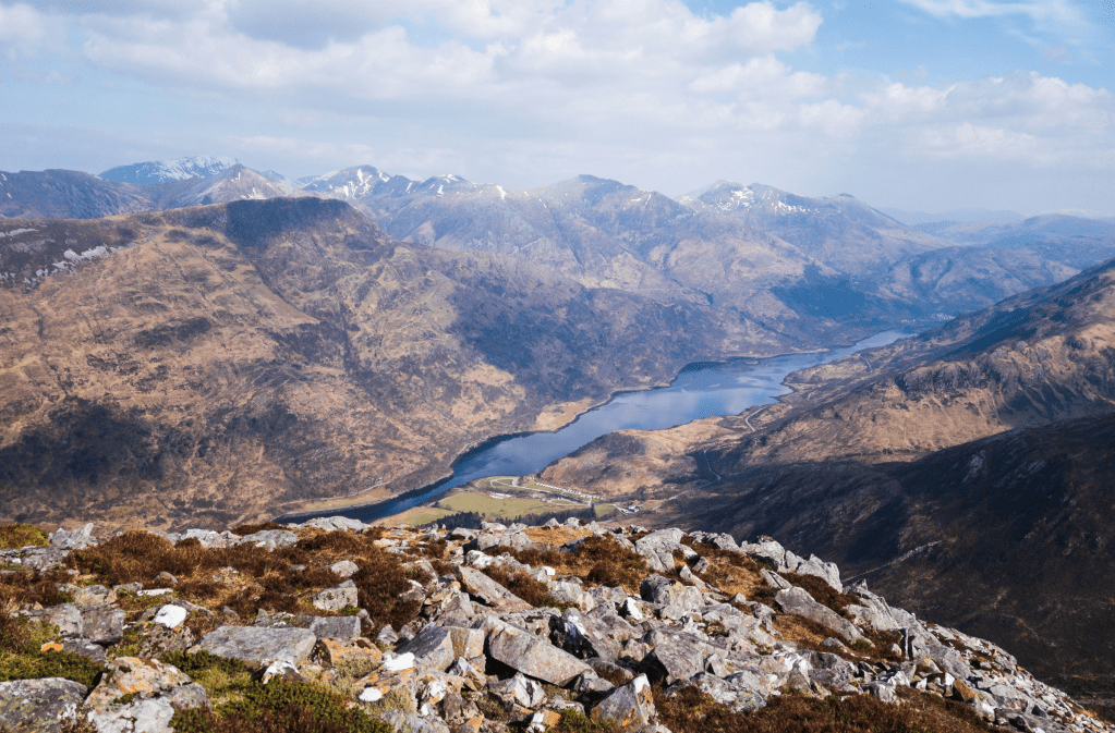
Cnicht, Eryri/Snowdonia
Francesca Donovan goes on a circular wander up to the ‘Welsh Matterhorn’, Cnicht, and finds a spectacularly underrated mountain.
Start/finish: Croesor car park (GR: SH631446) | Distance: 6.8 miles / 11km | Ascent: 2,093ft / 683m | Duration: 5 hours | Maps: OS Explorer OL17 (Snowdon/Yr Wyddfa)
Dare I say it? Cnicht is the finest peak in Eryri/Snowdonia. Despite its relatively modest 689m (2260ft), it offers spectacular panoramic views down to the Irish Sea and northwest to Yr Wyddfa/Snowdon itself on a short and sweet excursion. But here, despite the spoils, you’ll find far less foot traffic. Cnicht’s two tops and prominence of just 104m might mean it forgoes true mountain status. Yet, this peak – a perky pyramid befitting its nickname of ‘the Welsh Matterhorn’ – does allow you to get high in relative solitude.
While there are number of routes up Cnicht, this is especially true if you take a circular route from Croesor avoiding the major trails in favour of quieter footpaths where possible rather than taking a there-and-back option. In doing so, you will also experience much of what the Moelwynion has to offer: an abundance of flora and fauna, waterfalls trickling down slick slate, a short scramble, vast mountain llyns tucked behind tussocky ground, edge-of-your-seat walking along high ridges towards sea-to-sky views and incredible artefacts of recent mining history. For woodland lovers, a highlight will be the descent through pretty dappled woodland paths back to Croesor – it makes for a fine autumn walk.
Here is the detailed route description for Cnicht, Eryri/Snowdonia.
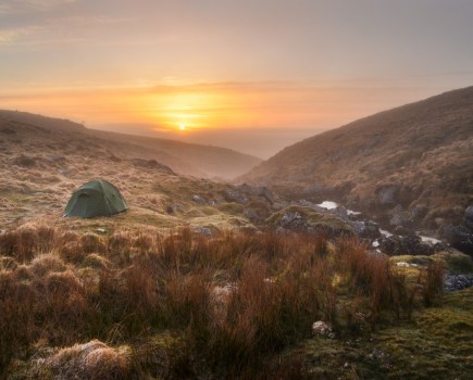
Devil’s Tor and Wistman’s Woods, Dartmoor
Dartmoor abounds with tales and legends, and the upper reaches of the West Dart River are no exception. So, why not visit Devil’s Tor and Wistman’s Wood and see what emerges from the undergrowth, suggests Tim Gent.
START/FINISH: The car park at Two Bridges; SX 609 751 | MAPS: OS Explorer OL28 | DISTANCE: 13.5km / 8.5 miles | ASCENT: 310m / 1,020ft | DURATION: 3-4 hours
Scientists will tell you that Wistman’s Wood is a fragmentary remnant of a once sizeable upland temperate rainforest. They will cite the many species of epiphytic moss, fern and liverwort that clothe the trees, or tell us that this is one of only two sites in Britain that provides a home for the horsehair lichen. They can name the lizards and shrews that skitter across the fallen leaves and the birds that flit amongst the branches, yet still fail to list every creature that lurks amongst those gnarled and ancient oaks. For the devil hunts these moors at night, and as dawn approaches, this wood is where he kennels his hounds. Walk here as dusk approaches and it is claimed the Wisht Hounds can be heard baying for release.
And don’t feel too safe once back at your car. The road between Two Bridges and Postbridge is reputed to be home to the Hairy Hands. First reported in the 1920s, these fiendish disembodied hands are said to grasp at steering wheels or motorcycles handlebars, forcing the helpless motorist off the road.
But let’s start this autumn walk with a visit to the devil, or at least his tor, lying close to one of the tallest standing stone on the moor.
Here is the detailed route description for Devil’s Tor and Wistman’s Woods in Dartmoor.