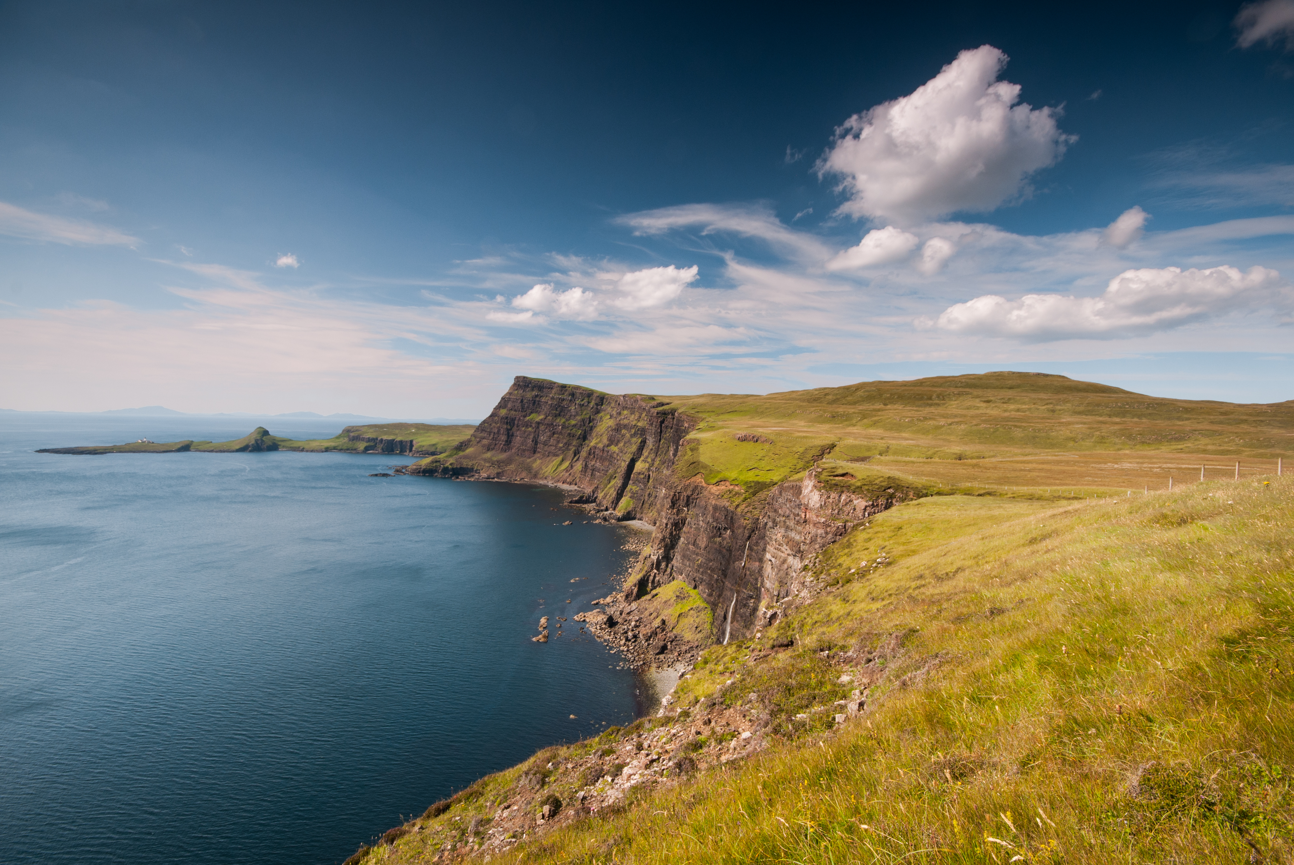
Walk Two – Ord to Dun Scaith Castle (6km – 1.5hrs)
Eilean Ruaridh from close to Dun Scaith Castle. Credit: Alastair Jackson Photography
An easy walk above low cliffs with some of the best coastal views in the country. Heading south to Armadale on the A851 turn left onto the minor loop road marked Ord/Tarskavaig. After about 6km, you will come down the hill to the coast where there is a large gravel parking area at Ord. After exploring the beach and its views, simply head over the bridge, and follow the gently undulating coastline for a couple of kilometres to the ruins of Dun Scaith Castle. The castle, perched on a rock above Loch Eishort, was a stronghold of the Macleods before it became the principal seat of the MacDonalds of Skye in the 15th century.
Walk Three – Dalavil and Gillean (9km -5hrs)
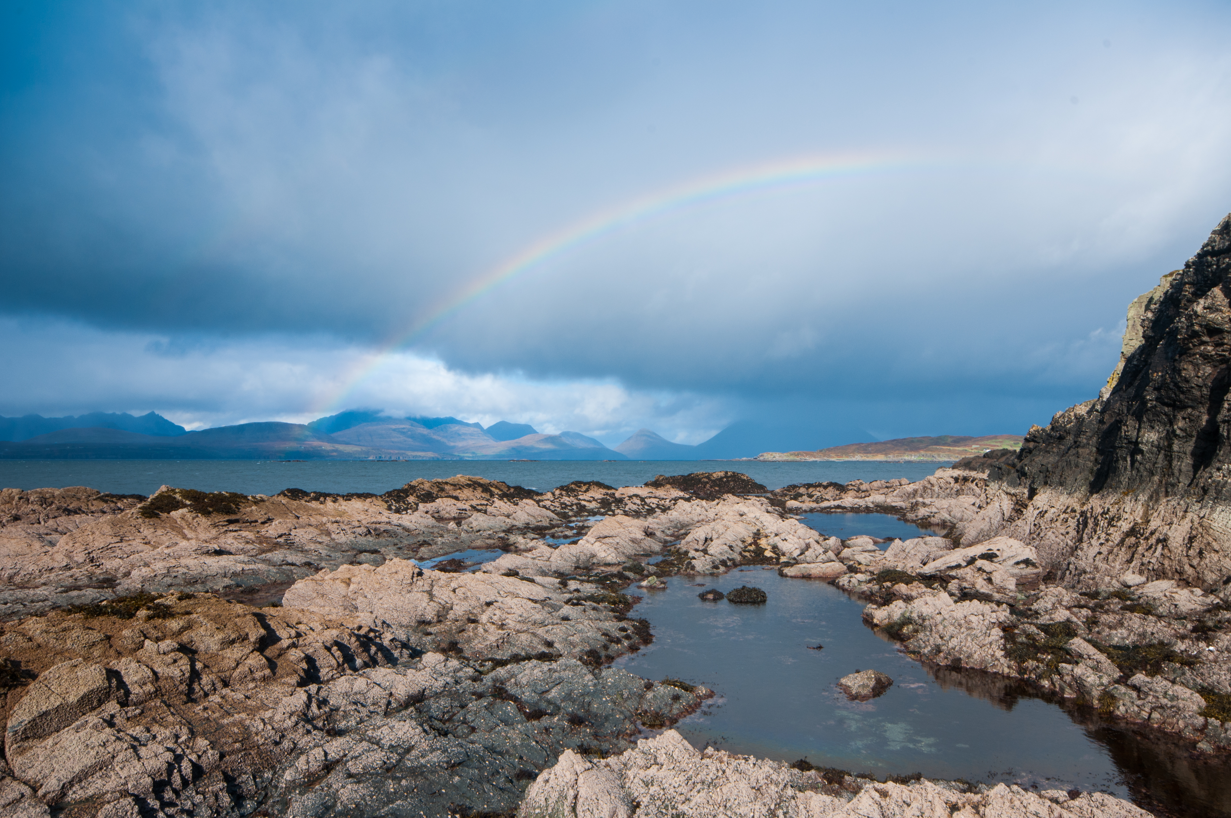
Rainbow at Rubha Sloc an Eorna. Credit: Alastair Jackson Photography
A challenging walk across moorland and very rough coastal terrain where you will encounter sea caves, oystercatchers and possibly sea eagles, and a delightful unnamed sandy beach. This walk requires two cars, one to be left at the large pebble beach at Gillean, and one at the signpost for Dalavil (both on the same loop road as above). Follow the rough track down to the loch with old beech trees and native woodland. From there simply continue a short distance to the shore. The rest of the walk to Gillean is along a challenging shoreline and should only be attempted at low tide, however, sheep tracks can be followed along the low cliffs above. If attempting the shoreline walk, you will need to head up a gully after 3km to avoid the abutting headland rock of Rubha Sloc an Eorna.
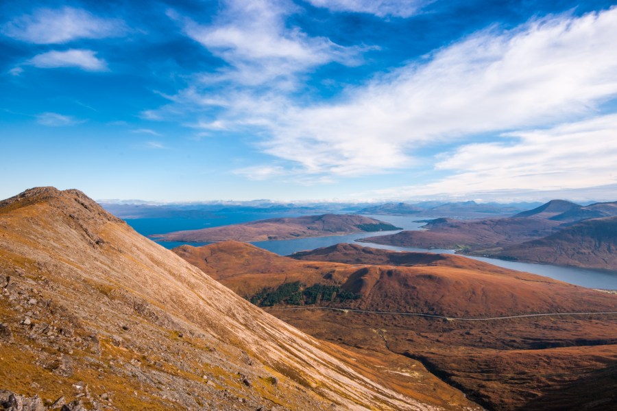
Walk Four – Glamaig (6.5km – 4.5hrs)
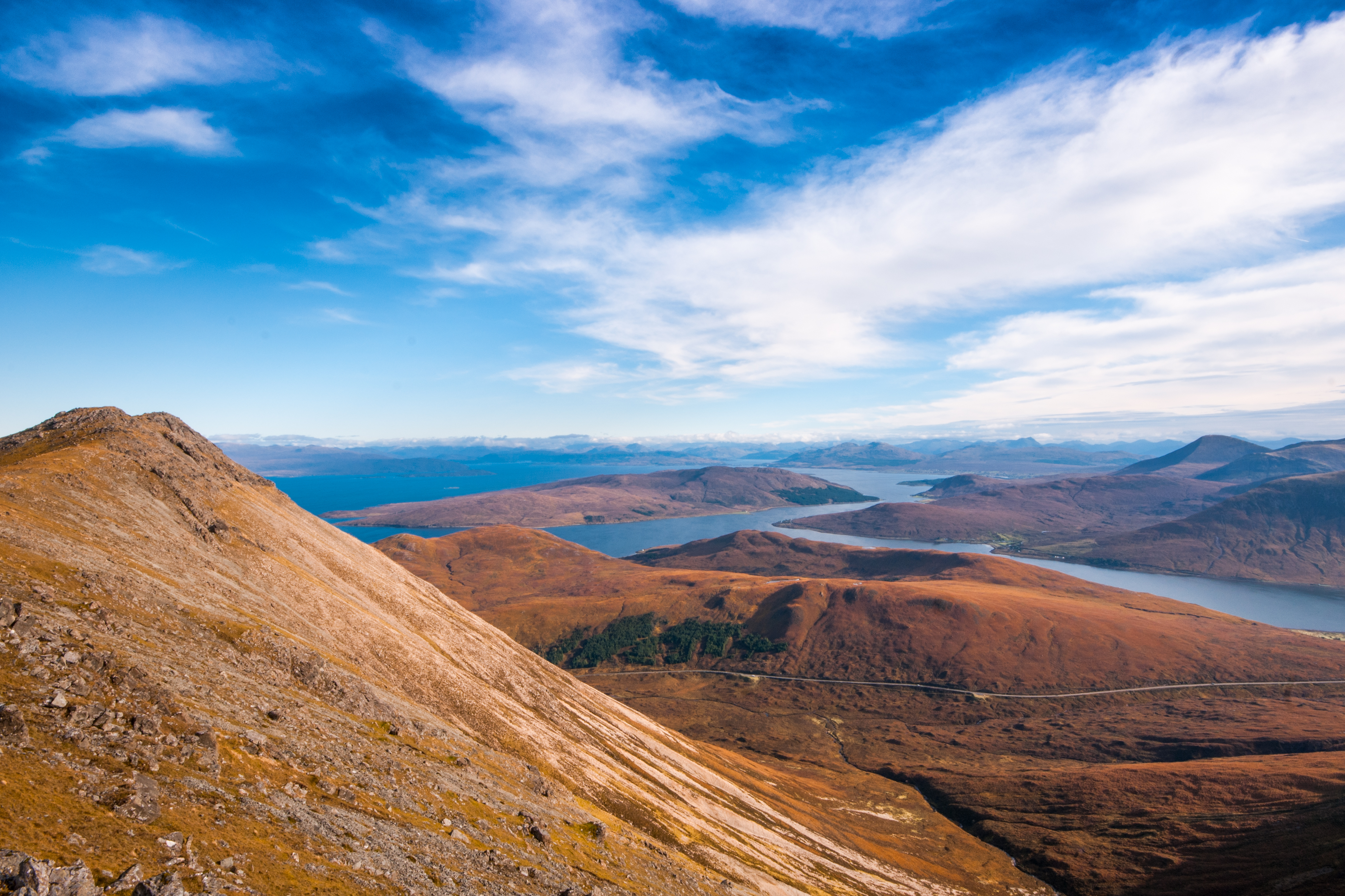
Summit ridge of Glamaig looking NE. Credit: Alastair Jackson Photography
A muscle stretcher from a sea level start to the 827metre peak of Glamaig in the Red Cuillin. This route avoids the scree runs from the Sligachan side, and because of its central position offers some of the best views to both the island of Raasay, the Black Cuillin and west of Skye & Small Isles. I had driven past the intimidating peak of Glamaig for decades, before finally making an assault on it last October. And it was certainly worth it. Park in the lay-by on the A87 just south of Sconser Golf Club. Head back along the road a short distance to a gate, and follow the fenceline up the slopes. Its an unrelenting route one slog all the way up, but the summit views are remarkable, and gratefully received.
Note: Some crazy folk like to run the annual Glamaig Hill Race from Sligachan. The race record is now a staggering 44 mins 27secs!
Walk Five – Talisker Bay (3.5km – 1hr)
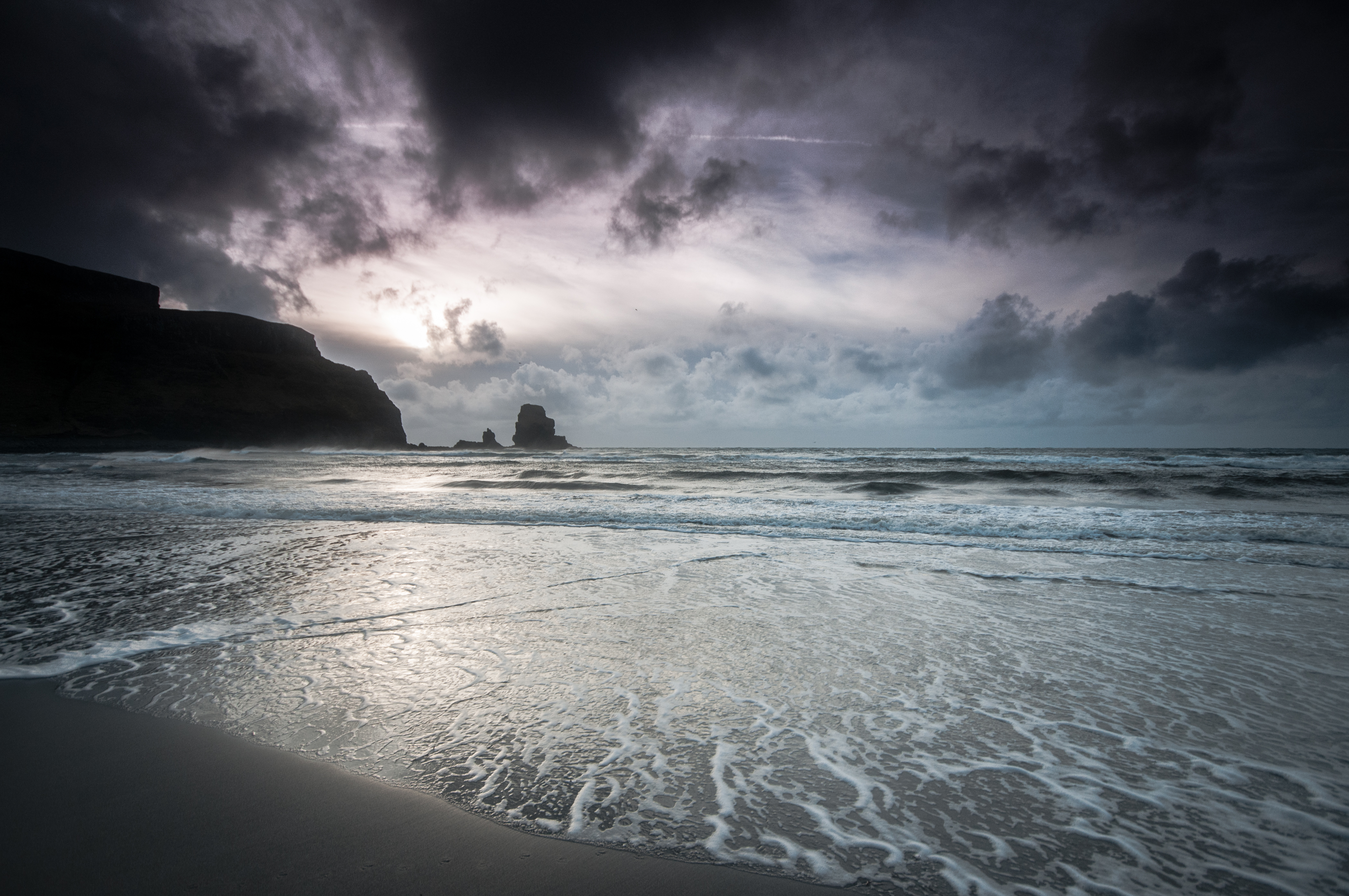
Not a picnic day at Talisker Bay! Credit: Alastair Jackson Photography
A short stroll to a black sand beach. Don’t make the mistake that many visitors do of driving to Talisker Distillery. Although, that’s no bad thing in itself! Park carefully near the end of the tarmac road to Talisker township, taking care not to block the turning area. Simply head through the gate past the white house, where Johnson and Boswell once stayed on their tour of the Highlands, and follow the track to the shore. An ideal walk for families to enjoy a picnic and a paddle in the Summer. Equally stunning on a stormy Winter day
Walk Six – Oronsay Tidal Island (5km – 2hr)
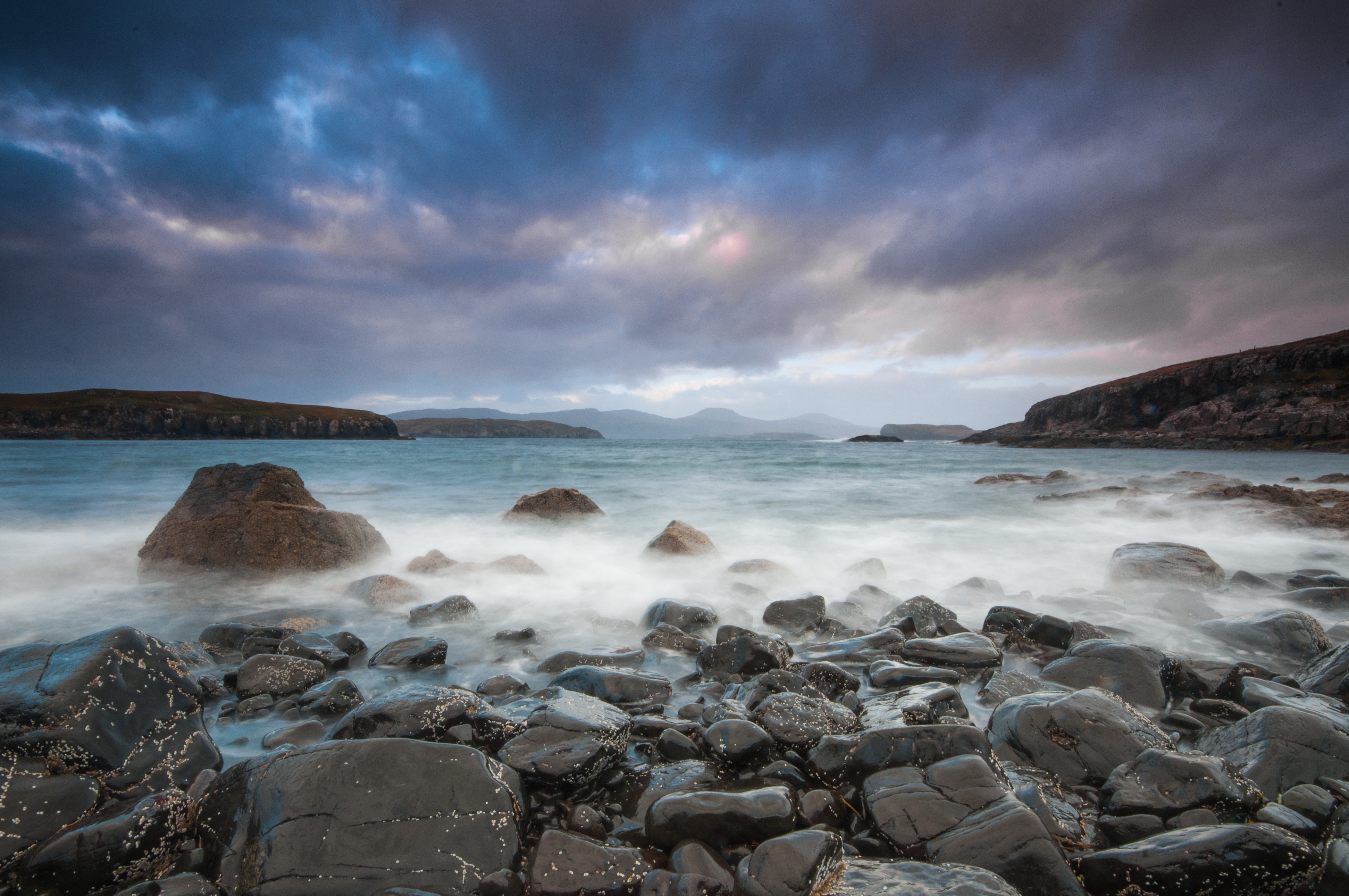
Crossing the causeway to Oronsay. Credit: Alastair Jackson Photography
A splendid walk to an island ‘off’ an island which is a delight at any time of the year with the possibility of seeing otters, dolphins & gannets. Note that it can only be done at low tide. You must time your visit to the Island carefully so that you do not get stranded. The nearest port with tide times is Loch Harport and these can be found on a number of tide chart websites. Park your car at the end of the single track road to Uillinish, where there is room for 5 cars, and head through the gate, following an easy path through another three gates. Eventually you’ll come to the causeway, which is about 220m long and comprised of pebbles and larger rocks. If the tide is heading out, you’ll have plenty time to explore as the causeway is covered with water roughly 2.5 hours each side of high tide.
Walk Seven – Waterstein Head and optional: South Duirinish Cliff walk (5km – 2hrs )
Looking back to Waterstein Head and Neist Point. Credit: Alastair Jackson Photography
Avoid the crowds of Neist Point in the Summer, and get better views on this stunning short walk to the 296m clifftop summit of Waterstein Head. Allow two hours to drink in the views, but be careful not to get too close to the edge. Park the car at the top of the steep hill leading down to Waterstein. You will see a turf wall running along the ridge towards your objective. Follow the ridge, as it climbs , and then continue along the edge of the cliff, on a well-worn track until you reach the summit and Trig Point. If you want to extend the walk, it’s possible to continue south along the cliff top on short springy turf on the inside of the fence line.
Walk Eight – Uiginish Point (4km -2hrs)
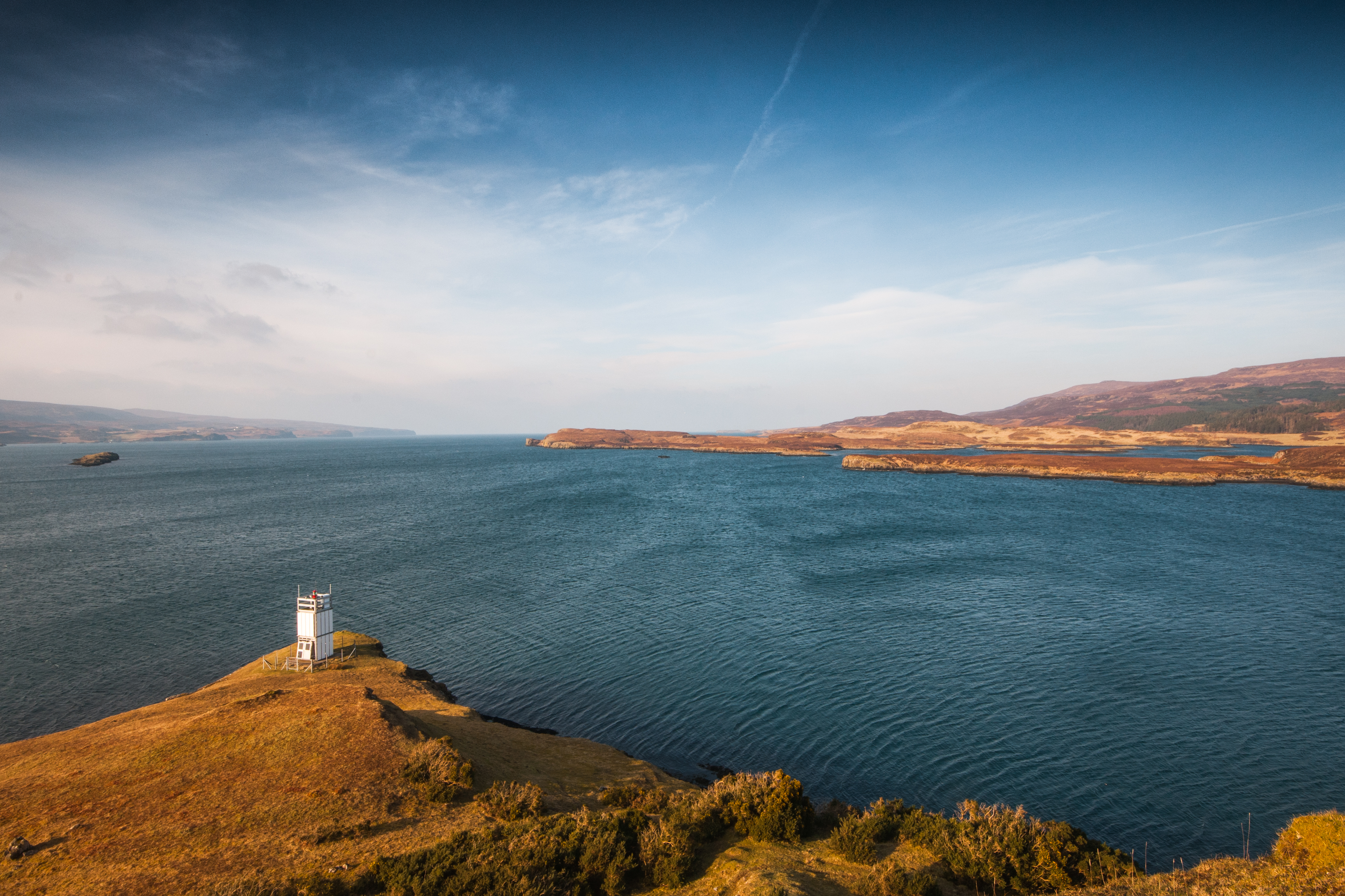
Uiginish Point & Lighthouse. Credit: Alastair Jackson Photography
An easy walk with fantastic sea views and almost guaranteed grey seals en-route for good measure. I disturbed about 20 of them once as they lazily plopped into the water, then popped their nosy heads upto see what the disturbance was. Park your car on the B884 road to Glendale just before the sign for Skinidin, and simply follow the coast all the way to the point with its lighthouse. There are no navigational issues, but note that this route is pathless, and you will have one stream crossing to negotiate on slippery boulders.
Walk Nine – Waternish Point (13.5km – 3.5-4hrs)
Waternish Point is a remote and bleak yet beautiful spot, with wonderful sea views, and interesting historical sites. You can almost hear the clashing of claymores from ancient battles and massacres. It’s an excellent place to watch for whales and dolphins too. Note that the walk crosses croft land and dogs should be kept on a lead. Park at the ruins of Trumpan church, at the far end of the Waternish road, where it does a slight loop back on itself. This spot was the site of one of the bloodiest massacres on Skye which took place in 1578. Head down the long downhill straight stretch of road for 0.5 km, and turn through the gate on your left onto a muddy track. You’ll pass two ruinous brochs along the way which are worth exploring. After the second broch, head off the track and follow the low cliff top to Waternish Point.
Walk Ten – Quirang Car Park to Beinn Edra Summit (14.5 km – 4.5hrs)
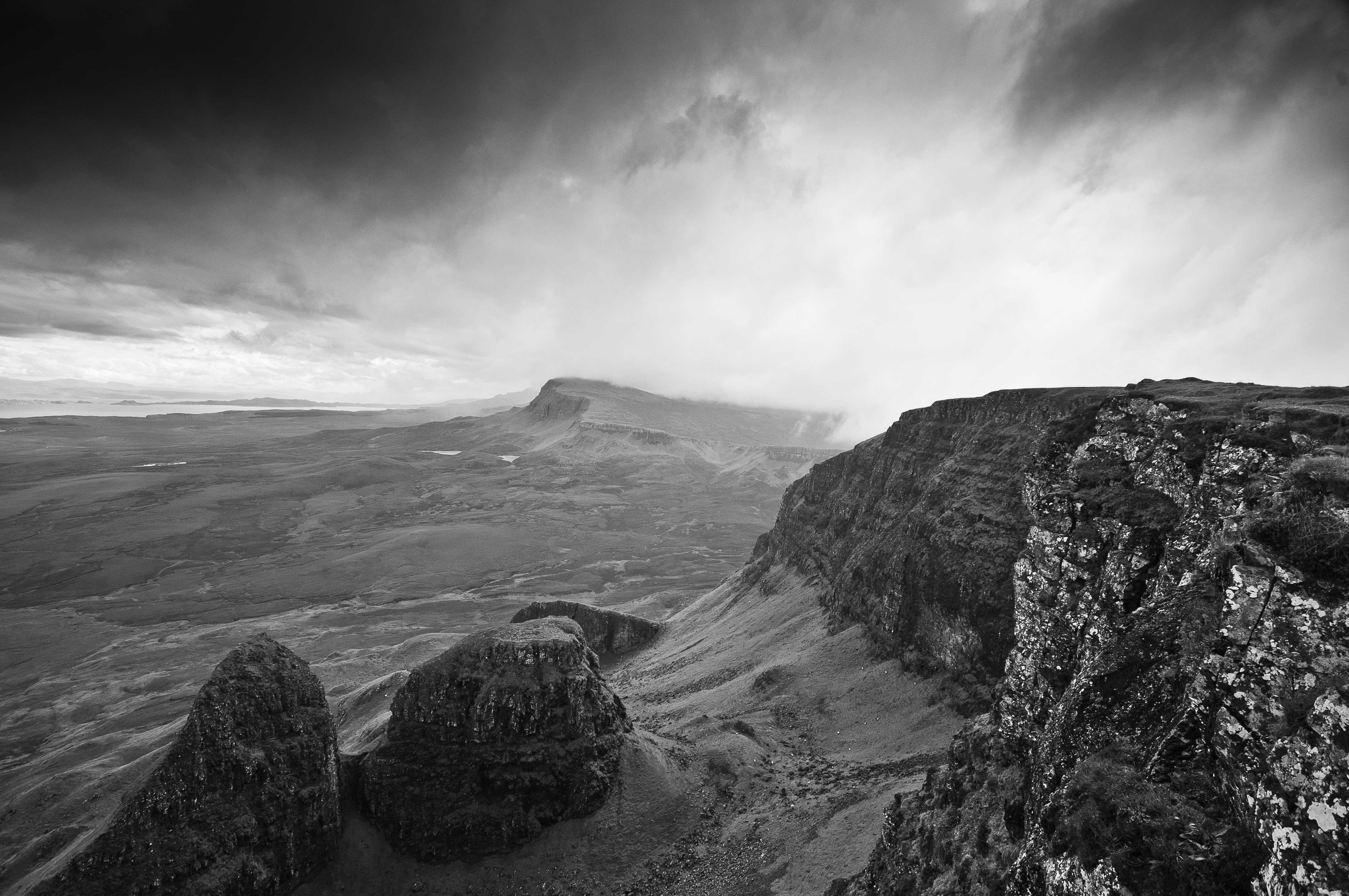
Biodha Buidhe & Pinnacles with Beinn Edra in background. Credit: Alastair Jackson Photogaphy
A long, yet relatively easy walk along an escarpment of amazing geological features. Leave early in the day to bag a parking spot at the Quirang car park, as it can get very busy in the Summer months. Note that there is a pay and display of £3 for up to 3 hours or £5 for up to 6 hours. The route is easy, simply turn right and follow the edge of the escarpment to Bioda Buidhe with its spectacular cliffs and the pinnacles of Dun Dubh and Druim an Ruma. The rock scenery is almost a match for the Quiraing and I’m always delighted to see everybody heading left from the car park! The summit has fine views in all directions -south along the Trotternish Ridge, east to the mainland over Staffin Bay, west over Uig Bay and north to the Quiraing.
Walk Eleven – Rubha Huinish (8km -3hrs)
A walk to the northern tip of Skye with views to the Outer Hebrides on a clear day, and potential for orca watching, with the ruined castle of Duntulm thrown in for good measure. Park at the marked castle car park just off the A855 and head down there for a quick stroll. Back at the car park turn left onto the road for 0.5km and then left down a track passed the, sadly closed, Duntulm Castle Hotel. Follow the shore and you’ll reach a path which will take you up, down, and back up again where you’ll cross two stiles and reach a metal gate to your right. Here you can choose to head down to the Hunish headland, or simply enjoy the stunning views if it seems too much of a scramble down the cliff path.
More about Alastair