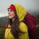
A ramble and a country pub: a classic combination as old as ale. After months of winter, hillwalking can help you blow away the cobwebs. While those short hours outdoors walking in the weak wintery light is almost always restorative, time indoors by the fireside in a great walkers’ watering hole can warm the soul, too. In their toughest assignment yet, our experts share their favourite pub walks for those gloomier days when a pint is the most fun you can have with your hiking boots on.
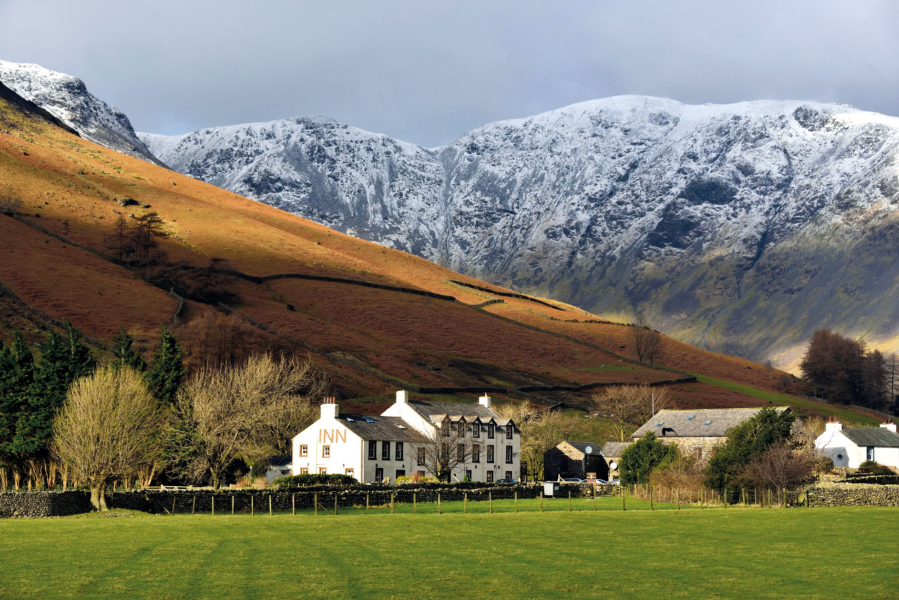
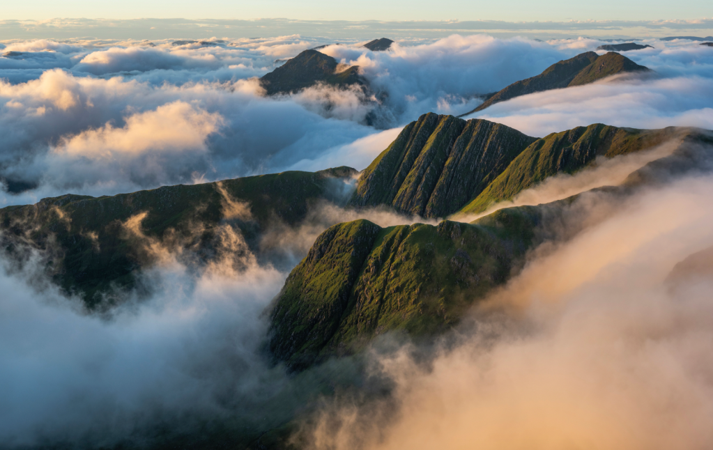
Main image: Wasdale Head Inn | Credit: Alamy
Our pick of the pints: the best pub walks in Britain
- Bruach na Frithe from Sligachan Hotel – Isle of Skye
- Ladhar Bheinn via the Old Forge – Knoydart
- The Lost Valley via the Clachaig Inn – Glen Coe
- Sgòr na h-Ulaidh via Clachaig Inn – Glen Coe
- Ill Bell via the Mortal Man – Lake District
- Mellbreak via Kirkstile Inn – Lake District
- Barton Fell via The Sun Inn – Lake District
- Kirk Fell via Wasdale Head Inn – Lake District
- Nine Standards Rigg via The Black Bull – North Pennines
- The Calf via The Cross Keys Temperance Inn – Howgills
- Tan Hill via Tan Hill Inn – Yorkshire Dales
- Cadair Berwyn via The Hand at Llanarmon – North Wales
Bruach na Frithe from Sligachan Hotel
James Roddie starts and ends a day on Bruach na Frithe at the famous Sligachan Hotel – frequented by climbers and mountaineers since the 1830’s.
Start/finish: NG 4856 2985 (Sligachan Hotel) | Ascent: 3271ft/997m | Duration: 5-7 hours | Length: 9.8 miles/15.8km | Maps: OS Explorer 411 (Cuillin Hills)
Many of the UK’s most technically challenging summits can be found in one small area on the Isle of Skye – the Black Cuillin. There are 11 Munros on the Cuillin Ridge, along with neighbouring Bla Bheinn, and most of them require technical scrambling skills to reach their summits safely in summer. Under snow, many of these Munros become serious winter mountaineering routes. Bruach na Frithe is amongst the least serious of the bunch, and whilst it is by no means a pushover in winter, it is within the grasp of most experienced winter hill walkers. In good weather and conditions this route provides a great introduction to the winter Cuillin, but you will need to be proficient with an ice axe and crampons, and comfortable on steep terrain under snow. The day starts and ends at the famous Sligachan Hotel – frequented by climbers and mountaineers since the 1830’s.
Here is the detailed route description for Bruach na Frithe from Sligachan Hotel.
Ladhar Bheinn via The Old Forge, Knoydart
James Roddie walks a long way for a remote pint at The Old Forge, commonly credited as Britain’s most hard-to-reach watering hole.
Start/finish: Inverie Pier (NG 7649 0017) | Maps: OS Explorer 413 (Knoydart, Loch Hourn and Loch Duich) | Distance: 13.75 miles/22.1km | Ascent: 4570ft/1393m | Duration: 9 to 12 hours
Ladhar Bheinn is one of Scotland’s remotest Munros, and surely one of the most memorable. To reach its summit by any route requires considerable effort, and will involve walking into the heart of the beautiful Knoydart peninsula. This is a unique place with a sad and complex history, but alive with a tangible sense of optimism and community.
Some walkers will choose to approach Ladhar Bheinn via a tough (but excellent) walk from Kinloch Hourn. Most popular, however, is the route described here. A boat trip from Mallaig harbour takes you to the small village of Inverie, where the route begins and ends. Whilst the initial few kilometres of walking are not particularly inspiring, this is quickly forgotten when the views begin to reveal themselves as you gain height. This is one of the UK’s finest mountain landscapes. On a clear day, Ladhar Bheinn’s summit view is amongst the best in Scotland. To reward your efforts, end your walk at the Old Forge Inn in Inverie, for an extremely well-earned pint and meal.
Here is the detailed route description for The Old Forge via Ladhar Bheinn.
The Lost Valley via Clachaig Inn
This Clachaig circuit in the Bidean nam Bian range gets all the best views, and is great in winter, says Alex Roddie.
START/FINISH: NN128567 Clachaig Inn, Glen Coe | MAPS: OS 1:25,000 Explorer sheet 384 (Glen Coe & Glen Etive), OS 1:50,000 Landranger sheet 41 (Ben Nevis), Harvey 1:40,000 British Mountain Map (Ben Nevis & Glen Coe) | DISTANCE: 22.6km / 14 miles | ASCENT: 1,069m / 3,507ft | DURATION: 9 to 12 hours
I’ll never forget the first time I climbed Bidean nam Bian in winter, striding along that snowy crest. Stob Coire nan Lochan is another perennial favourite. However, Bidean’s other close neighbour, Stob Coire Sgreamhach, has a somewhat aloof vibe – it wasn’t even recognised as a Munro until 1997, and getting to the top requires a bit more effort than an ascent of Bidean.
However, it is so worthwhile. Especially in winter, when this mountain takes on the atmosphere of a towering Himalayan or Alpine giant (think I’m exaggerating? Just go and look for yourself!) It’s not an easy climb from any side, with even the normal approach up the gorgeous Lost Valley involving a steep snow slope verging on Grade I. It’s best avoided if you aren’t competent with ice axe and crampons. And check the avalanche forecast beforehand (sais.gov.uk).
However, if you have the skills, this long day out, starting and finishing at the Clachaig, is one of the best in the West Highlands. You’ll particularly enjoy the amphitheatre of Coir Eilde on the descent.
Here is the detailed route description for The Lost Valley via Clachaig Inn.
Sgòr na h-Ulaidh via Clachaig Inn
Alex Roddie seeks a treasure of a winter pub walk to the Clachaig Inn in Glen Coe, taking in two high but lesser-known summits.
START/FINISH: Clachaig Inn, NN128567 | MAPS: OS 1:25,000 Explorer sheet 384 (Glen Coe & Glen Etive), OS 1:50,000 Landranger sheet 41 (Ben Nevis), Harvey 1:40,000 British Mountain Map (Ben Nevis & Glen Coe) | DISTANCE: 16.8km / 10.4 miles | ASCENT: 1,112m / 3,648ft | DURATION: 6 to 8 hours
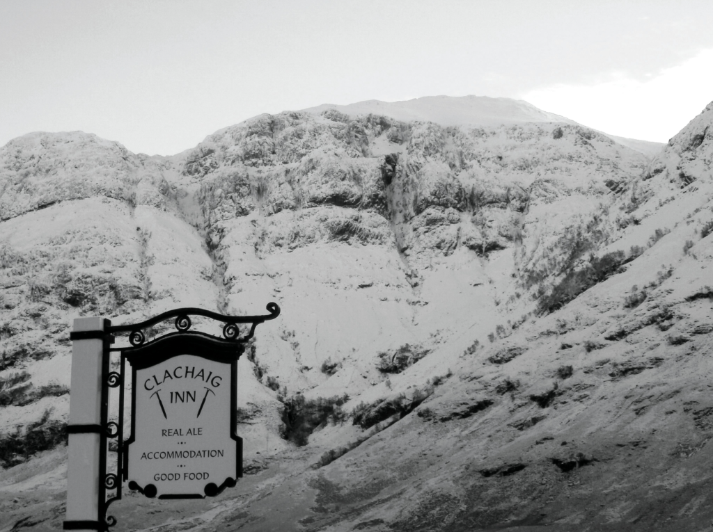
Glen Coe is one of the best places for hiking in Scotland, and with several very good reasons. Some of our finest mountains are to be found there. It’s accessible by car and public transport. But at the top of that list is, arguably, the Clachaig Inn: a mountain pub par excellence.
One of the Clachaig’s few downsides is that not many walks actually begin conveniently from its door. But a fine option takes in two of the glen’s lesser-known summits: the Munro of Sgurr na h-Ulaidh (994m) and the Munro Top of Stob an Fhuarain (968m). Sgurr na h-Ulaidh’s name means Peak of the Treasure, and it’s an apt description. It’s a gem, and you’ll find it a lot quieter than Bidean or the Buachaille.
With lengthy pathless sections, steep slopes, and navigational challenges, this is a tricky and strenuous hillwalk with a wilder feel than more popular Glen Coe objectives. In winter, pay attention to snow conditions and avoid the route when avalanche risk threatens N or W slopes.
Here is the detailed route description for Sgòr na h-Ulaidh via Clachaig Inn.
Ill Bell via the Mortal Man
Norman Hadley visits an Ill Bell Trio from the Mortal Man.
START/FINISH: Troutbeck | MAPS: OS Explorer South-eastern Lake District OL7 (1:25k), Harvey Ultra Map Lake District East (1:40k) | DISTANCE: 16.5 km / 10.3 miles | ASCENT: 800m / 2,625ft | DURATION: 4½ hours
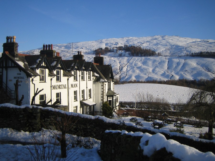
A fine location, good architecture and a memorable name put the Mortal Man well up in any walker’s top ten list of Lakeland Pubs, and much the same could be said of Ill Bell among hills. The pleasing bell-shaped summit is crowned with a set of cairns, while the form of the hill is echoed in miniature by its subsidiary top, Froswick to the north: famously, the sincerest form of flattery. To the south, Yoke may appear relatively unexciting, being a flat-topped sprawling mass, but it presents a fine, pyramidal form to the Kentmere side.
These hills are often tackled as part of the classic Kentmere Horseshoe, and form the highlight of that round. So, for shorter winter days, it makes sense to focus energies on the best bits. From the Troutbeck side, the ridge makes a pleasing switchback profile, with enough re-ascent to give each of the trio its own identity but without too much collar work. In fact, this route is notable for modest gradients, which could be a factor in its favour in winter conditions.
Here is the detailed route description for Ill Bell via the Mortal Man.
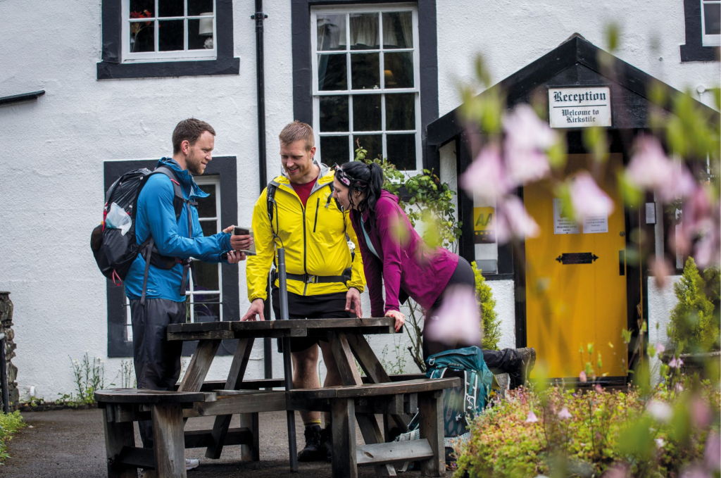
Mellbreak via Kirkstile Inn
Low in mileage but high in drama, James Forrest enjoys a quick jaunt up Mellbreak – followed by a pint in one of Lakeland’s best pub, the Kirkstile Inn.
START/FINISH: Church Bridge, where there is space for a few cars (GR: NY140208) | MAPS: OS Explorer OL4 (1:25k), OS Landranger 89 (1:50k), Harvey UltraMap XT40 Lake District North (1:40k) | DISTANCE: 6.6km / 4.1 miles | ASCENT: 467m / 1,532ft | DURATION: 3 hours
If you only have a few hours to indulge in the fells, you could do a lot worse than head for Mellbreak. The steep climb up the towering pyramid of the north ridge is a magnificent ascent full of drama and excitement. Next the wide plateau top, which consists of two summits separated by a broad saddle, offers excellent panoramas of Crummock Water and Buttermere, before the final leg via the lonely valley of Mosedale serves up a welcome dose of tranquillity and solitude. At less than five miles, the reward to effort ratio of this walk is phenomenal.
Every good walk should also end in a good country inn – and this Mellbreak route is no exception. Thankfully one of Lakeland’s best pubs, the 17th Century Kirkstile Inn, is located in Loweswater. The sun-drenched beer garden overlooks the dramatic pyramid of Mellbreak’s northern face – a mesmerising profile of the mountain – and is the perfect post-hike spot for supping on a pint of own-brew Loweswater Gold. If the sun isn’t out, simply dive into the cosy interior, snuggle next to an open fire and tuck in to some of the hearty, tasty food on offer.
Here is the detailed route description for Mellbreak via Kirkstile Inn, one of Britain’s best pub walks.
Barton Fell via The Sun Inn
Vivienne Crow enjoys contrasting sides of the far eastern fells with a route over Barton Fell from The Sun Inn at Pooley Bridge.
START/FINISH: The Sun Inn, Pooley Bridge, GR NY471244 | MAPS: OS Explorer OL5 (1:25k), OS Landranger 90 (1:50k), Harvey 1:25,000 Superwalker Lake District East | DISTANCE: 16.9km/10.5 miles | ASCENT: 604m/1980ft | DURATION: 5-6 hours
Lakeland’s eastern edge is dominated by gentle, rounded slopes and lengthy, whaleback ridges. It’s the sort of area I seek out when I want to hike for long, uninterrupted hours. Just occasionally though, you’ll come across something here that’s a little more interesting, something that’ll break your stride, maybe even stop you in your tracks. The north-western edge of Barton Fell does exactly that. While the ground to the south-east leads on to open, unassuming moorland, these craggy slopes plummet dramatically to a shelf of ancient enclosures, beyond which lies Ullswater. A faint trail skips along the escarpment edge, providing walkers with an uninterrupted view up the dark lake towards Helvellyn and its impressive neighbours. A place to linger…
The second half of the route, on the other hand, features that easy-going, skyline striding I mentioned earlier – along the ridge-top Roman road from Loadpot Hill. Resist the urge to march, legionary-like, if you can! Then, having enjoyed the best of both faces of these fells and with the winter wind still in your hair, warm up in one of Pooley Bridge’s pubs.
Here is the detailed route description for Barton Fell via The Sun Inn.
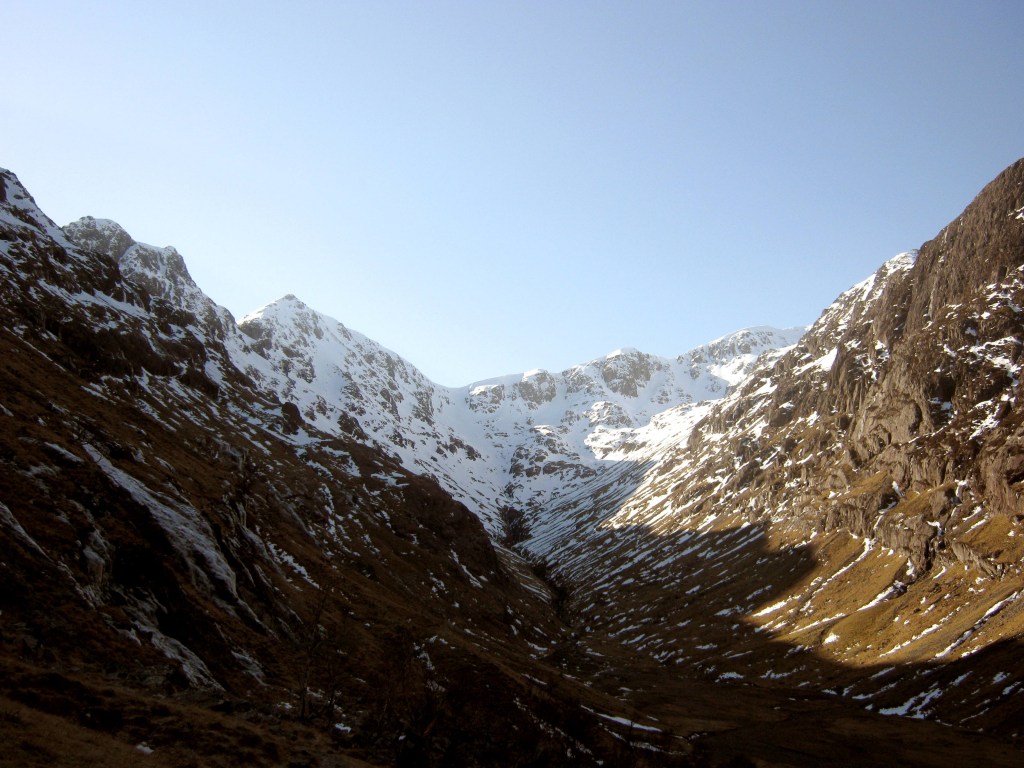
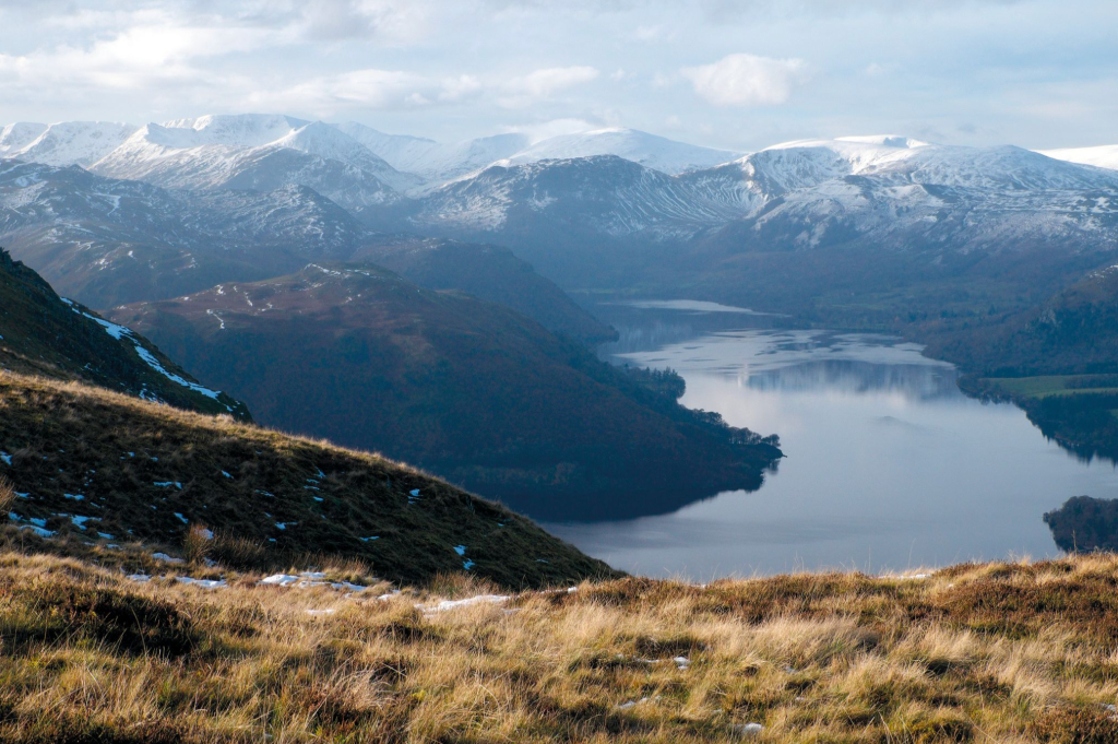
Kirk Fell via Wasdale Head Inn
Take on the short, sharp ascent of Kirk Fell to earn a pint on your return, says Francesca Donovan.
Start/finish: Lake Head Car Park, Wasdale (GR: NY 1868 0853) | Ascent: 759m/2,490ft | Distance: 7.2km/4.5 miles | Duration: 3 to 4 hours | Maps: OS Explorer OL6 – The English Lakes: South-western Area (1:25k)
Kirk Fell is one of the mostly finely situated fells in Lakeland. At the head of Wast Water, nestled between Great Gable and Pillar, its prominence offers hillwalkers perhaps the best view of a lake’s full length in Cumbria. It’s comparable with the vision of Buttermere as seen from the oft-photographed Fleetwith Pike – but with fewer outdoorsfolk.
Plus, Kirk Fell provides a short but welcome challenge when the weather is grim and you need a quick warm-up. While you may approach via one the two passes which hug its heft on either side – Black Sail Pass to the west and Beck Head Pass in the east – in fine weather, there’s a noteworthy ‘quick’ route. The subject of an amusing cartoon penned by Wainwright, some claim it’s the Lake District’s most exhausting ungraded walk. Anyone who has whiled away an hour or so at the Wasdale Head Inn beer garden alongside Mosedale Beck will have looked up at Kirk Fell and noted the bold and brazen path up, up and up its southern ridge.
Follow the intrigue for a long slog up a scree path (an alternative to the low-grade scramble of Kirk Crags) and at the top you’ll be treated to panoramic views across the Scafell group and Gables Great and Green. You’ve earned your refreshment of choice back at the inn.
Here is the detailed route description for Kirk Fell via the Wasdale Head Inn, one of Britain’s best pub walks.
Nine Standards Rigg and The Black Bull
Ian Battersby uncovers treasures hiding in the shadow of nine mysterious cairns.
START/FINISH: The Black Bull, Nateby; NY774067 | MAPS: OS Explorer OL19 (1:25k), OS Landranger 91 (1:50k) | DISTANCE: 16.4km / 10.2 miles | ASCENT: 614m / 2,015ft | DURATION: 6 hours
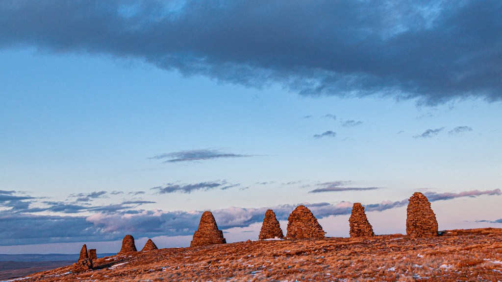
It could be claimed that Nine Standards Rigg makes for a fairly non-descript hill from afar, but its position on the border between Swaledale and the old county of Westmoreland may have saved it from obscurity. The motivation for the famed nine standard cairns perched just north of the summit has been misplaced in time, but they may have been used to mark this border. They can be seen against their skyline here well before reaching the top.
Whatever the reason, the cairns make a unique and fascinating draw, and deliver an all-embracing panorama that ranges from Wild Boar Fell and The Howgills, past the Lake District skyline, and up towards Cross Fell (rooftop of the Pennines). Its western flank is shaped by alluring edges, gills and limestone upstarts, and hidden deep within a wooded ravine Ladthwaite Beck forms an exceptional waterslide at the foot of Ewbank Scar.
All these are visited by this route, and thoughts and photos can be pored over while the landlord pulls pints of finest real ale and hearty meals served by the fireside at The Black Bull in Nateby. There’s plenty of room for chattering groups of rosy hikers.
Here is the detailed route description for Nine Standards Rigg.
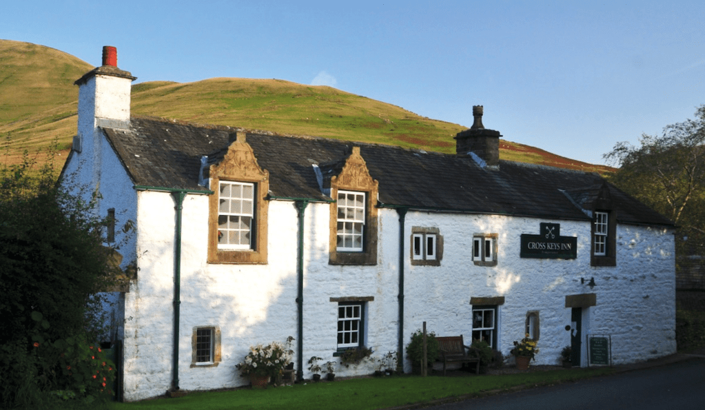
The Calf via The Cross Keys Temperance Inn
Roger Butler treads tussocky tops to The Calf by way of a 17th century temperance inn.
Start/Finish: Lay-by next to the Cross Keys Inn, grid ref SD698969 | Map: OS Explorer OL19 (1:25k), OS Landranger 91 and 98 (1:50k) | Distance: 16km/10 miles | Ascent: 1015m/3325 feet | Duration: 8 hours
Alfred Wainwright once described the smooth contours of the Howgill Fells as ‘a huddle of squatting elephants’ and, on a good day, it’s quite easy to wander across these tussocky tops with your hands firmly in your pockets. The rolling horizons, and a complete lack of walls and fences, might encourage you to whistle whilst you walk but the skylarks will also provide a suitable serenade.
This wriggling circuit includes breezy tops, deep valleys and dark crags and also passes over the broad summit of The Calf, the highest point in the range. You’ll climb over several fells, look down into the great gulch of Bowderdale, walk along the high edge of Cautley Crag and descend a steep zig-zag path next to the tallest above-ground waterfall in England. And there’s a pub. The Cross Keys Inn, from where the walk starts and finishes, dates from the 17th century but doesn’t serve alcohol since it operates as a temperance inn. Try their nettle cordial – but you can also bring a bottle of wine if you’re going to eat there!
Here is the detailed route description for The Calf via The Cross Keys Temperance Inn, one of Britain’s best pub walks.
Arkengarthdale via Tan Hill Inn
Ian Battersby becomes the guy who came in from the cold at Britain’s highest pub, the Tan Hill Inn.
START/FINISH: Verge parking above Whaw Bridge; NY980042 | MAPS: OS Explorer OL30 (1:25k) | DISTANCE: 24.3km / 15.1 miles | ASCENT: 536m / 1,758ft | DURATION: 7.5 hours
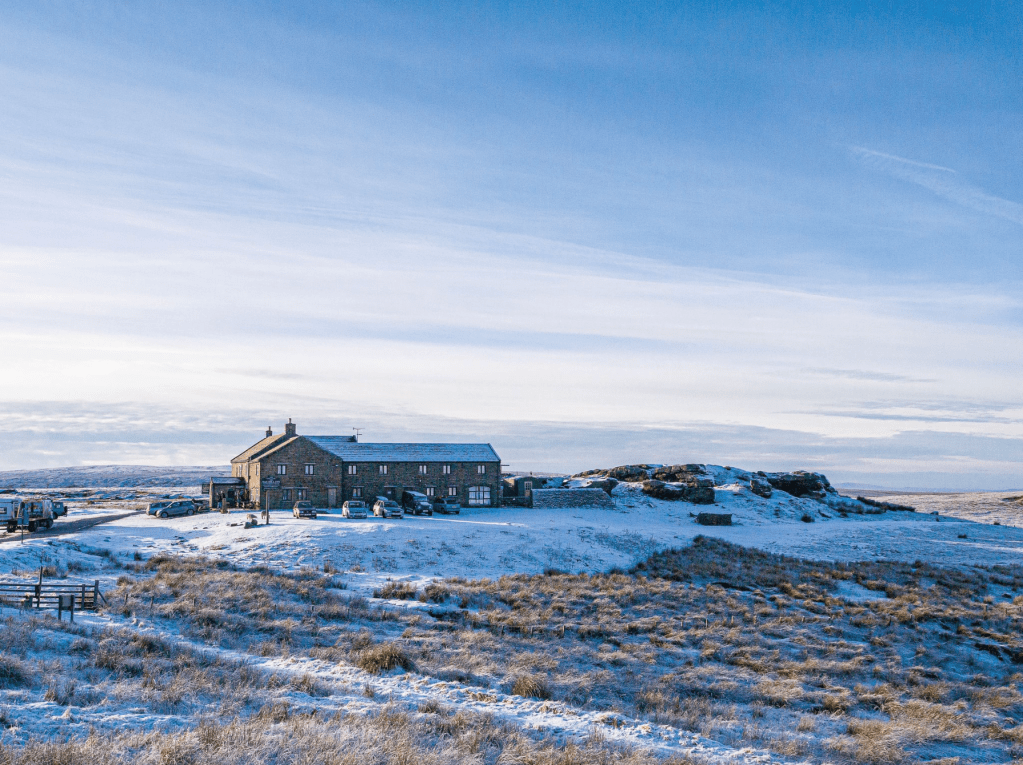
The Tan Hill Inn is Britain’s highest pub, and there are times when it exudes a hardy outpost atmosphere, particularly in winter, when icy roads deter drivers and the only callers are those who have climbed from the dales or those marooned in rooms. The warm welcome swells as mercury outside falls, after all, it takes the most determined oddball to stumble in from the bitter bite of our most precarious season. Real fires and the scent of a meal soon see hearty smiles cracking through rosy cheeks.
But winter can equally ease passage once away from the tarmac. Moorland miles are long here, with unfrequented paths little maintained as they wind a way through tussocks, bogs and heather. Even the passing Pennine Way sees meagre evidence of visitors. But frigid air freezes the ground hard, and if navigation skills are polished, the main barrier to a winter circular tour may only be the short interval of daylight, particularly with a hearty pub for distracting the unwary half way round. Warding off dusk with a firm dawn foundation is key to a longer lull in the bar.
Here is the detailed route description for Arkengarthdale via Tan Hill Inn, one of Britain’s best pub walks.
Cadair Berwyn via The Hand at Llanarmon
Andrew Galloway explores the Welsh village with two sixteenth-century pubs via a hike up Cadair Berwyn.
Start/Finish: The village of Llanarmon Dyffryn Ceiriog in the County Borough of Wrexham (GR: SH589218) | Distance: 25 km (15.5 miles) | Ascent: 890m | Time: 7 hours + breaks | Maps: Ordnance Survey Explorer 1:25,000 Sheet 255 Llangollen & Berwyn
The village of Llanarmon Dyffryn Ceiriog, nestled among the Ceiriog Valley’s verdant hills, is blessed with two public houses. The Hand and The West Arms were both constructed in the sixteenth century as farmhouses and later found use as watering holes for agricultural workers moving herds of livestock from rural Wales to the market towns of the Welsh Marches. Llanarmon village is at the intersection of a number of ‘drovers’ routes, ensuring plenty of passing trade. Nowadays, the hotels have a reputation for fine dining, the etymology of their unusual names deriving from the heraldry of two local families, the Myddletons of Chirk Castle and the Cornwallis-Wests of Ruthin Castle.
The drovers have hung up their boots and the historic tracks fanning out from the village square are now used by walkers to access the high cairns of the Berwyn Mountains. Lying outside the national park boundaries, these offer the discerning walker a secluded mountain experience and the opportunity to visit one of the finest waterfalls in Wales, Pistyll Rhaeadr, four miles to the west of the village of Llanrhaeadr-ym-Mochnant. That is, if they can separate themselves from the pubs’ nutty brown ales and cosy fireplaces.
Here is the detailed route description for Cadair Berwyn via The Hand at Llanarmon.
For more walks, check out our favourite family walks in the Peak District or waterfall walks in our first national park.