

Andrew Galloway explores the Welsh village with two sixteenth-century pubs via a hike up Cadair Berwyn.
The village of Llanarmon Dyffryn Ceiriog, nestled among the Ceiriog Valley’s verdant hills, is blessed with two public houses. The Hand and The West Arms were both constructed in the sixteenth century as farmhouses and later found use as watering holes for agricultural workers moving herds of livestock from rural Wales to the market towns of the Welsh Marches. Llanarmon village is at the intersection of a number of ‘drovers’ routes, ensuring plenty of passing trade. Nowadays, the hotels have a reputation for fine dining, the etymology of their unusual names deriving from the heraldry of two local families, the Myddletons of Chirk Castle and the Cornwallis-Wests of Ruthin Castle.
The drovers have hung up their boots and the historic tracks fanning out from the village square are now used by walkers to access the high cairns of the Berwyn Mountains. Lying outside the national park boundaries, these offer the discerning walker a secluded mountain experience and the opportunity to visit one of the finest waterfalls in Wales, Pistyll Rhaeadr, four miles to the west of the village of Llanrhaeadr-ym-Mochnant. That is, if they can separate themselves from the pubs’ nutty brown ales and cosy fireplaces.
Cadair Berwyn via The Hand at Llanarmon: route description
Start/Finish: The village of Llanarmon Dyffryn Ceiriog in the County Borough of Wrexham (GR: SH589218) | Distance: 25 km (15.5 miles) | Ascent: 890m | Time: 7 hours + breaks | Maps: Ordnance Survey Explorer 1:25,000 Sheet 255 Llangollen & Berwyn
Note: Please be considerate when parking as there is no public car park in the village
1, SJ157328: From the crossroads in the centre of the village take the road to the south, passing the school on your R. Follow the road for 500m to where the Nant Maengwyn stream passes beneath. A footpath to the R is indicated by a finger post. After 50m a stile on the L gives access to open pasture. The right-of-way is to the SE. Head in this direction for 500m to a wire fenced enclosure. From within the enclosure keep the fence on your L and head W for 400m. At a stile cross onto access land.
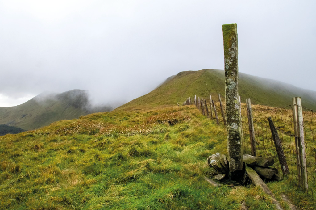
Boundary Stone below Cadair Berwyn. Credit: Andrew Galloway
2. SJ146320: Not marked on OS maps a vehicle track runs W along the top of a broad ridge. Follow the track to where it passes just N of a grassy knoll, indicated on the map with a spot height of 546m. 150m west of the spot height is a sheep fold. Pass through the sheep fold, following the line of a fence W for 400m. Where the fence turns to the SE, look ahead for an obvious rise of the ground (marked on the OS map as a Tumulus with a spot height of 591m.) This is a deviation from the direct route but worth it for the view into Cwm Maen Gwynedd.
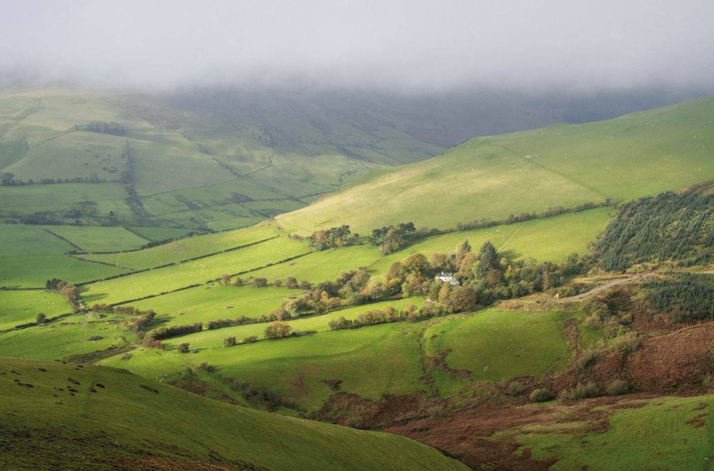
Cwm Maen Gwynedd. Credit: Andrew Galloway
3. SJ127318: From the tumulus head along the line of the wire fence N for 700m to a small boundary stone close by the spot height marked on the OS map as Rhos. Keeping to the N side of the fence, follow it W for 1.4km to reach the sizeable cairn on Mynydd Tarw (681m), your first Hewitt.
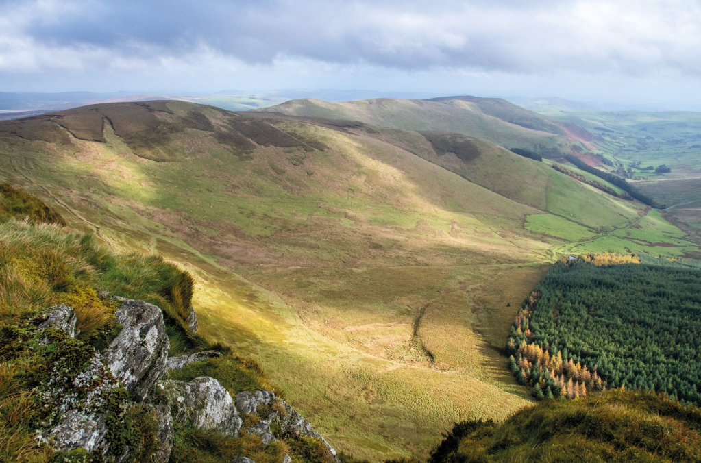
Foel Wen and Mynnyd Tarw from Cadair Berwyn. Credit: Andrew Galloway
4. SJ112324: From Mynydd Tarw continue along the broad ridge to the NW, using the wire boundary fence as a handrail, for 1.8km to the top of Foel Wen (691m), the second Hewitt along the ridge. Continue in a broadly W direction, following the boundary fence for a further 1.6km to the top of Tomle (742m), Hewitt number three. From here the ground falls away to the W for 500m to a col where an impressive boundary stone stands. A good place to catch your breath before climbing the final, steep 400m to reach the Berwyn ridge.
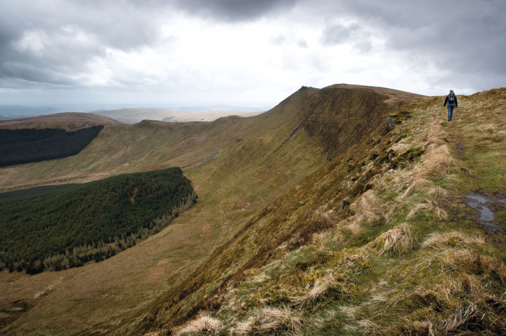
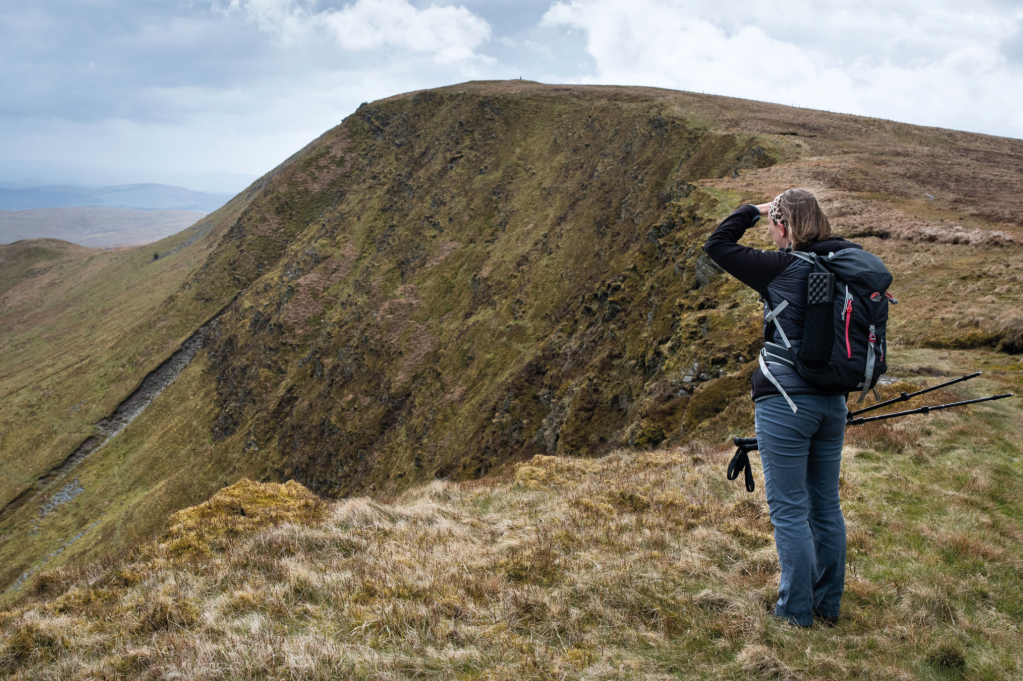
The Berwyn Ridge. Credit: Andrew Galloway
5. SJ076335: Walk S along the ridge above Craig Berwyn for 1km to the triangulation pillar at the summit of Cadair Berwyn (827m), the fourth Hewitt. Though chosen by the Ordnance Survey as the location of their triangulation pillar, Cadair Berwyn is not the highest point on the ridge. In 1987 it was confirmed that the craggy outcrop 400m S of Cadair Berwyn is higher. It is worth a deviation to this point for the splendid view into Cwm Lluncaws below.
Cadair Berwyn. Credit: Andrew Galloway
6. SJ071323: Retrace your steps back along the ridge N for 1.4km to where a stile crosses a boundary fence. Cross it and follow the permissive path – duckboards provided at boggy sections – for 1.1km to the summit of Hewitt number five, Cadair Bronwen (783m). The large circular cairn is recorded by Ordnance Survey as Bwrdd Arthur – Aruthur’s Table in English. There are no other references or extant myths regarding the fabled king in the area. The cairn was possibly named by locals because of its circular footprint and angular profile.
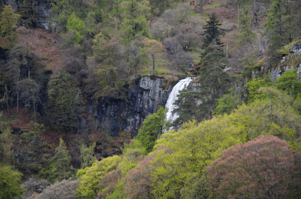
The top of the cascade that is Pistyll Rhaeadr. Credit: Andrew Galloway
7. SJ077346: A permissive path heads NE away from the cairn. Follow this path, tracing the line of the county boundary for 2.7km to Pen Bwlch Llandrillo where the old drover’s road crosses from Clwyd County into Wrexham Borough. A memorial plaque on the crag here commemorates a gentleman known as ‘The Wayfarer.’ This was the pen name of the cycling enthusiast Walter MacGregor Robinson, who attained a devoted following during the inter-war years of the twentieth century.
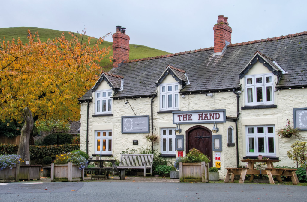
The Hand at Llanarmon. Credit: Andrew Galloway
8. SJ091365: From ‘The Wayfarer’ take the old drover’s road E. After 4km the track becomes a minor road. Continue along the minor road for a further 4km, passing the hamlet of Pentre, to return to Llanarmon Dyffryn Ceiriog.
Further information
Public Transport: Tanat Valley Coaches operate a regular bus service, number 64, from Llangollen. For further details see https://www.tanat.co.uk/public-services
Discover more walks in Wales as mapped by our expert contributors.


