
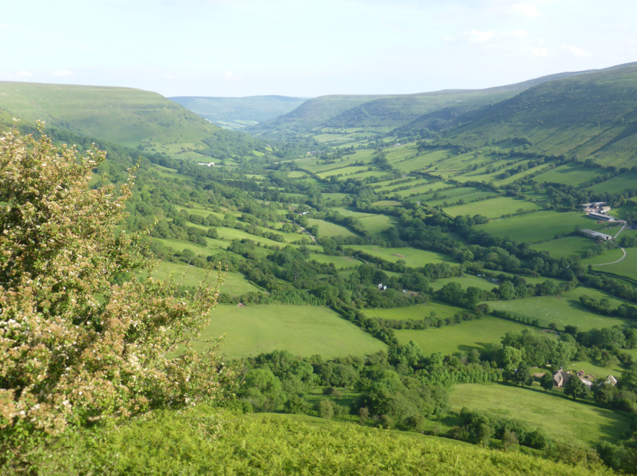
Fiona Barltrop strides out along the ridges of the The Vale of Ewyas in the Black Mountains.
For those unfamiliar with Bannau Brycheiniog (as we are now urged to call the Brecon Beacons) a few words of explanation. The National Park comprises four separate ranges, from west to east: the Black Mountain (singular), Fforest Fawr, central Beacons and Black Mountains (plural). Just to confuse matters more, there’s also a peak – really a point along a ridge – in the Black Mountains called Black Mountain and another called Black Hill. Unlike the central Beacons where you’ll rarely have the likes of Pen y Fan et al to yourself, the long ridges of the Black Mountains afford plenty of space and scope for solitude.
Horseshoe-type routes are the usual thing here. It’s not difficult to devise ridge/valley combinations of one’s own, though there are some common guidebook ones. The Vale of Ewyas is a particularly attractive valley, and combining a stretch of the Offa’s Dyke Path which runs to the east with a length of ridge on the other side and a section of the northern escarpment to link the two at one end makes for a splendid day.
The Vale of Ewyas, Black Mountains: route descritiption
START/FINISH: Rhos Fach Common, a couple of miles from Talgarth – park on roadside grass (SO188333). Alternatively at Gospel Pass car park on route of walk (SO237350), which shortens distance by about 6km/3¾ miles | MAPS: OS Explorer OL13 (Brecon Beacons National Park – Eastern Area); Landranger 161 (The Black Mountains) | DISTANCE: 27 km/16¾ miles | ASCENT: 1088 m/3570ft | DURATION: 8 – 8½ hours
1. SO188333: Follow the wide grassy track east-southeast towards the foot of the escarpment, soon ascending more steeply above Cwm Cwnstab on the left to reach the top of the escarpment.
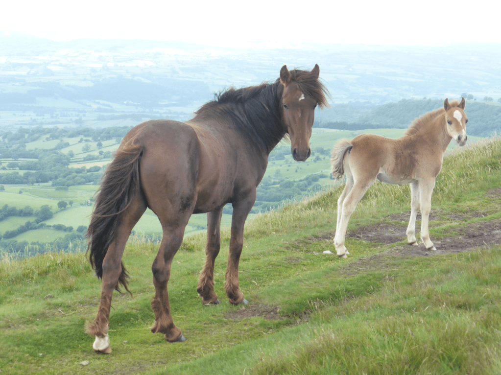
Welsh mountain pony & foal on N escarpment. Credit: Fiona Barltrop
2. SO204327: Head north-east along the escarpment past the trig point to Twmpa/Lord Hereford’s Knob (SO225350) and descend to Gospel Pass (road). Continue up the other side to the trig point atop 677m/2,221ft Hay Bluff (Penybegwn in Welsh). This is a fine viewpoint overlooking the Wye Valley and Hereford plains. Note, however, that it is certainly not ‘the highest peak in the Black Mountains’, as the official website says! That accolade goes to 811m/2661ft Waun Fach. And should you come across another website for the area, with a striking photo of Llyn y Fan Fach ‘surrounded by the peaks of the Black Mountains’ and recommended for wild swimming, you’ll look for the lake in vain here, since it’s to be found in the Black Mountain (singular), the westernmost area of the National Park!
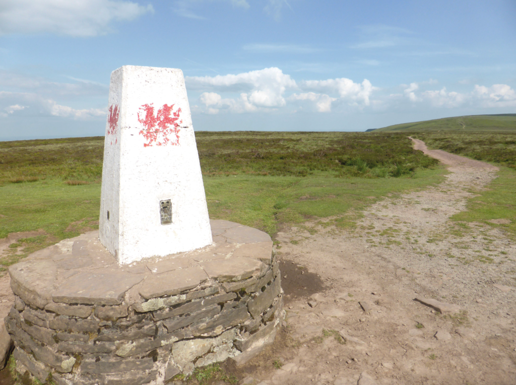
Trig point atop Hay Bluff. Credit: Fiona Barltrop
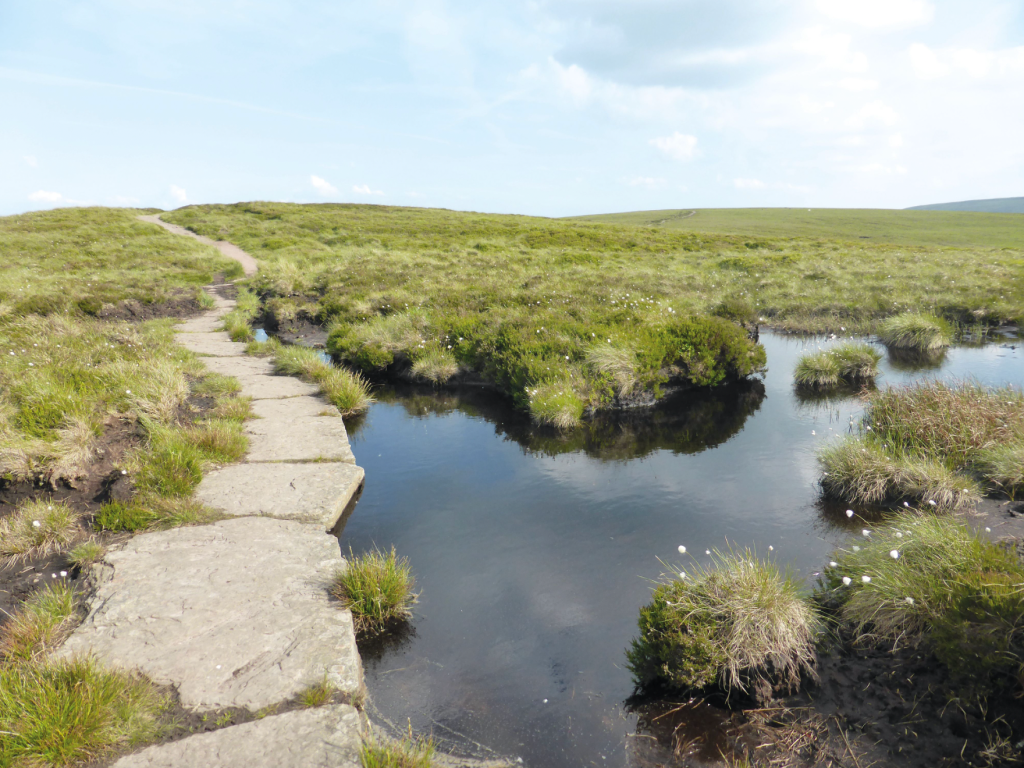
3. SO244366: Turn right along the well surfaced path, soon following the Offa’s Dyke Path which joins from the left. The National Trail follows both the crest of the ridge as well as the England-Wales border. Continue to the ‘Pile of Stones’ path intersection, 5.7km/3½ miles from the trig point.
Stone slabs along Offa’s Dyke Path. Credit: Fiona Barltrop
4. SO270320: Turn right down the path towards the Vale of Ewyas. After the bare moorland ridges, the beautiful vale with its lush green pastures provides a pleasing contrast. Lower down follow the waymark posts signed for Capel y Ffin, heading along the base of the ridge above Afon Honddu to arrive at the Church of St Mary the Virgin, Capel y Ffin. Built in 1762, it’s a small, quaint church, one of the smallest in Wales with a distinctive lopsided bellcote and ancient yew trees in the churchyard.
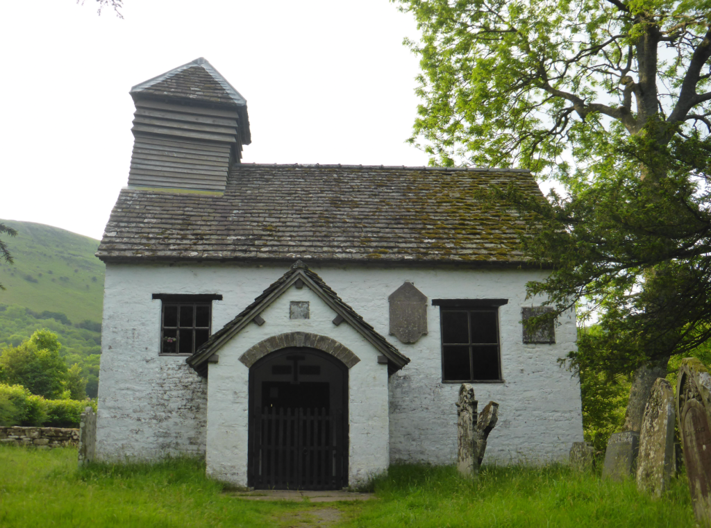
Capel y Ffin church. Credit: Fiona Barltrop
5. SO255315: Turn left from the church to the lane junction, then sharp right and continue along the narrow lane passing below the Monastery. This was founded in 1870 by Joseph Leycester Lyne, known by his religious name as Father Ignatius, an Anglican Benedictine Monk, with the aim of restoring monastic life to the Church of England. He named it Llanthony Abbey, having originally hoped to acquire the ruins of the Augustinian Llanthony Priory a few miles down the valley. It was later home to Eric Gill, the sculptor and typographer, who designed the typefaces Perpetua, Gill Sans and Solus, while living there (1924 to 1928). Despite Gill’s religious beliefs (he was a Catholic), revelations about his personal life in a biography published in 1989, almost 50 years after his death, have overshadowed his fame.
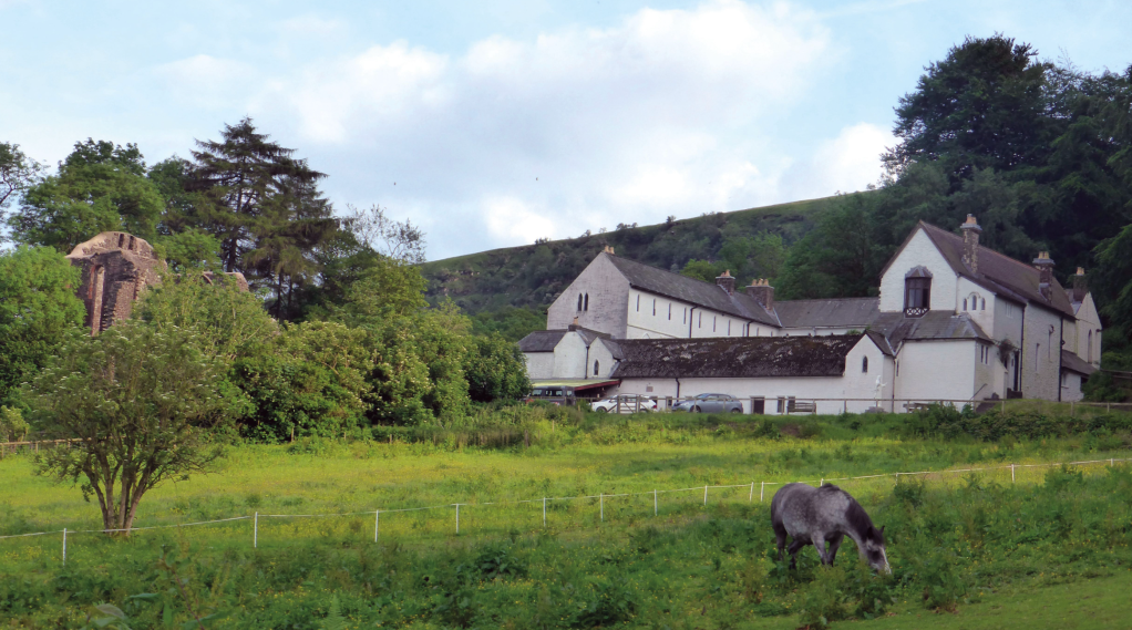
The Monastery & ruin of original church at Capel y Ffin. Credit: Fiona Barltrop
The Monastery has now been owned by the same family for almost 40 years, providing self-catering accommodation. However, it is currently (late 2023 – with accommodation still available) up for sale. Those with deep pockets might want to investigate….and others who might like to dream about living in such a location should have a look at Rightmove, too..! A magnificent property in a spectacular setting, indeed.
Turn left at the Grange Trekking Centre (which also provides accommodation: B&B, camping and glamping, as well as trekking/riding) and follow the bridleway southwards uphill to the top of the ridge.
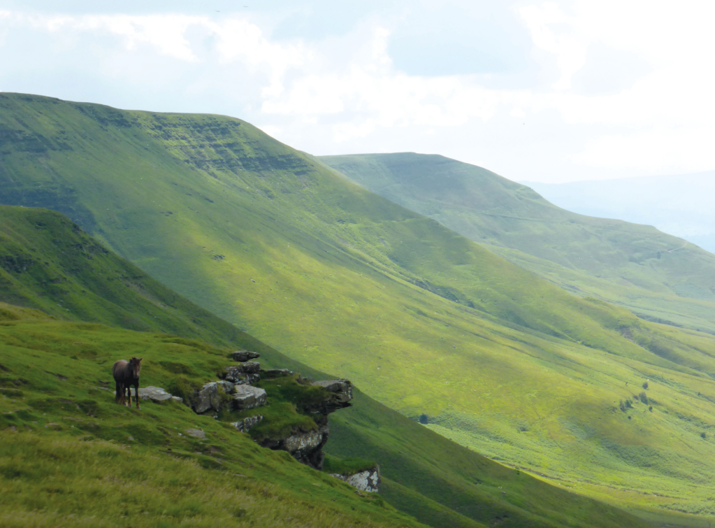
Northern escarpment. Credit: Fiona Barltrop
6. SO250302: Turn right to head north-west along the ridge back to the trig point atop Pen Rhis Dirion on the northern escarpment.
7. SO212334: Turn left to retrace initial outward steps to the start.
Further information
PUBLIC TRANSPORT: None to start
TOURIST INFORMATION: National Park Visitor Centre (01874 623366), breconbeacons.org
Discover more walks in Wales as mapped by our expert contributors.


