
Francesca Donovan guides you on a fine Peak District day challenge taking in the highlights of the Edale Valley: The Edale Skyline.
The Edale Skyline is the most fun you can have in the Peak District on two feet. That is, if you find admiring sweeping views across the most popular (read: best) hillwalking territory in our first national park fun. This route, which skirts the edges above the entire Edale valley, is a well-loved trail run; but it can be squeezed into a day of walking too. There’s only one sustained ascent and the rest of the walk involves staying high for many undulating miles.
It’s well worth the effort. On the Edale skyline, you’ll bag five trig points, enjoy views over the Ladybower Reservoir, encounter fascinating gritstone formations at the edges of the Kinder plateau, and finish along The Great Ridge. Whilst there may be more adrenaline-fuelled routes up to the Kinder Plateau – The Peak’s high point – via cloughs and falls, there are few longer full-day routes in this part of the world.
Accessible by public transport into the park, most walkers start in Hope village; but you can easily adjust the route to begin at any stop on the Manchester to Sheffield train line.
The Edale Skyline: route description
Start/finish: Hope train station (GR: SK181832) | Maps: OS Explorer OL24 (1:25k) | Distance: 32km/20 miles | Ascent: 1096m/3596ft | Duration: 9-10 hours
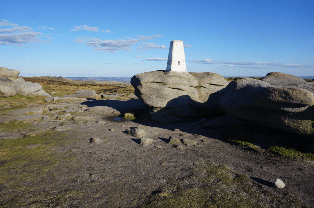
1. SK181832: If arriving at Hope station from Sheffield, exit the train and cross the footbridge to reach the footpath skirting the eastbound platform. Those arriving from Manchester simply need to leave the platform and take this path, go through the gate and head NNE on the footpath skirting the field ahead. After 300m, take the R footpath and follow it for a further 300m to then join the lane heading N. Follow it for 700m, through the small settlement. Take the NE footpath ascending past High Field Head Farm for 1.5km as the path gently curves above Thornhill Carrs, heading N towards Win Hill plantation. Here, turn L onto the footpath heading W and use this to ascend to Win Hill trig point for views down to Ladybower Reservoir and towards Stanage Edge.
The trig point on Win Hill with Mam Tor in the distance. Credit: Francesca Donovan
2. SK187851: Head W off Win Hill for 1km and then continue NW above Hope Brink. Look back for views to The Great Ridge and Mam Tor. It’s easy navigating along NNW pathways for 2km, keeping Woodlands Valley to your R and passing Hope Cross. Leave the rocky path for the grassy ascent of Crookstone Hill, heading W then NW, passing a cairn. After 1.5km take the bend in the path, heading SW to eventually emerge on the path above Crookstone Out Moor. After 1.3km cross the small falls of Jaggers Clough.
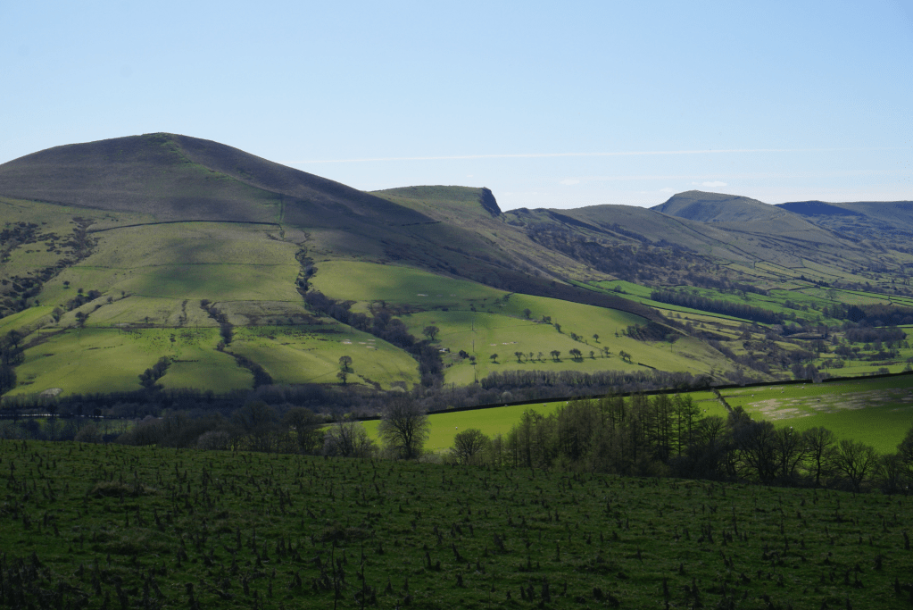
Mam Tor and The Great Ridge in cloud shadow. Credit: Francesca Donovan
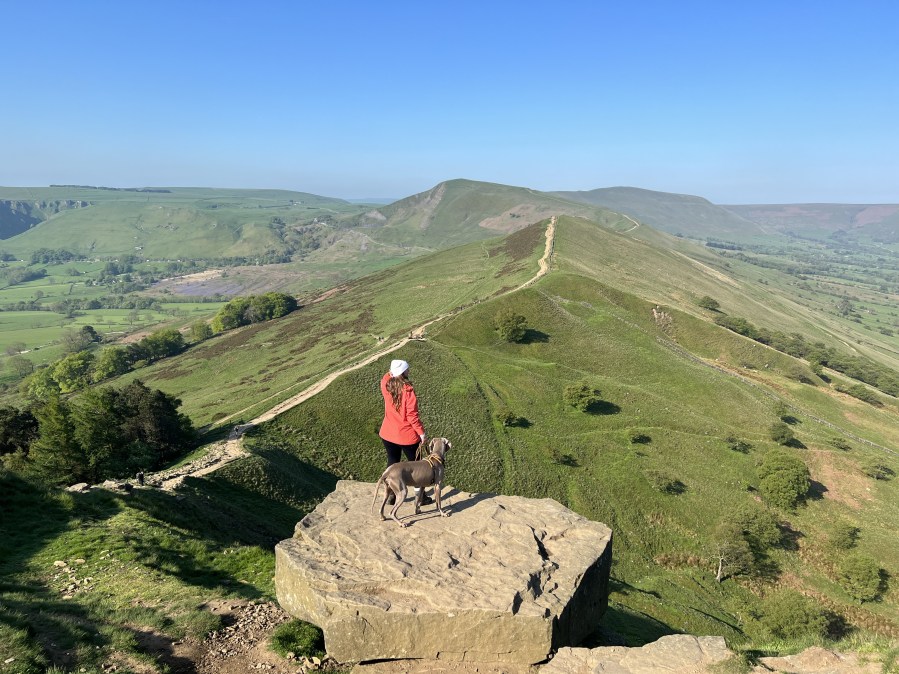
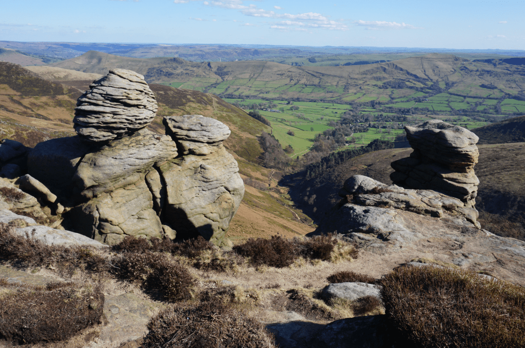
3. SK140878: Here, the edge-of-plateau walking ‘proper’ begins. Join the clear path along the S edge of Edale Moor, taking in Ringing Roger and the gritstone-framed views across the valley and down into the many cloughs of Kinder. After 6km, you’ll reach Crowden Tower, where the going gets more challenging due to the wet, peaty ground. It’s worth it to walk amongst the Wool Packs – a clump of characterful formations that can look as funny on a sunny day as they can menacing in the mist. Continuing W, pass Edale Head rocks and follow the gentle curve of the ridge SW past Edale Rocks.
Views through the Nether Tor rock formations down to Edale. Credit: Francesca Donovan
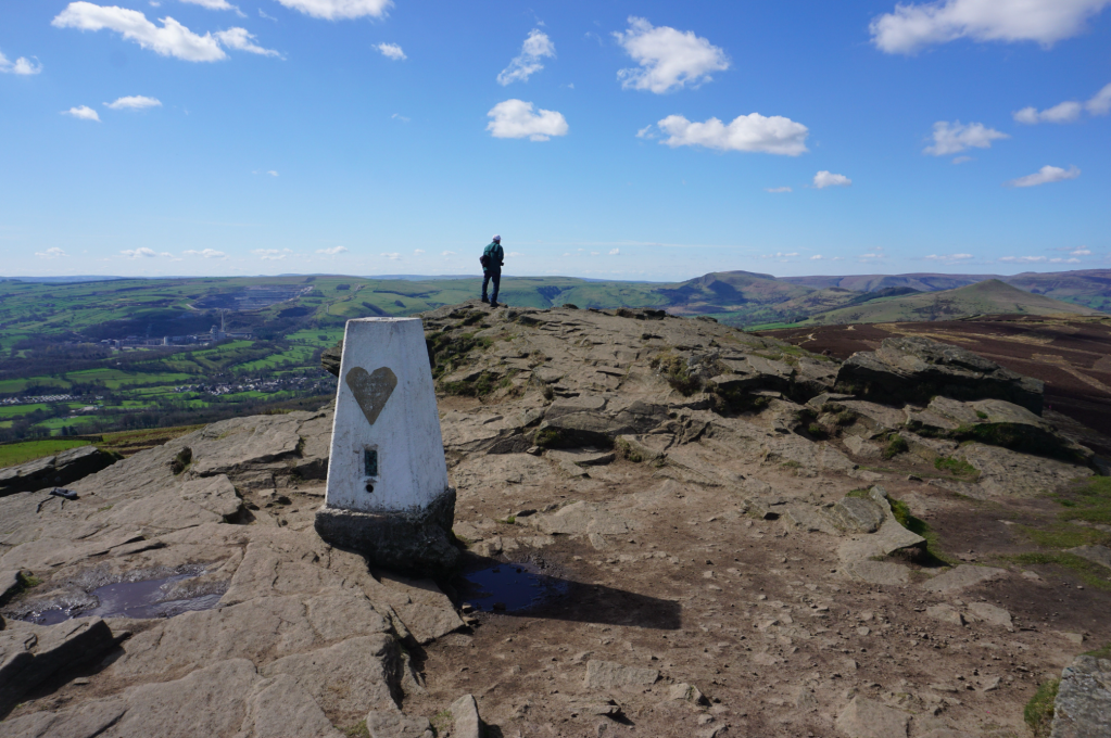
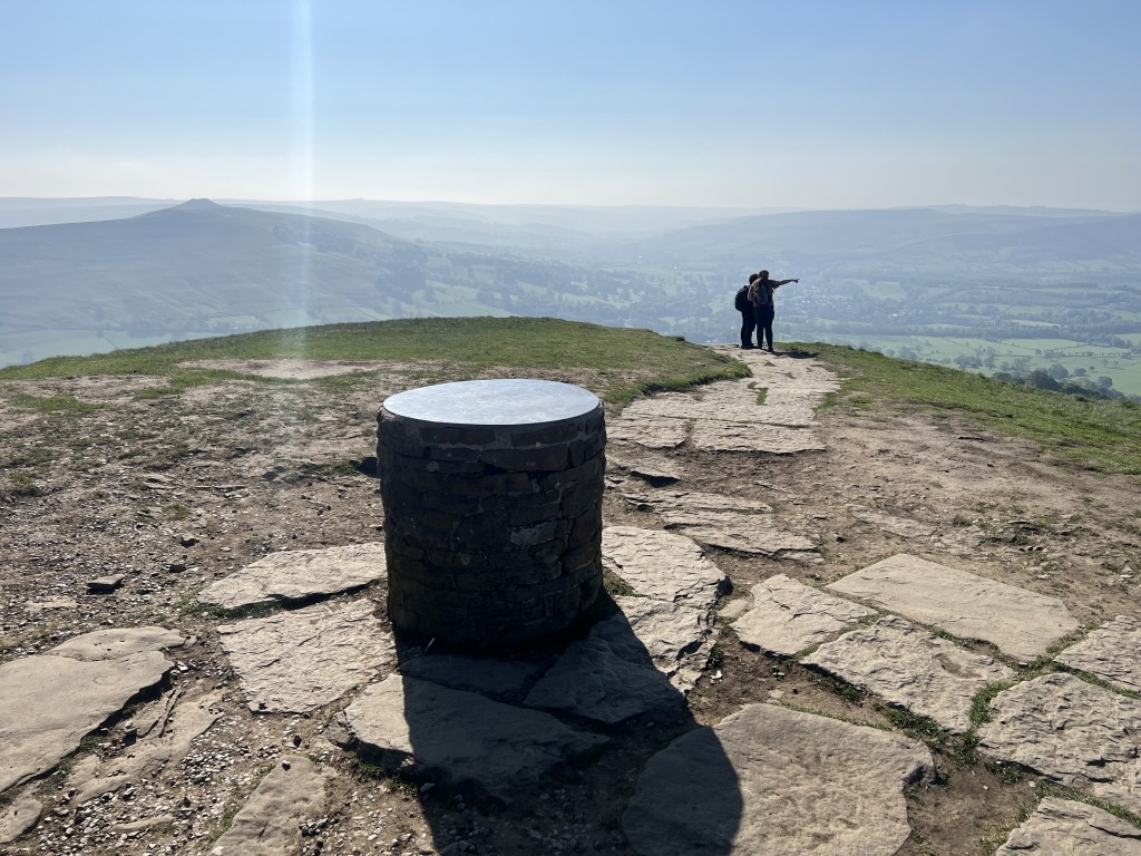
4. SK079865: Here, you can take the path heading N to ‘bag’ the trig at Kinder Scout. Or continue on the path below Swine’s Back heading SSW for 500m. At the four-way footpath intersection, continue SW. In 800m turn L, taking the footpath heading SW
to Brown Knoll trig point. It’s 2km of deceptively tiring flagstone walking from here.
Kinder Low trig point. Credit: Francesca Donovan
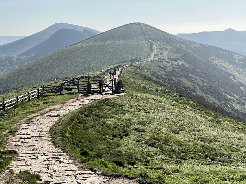
5. SK098832: Pick up the Chapel Gate track heading S. After 300m turn L along Rushup Edge, the start of The Great Ridge. Head ENE for 1.5km to reach Lord’s Seat for the last quiet ponderings before you reach the honeypot of Mam Tor. Head E off Lord’s Seat for 1.3km until you reach the road. Cross it and take the footpath leading the flagstone steps. Follow these all the way to the Mam Tor trig point.

Looking back on the Kinder plateau from Mam Tor. Credit: Francesca Donovan
6. SK127836: This is a great vantage point to admire the extent of your full walking route. Next, take the paved ridge path for 1.4km to Hollins Cross. Continue to the steep ascent up Back Tor past its famous lone tree and then onwards to Lose Hill.
A quiet day on the Great Ridge with views of the isolated Back Tor tree. Credit: Francesca Donovan
7. SK153854: Marking the end of The Great Ridge, Lose Hill offers views across to neighbouring Win Hill. Local legend says the hills got their names from the outcome of a 7th-Century battle between Edwin of Northumbria and Cynegils of Wessex. There’s no evidence suggesting a battle took place on slopes of either hill, however! Leave Lose Hill by its grassy slope, heading SE for 1.8km.
The descent off Lose Hill. Credit: Francesca Donovan
8. SK168845: Here, turn R onto Edale Road. You’ll stumble upon The Cheshire Cheese Inn, dating back to the 1500s. You’ve earned the home-cooked food and open fires. Later, follow the road for 1km, then turn L onto the A6187. In 700m, turn L into Hope Station. Your train home awaits.
Further information
Transport: an hourly Northern Trains service runs between Manchester and Sheffield, stopping at Hope station
Tourist information: Edale TIC, peakdistrict.gov.uk, 01629 816587
Discover more walks in the Peak District and UK mountain challenges as mapped by our expert contributors.


