
Often dismissed as boring and grassy, this secret route up the little-known Fisher’s Wife’s Rake path brings out the best of eastern Dodds, says James Forrest.
At the northern end of the Helvellyn massif, in a patch of high land wedged between Thirlmere and Ullswater and bounded by the valleys of St John’s in the Vale, Threlkeld and Matterdale, lies a group of fells known collectively as the Dodds. Sometimes unjustly labelled as boring, grassy and rounded, this substantial high plateau should not be dismissed. While the eastern aspect is all grassy shoulders and rolling terrain, if you approach from the west, there is drama to be discovered in Castle Rock, Clough Head’s crags and – best of all – this secret ascent.
Fisher’s Wife Rake is a rough, steep and exciting climb, with a fascinating history. The Fisher family of St John’s in the Vale burnt peat to keep their cottage warm in the harsh 1800s. Mr Fisher’s job was cutting out slabs of peaty fuel from Clough Head’s summit; his wife’s unenviable role was to shuttle them up and down the mountain. The quickest route was a tilted, grassy rake through Wanthwaite Crags, and hence the trod was forever named after Mrs Fisher. Beyond the rake, our route continues southwards to bag Great Dodd, Watson’s Dodd and Stybarrow Dodd, before a looping return via Sticks Pass. It’s a far better option than a brutal up-and-down the rake – we’ll leave such hardship to the memory of that intrepid, peat-carrying woman of the 1800s.
The Dodds Round: route description
START/FINISH: United Utilities car park in Legburthwaite, CA12 4TQ. (GR: NY317195) | MAPS: OS Explorer OL5 (1:25k), OS Landranger 90 (1:50k), Harvey UltraMap XT40 Lake District East (1:40k) | DISTANCE: 15.2km / 9.4 miles | ASCENT: 943m / 3,094ft | DURATION: 6 hours
Note: Fisher’s Wife’s Rake is not a graded scramble, but it encounters steep, rough and pathless ground. First-rate navigation skills are required to find and safely negotiate the rake.
1. NY317195: Exit north-west end of car park. Turn left along minor road. Cross bridge over How Beck and turn right on A591. Cross St John’s Beck and turn right over ladder stile. After 10m, fork left and take higher path. Ignore turn-off to left (for High Rigg) and instead head north-east and north. Continue to Low Bridge End Farm. Pass to left of buildings. At three-way path junction, turn right through metal gate and then immediately left. Pass to right of large wooden shed, go through gate and head north-north-west through grassy fields. Turn right across Sosgill Bridge and veer right to B5322. Turn left and head north. Take extreme precaution on the busy road (or to avoid some road walking, take bridge further north via dog-legged route).
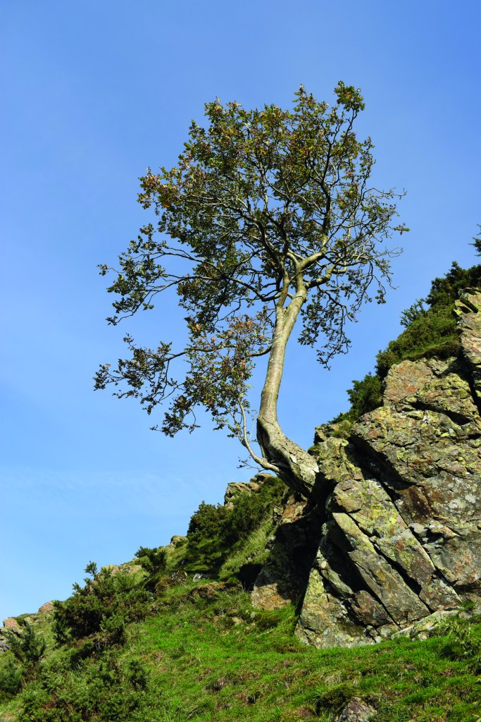
The prominent tree marking the start of the ascent. Credit: James Forrest
2. NY318219: Turn sharp right on gravel track. Pass vehicle barrier, head south and then loop sharply left. Continue north into Bramcrag Quarry (disused) on wide 4×4 track. Where track loops sharply right, fork left instead on another wide track. Almost immediately, veer right and then turn immediately left on little trod up to grassy rake. Turn right to head south-east. Emerge to open ground with views of quarry cliffs. Ignore more obvious grassy, shelf-like path to left and instead take stony trod – passing to left of upright, rusting metal girder – ascending north-east up to wall. Go through gate onto open fellside, which is strewn with scree and boulders, and pathless. Consequently pick your own line aiming north-east for prominent rowan tree (NY322222), which is growing out of a crag with a curved profile.
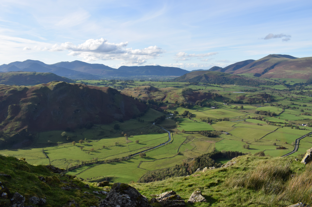
Views of St John’s in the Vale valley from Fisher’s Wife’s Rake. Credit: James Forrest
This is beginning of Fisher’s Wife’s Rake. Ignore more obvious sheep trod traversing south-south-west at lower contour. Instead go uphill slightly and find higher trod, turning right and climbs right steeply south-south-east, passing another prominent tree and sticking to base of crags. Continue up trod, aiming for grassy notch on skyline.
Looking down at the Fisher’s Wife’s Rake ascent. Credit: James Forrest
Ignore huge gully to left, and instead the winding trod guides you south over easier ground. At NY323220 you top out at grassy platform with superb views. From here the going is easier. A faint path zig-zags uphill to reach Clough Head’s upper flanks. Turn left and take intermittent path north-east to Jim’s Fold sheepfold. Head north-east to Clough Head.
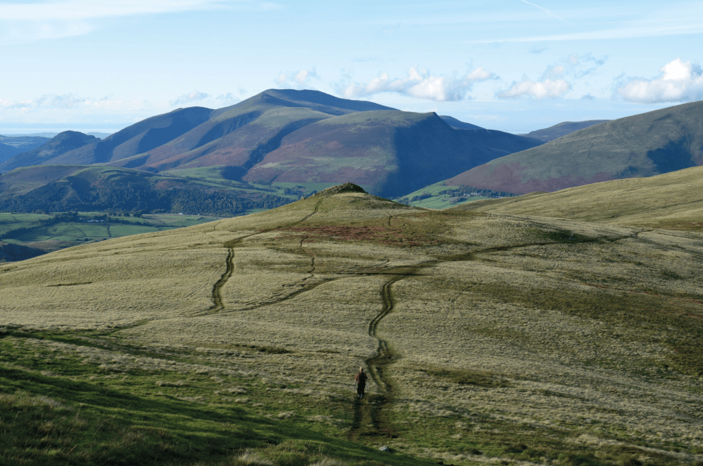
A hiker heading towards Calfhow Pike. Credit: James Forrest
3. NY333225: Take grassy path south to broad col. Fork left to bypass Calfhow Pike’s craggy summit. Go through gate and loop left on path, ascending south-east and east to Great Dodd. Turn right and head south-east to large wind shelter.
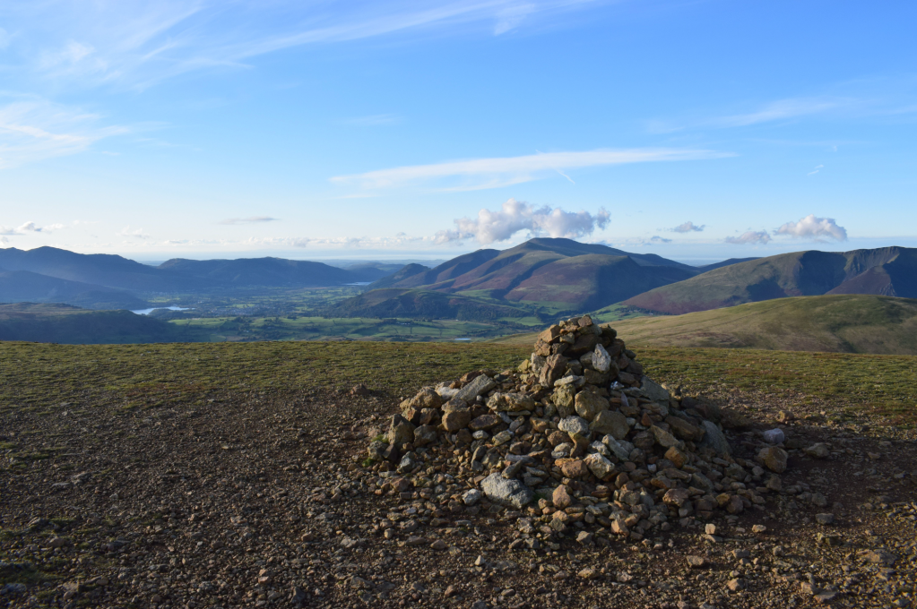
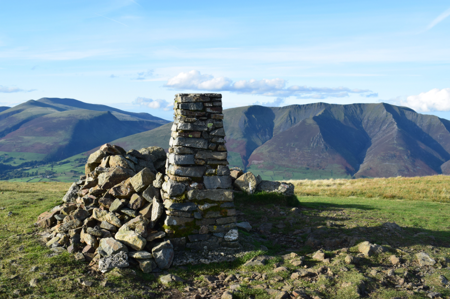
Great Dodd’s summit. Credit: James Forrest
Veer right again and descend descending gently south-west to col. Fork right and take a grassy path to Watson’s Dodd.
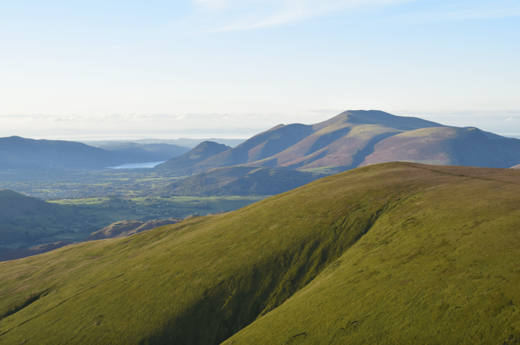
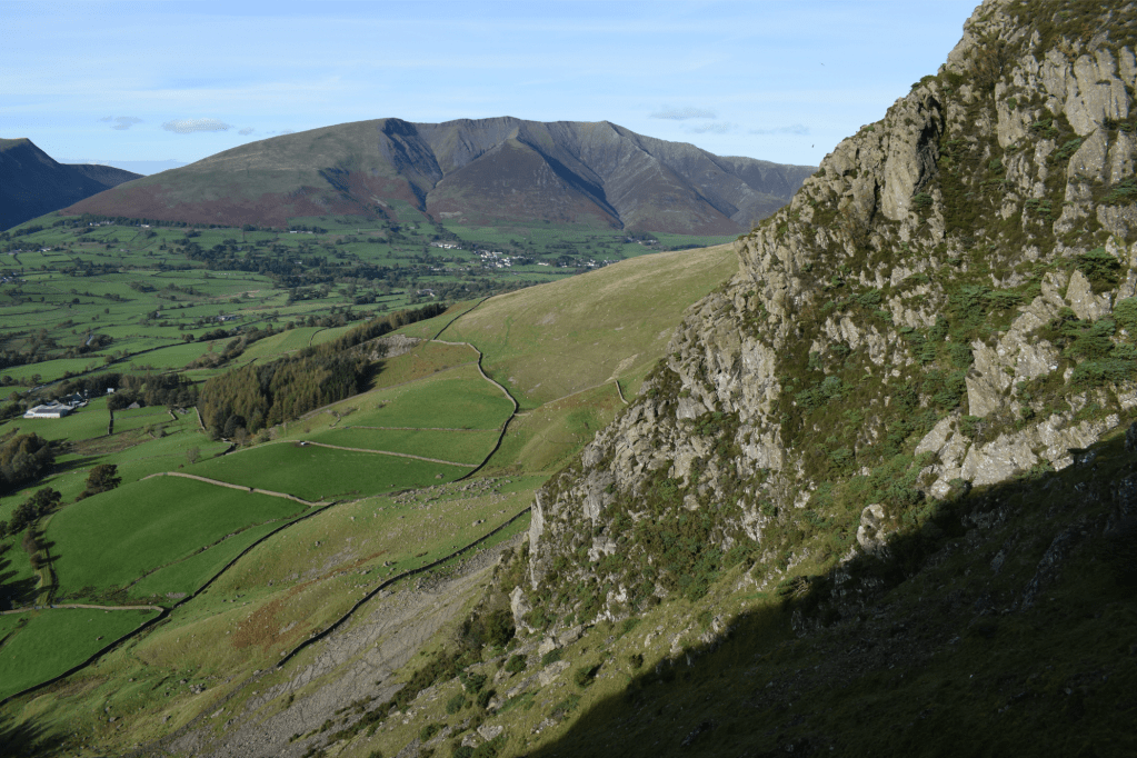
Watson’s Dodd with Skiddaw and Bassenthwaite in the distance. Credit: James Forrest
4. NY335195: Turn sharp left and head south-east to Stybarrow Dodd’s base. Ascend right, skirting high above Stanahgill Head. Confusingly the main path bypasses the summit, so turn left and climb south-east to small summit cairn. Turn right, rejoin main path and ascend grassy hump with cairn. Veer slightly left and descend south to Sticks Pass.
5. NY342181: At four-way junction, turn right and descend west. Stay on path as it veers slightly right away from Sticks Gill. Descend west and north-west to reach sheepfold. Pass to right of fold and descend alongside fence. Follow path as it drops steeply north-west and west. At junction, fork right and descend closer to Stanah Gill. Arrive at in-take wall above Stybeck Farm. Turn right through gate, cross footbridge over Stanah Gill and veer left through another gate. Descend north-west, cross water channel, go through gate and loop left downhill next to barn. Beyond another gate, turn left down road. Pass few houses and arrive at B5322. Turn right on road, walk past The Lodge in the Vale and return to car park.
Further information
PUBLIC TRANSPORT: Take Stagecoach’s 555 Kendal-Keswick bus and alight at the Legburthwaite stop.
TOURIST INFORMATION: www.visitlakedistrict.com
Discover more walks in the Lake District as mapped by our expert contributors.


