
Alex Roddie seeks a treasure of a winter pub walk to the Clachaig Inn in Glen Coe, taking in two high but lesser-known summits.
Glen Coe is one of the best places for hiking in Scotland, and with several very good reasons. Some of our finest mountains are to be found there. It’s accessible by car and public transport. But at the top of that list is, arguably, the Clachaig Inn: a mountain pub par excellence.
One of the Clachaig’s few downsides is that not many walks actually begin conveniently from its door. But a fine option takes in two of the glen’s lesser-known summits: the Munro of Sgurr na h-Ulaidh (994m) and the Munro Top of Stob an Fhuarain (968m). Sgurr na h-Ulaidh’s name means Peak of the Treasure, and it’s an apt description. It’s a gem, and you’ll find it a lot quieter than Bidean or the Buachaille.
With lengthy pathless sections, steep slopes, and navigational challenges, this is a tricky and strenuous hillwalk with a wilder feel than more popular Glen Coe objectives. In winter, pay attention to snow conditions and avoid the route when avalanche risk threatens N or W slopes.
Sgurr na h-Ulaidh via Clachaig Inn: route description
START/FINISH: Clachaig Inn, NN128567 | MAPS: OS 1:25,000 Explorer sheet 384 (Glen Coe & Glen Etive), OS 1:50,000 Landranger sheet 41 (Ben Nevis), Harvey 1:40,000 British Mountain Map (Ben Nevis & Glen Coe) | DISTANCE: 16.8km / 10.4 miles | ASCENT: 1,112m / 3,648ft | DURATION: 6 to 8 hours
1. NN128567: Turn right outside the Clachaig Inn, then take a right turn down a small footpath almost immediately. After crossing a bridge over the River Coe, continue for a couple of minutes to reach the Signal Rock car park and the A82.
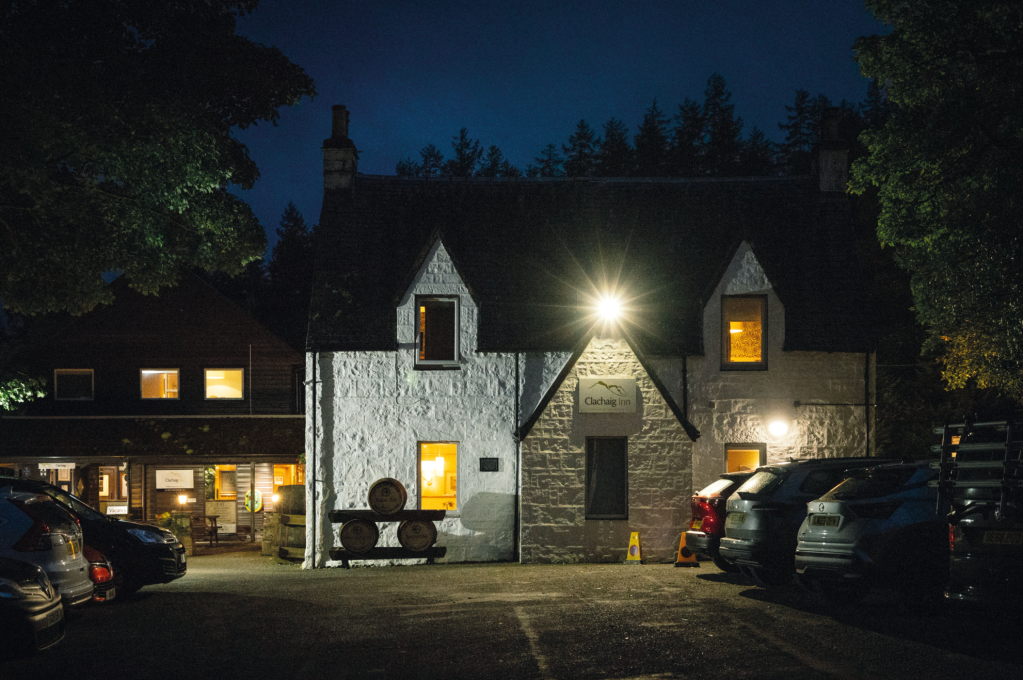
After dark at the Clachaig. Credit: Alex Roddie
2. NN128564: Turn right and follow the A82 carefully W for 1km. It’s a busy road, so take care. As you walk, a view opens up to your left. The prominent rocky prow of Aonach Dubh a’ Ghlinne forms the northern spur of Stob an Fhuarain, and the lower mountain to its right is Meall Lighiche, a fine Corbett that can be optionally combined with this route.
The view of Aonach Dubh from the Clachaig Inn. Credit: Alex Roddie
3. NN119565: Reach a track turning left just after the road bridges a burn. Follow it gently uphill for just over 1km until it crosses the burn again via a bridge.
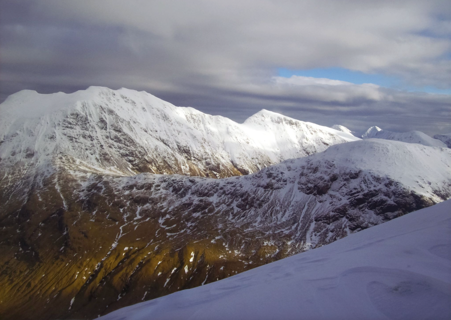
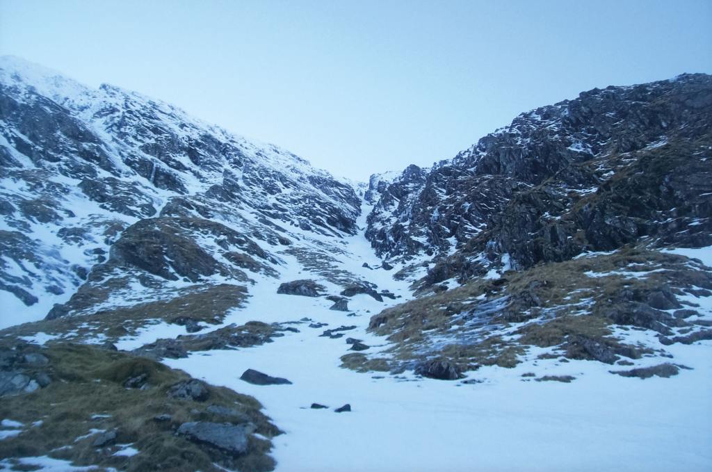
4. NN115554: After passing a house on the left, the path veers away from the track to circle around another group of buildings, then rejoins the main trail in a few hundred metres. The track soon becomes a path, which continues alongside the river and gradually steepens as it turns due S. Directly ahead are the steep N cliffs of Sgurr na h-Ulaidh, with the graded winter climb of West Gully clearly visible; right are the cliffs of Creag Bhan.
1 On the approach, looking up at the cliffs of Creag Bhan. Credit: Alex Roddie
5. NN106544: Near a small island in the river is an optional detour. While the main route continues on the E (left) bank of the burn uphill, a possible diversion crosses the river to climb the steep N ridge of Creag Bhan and continue on to the summit of Meall Lighiche (772m) before rejoining the approach to Sgurr na h-Ulaidh at Bealach Easain. This is a steep, rough and largely pathless route that will add around 1:30 to 2 hours to your day. Otherwise, the route as described follows the stalker’s path beside the river.
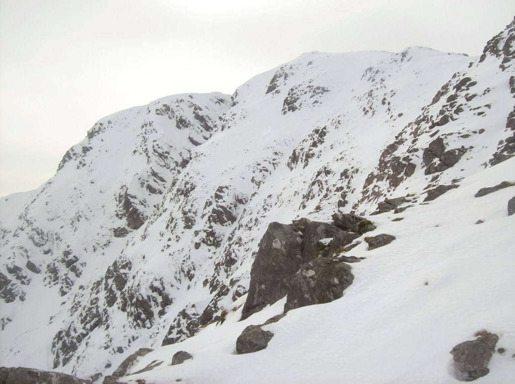
The north face of Sgurr na h-Ulaidh. Credit: Alex Roddie
6. NN108528: At around the 350m contour, the stalker’s path begins to grow faint. Cross the burn and gain 180m elevation SW towards Bealach Easain. Don’t veer too far S as you may encroach on the cliffs bordering West Gully.
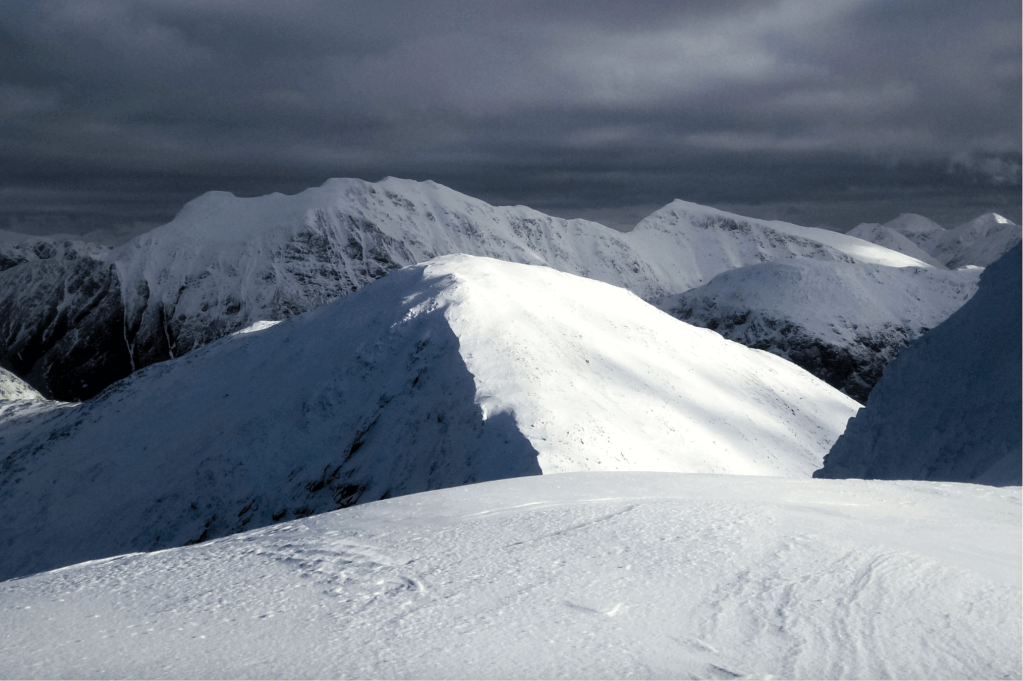
Near the summit of Sgurr na h-Ulaidh, looking across Stob an Fhuarain towards Bidean nam Bian. Credit: Alex Roddie
7. NN104524: At the bealach there is a line of fence posts and a gate. Do not follow the fence line S as it leads into technical ground. Instead, make a rightward rising traverse to easier terrain, then climb SE to Corr na Beinne. This is a rough, steep, exposed ascent that may require ice axe and crampons in winter, and is best not attempted in descent. A careful approach to route-finding must be adopted to avoid small crags. Once on the ridge, follow it E towards the summit of Sgurr na h-Ulaidh. In summer traces of a path can be found.

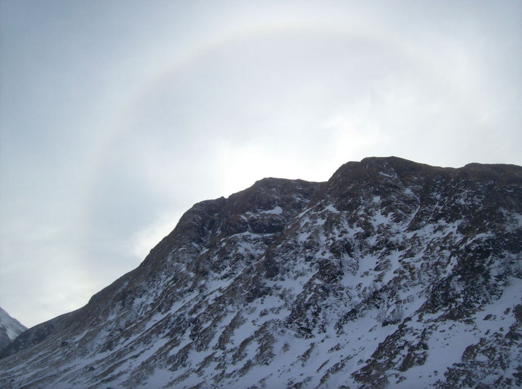
A closer view of Bidean nam Bian from the approach to Stob an Fhuarain. Credit: Alex Roddie
8. NN112518: From the summit, which has great views of Bidean nam Bian and south to Glen Etive, descend steeply NE towards Stob an Fhuarain, avoiding cornices at gully exits. A short and gentle ascent leads to the top of Stob an Fhuarain; from here descend N to a minor bealach at 798m.
The dramatic east face of Stob an Fhuarain. Credit: Alex Roddie
9. NN119530: With care, many descents W back to the stalker’s path are possible from this ridge, but the easiest begins from the 798m bealach. Cautious to avoid small rock bands and areas of unstable scree, follow a small burn downhill, taking the best line to find the easiest ground. Once you have rejoined the stalker’s path, retrace the approach back to the Clachaig Inn.
Further information
PUBLIC TRANSPORT: Citylink bus service 914 connects Glen Coe with Glasgow and Fort William. Ask to be let off at Achnacon.
TOURIST INFORMATION: discoverglencoe.scot, or Glencoe Visitor Centre, 01855 811307
Discover more walks in Scotland as mapped by our expert contributors.


