
Low in mileage but high in drama, James Forrest enjoys a quick jaunt up Mellbreak – followed by a pint in one of Lakeland’s best pub, the Kirkstile Inn.
If you only have a few hours to indulge in the fells, you could do a lot worse than head for Mellbreak. The steep climb up the towering pyramid of the north ridge is a magnificent ascent full of drama and excitement. Next the wide plateau top, which consists of two summits separated by a broad saddle, offers excellent panoramas of Crummock Water and Buttermere, before the final leg via the lonely valley of Mosedale serves up a welcome dose of tranquillity and solitude. At less than five miles, the reward to effort ratio of this walk is phenomenal.
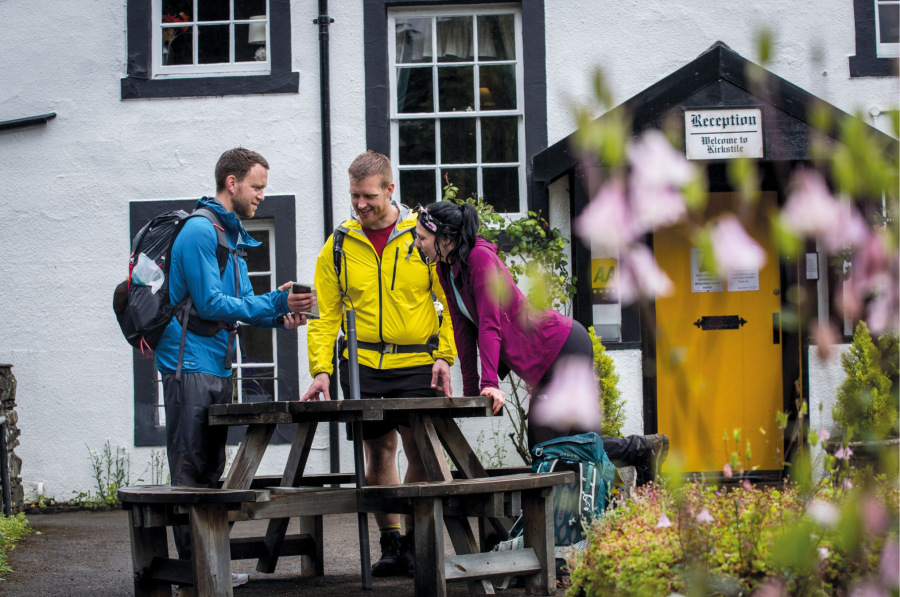
Every good walk should also end in a good country inn – and this Mellbreak route is no exception. Thankfully one of Lakeland’s best pubs, the 17th Century Kirkstile Inn, is located in Loweswater. The sun-drenched beer garden overlooks the dramatic pyramid of Mellbreak’s northern face – a mesmerising profile of the mountain – and is the perfect post-hike spot for supping on a pint of own-brew Loweswater Gold. If the sun isn’t out, simply dive into the cosy interior, snuggle next to an open fire and tuck in to some of the hearty, tasty food on offer.
Mellbreak via the Kirkstile Inn: route description
START/FINISH: Church Bridge, where there is space for a few cars (GR: NY140208) | MAPS: OS Explorer OL4 (1:25k), OS Landranger 89 (1:50k), Harvey UltraMap XT40 Lake District North (1:40k) | DISTANCE: 6.6km / 4.1 miles | ASCENT: 467m / 1,532ft | DURATION: 3 hours
1. NY140208: Parking is a bit problematic in Loweswater. You can try Church Bridge (as detailed above), the telephone box at NY143211, or – further afield – Maggie’s Bridge. From Church Bridge head south on the road towards the white buildings of Kirkgate Farm. Pass to the left of the buildings. From here the north ridge of Mellbreak looks formidable, possibly even impenetrable, but – as is often the case in the mountains – it looks worse than it actually is. Continue south on a beautiful walled lane which winds through the sheep fields. Arrive at a gate.
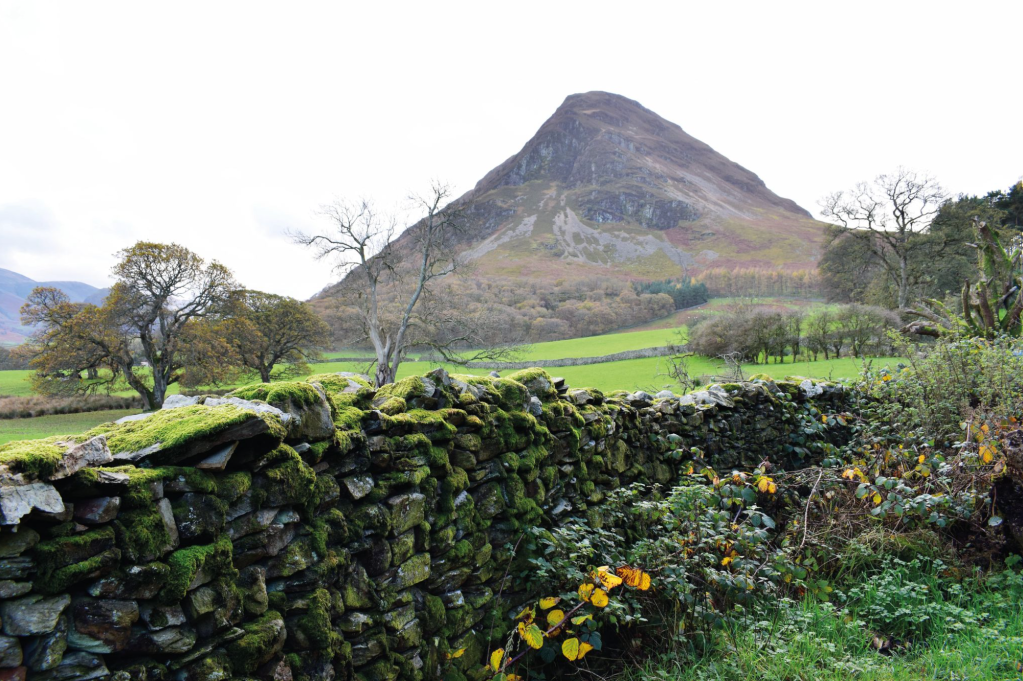
Mellbreak as seen from the start of the walk. Credit: James Forrest
2. NY139202: Ignore the bridleway, which turns right at the gate, and instead head straight up through a small plantation of trees and emerge to the open fellside beyond another gate. Take a grassy path up towards the base of the climb up White Crag. At the scree ahead take an obvious rake, which zig-zags uphill on steep, eroded and unstable ground. This section is somewhat confusing, with multiple lines created by fellow walkers. It is best to follow your nose and pick the best line, heading generally south-east, in the reassuring knowledge that – upon reaching the nose of the main ridge – a clear path thankfully appears. Pause at a promontory to gaze down over Loweswater before continuing to ascend south and finally reach the flatter north top of Mellbreak (509m), where two cairns in close proximity mark the summit.
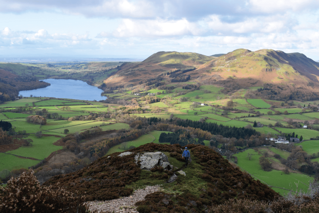
Climbing the north ridge of Mellbreak. Credit: James Forrest
3. NY143194: Continue south into the depression between Mellbreak’s north and south tops. This broad plateau is prone to waterlogging and can prove a boggy, muddy slog, so where possible stick to the winding, grassy path. In theory, it should negotiate the terrain in the best possible way, but damp feet are not uncommon in these parts. From the col between the two tops, climb gently and easily to the south top (512m), where the cairn is oddly not quite on the highest ground.
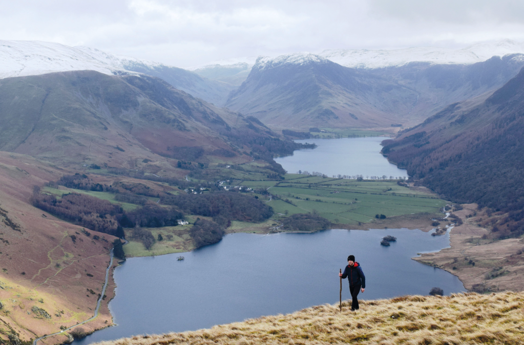
Views over Crummock Water and Buttermere from Mellbreak. Credit: James Forrest
4. NY148186: Take a few moments to enjoy the glorious views towards Buttermere. Alfred Wainwright was quite critical of Mellbreak’s south summit, describing it as inferior to the north top – “it is the lower north top that captures the fancy, not the other” – but you can make your own mind up. Once you’re done with ogling the view, head north-west, re-tracing your steps on the grassy path back to the boggy saddle and a path junction.
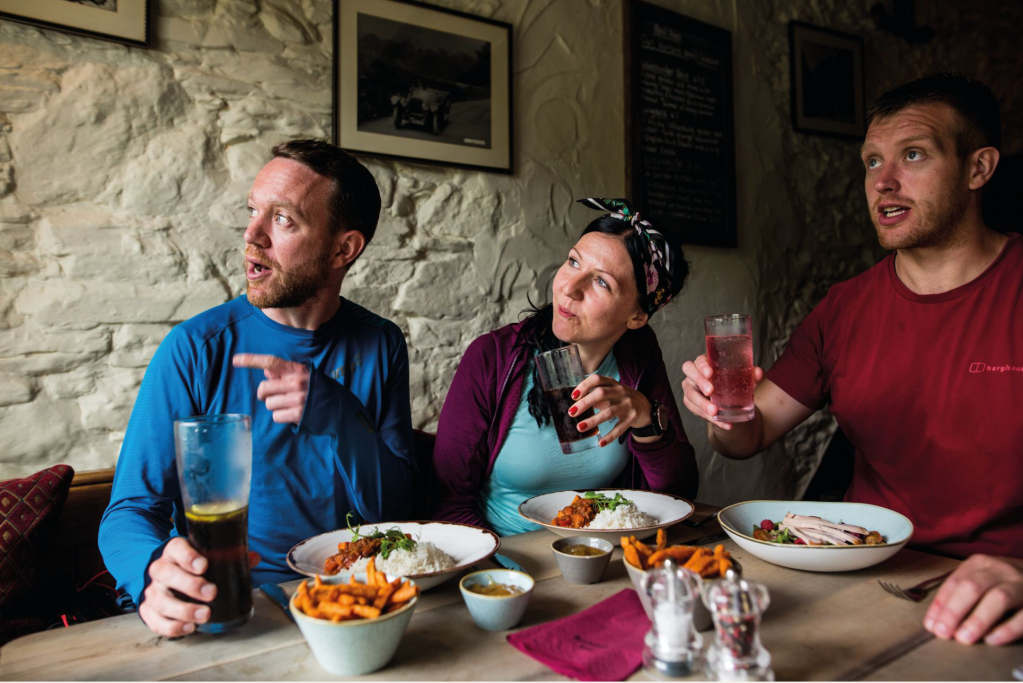
Inside the Kirstile Inn. Credit: Jessie Leong
5. NY144190: Turn left on a faint path that heads south and then south-west towards the Mosedale Holly Tree, the only single tree in Lakeland to be named on maps. Reach the main path in the valley and turn right. Continue north on the 4×4 track alongside a metal fence, with Mosedale Beck to your left and the steep slopes of Mellbreak to your right. Arrive at a forest edge and veer right, before taking the walled lane back to Church Bridge. Your reward? Head to the Kirkstile Inn for some well-deserved post-hike refreshments.
Further information
PUBLIC TRANSPORT: There are no bus services direct to the start of the walk, but the 77/77A Honister Rambler connects Keswick with Lorton and Buttermere during the summer season only.
TOURIST INFORMATION: www.visitlakedistrict.com
Discover more walks in the Lake District as mapped by our expert contributors.


