The Great Outdoors rounds up the best Peak District waterfall walks – in both the Dark Peak and the White Peak – and how to go waterfall hunting to find your own secret spots.
With their tumbling waters set into hillsides and cloughs, waterfalls are almost always worth hunting. And yet, many are accessible and well-trodden enough to be within reach for most adventurers, especially in the Peak District. Our first national park may be small, but what it lacks in elevation it makes up for in charm and character, condensed around friendly communities that cement it as a popular destination for hillwalkers. They might not cascade from great heights, but these Peak District waterfall walks have their own kind of enchanting charm.
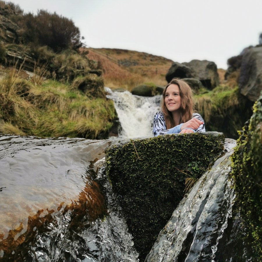
Words: Francesca Donovan | Main image credit: Francesca Donovan
Please respect the environment and the local communities by ensuring you leave no trace on your waterfall walks.
- Kinder Downfall
- Birchen Clough
- Middle Black Clough
- Fairbrook Clough
- Wessenden Reservoir Falls
- Issue Clough
- Three Shires Head
- Lathkill Dale
- Little Waterfall Swallet
- Monsal Dale weir
- Danebridge weir
- Chatsworth weir
The best Peak District waterfall walks: Dark Peak
With gritstone cloughs and superlative elevation comes good waterfall-hunting territory. Look to the north of the Peak District – the Dark Peak – for some challenging days out. Almost all of these Peak District waterfall walks require you to come off the beaten track at points. Good navigational skills are advised. Likewise, some of these routes include grade 1 scrambles and so should be approached with caution, especially in difficult conditions.
1. Kinder Downfall
Start/finish: Bowden Bridge car park | Maps: OS Explorer OL1 – The Peak District, Dark Peak (1:25k scale) | Distance: 7.9 miles/12.8km | Ascent: 1,425ft/424m | Duration: 4 to 5 hours | Transport: None to start
Red Brook waterfalls Credit: Francesca Donovan
Kinder Downfall is the highest waterfall in the Peak District, perched on the Pennine Way, located on Kinder Scout with views down to Kinder reservoir. The 30-foot falls are best viewed in winter when the flow of water is stronger. Otherwise, you might be hiking for a trickle. Catch it on a windy day and you may be treated to watching the waterfall ‘flow’ upwards in the gusts. Once in a blue moon, the conditions will become cold enough for the waterfall to freeze over and transform into the premier Peak District ice-climbing spot.
While there is no ‘quick’ route to get here, there are two enjoyable circular walking options to reach your waterfall. The shorter route begins in Hayfield – the meeting place of the Kinder Mass Trespass – and climbs up William Clough (12.5km). This is a bit of a scramble so sure-footedness and good fitness are required. You’ll pass Kinder Low and descend via Kinderlow End, enjoying views down to the reservoir.
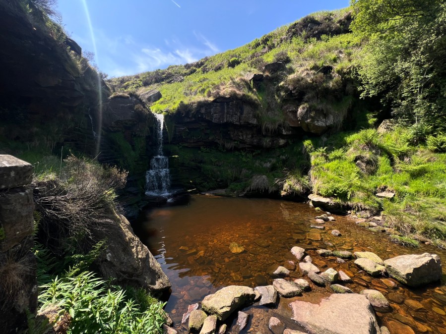
If you fancy a spicier scramble, Red Brook will spit you out just south of Kinder Downfall, bypassing some smaller falls just about deep enough for a dip.
You can also approach Kinder Downfall from the start of the Pennine Way in Edale (or cut out a bit of the walk by starting at Upper Booth). This route will take you via more waterfall territory, either up Grinsbrook Clough (14km) or Crowden Clough (15km). Once again, these are routes with a scrambling element. On the return via Kinder Low trig point, taking in vistas over the Edale valley towards Mam Tor and The Great Ridge, you’ll get respite coming down the old packhorse route of Jacob’s Ladder.
2. Birchen Clough
Start/finish: Dovestone Reservoir car park | Maps: OS Explorer OL1 – The Peak District, Dark Peak (1:25k scale) | Distance: 9 miles/14.5km | Ascent: 1,050ft/320m | Duration: 5 to 6 hours | Transport: None to start
Birchen Clough plunge pools Credit: Francesca Donovan
A classic Peak District walk and a great option as a starter scramble, this 9km route around Dovestones Reservoir has some great additional features, including the Trinnacle. There are options to add the windswept Chew Reservoir (mapped below) and also Alphin Pike for trig baggers, but after a tough shuffle on hands and feet up Birchen Clough waterfalls, you might want to duck out earlier. This clough can be difficult – and very slippery – to cross and climb especially after rain and it’s a less spectacular sight than other falls on this list. Really, this scramble is a quick adrenaline rush to be enjoyed on a big day out in the Dark Peak moors taking in views over to Manchester and beyond. Gaiters at the ready!
3. Middle Black Clough
Start/finish: A628 layby car park | Maps: OS Explorer OL1 – The Peak District, Dark Peak (1:25k scale) | Distance: 1.4 miles/2.3km | Ascent: 225ft/69m | Duration: 1 to 2 hours | Transport: None to start
This is the shortest route to a waterfall in the Dark Peak so perhaps one to avoid if you’re looking for a long adventure day. This waterfall is tucked away off the beaten paths and the Trans Pennine Trail around Torside and Woodhead Reservoirs to the west, right off a layby on the A628. But don’t let that fool you. The linear route does also boast some mildly challenging terrain, a crossing of the River Etherow and a quick ascent so you’ll work up a sweat. The adjacent clough, Near Black Clough, also boasts delightful triple falls so the area is worth exploring further. Taking in a two-pronged route to both waterfalls you’ll cover 5km, but you have the option to walk a there-and-back route to Middle Black Clough of 3km.
4. Fairbrook Clough via Ashop Clough
Start/finish: Snake Pass Hope Woodland car park | Maps: OS Explorer OL1 – The Peak District, Dark Peak (1:25k scale) | Distance: 9 miles/14.7km | Ascent: 1,175ft/358m | Duration: 4 to 6 hours | Transport: None to start
Halfway up Fairbrook Naze Credit: Francesca Donovan
This is a longer route than others on this list, racking up a solid 13km and 547m of ascent. It’ll likely take six hours or more due to both a clough-bound ascent (Fairbrook) and descent (Ashop) via Kinder Edge. But, the northern side of the Kinder Plateau is quieter waterfall territory, just off the Snake Pass. It’s worth the extra effort and navigational requirements. Plenty of mini plunge pools offer perfect spots for quick dips or pork pie picnics. Be cautious in wet conditions because this route can be unstable underfoot and hand.
5. Wessenden Reservoir Falls
Start/finish: Wessenden Head car park | Maps: OS Explorer OL1 – The Peak District, Dark Peak (1:25k scale) | Distance: 5.4 miles/8.7km | Ascent: 750ft/229m | Duration: 2 to 3 hours | Transport: None to start
A lovely place for a quick dip on a hot day. Credit: Francesca Donovan
Numerous falls tumble down into Wessenden Reservoir so it’s a great area to explore on long days out or in shorter jaunts up to these relatively quiet spots along the Pennine Way. Starting at the Wessenden Head car park, a 9km route will include Sike Clough, Blakely Clough and the bottom reservoir, returning along the Pennine Way as you came. Stay south of the reservoir to pick your own path to further falls on Wessenden Brook, leading to Wessenden Head reservoir and back to your starting point. Alternatively, include West Nab trig point on an extended loop.
6. Issue Clough
Start/finish: Wessenden Head car park | Maps: OS Explorer OL1 – The Peak District, Dark Peak (1:25k scale) | Distance: 4.6 miles/7.4km | Ascent: 725ft/221m | Duration: 3 to 4 hours | Transport: None to start
Alternatively, head south from the Wessenden Head car park and you’ll reach Issue Clough, after some slippery terrain and navigation. You can include Black Hill on this 7km almost-linear route, and it’s worth doing to reach some big skies after the enclosed clough walk-up. Certainly, the clough feels far away from the busy A-road traffic above and this moorland section of the Pennine Way is relatively quiet in comparison to those close by to Kinder Scout.
The best Peak District waterfall walks: White Peak
For more family-friendly options, look south to the White Peak. Here, the terrain is generally easier and navigation doesn’t often require you to pick your way across vast plateaus. But the rolling hills offer great low-stakes days out.
1. Three Shires Head
Start/finish: Gradbach car park | Maps: OS Explorer OL24 – The Peak District, White Peak (1:25k scale) | Distance: 3.8 miles/6km | Ascent: 400ft/122m | Duration: 3 to 4 hours | Transport: None to start
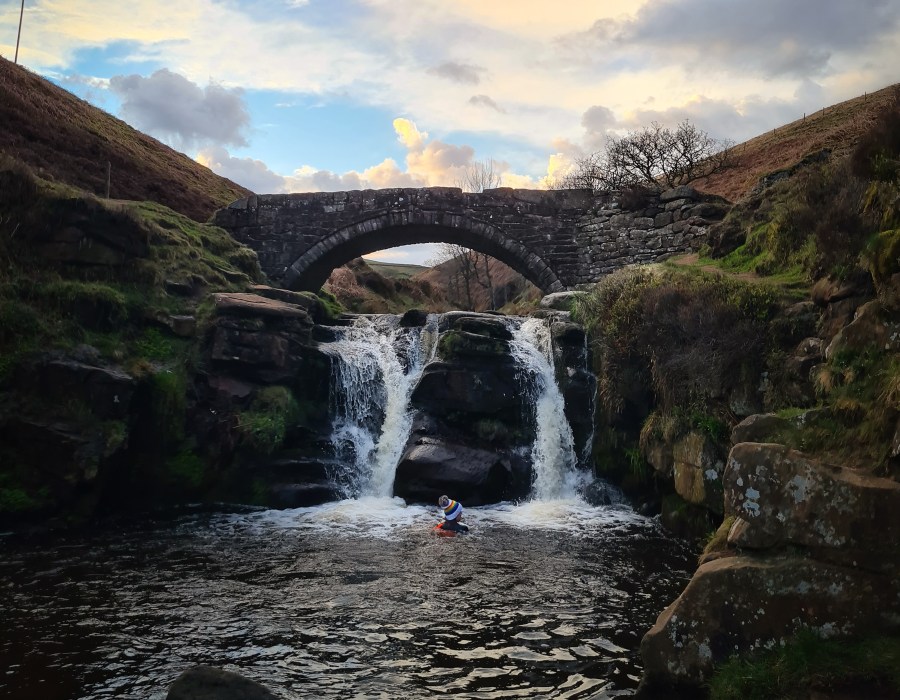
Three Shires Head Credit: Francesca Donovan
It would be remiss to create a list of Peak District waterfall walks without including Three Shires Head. While you may have to share the experience with others due to its popularity, there are good reasons for this. It is an easy bimble with no scrambling and yet you’ll still be rewarded with not one but two waterfalls – including Panniers Pool – in a simple two-hour walk from Gradbach.
The real beauty of this spot is the history in which it is shrouded. The old packhorse bridge at Three Shires Head crosses the River Dane at the county boundaries of Cheshire, Derbyshire and Staffordshire and was an infamous scene of lawlessness associated with bare-knuckle boxing and illegal gambling for its prime position on constabulary borders.
2. Lathkill Dale
Start/finish: Over Haddon car park | Maps: OS Explorer OL24 – The Peak District, White Peak (1:25k scale) | Distance: 8.4 miles/13.5km | Ascent: 750ft/229m | Duration: 4 to 5 hours | Transport: None to start
This White Peak waterfall is a picturesque spot perfect for dog walking or family rambles – or just for a restful ramble. It is one of the prettiest limestone Derbyshire Dales and makes for a popular riverside destination. You can reach it on an easy there-and-back walk from Over Haddon. There is no swimming permitted here. However, if it’s a refreshing dip you seek, you can make this route a longer (14km) circular taking in the Haddon Estate’s swimming pool at Youlgreave. Both of these waterside spaces do get busy, especially in summer, but the quiet bimble in between across the open hillside should provide some peace and quiet.
3. Little Waterfall Swallet
Start/finish: Eyam car park | Maps: OS Explorer OL24 – The Peak District, White Peak (1:25k scale) | Distance: 4.2 miles/6.8km | Ascent: 500ft/152m | Duration: 2 to 3 hours | Transport: None to start

Little Waterfall Swallet in winter. Credit: Francesca Donovan
This is one of Eyam’s best-kept secrets. While most of the village’s footfall can be attributed to its place in the history of the plague, waterfall hunters walk here, too. Best viewed after heavy rain, Waterfall Swallet is easily accessible, just off the road between Eyam and Foolow. The cavernous feel of the falls, covered in moss, adds to its magical qualities and it’s a lovely place to take a breather. A short circular walk (7km) along easy trails, with a short ascent up to Bole Hill and Eyam Edge, will take in the plague stones, the falls and both villages. To make the walk easier, you could simply follow the road out of Eyam heading west.
4. Monsal Dale weir
Start/finish: Monsal Head car park | Maps: OS Explorer OL24 – The Peak District, White Peak (1:25k scale) | Distance: 1.9 miles/3km | Ascent: 350ft/107m | Duration: 1 to 2 hours | Transport: None to start
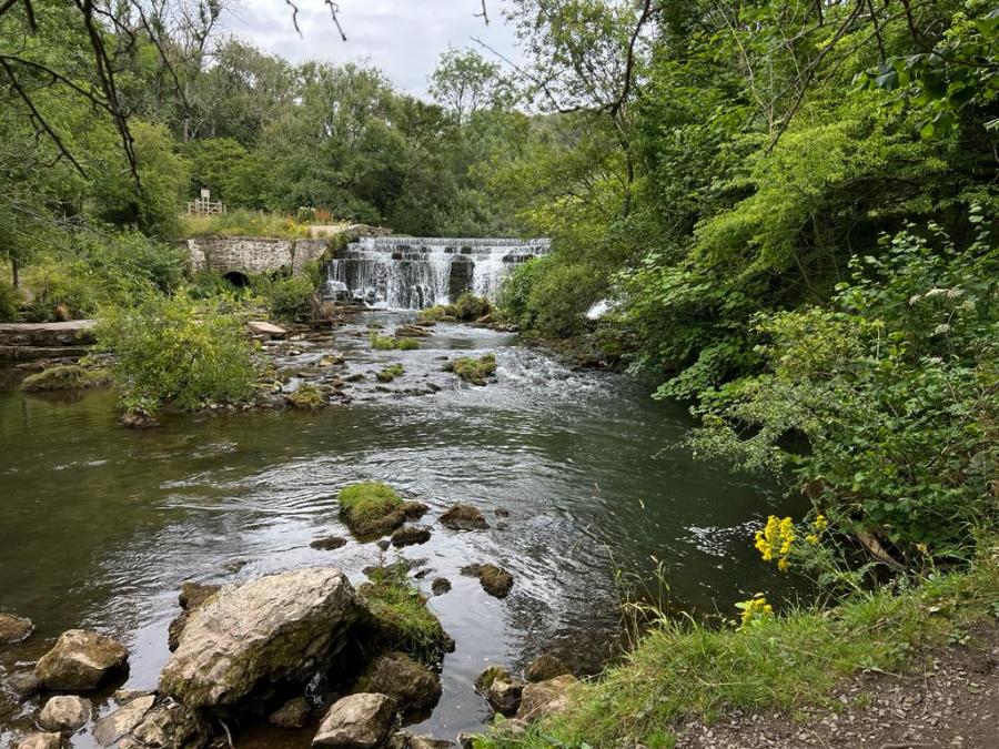
Monsal Dale Credit: Francesca Donovan
We’ve taken the liberty of including a few weirs on this list of Peak District waterfall walks. If you like the sound of running water, and want an easy route, these are sometimes convenient alternatives. Monsal Dale on the River Wye is a deep dale of dense woodland which, on a quiet day, can feel worlds away from the bustling viaduct viewpoint – complete with ice cream van – at Monsal Head. The weir is reached in a 3km circular with a fair amount of ascent up and down Monsal and Cressbrook dale on the Monsal Trail. The caves and woodlands are well worth exploring, especially for young adventurers. For a longer but quieter woodland waterside route, park at Lees Bottom.
4. Danebridge weir
Start/finish: Wincle village | Maps: OS Explorer OL24 – The Peak District, White Peak (1:25k scale) | Distance: 2.3 miles/3.7km | Ascent: 637ft/46m | Duration: 1 to 2 hours | Transport: None to start
Danebridge Weir Credit: Francesca Donovan
Wincle has to be one of the best villages to wander around in the Peak District. With a particularly nice pub and the Wincle Brewery to pick from, there are plenty of places to quench your thirst after wandering through woodland and meandering paths through fields to find this weir on the river Dane.
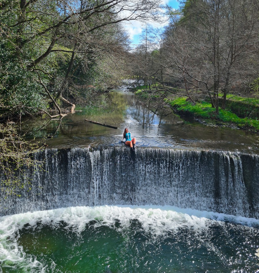
6. Chatsworth weir
Start/finish: Calton Lees car park | Maps: OS Explorer OL24 – The Peak District, White Peak (1:25k scale) | Distance: 3.8 miles/6km | Ascent: 425ft/130m | Duration: 2 to 3 hours | Transport: None to start
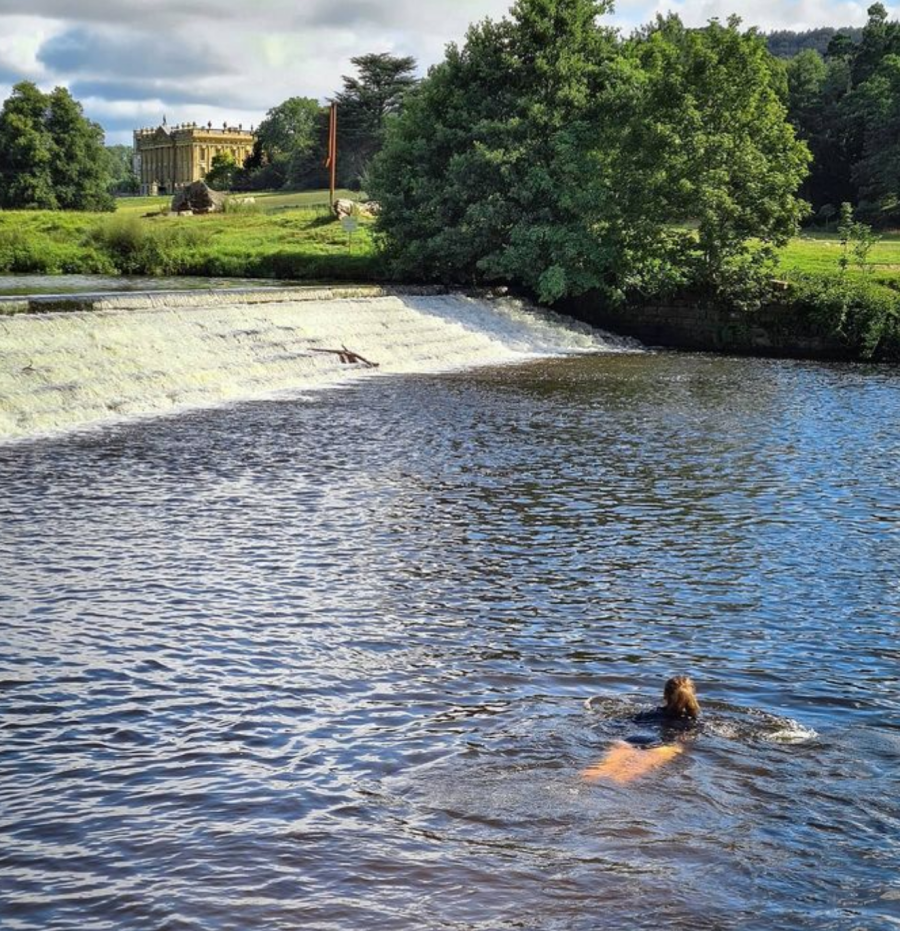
Views over to Chatsworth House Credit: Francesca Donovan
Again, more weir than waterfall, we’ve added this to the list as it’s a great place for a swim. The Chatsworth Estate is known to turn a blind eye to swimmers so it’s a favourite of local dipping groups. With views across to Chatsworth House itself, the walks across its sweeping grounds are easy going. There is parking close by at Calton Lees car park. We recommend a 6km circular taking in some of the Estate on the Derwent Valley Heritage Way and the toy-town village of Edensor.
How to find a hidden waterfall
This is not an exhaustive list of every single waterfall in the Peak. There are plenty of other Peak District waterfall walks that have been hard-won by waterfall hunters. One of the great joys of walking is stumbling across a little-known spot while out on a bimble, or finally hearing the sound of tumbling water after trudging through the Dark Peak bog.
So, here are some of The Great Outdoors‘ top tips for finding waterfalls.
- Grab an OS Map: OL1 – Peak District Dark Peak and OL24 – Peak District White Peak cover the Peak District waterfall walks)
- Locate the markings for ‘waterfall’ or ‘fall’: many are already labelled to make hunting a little easier.
- Seek out water sources: if there are no marked waterfalls in your search area, locate the thin blue lines (these mark water sources) that cross close contour lines which indicate geographical drops.
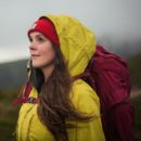
- Check the forecast: waterfalls are at their best just after rain when the flow is most impressive. This means getting out during changeable seasons, so be prepared with appropriate waterproof jacket.
- Be prepared: like all hillwalking, you should select your route based on the walkers’ fitness and navigational capabilities. Take a map, compass, and first aid kit, especially on routes that involve scrambling.
Discover more beautiful walks in the Peak District, including five of the best Peak District pub walks. Alternatively, if you’re seeking altitude only a few hours from Manchester and Liverpool, check out The Great Outdoors‘ six best hiking routes in Snowdonia.
Please remember to take care of the Peak District and leave no trace on your adventures.