We often head into the outdoors for peace and quiet. But history buffs and spook-seekers will tell you how our collective human history – from the mythological to the truly tragic – sometimes haunts these spaces. Our hills have played host to wraiths and giants as well as almost-forgotten tragedies centuries gone by and the persecution of misunderstood and marginalised people. Whether you’re hunting for history or simply want to creep out your walking companions with a tall folk tale of yore, here are 13 of Britain’s most spooky walks – including spots where some say you can physically sense the spiritual and mythological past – as selected and mapped by our expert contributors.
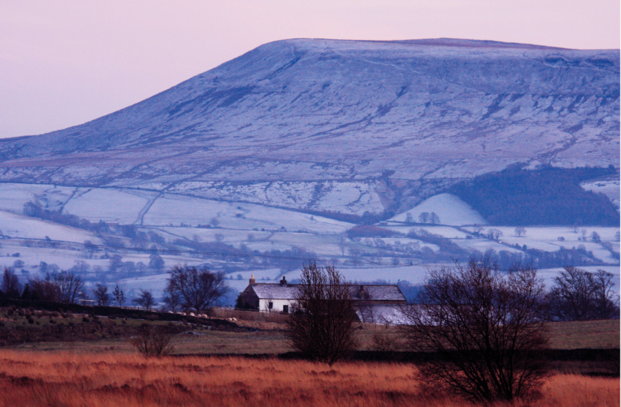
Main image: Pendle Hill exerting a brooding presence over the Ribble valley | Credit: Andy Carson
Some of Britain’s most spooky and spiritual walks
- Ben Macdui, Cairngorms
- Hadrian’s Wall, Northumberland
- Pendle Hill, Lancashire
- The Corpse Road, Lake District
- Yr Wyddfa/Snowdon, Eryri/Snowdonia
- Rhinog Fawr’s Roman Steps, Eryri/Snowdonia
- Moelywnion, Eryri/Snowdonia
- Bleaklow Head and Higher Shelf Moor, Peak District
- Walsgrove Hill and Devil’s Den, Worcestershire
- Llyn y Fan Fawr & Llyn y Fan Fach, Bannau Brycheiniog/Brecon Beacons
- Cwmyoy and Hatterall Hill, Black Mountains
- Devil’s Tor and Wistman’s Woods, Dartmoor
1. Ben Macdui, Cairngorms
Watch your step in the Cairngorms, says Craig Weldon – you might be being followed!
START/FINISH: National Trust for Scotland Linn of Dee carpark; NO063898 | MAPS: OS Explorer OL57 & OL58 (1:25k), OS Landranger 36 & 43 (1:50k), Harvey British Mountain Map Cairngorms & Lochnagar (1:40k) | DISTANCE: 32km/20 miles | ASCENT: 1000m/3,300ft | DURATION: 9.5 hrs
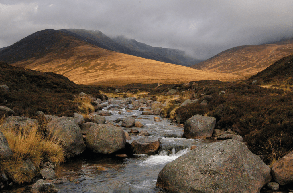
The Cairngorms have always been Scotland’s historic wilderness: too high, barren and windswept to sustain human life, they are stalked instead by the terrifying creatures of folklore. Creatures such as Lamh Dearg (bloody hand), who haunts the paths challenging victims to a fight. Accept! Those who refuse he kills, but those who face up to his challenge he allows to pass as a friend.
It’s no wonder the summit too has its spectre, Am Fear Liath Mor, the Big Grey Man of Ben Macdui. Rarely seen but sometimes sensed, the Grey Man is responsible for those eldritch neck prickles when you are alone in the mist and become convinced someone is just behind you. Whether the spirit of the mountain is a Brocken spectre, or infrasound, or something else entirely, it exists: many experienced hillwalkers can testify to an odd or uncanny experience when up these hills and far from home. Take care of yourself on the Cairngorm plateau – there’s more to deal with out there than bad weather.
Read the full route description for Ben Macdui.
2. Hadrian’s Wall, Northumberland
Ian Battersby discovers a long length of breath-taking scenery and lung-busting undulations once frequented by Roman militia fending off northern raiding parties.
START: Thirlwall Castle small car park; GR: NY658659 | FINISH: The Old Repeater Station bus stop; GR NY816701 | MAPS: OS Explorer OL43 (1:25k), Harvey National Trail Hadrian’s Wall Map (1:40k) | DISTANCE: 19.8km / 12.3 miles | ASCENT: 775m / 2,542ft | DURATION: 6.5 hours
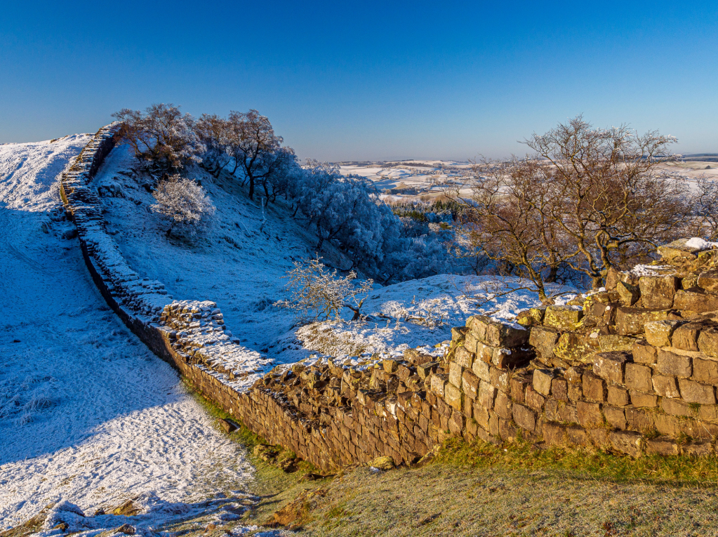
Hadrian’s Wall became a World Heritage Site in 1987, and the sense of history is as embedded now as were the Roman militia then, stationed here to fend off northern raiding parties. This was the extreme north-western limit of the empire, and certainly no place like Rome, but some argue that skirmishes were scarce, and it was better than risking life and limb elsewhere.
And what a view they enjoyed! The wall follows the Whin Sill, a geological fault line of tough dolerite that parades as a rolling scarped edge stretching into the far-flung east. Dolerite is so robust the Romans didn’t use it for the wall, instead quarrying softer stone from nearby locations. The wall forms a natural linear walk, and the B6318 runs parallel at a discrete distance, with plenty of escape routes should the beauty of the area, or the unexpected gradient, make the uninitiated late for the last bus back.
Read the full route description for Hadrian’s Wall.
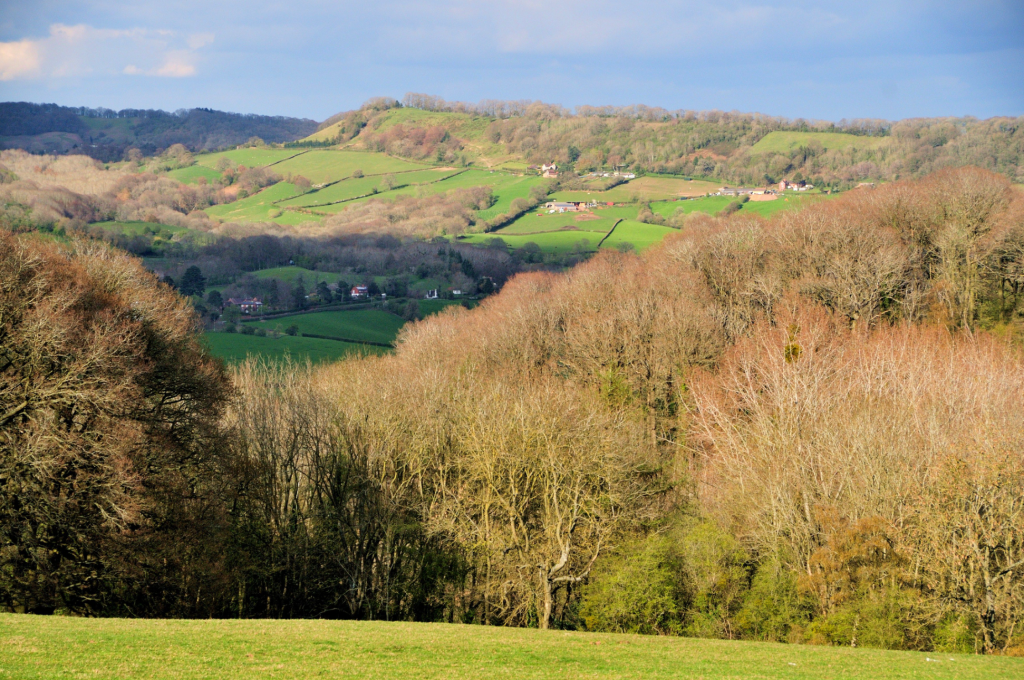
3. Pendle Hill, Lancashire
Pendle is one of a kind, a spooky walk standing aloof between the Ribble and Calder valleys says Norman Hadley.
START/FINISH: There’s a small car park in Downham (GR: SD785441) | MAPS: OS Explorer Forest of Bowland and Ribblesdale OL41 (1:25k) | DISTANCE: 15km / 9.3 miles | ASCENT: 460m / 1,509ft | DURATION: 4½ hours
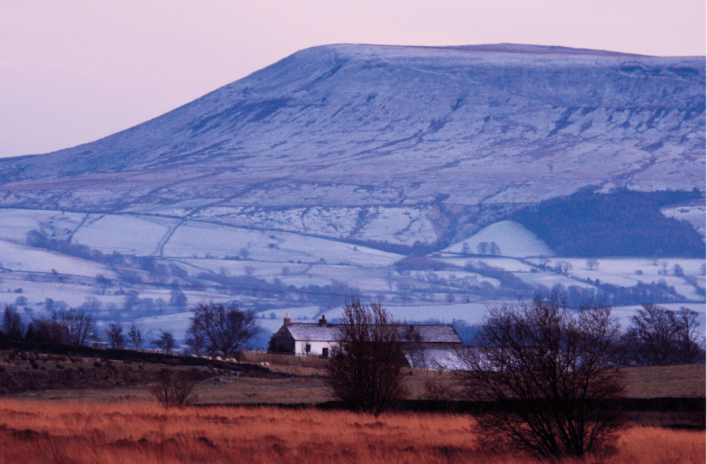
Pendle Hill forms a comfortingly familiar profile from viewpoints far away in Lakeland and the Dales. It is rich in history; you’ll know the story of the so-called witches, which is far darker than the pointy-hatted broomstick-riding profiles beloved of the local tourism industry.
There’s also an enlightened side to 17th century Lancashire history too. Here it was that George Fox begat the gentle faith of Quakerism and here it was that proto-scientist Richard Towneley discovered the relationship between altitude and air pressure. Nowadays, Pendle Hill is popular with paragliders and outdoor enthusiasts who prefer their adventures on two feet.
There are many ways up but the best are at the steep end from Barley or Downham, an out-of-this-century village. Notice the lack of TV aerials, satellite dishes or telegraph poles, masking it popular as a location for period dramas. For older readers, it was the setting for the 1961 film Whistle Down the Wind. The gents ’toilets are an Olde Worlde marvel, converted from an old byre.
Read the full route description for Pendle Hill.
4. The Corpse Road, Lake District
Vivienne Crow follows in the footsteps of ancient mourners in the Lake District Far Eastern Fells on the Corpse Road.
START/FINISH: Mardale Head car park at southern end of Haweswater Reservoir, GR NY469107 | MAPS: OS Explorer OL5 (1:25k), OS Landranger 90 (1:50k), Harvey 1:25,000 Superwalker Lake District East | DISTANCE: 8.7km/5.4 miles | ASCENT: 518m/1,700ft | DURATION: 3½-4 hours
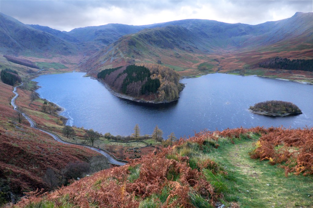
For many centuries, the people of Mardale used to have to carry their deceased from their remote home valley, across the fells into neighbouring Swindale and then on to Shap, seven miles away, for burial. They had their own church, but the burial ground wasn’t consecrated until the 18th century. The route they took is what we now call a ‘corpse road’, one of many that cross the Lake District fells. And, while the last body carried along this particular corpse road was that of John Holme in 1736, these ancient routeways continue to be used by walkers today, crossing from one valley to another.
The route featured here climbs from Mardale Head on to the desolate moorland peaks of Branstree and Selside Pike. From the moody ridge linking the two tops, we look down on Haweswater, the reservoir now covering the settlements that once existed in Mardale, including the old church. The route then drops on to the corpse road and follows its zig-zagging descent, past disused peat huts and back into the valley.
Read the full route description for Branstree and the Corpse Road.
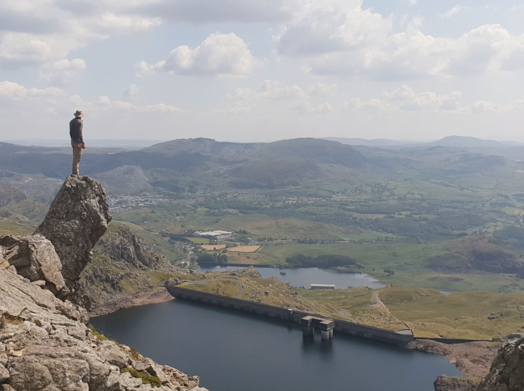
5. Yr Wyddfa/Snowdon, Eryri/Snowdonia
Have you put off scaling Yr Wyddfa because you’re worried it might be busy? Alex Roddie thinks you might be doing it a disservice and suggests you visit the resting resting place of Rhudda/Rhitta Gawr, the strongest and most violent of all the giants of ancient times.
START/FINISH: SH583597, car park at Snowdon Mountain Railway Station, Llanberis | MAPS: OS 1:25,000 Explorer sheet OL17 (Snowdon/Yr Wyddfa), OS 1:50,000 Landranger sheet 115 (Snowdon/Yr Wyddfa), Harvey 1:40,000 British Mountain Map (Snowdonia North) | DISTANCE: 13.7km / 8.5 miles | ASCENT: 969m / 3,179ft | DURATION: 6 to 7 hours
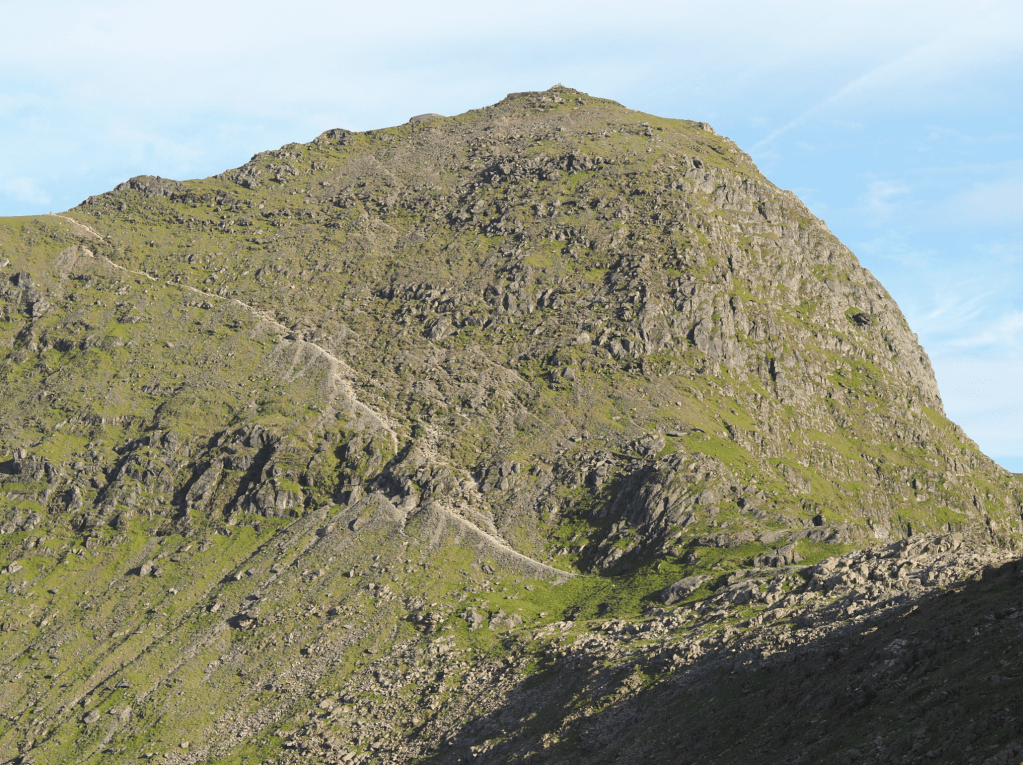
Snowdon (Yr Wyddfa in Welsh) is one of the most popular mountains in the UK, and the most popular route is the Llanberis Path. This route climbs from Llanberis to the summit, partly following the route of the Snowdon Mountain Railway, and can be a busy climb – especially on a sunny weekend or Bank Holiday. There’s a lot of ascent, but in good conditions it’s suitable for most hillwalkers and is therefore an accessible introduction to walking in Wales. However, it can feel overly busy; if you are looking for solitude then there are countless other routes to try. But combining it with a more interesting descent to make a complete traverse of Yr Wyddfa can transform the experience.
The Watkin Path is one of the more challenging walking routes on the mountain, descending rugged slopes south of the summit before dropping down into the wild and beautiful Cwm Llan. There is evidence of past mining activity on the way down. With a very different character, this makes a delicious contrast to the Llanberis Path: something to look forward to on your stroll to the summit.
Read the full route description for Yr Wyddfa via the Watkin and Llanberis Paths.
6. Rhinog Fawr’s Roman Steps, Eryri/Snowdonia
Ian Battersby finds gold on Rhinog Fawr – but not by chasing Roman ghosts on one of the spooky walks of Eryri.
START/FINISH: Farm and parking at Cwm Bychan; SH646315 | MAPS: OS Explorer OL18 (1:25k), OS Landranger 124 (1:50k), Harvey British Mountain Map Snowdonia South De Eryri (1:40k) | DISTANCE: 11.7km / 7.3 miles | ASCENT: 766m / 2513ft | DURATION: 5 hours
The Roman Steps above Bwlch Tyddiad on Rhinog Fawr were built and used by battalions of Roman warriors during their centuries of Welsh occupation. Their presence was so rooted here that even today it is possible – according to some – to glimpse leagues of troops marching the route, and leading those who would follow to gold. As you march the slabs and look up at the towering crags, it’s easy to imagine potential ambush, but it turns out that imagination is mostly what feeds this tall tale.
In fact the route is likely rooted in the Bronze Age, and the stepped upgrade is thought to be Medieval, but many a true word is spoken in jest. The Romans may have used the route before the “Steps” were a twinkle, long before what we now know as the Cambrian Way came to fruition, and going along with the myth is fun. Legend has it, it may also bring golden rewards that come with successfully navigating this taxing terrain to uncover waterfalls, dense woods, alluring lakes and formidable crags with far-reaching vistas.
Read the full route description for Rhinog Fawr.
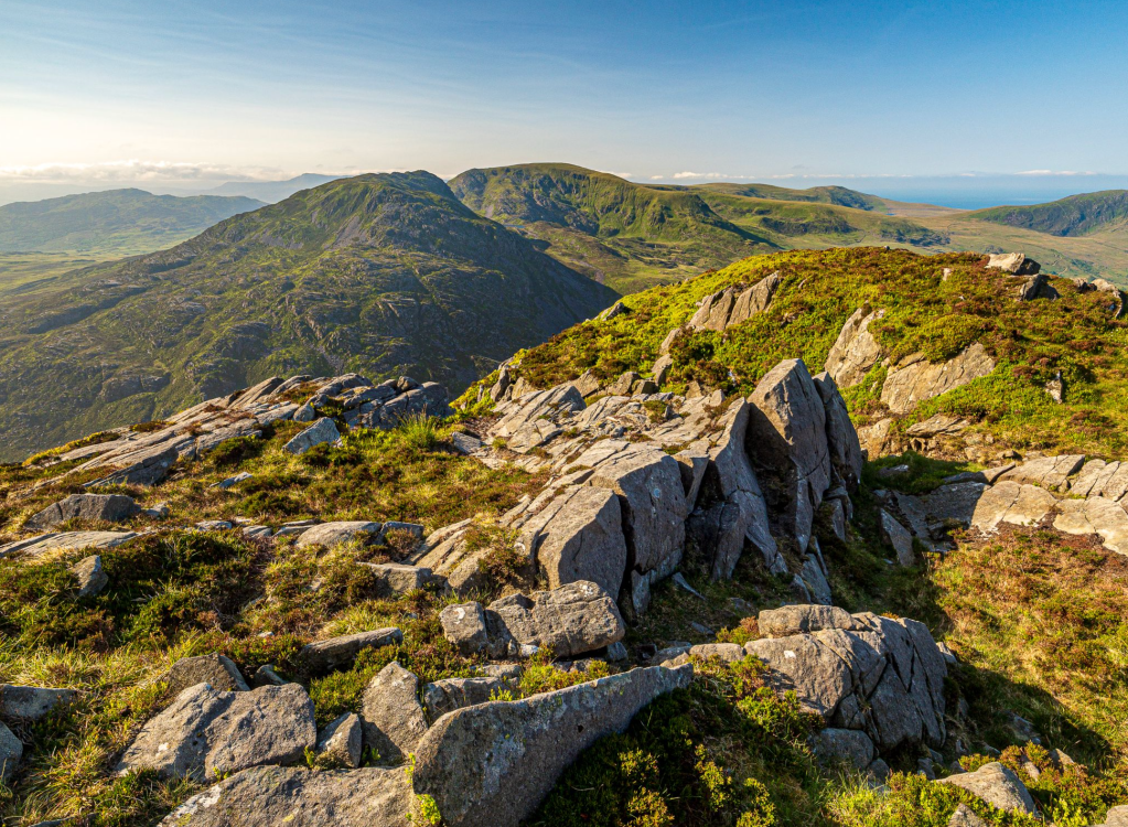
7. Moelywnion, Eryri/Snowdonia
For a pleasant day out that includes tops, lakes, lots of ruins and an angry giant, look no further than the Moelywnion, says Emily Woodhouse.
START/FINISH: Fairly small car park off the side of the road, just south east of Tanygrisiau station; SH 685 448 | MAPS: OS Explorer Map OL18 (1:25k), OS Landranger Map 124 (1:50k), Harvey British Mountain Map Snowdonia North (1:40k) | DISTANCE: 10.5km / 6.5 miles | ASCENT: 750m / 2500ft | DURATION: 4 hours
The Moelywnion are an often forgotten but very pleasant group of mountains in central Snowdonia. Compared to the sheer rocky peaks of the north, they are rolling and grassy. This walk takes in two of the higher summits in the range: Moelwyn Mawr and Moelwyn Bach. Aside from the tops, the area is covered in disused quarry pits and buildings. The route passes several you can explore, following sections of the Snowdonia Slate Trail and Cumbrian Way.
For a bit of fun folklore: the eponymous Maen Twrog is a strange round-topped standing stone outside the church in the village of Maentwrog. It is said that the stone was thrown there from the top of Moelwyn Mawr. In the version I was told, it was a giant throwing the stone down at the villagers in anger. However in other versions the stone is thrown by Saint Twrog, given superhuman strength in his battle against the devil. Either way, you can stand on the top of Moelwyn Mawr, look south and wonder what it might have looked like to see a boulder be thrown 5km.
Read the full route description for the Moelywnion.
8. Bleaklow Head and Higher Shelf Moor, Peak District
Andrew Galloway goes in search of the wreckage of aeroplanes in the Peak District on Bleaklow.
Start/Finish: The crossroads of High Street and Victoria Street in the centre of Glossop. (GR: SK035940) | Distance: 19.5 km (12 miles) | Ascent: 560m | Time: 6 hours | Maps: Ordnance Survey 1:25,000 Peak District OL1
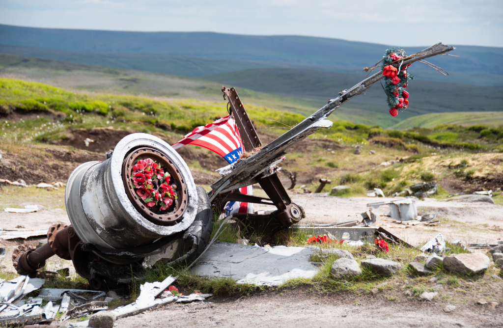
Just a few hundred metres north of the trig-point we found the first piece of twisted aluminium lying against black peat, shining in sunlight as if newly cast. In fact it has lain here, high on the moor near Bleaklow, for seventy years.
It takes a while to orientate yourself among the wreckage, spread out over a hundred square metres. The fragments of an aeroplane slowly begin to knit together to form a whole: four engines first, followed by undercarriage, wings, tail-plane. Then you think of the crew. This USAF Boeing RB-29 known as “over-exposed” was taking payroll and mail from Scampton in Lincolnshire to the USAF supply base at Burtonwood near Warrington on 3 November 1948. In poor weather conditions the flight was conducted on instruments, the pilots effectively flying blind. It is thought that the captain understood his position to be further west and began to descend too early to make his approach with disastrous consequences. All thirteen crew were instantly killed as the aircraft ploughed into the ground.
Some years ago, local historian Gerald Scarratt discovered what he thought to be a washer at the crash site. On later inspection, he found it to be a gold ring. It was engraved with the name of the aircraft’s captain, Langdon P. Tanner. Gerald was able to trace the captain’s daughter in America and return the ring to her. Shrouded in history, I have used this route of Bleaklow as part of a navigation course for the Ramblers. Participants are provided with the grid references for the aircraft wrecks, sent to locate them and take a moment to commemorate those lost.
Read the full route description for Bleaklow and Higher Shelf Moor.
9. Walsgrove Hill and Devil’s Den, Worcestershire
Roger Butler explores steep wooded dingles and dark creepy defiles amidst the quiet hills of Worcestershire.
Start/Finish: Parking by the church in Clifton upon Teme, grid ref SO714615 | Map: OS Explorer 204 (1:25k), OS Landranger 149 and 150 (1:50k) | Distance: 20km/12½ miles | Ascent: 730m/2400 feet | Duration: 8 hours
You wouldn’t want to get Tame and Teme mixed up. The River Tame passes beneath Spaghetti Junction whilst the River Teme twists through glorious hill country in Shropshire and Worcestershire. And who can resist a walk which includes Devil’s Den and Hell Hole? These might sound like hostile hideaways in a Birmingham subway but they’re just some of the steep wooded dingles which rise above the narrow valley below charming Clifton upon Teme. Paths cross wooded spurs which flow with the rhythms of sunshine and shadow and reach a high point on Walsgrove Hill, with views to the Clee Hills and distant Black Mixen.
On the other side of the valley, the route pushes through silent tangled forestry where it’s easy to imagine haunted happenings. Muntjac deer leave hundreds of small muddy hoof prints – but the defile at Devil’s Den would also be a perfect habitat for the mythical Gruffalo.
Read the full route description for Walsgrove Hill.
10. Llyn y Fan Fawr & Llyn y Fan Fach, Bannau Brycheiniog/Brecon Beacons
Seek the Lady of the Lake on this walk of Llyn y Fan Fawr and Llyn y Fan Fach – one of the best wild walks in Bannau Brycheiniog/the Brecon Beacons, says Steve Eddy.
START/FINISH: lay-by next to Tafarn-y-Garreg; SN848170 (free parking) | MAPS: OS Explorer OL12 Landranger 160 | DISTANCE: 21km / 13 miles | ASCENT: 986m | DURATION: 7 hours
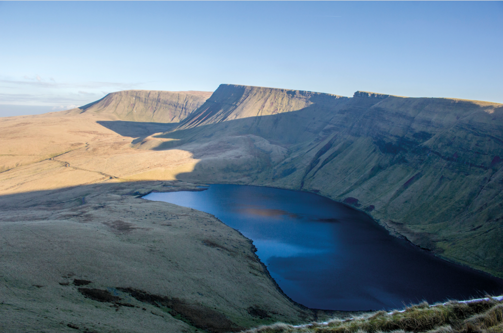
Remote glacial lakes edged by swooping escarpments, long lonely pathways with awe-inspiring views await you. This route crosses the rocky river Tawe. It ascends gradually to the lovely Llyn y Fan Fawr (Lake of the Big Peak) where you could almost expect a hand to emerge holding Excalibur aloft. Then, drop down to Llyn y Fan Fach (Lake of the Small Peak), which has its own legend of an otherworldly woman emerging from the waters to marry a mortal, eventually abandoning him and returning to the lake when he gives her ‘three causeless blows’.
A steep ascent up to Waun Lefrith is rewarded by expanding views of the mirror-like lake below and the rolling peaks of Bannau Sir Gaer and Fan Brycheiniog. On a clear day, you’ll see Pen y Fan to the east, and the Preseli Hills to the west. The easy last leg, the gradual ridge descent of Fan Hir, is particularly lovely in evening sunlight. Nonetheless, this is a long walk, so it pays to start early!
Read the full route description for Fan Hir and Picws Du.
11. Cwmyoy and Hatterall Hill, Black Mountains
This Black Mountains walk up Hatterall Hill – within spitting distance of the haunted Skirrid Inn – has its own intriguing start point and some fascinating geology, says Steve Eddy.
START/FINISH: St Martin’s Church, Cwmyoy; SO299233. There is parking by the church for several cars. | MAPS: OS Explorer 1:25,000 map OL13 (Brecon Beacons Eastern area) | DISTANCE: 6.38km / 4 miles | ASCENT: 345m / 1,132ft | DURATION: 3 hours (add 15 minutes to climb the landslip)
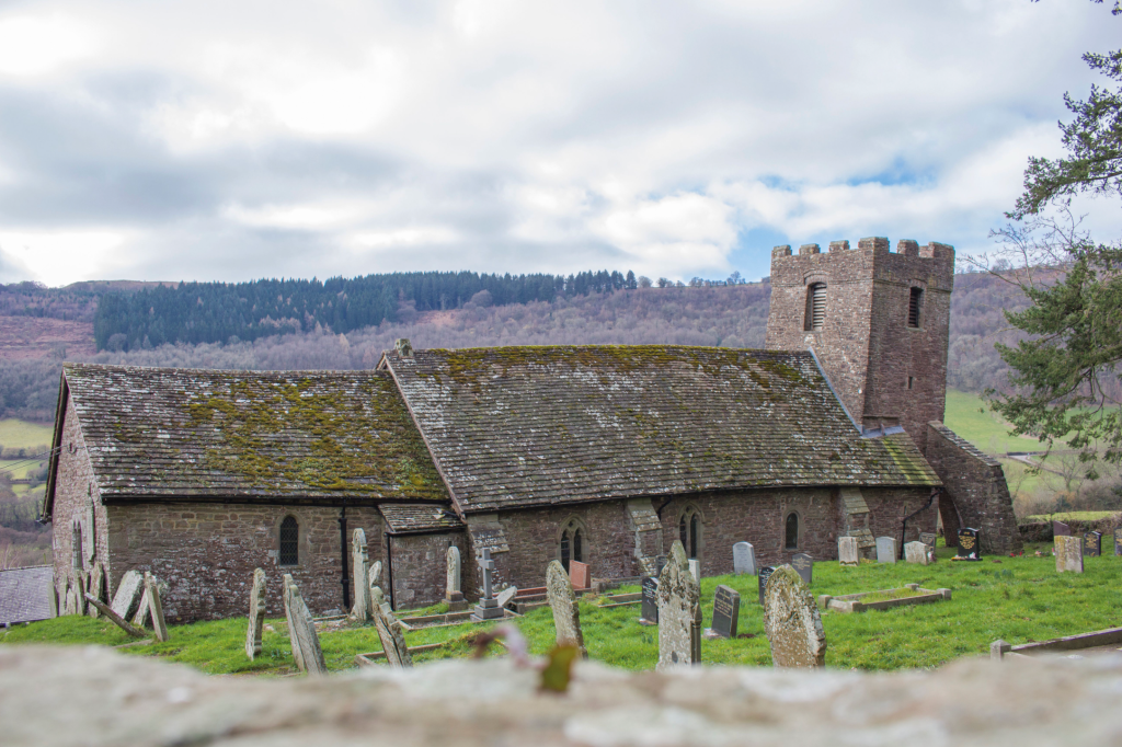
The Black Mountains (Y Mynydd Du or sometimes Y Mynyddoedd Duon) are known for their legends. This walk is not far from The Skirrid Mountain Inn, a former courtroom and execution place with its own oak hanging beam thusly claimed to be the oldest and most haunted pub in Wales, and it starts by the most crooked old church you’re ever likely to see, shaken out of alignment by years of subsidence in the past. Legend has it that the landslip that started it all off was caused by the Crucifixion – but take a look inside the church porch for the geological version, which explains how it really happened under Hatterall Hill in the Ice Age.
The walk begins with a sunken path lined by ancient trees, circles the massive and craggy landslip, and then climbs up onto the moorland heights of Hatterrall Hill before descending gently over rough grazing to its start point. Hatterall Hill is popular with red kites and paragliders alike. It also features some old grouse ‘butts’ from which grouse were once shot, and you may still see grouse here.
Read the full route description for Hatterall Hill.
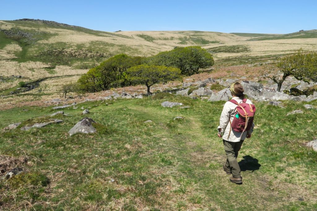
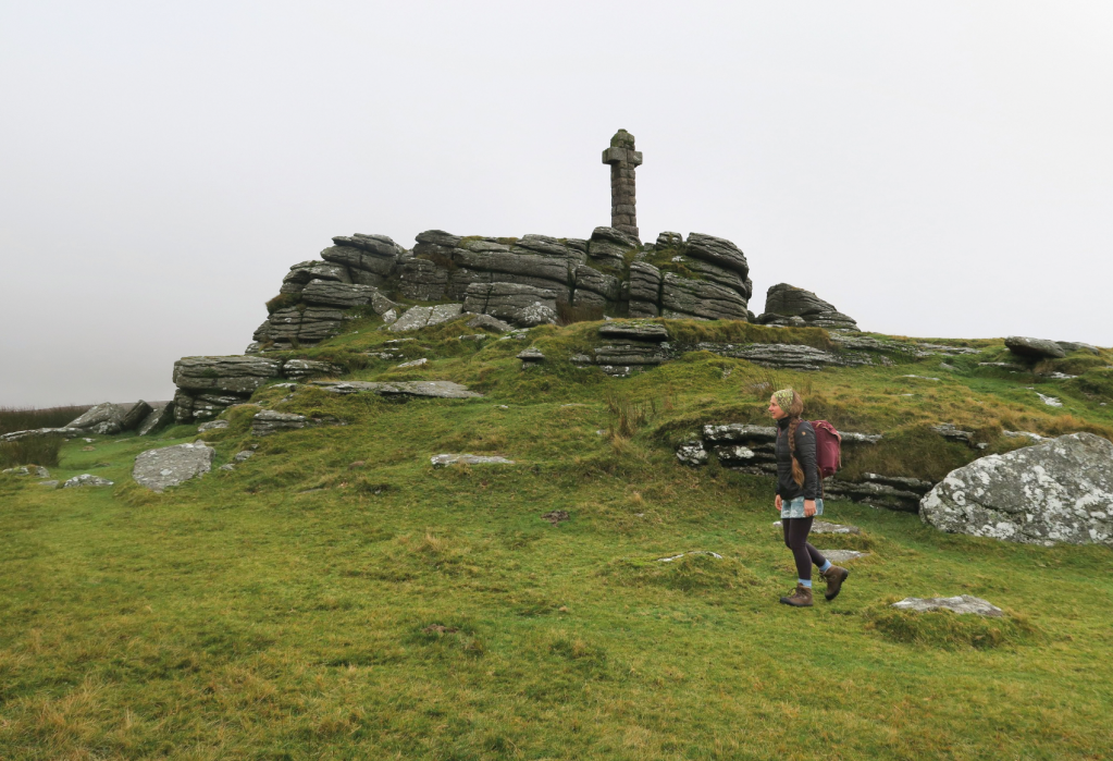
12. Devil’s Tor and Wistman’s Woods, Dartmoor
Dartmoor abounds with tales and legends and the upper reaches of the West Dart River are no exception. So, visit Devil’s Tor and Wistman’s Wood and see what emerges from the undergrowth, suggests Tim Gent.
START/FINISH: The car park at Two Bridges; SX 609 751 | MAPS: OS Explorer OL28 | DISTANCE: 13.5km / 8.5 miles | ASCENT: 310m / 1,020ft | DURATION: 3-4 hours
Scientists will tell you that Wistman’s Wood is a fragmentary remnant of a once sizeable upland temperate rainforest. They will cite the many species of epiphytic moss, fern and liverwort that clothe the trees, or tell us that this is one of only two sites in Britain that provides a home for the horsehair lichen. They can name the lizards and shrews that skitter across the fallen leaves and the birds that flit amongst the branches, yet still fail to list every creature that lurks amongst those gnarled and ancient oaks. For the devil hunts these moors at night, and as dawn approaches, this wood is where he kennels his hounds. Walk here as dusk approaches and it is claimed the Wisht Hounds can be heard baying for release.
And don’t feel too safe once back at your car. The road between Two Bridges and Postbridge is reputed to be home to the Hairy Hands. First reported in the 1920s, these fiendish disembodied hands are said to grasp at steering wheels or motorcycles handlebars, forcing the helpless motorist off the road.
But let’s start this walk with a visit to the devil, or at least his tor, lying close to one of the tallest standing stone on the moor.
Read the full route description for Devil’s Tor.
13. Bleak House, Dartmoor
Tim Gents visits Bleak House, a ruined remote home with a history of spies on Dartmoor.
START/FINISH: The car park to the east of Dartmoor Inn, Lydford (SX 522 852) | MAPS: OS Explorer OL28 | DISTANCE: 12.5.km / 7.8 miles | ASCENT: 349m / 1,145ft | DURATION: 4-5 hours
Dartmoor has experienced various attempts to strip it of its assets. Even swathes of the peat that blanket the hills have been dug up and hauled away. The remains of these endeavours are still visible today, and one of the most enigmatic is Bleak House. It’s worth a visit, suggests Tim Gent.
A license to extract peat near Great Links Tor was granted in 1878. Only a year later, The Rattlebrook Peat Works had installed a railway and drying kilns and built a home for the manager. Originally named Dunnagoat Cottage, early photos show an imposing dwelling, built using granite from nearby outcrops. Despite the investment in time and money, the works never flourished. The rails for the railway were lifted in 1932, and the army soon demolished the drying buildings. At some point, the crumbling remains of the manager’s isolated home became known as Bleak House. All Dartmoor features carry a tale of course, and during WWI, Bleak House was said to have been the hiding place of a German spy. The fact that the works employed a scientist called Muller at the time, may provide a rather less sensational explanation.
Find the full route description for the Bleak House.
Read more: 14 autumnal walks in Britain’s woodlands and beyond