
Watch your step in the Cairngorms, says Craig Weldon – you might be being followed!
The Cairngorms have always been Scotland’s historic wilderness: too high, barren and windswept to sustain human life, they are stalked instead by the terrifying creatures of folklore. Creatures such as Lamh Dearg (bloody hand), who haunts the paths challenging victims to a fight. Accept! Those who refuse he kills, but those who face up to his challenge he allows to pass as a friend. It’s no wonder the summit too has its spectre, Am Fear Liath Mor, the Big Grey Man of Ben Macdui. Rarely seen but sometimes sensed, the Grey Man is responsible for those eldritch neck prickles when you are alone in the mist and become convinced someone is just behind you. Whether the spirit of the mountain is a Brocken spectre, or infrasound, or something else entirely, it exists: many experienced hillwalkers can testify to an odd or uncanny experience when up these hills and far from home. Take care of yourself on the Cairngorm plateau – there’s more to deal with out there than bad weather.
Ben Macdui: route description
START/FINISH: National Trust for Scotland Linn of Dee carpark; NO063898 | MAPS: OS Explorer OL57 & OL58 (1:25k), OS Landranger 36 & 43 (1:50k), Harvey British Mountain Map Cairngorms & Lochnagar (1:40k) | DISTANCE: 32km/20 miles | ASCENT: 1000m/3,300ft | DURATION: 9.5 hrs
1. NO063898: 200m after crossing the spectacular Linn of Dee river gorge, park at the NTS car park (£3 charge in 2023). A discreet sign ‘Path to Glen Lui’ points you in the correct, northerly direction.
2. NO065903: After half a kilometre, turn left onto a land rover track.
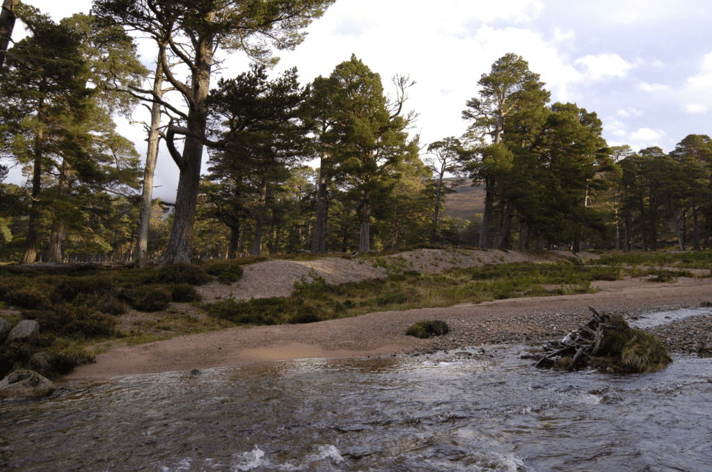
3. NO064915: After a further kilometre, the track crosses the Lui Water on a bridge and terminates at a T-junction. Take the land rover track going left. It is possible to ride a bike as far as Derry Lodge.
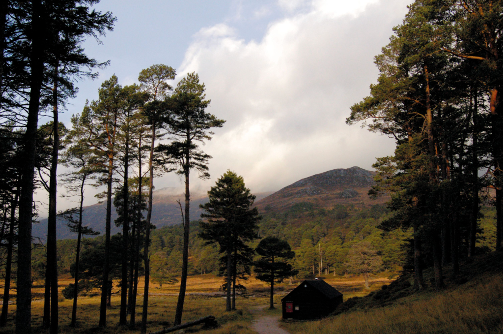
Mountain rescue hut at Derry Lodge. Credit: Craig Weldon
4. NO043931: Three kilometres of good track takes you to Derry Lodge, a Victorian hunting lodge, and just beyond that, a mountain rescue hut. However, keep your eyes open to the left just before Derry Lodge for an alternative detour. You will see a path down to Bob Scott’s, perhaps the most famous and best-loved bothy in the Scottish Highlands. Rejoin the main path if you take a look at the bothy.
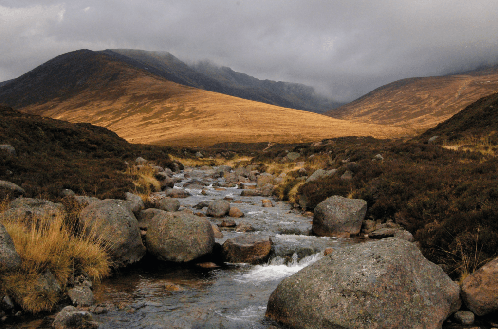
5. NO041935: Floods damaged the bridges upstream of Derry Lodge, but they have since been repaired. Cross the Derry Burn then take the path that heads west up Gleann Laoigh Bheag. The trail becomes less of a land rover track and more of a well-made footpath.
After crossing the Derry Burn. Credit: Craig Weldon
6. NO019938: When the path forks 3km beyond Derry Lodge, take the right fork to continue up the east bank of the Luibeg Burn. The left fork appears to be a continuation of the path but is the wrong way, heading instead for the Lairig Ghru. It enters a forest beyond a deer fence.
Sron Riach comes into view. Credit: Craig Weldon
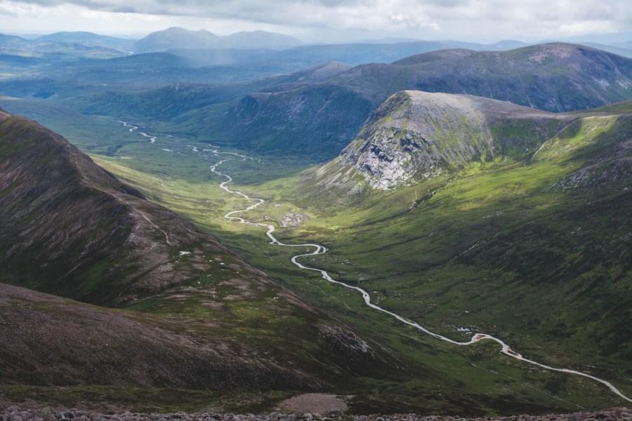
7. NO011957: Eventually you will reach the foot of Sron Riach, the approach ridge to Ben Macdui. The stream of the Luibeg burn must be forded to reach Sron Riach and a good path, clearly visible from a distance, climbs the ridge.

Cairn Toul from Sron Riach. Credit: Craig Weldon
8. NN998978: After passing a 30m dip in the ridge at 1110m (the path bypasses the dip), provided there is no snow cover, stick to the line of cliffs ringing Lochan Uaine (one of four identically named bodies of water in the Cairngorms). In clear weather this gives you a good view of the Lochan, and in mist allows you to take a bearing towards Ben Macdui from the highest point of the cliffs.
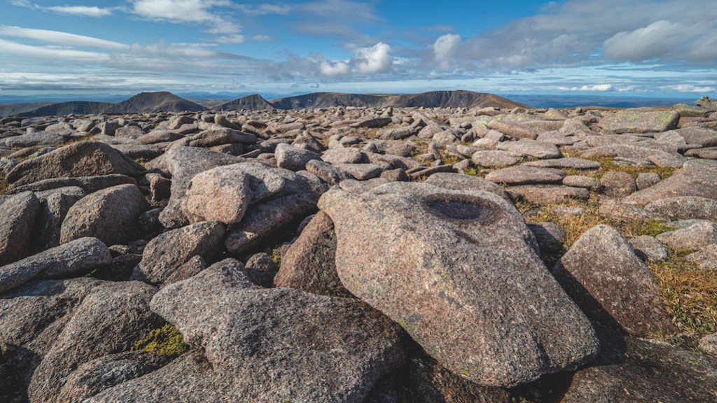
Looking out over the granite boulder field that forms part of the summit of Ben Macdui over to Braeriach. Credit: Shutterstock
9. NN998986: From the top of the cliffs, make for Ben Macdui, 1km distant on a WNW bearing across bouldery terrain.
10. NN989989: The summit of Ben Macdui is crowned by a viewpoint indicator, but if it is clear, walk another 150m WNW for a spectacular view across the Lairig Ghru into an Garbh Choire.
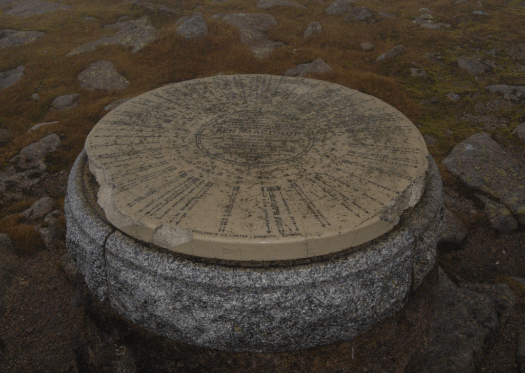
Ben Macdui summit viewpoint indicator. Credit: Craig Weldon
11. NN989989: From Ben Macdui, a faint path leads across gravelly tundra for 1km to reach the right bank of a stream feeding Loch Etchachan: at 927m, it is the highest largeish body of water in Britain. Follow the path down to the outflow of the loch.
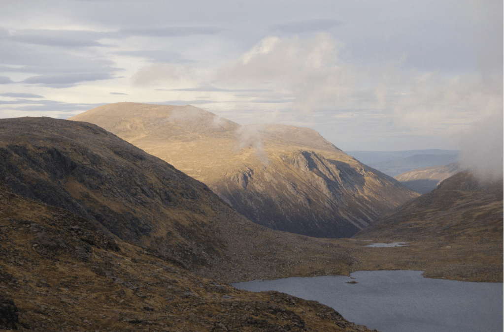
Cairn Gorm and Loch Etchachan. Credit: Craig Weldon
12. NJ012003: Take the obvious, steep and stony path down into Glen Derry, passing close to the Hutchison Memorial Hut, the second bothy of the day.
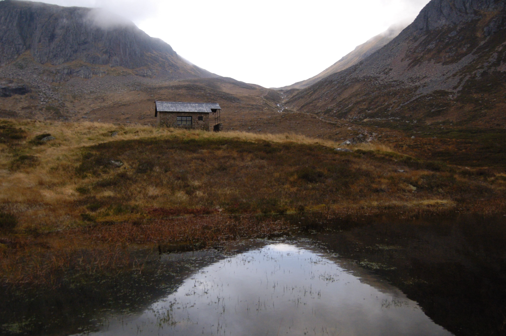
Hutchison Memorial Hut. Credit: Craig Weldon
13. NO032995: Cross the Coire Etchachan Burn on a footbridge and continue down Glen Derry.
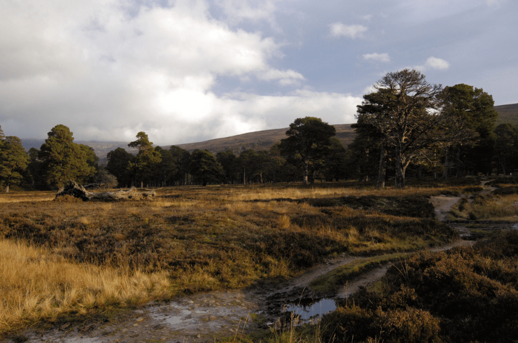
14. NO038961: After 3.8km, the path branches. Take any fork: they all lead back to Derry Lodge.
Derry Burn at Derry Lodge. Credit: Craig Weldon
15. NO041935: From Derry Lodge, retrace your steps back to Linn of Dee.
Further information
PUBLIC TRANSPORT: None. The nearest bus stop is 9km away in Braemar.
TOURIST INFORMATION: Braemar Tourist Information Centre: 01339 741600.
Discover more walks in Scotland as mapped by our expert contributors.


