
Vivienne Crow follows in the footsteps of ancient mourners in the Lake District Far Eastern Fells on the Corpse Road.
For many centuries, the people of Mardale used to have to carry their deceased from their remote home valley, across the fells into neighbouring Swindale and then on to Shap, seven miles away, for burial. They had their own church, but the burial ground wasn’t consecrated until the 18th century. The route they took is what we now call a ‘corpse road’, one of many that cross the Lake District fells. And, while the last body carried along this particular corpse road was that of John Holme in 1736, these ancient routeways continue to be used by walkers today, crossing from one valley to another.
The route featured here climbs from Mardale Head on to the desolate moorland peaks of Branstree and Selside Pike. From the moody ridge linking the two tops, we look down on Haweswater, the reservoir now covering the settlements that once existed in Mardale, including the old church. The route then drops on to the corpse road and follows its zig-zagging descent, past disused peat huts and back into the valley.
Branstree & the Corpse Road: route description
START/FINISH: Mardale Head car park at southern end of Haweswater Reservoir, GR NY469107 | MAPS: OS Explorer OL5 (1:25k), OS Landranger 90 (1:50k), Harvey 1:25,000 Superwalker Lake District East
| DISTANCE: 8.7km/5.4 miles | ASCENT: 518m/1,700ft | DURATION: 3½-4 hours
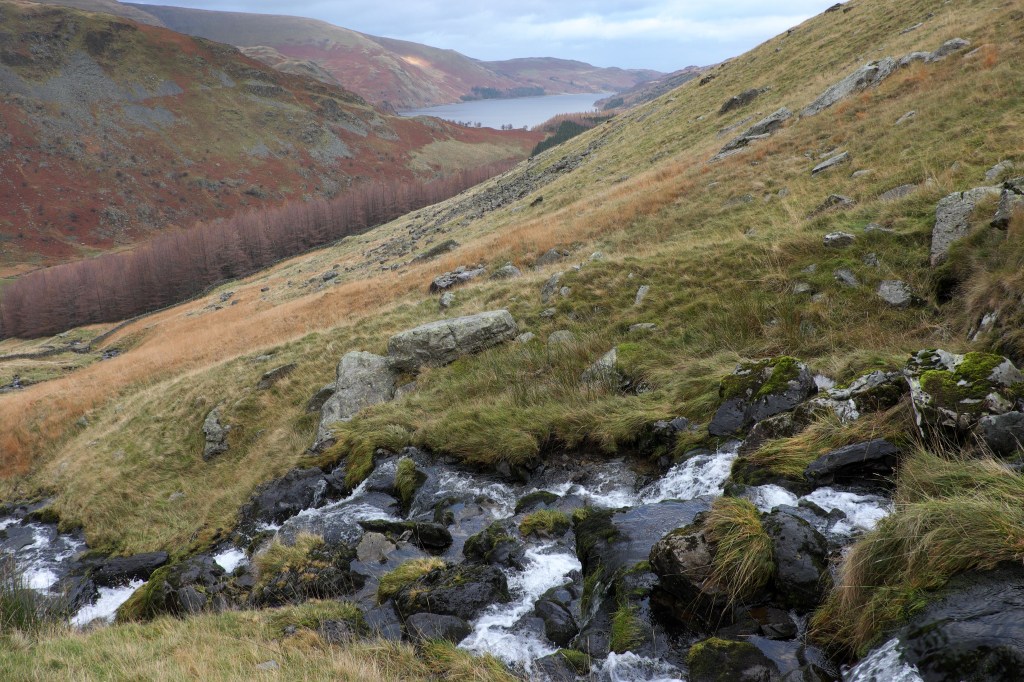
1. NY469107: Go through the deer gate at the road end and, when the path splits, bear left. The wide, stony byway climbs with the crags of Harter Fell up to the right and Gatescarth Beck to the left. There is a brief easing of the gradient before the route climbs more steeply again via a series of tight zigzags.
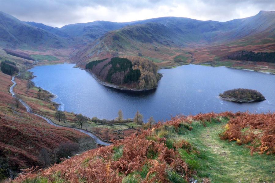
Gatescarth Beck with Haweswater in the distance. Credit: Vivienne Crow
2. NY473094: When the ascent eases again and the track swings right, bear left along a faint, grassy trail (east-south-east, quickly veering north-east). Stay with the clearest path at two faint forks to reach a fence. Continue uphill with this on your immediate right. If you look over your right shoulder soon, you will see the lonely upper reaches of Longsleddale, while, over your left shoulder, there’s High Street. Gaining height, you might also catch a glimpse of Blea Water just below the slopes of Riggindale Crag.
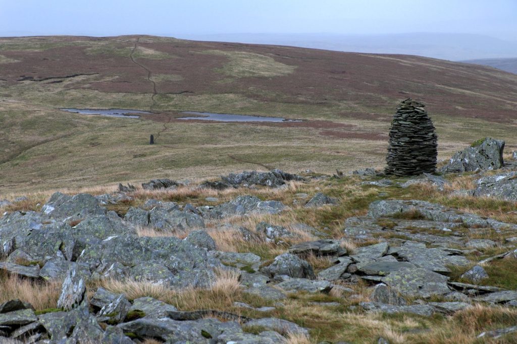
Cairn on Branstree. Credit: Vivienne Crow
3. NY478099: The top of Branstree is reached when you see a wall to the right of the fence. The clear path swings left – to the true summit, which is just a few metres from the fence. The top is marked by an Ordnance Survey trig ‘ring’ rather than the more usual trig pillar. From here, bear right (north-east), towards two prominent cairns. From the second of these, the path swings back over to the fence on the right. For the next 1.5km, the route follows the clear trail beside the fence. Early on, you’ll see a pillar on the far side of the fence – a survey column used in the construction of the Longsleddale aqueduct for carrying water from Haweswater to Manchester. The tunnel is about 400m below your feet at this point.
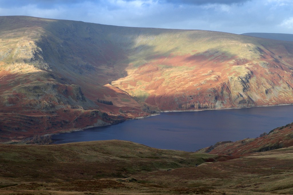
Haweswater and Whelter Bottom from Selside Pike. Credit: Vivienne Crow
4. NY490111: Selside Pike’s summit is marked by a shelter. Say goodbye to the guiding fence here. Standing in front of the shelter, you should see two faint paths straight ahead. Take the one on the left, north at first, then swinging north-east. Keep left when a narrower trail goes right. Then, on nearing flatter, boggier ground, bear left (north-west) at another fork, this time following the less obvious (and wetter) option. Don’t worry too much if you miss this fork though; whichever branch you take, you’ll soon reach a clear, grassy path – part of the old corpse road.
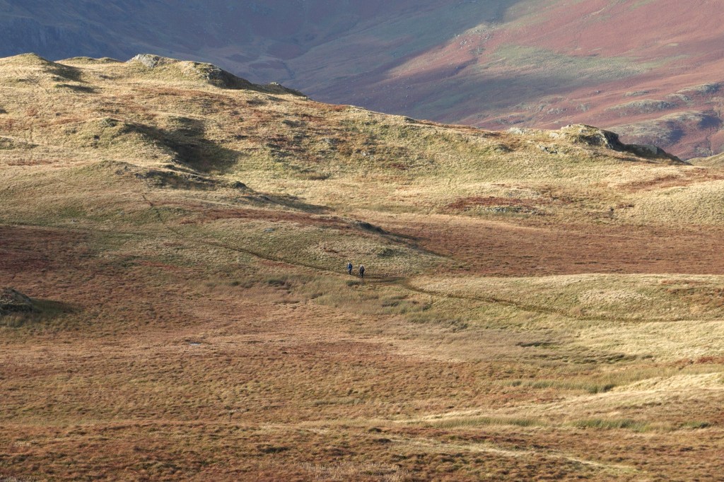
A pair of walkers on the corpse road. Credit: Vivienne Crow
5. NY492122: Turn left along this. Ignoring any trails heading on to higher ground to the right, keep to level ground for now. Eventually, the corpse road starts descending and passes a couple of ruined stone buildings. Beyond these, the path steepens, dropping in zig-zags. The views of Haweswater, only intermittently visible from the ridge earlier, are magnificent now. The far end of the reservoir is ringed by some dramatic fell scenery that includes the dark crags of Harter Fell, High Street’s eastern corries, Rough Crag and Kidsty Pike.
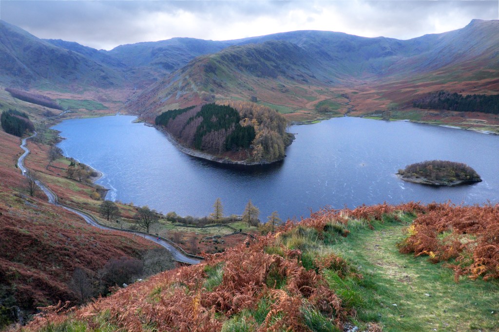
Haweswater and Mardale Head from the corpse road. Credit: Vivienne Crow
6. NY479118: On reaching the road, turn left. It’s now about 1.6km back to the parking area, and you’ll have views across Haweswater for the entire distance. The reservoir was created following an Act of Parliament in 1919, which saw the building of a 28m-high dam. The residents of the tranquil dale were evicted, all the cottages and farmhouses were demolished, and 100 bodies had to be exhumed from the churchyard (and reburied in Shap) before the valley was flooded in the mid-1930s. Today, when water levels are low, the remains of the village of Mardale Green are revealed at the southern end of the reservoir.
Further information
PUBLIC TRANSPORT: None
TOURIST INFORMATION: www.lakedistrict.gov.uk, 0845 9010845
NEAREST YHA: Patterdale
Discover more walks in the Lake District as mapped by our expert contributors.


