

Andrew Galloway goes in search of the wreckage of aeroplanes in the Peak District on Bleaklow.
Just a few hundred metres north of the trig-point we found the first piece of twisted aluminium lying against black peat, shining in sunlight as if newly cast. In fact it has lain here, high on the moor near Bleaklow, for seventy years.
It takes a while to orientate yourself among the wreckage, spread out over a hundred square metres. The fragments of an aeroplane slowly begin to knit together to form a whole: four engines first, followed by undercarriage, wings, tail-plane. Then you think of the crew. This USAF Boeing RB-29 known as “over-exposed” was taking payroll and mail from Scampton in Lincolnshire to the USAF supply base at Burtonwood near Warrington on 3 November 1948. In poor weather conditions the flight was conducted on instruments, the pilots effectively flying blind. It is thought that the captain understood his position to be further west and began to descend too early to make his approach with disastrous consequences. All thirteen crew were instantly killed as the aircraft ploughed into the ground.
Some years ago, local historian Gerald Scarratt discovered what he thought to be a washer at the crash site. On later inspection, he found it to be a gold ring. It was engraved with the name of the aircraft’s captain, Langdon P. Tanner. Gerald was able to trace the captain’s daughter in America and return the ring to her.
Shrouded in history, I have used this route of Bleaklow as part of a navigation course for the Ramblers. Participants are provided with the grid references for the aircraft wrecks, sent to locate them and take a moment to commemorate those lost.
Higher Shelf Moor and Bleaklow Head: route description
Start/Finish: The crossroads of High Street and Victoria Street in the centre of Glossop. (GR: SK035940) | Distance: 19.5 km (12 miles) | Ascent: 560m | Time: 6 hours | Maps: Ordnance Survey 1:25,000 Peak District OL1
1. SK035940: The crossroads at the centre of Glossop make for a convenient location to start, with nearby car parks and coffee shops. Head eastwards along Main Street (A57) for 500m to a small roundabout. Turn left onto Corn Street and into Manor Park. Walk northwards through the park keeping to the right of the boating lake. Leave the park to the north onto Church Close. Turn right onto Church Walk. Pass the church on your left then turn right onto Manor Park Road. After 50m look for the Queens Arms public house on the left.
Shelf Brook, Glossop. Credit: Andrew Galloway
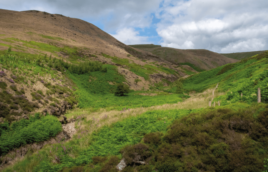
2. SK042947: Turn left onto Shepley Street. Walk eastwards along Shepley Street for 100m, passing by an industrial area, until tarmac gives way to a rough track. This is the Doctor’s Gate Path, at one time thought to be the course of an old Roman Road through the Pennine Hills. After 800m the path branches into two. Take the path on the right for a further 800m towards Mossy Lea Farm. Pass through a field gate and continued eastwards along Doctor’s Gate. After 500m, at a cattle shed, the path again splits. Keep to the right following the Doctor’s Gate path beside Shelf Brook for a further 1.7km.
James’s Thorn seen from Shelf Brook. Credit: Andrew Galloway
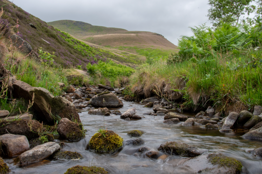
3. SK079940: At a small oval shaped pool leave the track to the north. Look for a faint path passing east of the pool. Cross the brook and head northwards into Ashton Clough. As you ascend the clough you will encounter a handful of small waterfalls, each between 2-3m in height. In all cases rock steps to the left of the stream provide passage with careful negotiation. Just beyond the first waterfall look for a rusted engine block.
Part of C-47 fuselage Ashton Clough. Credit: Andrew Galloway
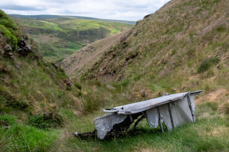
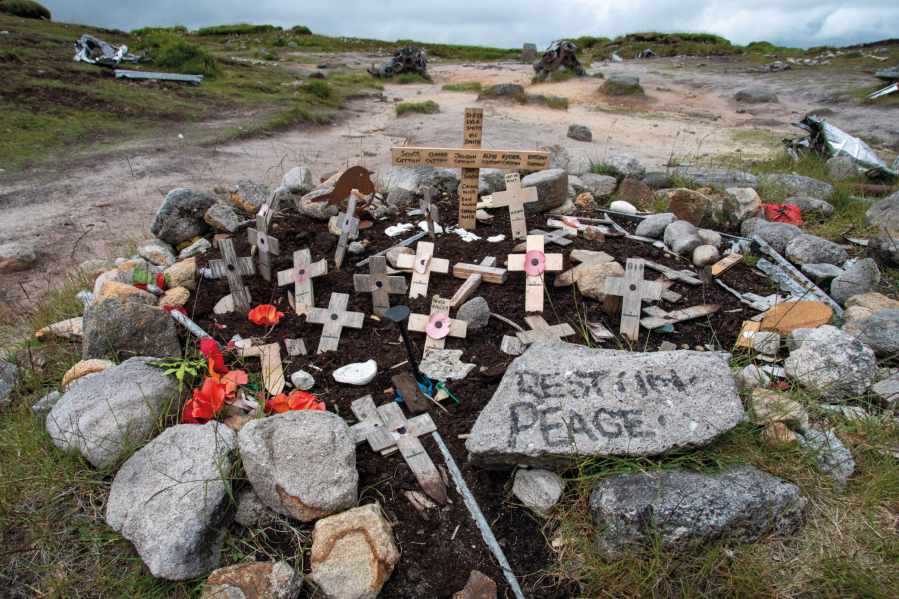
This is a small part of the wreckage of a USAF C-47 twin-engine aircraft which crashed onto James’s Thorn above whilst on a routine flight from Leicester to Glasgow on 24 July 1945. All five crew members and two passengers were killed. What remains of the fuselage of the aircraft is located roughly at the 450m contour line. Climb the stream northwards to reach this point, then continue on to where a wire fence marks the break a break in slope. Small wooden crosses arranged among an assemblage of wreckage marks the impact site of the C-47 crash.
USAF Boeing RB-29 crash site on Higher Shelf Moor. Credit: Andrew Galloway
4. SK081948: Follow the fence westwards for 300m then follow a narrow path northwards for 100m onto the knoll of James’s Thorn. On the south facing flank of the knoll look for a small memorial plaque on scorched ground. It marks the location where an Avro Lancaster of No. 408 Squadron of the Canadian Royal Air Force crashed on the evening of 18 May 1945. The aircraft had been on a training exercise from RAF Lynton-on-Ouse. It is thought the pilots had become disoriented as darkness fell. The six crew members were killed upon impact.
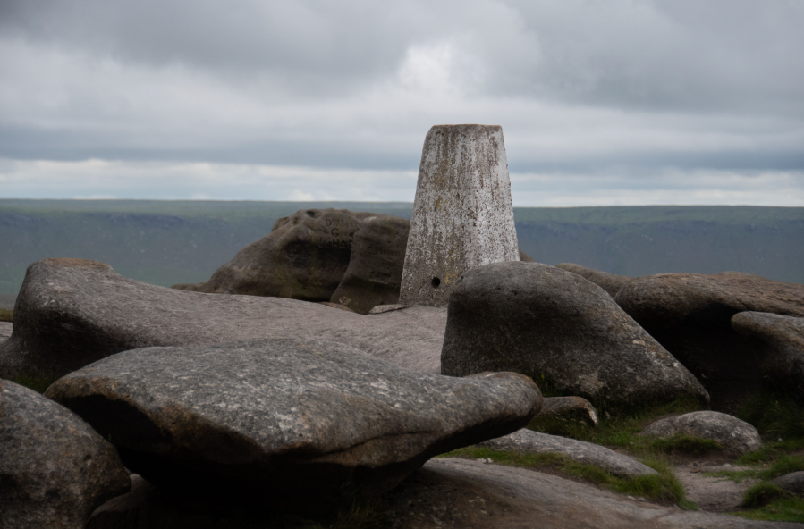
Triangulation Pillar at Higher Shelf Stones. Credit: Andrew Galloway
5. SK079948: Follow the path north-east for 150m to the intersection with a path oriented east-west. Take this path eastwards across Shelf Moor for 800m to the triangulation pillar on Higher Shelf Stones.

Engine blocks of USAF Boeing RB-29 Higher Shelf Moor. Credit: Andrew Galloway
6. SK089948: 100m to the north of the stones, within a shallow depression, lie the scattered remains of USAF Boeing RB-29 “over-exposed.” Just to the north of the memorial stone a path leads North-North-East for 600m across Shelf Moor to Hern Stones. Continue 550m north to reach the Wain Stones and the famous “kiss.” 250m to the north-east a wooden post set within a large cairn marks Bleaklow Head.
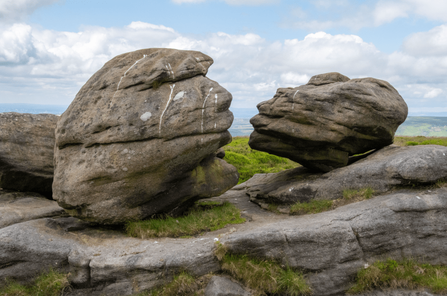
The Kiss – Wain Stones Bleaklow Head. Credit: Andrew Galloway
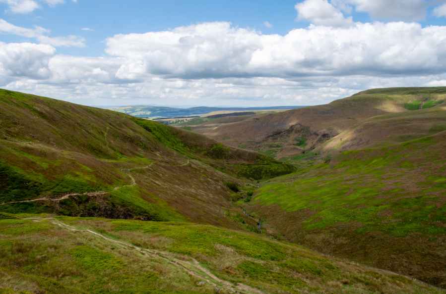
7. SK093960: On Bleaklow, locate the obvious scar of the Pennine Way, for 200m heading roughly south-west, then exploiting a natural depression south-south-east for 1.3km across the moor to the head of Hern Clough. Continue south-west along the Pennine Way for a further 1.8km to the intersection with the Doctor’s Gate path, the location rather bizarrely referred to on the Ordnance Survey map as Old Woman.
Doctors Gate Path above Glossop, Derbyshire. Credit: Andrew Galloway
8. SK089933: Leave Old Woman heading to the west along the Doctor’s Gate path for 5.5km, beyond Ashton Clough retracing your steps to the Queen’s Arms. Turn left onto Manor Park Road. After 100m a small gate on the right permits access to the park. Walk through the park to the Corn Street car park and so to the roundabout on Main Street (A57). Walk westwards along Main Street for 500m to arrive at the crossroads in the centre of the town.
Further information
Public Transport: There are regular trains from Glossop to Manchester and Sheffield. Check nationalrail.co.uk for an up-to-date timetable. Parking available at Glossop Station (Post Code: SK13 8AL)
Tourist Information: peakdistrict.gov.uk
Nearest YHA: Edale Activity Centre
Discover more walks in the Peak District as mapped by our expert contributors.


