
Pendle is one of a kind, standing aloof between the Ribble and Calder valleys says Norman Hadley.
Pendle Hill forms a comfortingly familiar profile from viewpoints far away in Lakeland and the Dales. It is rich in history; you’ll know the story of the so-called witches, which is far darker than the pointy-hatted broomstick-riding profiles beloved of the local tourism industry. There’s also an enlightened side to 17th century Lancashire history too. Here it was that George Fox begat the gentle faith of Quakerism and here it was that proto-scientist Richard Towneley discovered the relationship between altitude and air pressure.
Nowadays, Pendle Hill is popular with paragliders and outdoor enthusiasts who prefer their adventures on two feet. There are many ways up but the best are at the steep end from Barley or Downham, an out-of-this-century village. Notice the lack of TV aerials, satellite dishes or telegraph poles, masking it popular as a location for period dramas. For older readers, it was the setting for the 1961 film Whistle Down the Wind. The gents ’toilets are an Olde Worlde marvel, converted from an old byre.
From Pendle Hill, the best way down is gradually with the sea in front.
Pendle Hill: route description
START/FINISH: There’s a small car park in Downham (GR: SD785441) | MAPS: OS Explorer Forest of Bowland and Ribblesdale OL41 (1:25k) | DISTANCE: 15km / 9.3 miles | ASCENT: 460m / 1,509ft | DURATION: 4½ hours
1. SD786441: Leave the village by a track heading southwest, forking left from the B-road. Head through lovely pastures to a right turn up a wooded gill. Follow this upward, with a slight left-right dink near Clay House, to the road crossing at Lane Head.
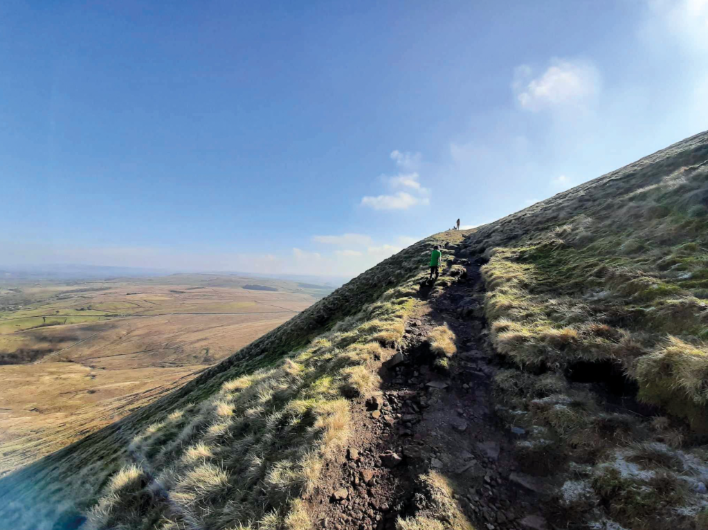
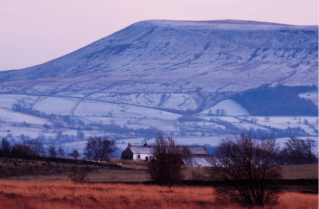
Views out to the Dales over Annel Cross. The diagonal rake makes easier work of the steep northern edge. Credit: Andy Carson
2. SD798433: After crossing the road, head straight onto the open fell. Your mantra now is up: there are a few branchings in the path but head upward and rake slightly left to gain the edge of the summit plateau. The path will lead you past a wall with a plaque honouring George Fox and on to the summit with its distinctive concentric rings of stones around the trig point.
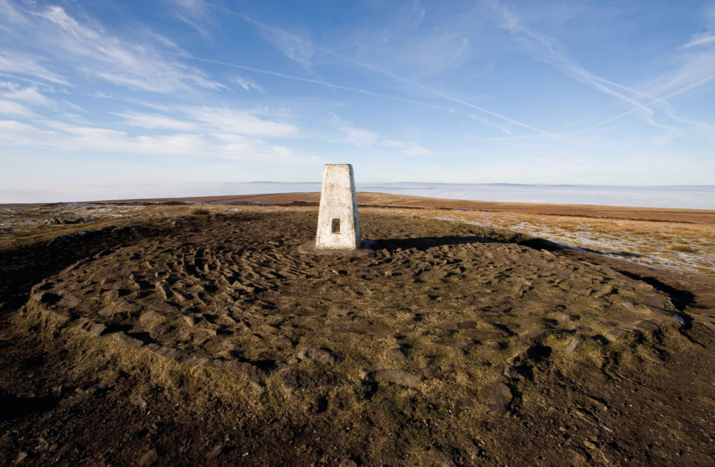
Pendle summit trig pillar overlaid on a Bronze Age burial mound. Credit: Andy Carson
3. SD805414: Leave the summit on a west-south-west bearing. This soon becomes a good flagstone path heading down to Ogden Clough. Cross the stream and follow the clough down on its true right bank, gradually tapering away from the stream to gain a shallow col. Keep heading south west, the ridge becomes gradually more pronounced.
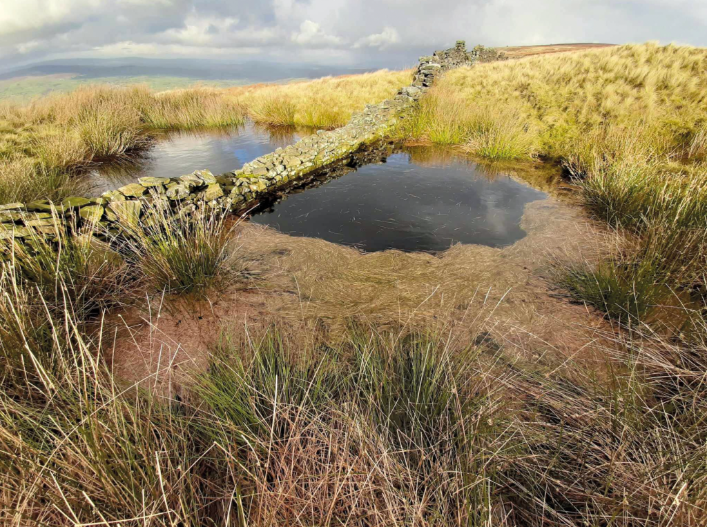
The seemingly flat plateau conceals secret folds and pools. Credit: Andy Carson
4. SD776390: Just before you get to the Nick of Pendle, fork right towards the Wellsprings restaurant and dry ski-slope. Walk down the road only a few paces to a pull-in on the right. At the uphill end of the pull-in there’s a footpath sign but leave from the downhill end, by the rusty steel post as this route has fewer deviating tracks. Hold a northerly bearing, with two barns ahead as leading beacons. Converge with the wall on your left, to the little footbridge over Ashendean Clough. Keep heading north to the second barn: an old ruin. Climb the ladder-stile and circle the ruin anti-clockwise before continuing west-north-west, alongside a stream and down a grassy groove through a landscape of twisted, gnarly hawthorns.
5. SD769407: Turn right and cross the cattlegrid to gain a series of bridleways, roads and footpaths contouring the base of Pendle, past Little Mearley Hall. The aim here is for the dip in the skyline between the rounded knoll of Worsaw Hill and the darker mass of Pendle itself. Eventually you’ll pass the camping and Caravanning Club site at Angram Green.
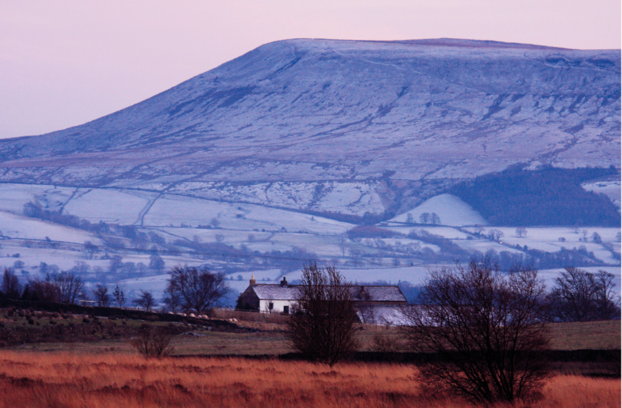
Pendle Hill exerting a brooding presence over the Ribble valley. Credit Andy Carson
6. SD780427: Turn left at the road junction and follow the lane north-north-west for 150 metres to where it dinks right. Take the footpath straight ahead, down to Worsaw End House. Cross the little yellow bridge, pass to the left of a tall conifer and go up to and through the contouring wall parallel to some distinctive power-lines. Your route back circles the base of Worsaw Hill then follows a steady north-north-east line back to Downham.
Further information
PUBLIC TRANSPORT: Bus 19 from Preston to Clitheroe then number 280 will take you as far as Christ Church, within 15 minutes ’walk of Downham.
TOURIST INFORMATION: www.visitpendle.com, 01282 661701
NEAREST YHA: Haworth
Discover more walks in the North of England as mapped by our expert contributors.


