
This Black Mountains walk up Hatterall Hill has an intriguing start point and some fascinating geology, says Steve Eddy.
The Black Mountains (Y Mynydd Du or sometimes Y Mynyddoedd Duon) are known for their legends. This walk is not far from The Skirrid Mountain Inn, a former courtroom and execution place with its own oak hanging beam thusly claimed to be the oldest and most haunted pub in Wales, and it starts by the most crooked old church you’re ever likely to see, shaken out of alignment by years of subsidence in the past. Legend has it that the landslip that started it all off was caused by the Crucifixion – but take a look inside the church porch for the geological version, which explains how it really happened under Hatterall Hill in the Ice Age.
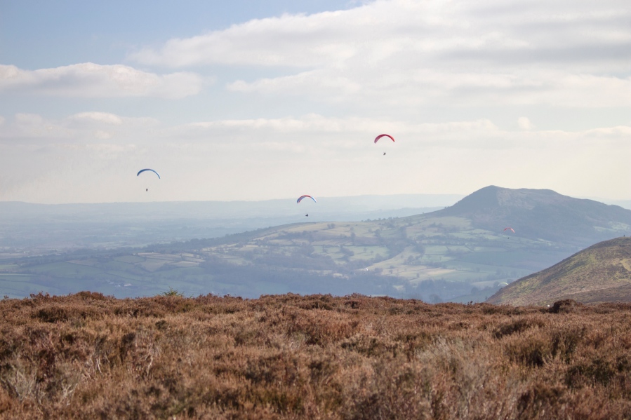
The walk begins with a sunken path lined by ancient trees, circles the massive and craggy landslip, and then climbs up onto the moorland heights of Hatterrall Hill before descending gently over rough grazing to its start point. Hatterall Hill is popular with red kites and paragliders alike. It also features some old grouse ‘butts’ from which grouse were once shot, and you may still see grouse here.
Hike Cwmyoy and Hatterall Hill: route description
START/FINISH: St Martin’s Church, Cwmyoy; SO299233. There is parking by the church for several cars. | MAPS: OS Explorer 1:25,000 map OL13 (Brecon Beacons Eastern area) | DISTANCE: 6.38km / 4 miles | ASCENT: 345m / 1,132ft | DURATION: 3 hours (add 15 minutes to climb the landslip)
1. SO299233: Begin at St. Martin’s Church. Nestled beneath a spur of nearby Hatterall Hill, the church’s unusual form is a result of a landslide. But local tradition says it was caused by a terrible earthquake during the crucifixion of Christ “when darkness descended”. In fact, the church was built on top of the landslide drift and has warped and twisted on its unstable ground. Look closely and you will see how the nave bows out, the walls are crooked and the top of the tower leans out over its foundations by 6ft. From here, take the uphill sunken path opposite the car park and follow it to a metal gate just past an ancient stone gatepost. At the information board, follow the right-hand path, past the craggy landslip, to a junction of paths just past a cottage.
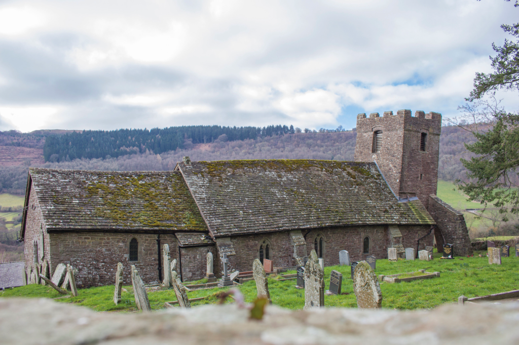
St Martin’s Church from the north. Credit: Steve Eddy
2. SO301237: Turn left up a path lined by trees on one side, along the stone-walled field edge. After about 150m you will reach the massive landslip, split into two. An optional climb up the larger half will take you to a flat, grassy summit, with views all around. It is easier to climb up and down if you follow a path skirting around its western side. From the base of the landslip, either cross two stiles or just pass through a metal gate, onto a short, wide path between stone walls leading to the moor edge.
View from landslip showing path between walls to moor edge. Credit: Steve Eddy
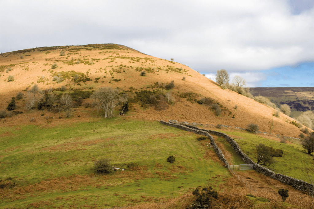
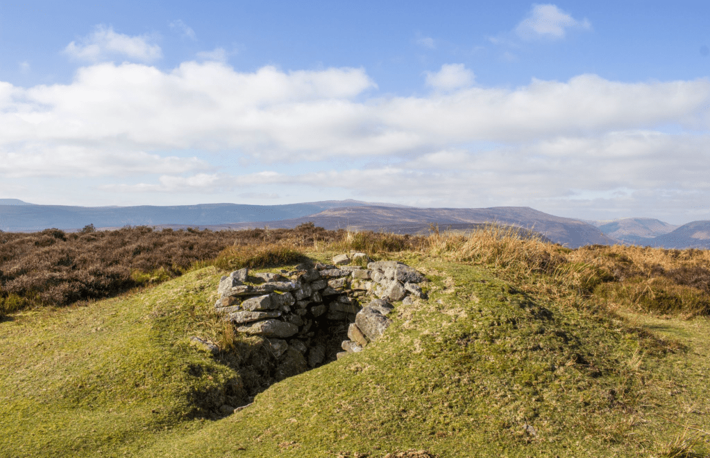
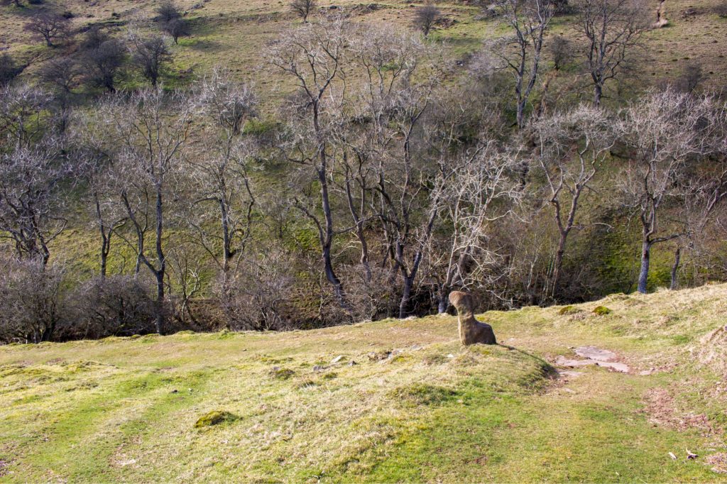
3. SO300238: Follow a path along the moor edge by a wall to the right, slightly downdip, then uphill to the left below a ruined shepherd’s hut. Climb up steeply through bracken and gorse, then heather. The path becomes somewhat sunken. Carry on, taking a right fork (though the left brings you to the same point), with the gradient gradually levelling out, to reach a summit (516m). Pass a ‘cross dyke’ (only visible on the map) and then an old semi-circular stone grouse butt.
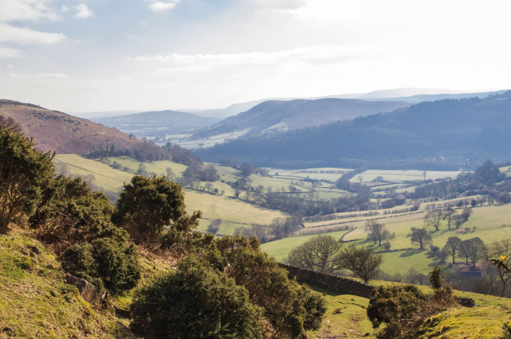
Grouse butt with Pen Twyn Mawr, Bal Bach, Bal Mawr and Waun Fach in distance. Credit: Steve Eddy
At a fork, keep left to reach a second summit (531m) near the Offa’s Dyke Path, the 177 mile (285km) long walking trail named after, and often following, the spectacular Dyke King Offa ordered to be constructed in the 8th century, probably to divide his Kingdom of Mercia from rival kingdoms in what is now Wales.
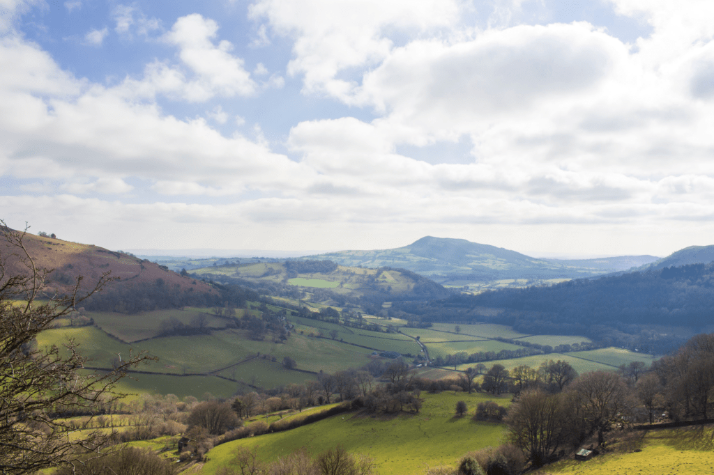
The Skirrid from the lower part of Hatterrall Hill. Credit: Steve Eddy
4. SO308256: Pick up the path, a few metres east, that heads south-east from the Offa’s Dyke Path. This circles around an area of shallow disused limestone quarries, to head south, then west. The path becomes wide, grassy and indistinct, though very easy going, and eventually becomes sunken through gorse to reach a gate in a stone wall. There are good views westwards.
Sunken path through gorse. Credit: Steve Eddy
5. SO308247: From the gate, continue downhill and west to the left of the wall (taking the stile and path straight ahead instead would take you to Blaenyoy Farm). Pass an interestingly shaped upright stone by the path and reach a sparsely wooded area in a dip, with a small stream. Lift the loose-hanging wooden gate to pass through, and continue on the path through rough pasture and eventually beside the yellow-painted 16th century farmhouse of Ty Hwnt y Bwlch. Pass through gates both before and after the farmhouse, and continue along a rough track which soon reaches the first cottage passed earlier.
Interestingly shaped stone by descending path. Credit: Steve Eddy
6. SO301237: Continue straight ahead to retrace your footsteps to the start.
Further information
PUBLIC TRANSPORT: Trains to Abergavenny; X3 bus to Llanvihangel Crucorney
TOURIST INFORMATION: www.breconbeacons.org
NEAREST YHA: Llangattock Mountain Bunkhouse
Discover more walks in South Wales as mapped by our expert contributors.


