
Have you put off scaling Yr Wyddfa via Llanberis Path because you’re worried it might be boring? Alex Roddie thinks you might be doing it a disservice.
Snowdon (Yr Wyddfa in Welsh) is one of the most popular mountains in the UK, and the most popular route is the Llanberis Path. This route climbs from Llanberis to the summit, partly following the route of the Snowdon Mountain Railway, and can be a busy climb – especially on a sunny weekend or Bank Holiday. There’s a lot of ascent, but in good conditions it’s suitable for most hillwalkers and is therefore an accessible introduction to walking in Wales. However, it can feel overly busy; if you are looking for solitude then there are countless other routes to try. But combining it with a more interesting descent to make a complete traverse of Yr Wyddfa can transform the experience.
The Watkin Path is one of the more challenging walking routes on the mountain, descending rugged slopes south of the summit before dropping down into the wild and beautiful Cwm Llan. There is evidence of past mining activity on the way down. With a very different character, this makes a delicious contrast to the Llanberis Path: something to look forward to on your stroll to the summit.
Yr Wyddfa via Llanberis and Watkin: route description
START/FINISH: SH583597, car park at Snowdon Mountain Railway Station, Llanberis | MAPS: OS 1:25,000 Explorer sheet OL17 (Snowdon/Yr Wyddfa), OS 1:50,000 Landranger sheet 115 (Snowdon/Yr Wyddfa), Harvey 1:40,000 British Mountain Map (Snowdonia North) | DISTANCE: 13.7km / 8.5 miles | ASCENT: 969m / 3,179ft | DURATION: 6 to 7 hours
1. SH583597: Start at the Snowdon Mountain Railway Station in Llanberis. Cross the road and pass the railway station to your right, then turn right at a small roundabout along the minor road past groups of houses. The road soon leaves the houses behind and crosses a cattle grid where it enters woodland. It now begins climbing uphill (in places steeply). After a short, steep climb, the road breaks out above woodland and passes Pen-y-Ceunant Isaf Tea House. The road climbs a few hundred metres after this before an obvious trail branches out left and goes through a gate.
2. SH582589: After passing through the gate, a broad, stony path climbs gentle grassy slopes. Views open up to Llanberis and Llyn Padarn behind, while the terraced slate quarries of Dinorwic are visible rising above woodland on the far side of the valley. In places there are slight steepenings in the trail and a few rocky steps.
The view out to sea on the Llanberis Path. Credit: Alex Roddie
3. SH587581: 2km after leaving the road, the Snowdon Mountain Railway, which has been gradually rising on slopes below the path, converges with the trail – and then the trail crosses it. Watch out for trains here! For the next kilometre, the path stays parallel with the railway on the downhill side as it continues to gently climb, with expansive views west down into the valley.
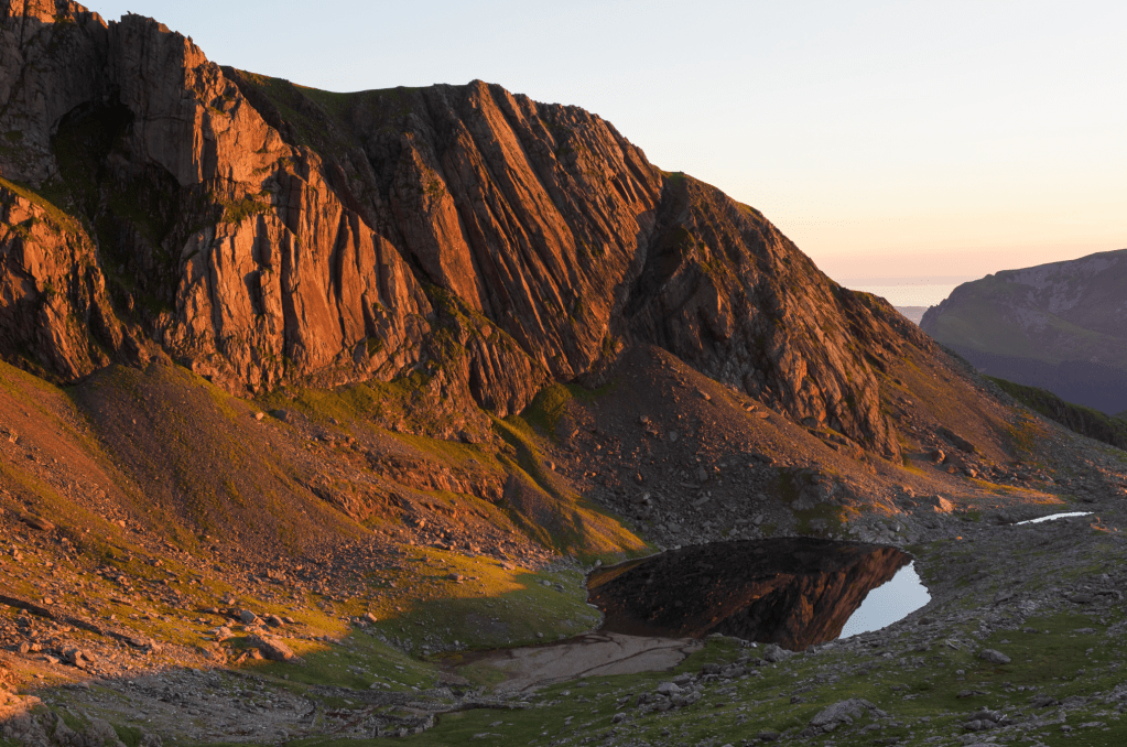
Sunset light on Clogwyn Du’r Arddu. Credit: Alex Roddie
4. SH599570: The Halfway House, marked on OS maps, is a stone building with a small kiosk where drinks and food can be purchased when open. Here the railway begins to climb further uphill away from the trail towards the summit of Llechog. As the trail climbs beyond, views of Clogwyn Coch and Clogwyn Du’r Arddu – impressive cliffs with many classic climbing routes – begin to rise above the grassy slopes. The trail soon veers SW and begins to climb more steeply towards Clogwyn Station, with many stone steps underfoot.
On the Llanberis Path near the mountain railway. Credit: Alex Roddie
5. SH608560: The path reaches the ridge by passing beneath a railway bridge just SE of Clogwyn Station, revealing sudden views N to Gwastadnant and the Glyderau. After a sharp right turn, the path continues – more gently – along the ridge, which soon becomes broad as it contours around Crib-y-Ddysgl. It then narrows again at Bwlch Glas where there are exceptional views to Yr Wyddfa’s summit and Crib Goch. A final steep and rocky pull (alongside the railway) leads to the summit of Yr Wyddfa (1,085m).

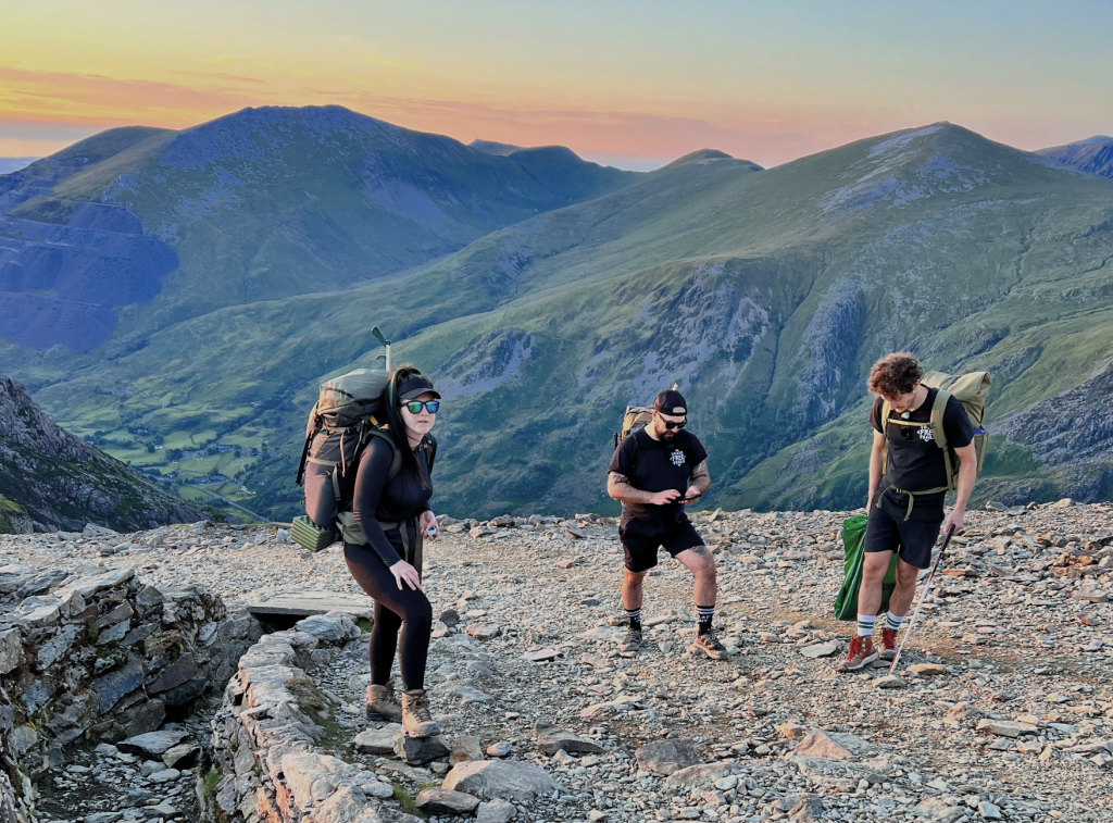
James Forrest at the summit of Yr Wyddfa. Credit: James Forrest
6. SH610544: After taking in the summit views, descend much steeper and rockier terrain SW – the top of the Rhyd Dhu and Watkin Paths. At SH609542 a prominent upright stone marks a traverse path cutting E across Yr Wyddfa’s S face: the Watkin Path. Take the turn, descending gradually (excellent views ahead) as the path continues just beneath the crest of a ridge.
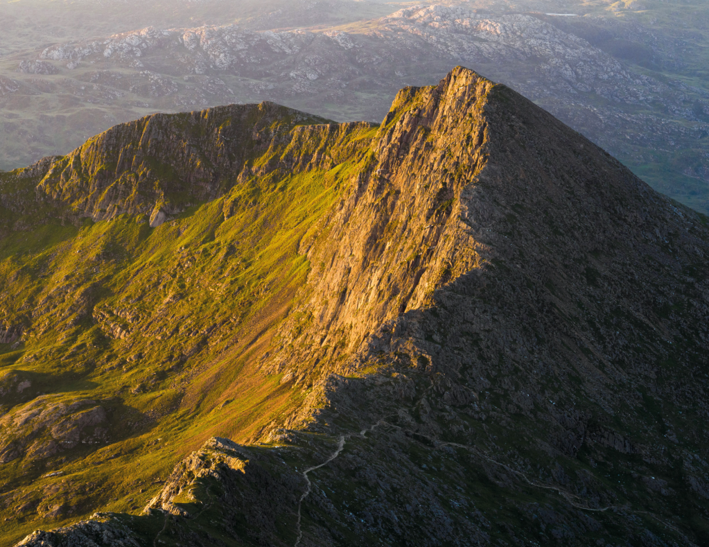
The jagged summit ridge of Y Lliwedd. Credit: Alex Roddie
7. SH620547: At Bwlch Ciliau, marked by a large cairn, there are views of Y Lliwedd’s jagged crest ahead. A rocky path descends abruptly SW (right) and makes its way down into Cwm Llan. At first the going is rough but there are sections of stone steps. Continue until the gradient eases and the trail reaches disused quarries with obvious spoil tips near the stream (Afon Cwm Llan).
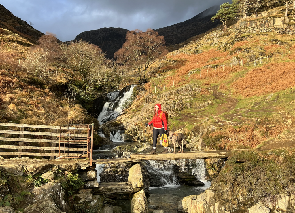
The Watkin Pools. Credit: Francesca Donovan
8. SH614525: The path now turns E, descending gradually as it passes Gladstone Rock (marked by a large plaque) and then converging with the river (attractive waterfalls and pools). Further down, the path becomes a broad gravel track, then meets a narrow lane. Continue along this to the road.
9. SH627506: Cross the A498 to find the car park.
Further information
PUBLIC TRANSPORT: Llanberis is accessible by train to Bangor, then bus service S2. It can also be reached from Betws-y-Coed by bus S1. From the finish, take bus S4 to Pen-y-Pass then S5 back to Llanberis.
TOURIST INFORMATION: 01286 870500, Snowdonia Hwb Eryri Llanberis
Discover more walks in North Wales as mapped by our expert contributors.


