
For a pleasant day out that includes tops, lakes, lots of ruins and an angry giant, look no further than the Moelywnion, says Emily Woodhouse.
The Moelywnion are an often forgotten but very pleasant group of mountains in central Snowdonia. Compared to the sheer rocky peaks of the north, they are rolling and grassy. This walk takes in two of the higher summits in the range: Moelwyn Mawr and Moelwyn Bach. Aside from the tops, the area is covered in disused quarry pits and buildings. The route passes several you can explore, following sections of the Snowdonia Slate Trail and Cumbrian Way.
For a bit of fun folklore: the eponymous Maen Twrog is a strange round-topped standing stone outside the church in the village of Maentwrog. It is said that the stone was thrown there from the top of Moelwyn Mawr. In the version I was told, it was a giant throwing the stone down at the villagers in anger. However in other versions the stone is thrown by Saint Twrog, given superhuman strength in his battle against the devil. Either way, you can stand on the top of Moelwyn Mawr, look south and wonder what it might have looked like to see a boulder be thrown 5km.
The Moelywnion: route description
START/FINISH: Fairly small car park off the side of the road, just south east of Tanygrisiau station; SH 685 448 | MAPS: OS Explorer Map OL18 (1:25k), OS Landranger Map 124 (1:50k), Harvey British Mountain Map Snowdonia North (1:40k) | DISTANCE: 10.5km / 6.5 miles | ASCENT: 750m / 2500ft | DURATION: 4 hours
1. SH 685 448: From the car park or railway station, walk along the road west across the top end of Tanygrisiau Reservoir. Bear around to the right, where the railway crosses the road, and continue uphill past the weir and over the river. Look out for Snowdonia Slate Trail markers to help you navigate. Just over the river there is a t-junction: turn left and follow the road as it turns more and more into a track. There is a huge spoil tip to your right and Cwmorthin Waterfall soon appears on the left.
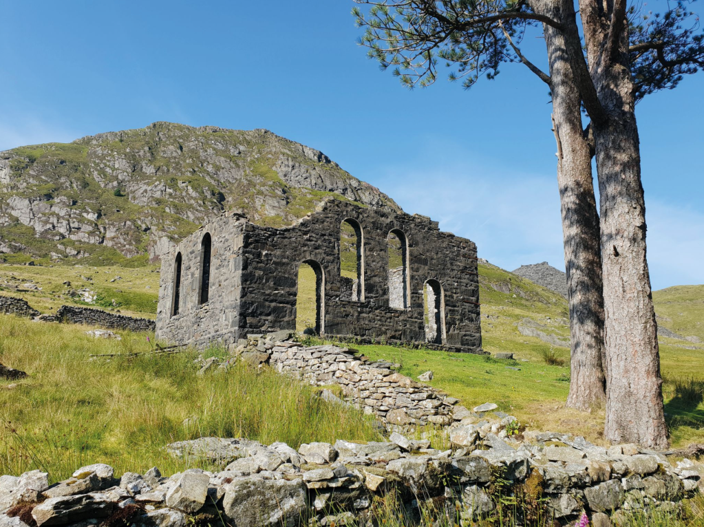
Capel Rhosydd. Credit: Emily Woodhouse
2. SH 678 460: At the corner of Llyn Cwmorthin, continue left along the wide track that runs along the side of the lake. You will pass by the ruin of Capel Rhosydd, an isolated chapel for a quarry you will pass through later. The building no longer has a roof but is still very striking against the landscape. Llyn Cwmorthin behind, the conical-looking lumps of old spoilt heaps look peculiar from the valley.
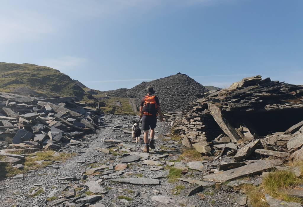
Walking through the quarry ruins on the Snowdonia Slate Trail. Credit: Emily Woodhouse
3. SH 669 466: Continue along the well made track, past the first ruins of this walk. Cwmorthin Quarry began extracting slate in 1810 and continued to be worked at some scale until 1997. Soon the clear track ends at the foot of a spoil heap. The ruined building to the right of the track, and nearby waterfall, are a fun to explore – but don’t spend too long because there is a lot more coming! The way becomes less obvious for a while, but head roughly south across the black landscape. This is part of the Snowdonia Slate Way, so there are occasional sign posts. Pass to the right of the flooded pit and continue up the incline.
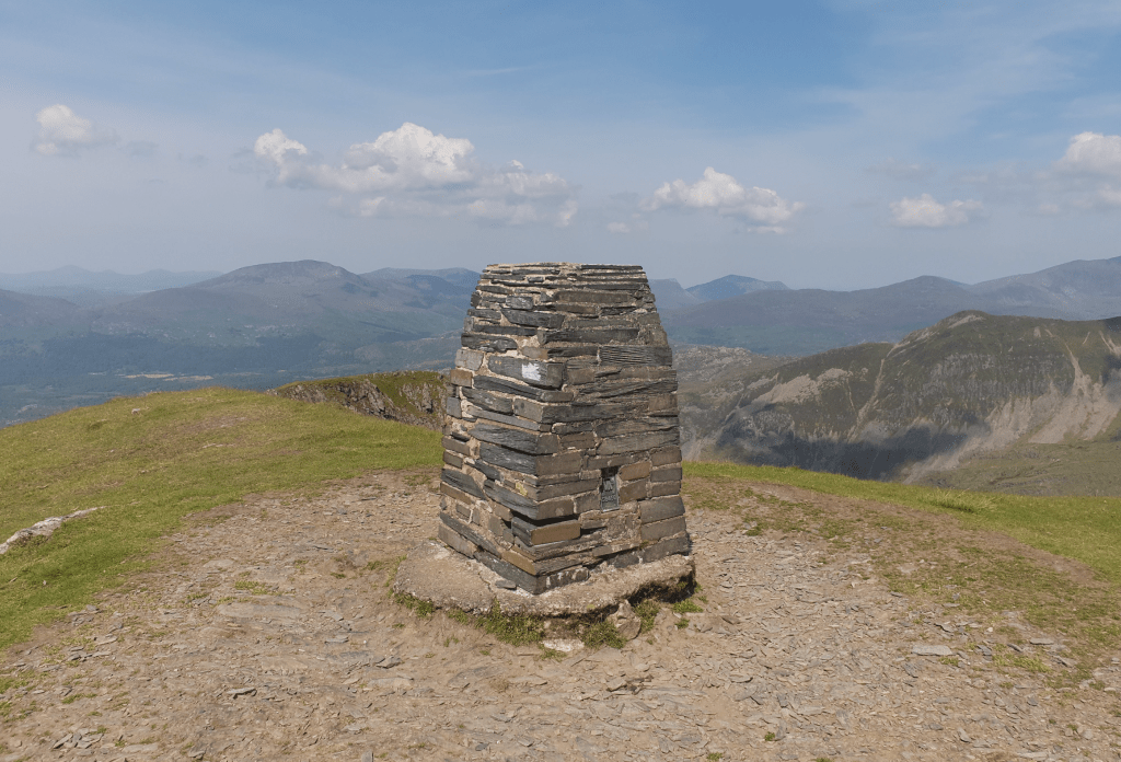
Moelwyn Mawr summit trig. Credit: Emily Woodhouse
4. SH 665 456: The remains of Rhosydd Quarry, its buildings and workings, extend across the hillside. There are many interesting ruins to explore, including the remains of a barracks, mill and cable-way. The scattered slate and slab fencing feels like stepping into another world. It is quite possible to spend hours here, but do be aware of the hazards that these areas do present, including open adits. From the westernmost group of buildings, beside the upper quarry pits, cut west to rejoin the Cambrian Way. This footpath will take you up a grass spur and onto the summit of Moelwyn Mawr. On a clear day, there are particularly fine views towards the sea from the trig point. Descend south east off the summit, the path becoming a clear dirt track with a steep view over the reservoir below. And don’t forget to size up your giant’s throw to Maentrog!

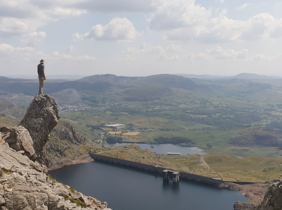
View across the reservoir and beyond. Credit: Emily Woodhouse
5. SH 660 440: At the end of the descent from Moelwyn Mawr, the path meets up with the long track that contours around the bowl of the reservoir, Llyn Stwlan. Although there is no path marked on the map, there is a line on the ground that will take you onto the summit of Moelwyn Bach. It is well worth it for the view, even though it is a short there and back. Either way, follow the contour path north about 100m before turning right and crossing the bowl of the reservoir on pathless grass ground. This can be quite boggy even in summer but is worth it for the impressive close up of the arched facade of Llyn Stwlan’s dam. Hop across the stream where it is narrow and pick up the wide access track. This descends gently back towards Tanygrisiau, meeting up at the river with the start of the walk. Retrace your steps back to the carpark.
Further information
PUBLIC TRANSPORT: Trains to Llandudno Junction, then train to Blaenau Ffestiniog
TOURIST INFORMATION: www.visitsnowdonia.info, 01492 577566
Discover more walks in North Wales as mapped by our expert contributors.


