
Roger Butler explores steep wooded dingles and dark creepy defiles amidst the quiet hills of Worcestershire.
You wouldn’t want to get Tame and Teme mixed up. The River Tame passes beneath Spaghetti Junction whilst the River Teme twists through glorious hill country in Shropshire and Worcestershire. And who can resist a walk which includes Devil’s Den and Hell Hole? These might sound like hostile hideaways in a Birmingham subway but they’re just some of the steep wooded dingles which rise above the narrow valley below charming Clifton upon Teme. Paths cross wooded spurs which flow with the rhythms of sunshine and shadow and reach a high point on Walsgrove Hill, with views to the Clee Hills and distant Black Mixen.
On the other side of the valley, the route pushes through silent tangled forestry where it’s easy to imagine haunted happenings. Muntjac deer leave hundreds of small muddy hoof prints – but the defile at Devil’s Den would also be a perfect habitat for the mythical Gruffalo.
Walsgrove Hill and Devil’s Den: route description
Start/Finish: Parking by the church in Clifton upon Teme, grid ref SO714615 | Map: OS Explorer 204 (1:25k), OS Landranger 149 and 150 (1:50k) | Distance: 20km/12½ miles | Ascent: 730m/2400 feet | Duration: 8 hours
1. SO714615: Take the footpath next to the church, fork R and fork R again to follow the path on L side of Church House Farm. Take path on R after buildings and then go L through gate onto bridleway by next barn. Walk past forestry plantation on L and continue south-east, downhill through gap and above valley, to pass through two small gates. Go R in wood, cross small footbridge and cross field to gates at lane at Ham Bridge. Turn R, then L to cross the road bridge over the River Teme and take the first path/track on L at Hambridge Farm.
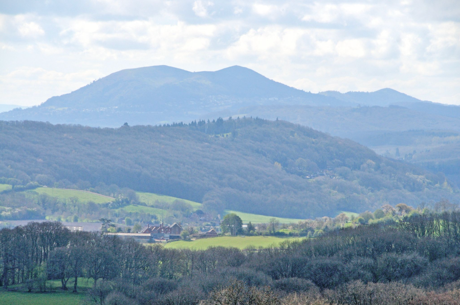
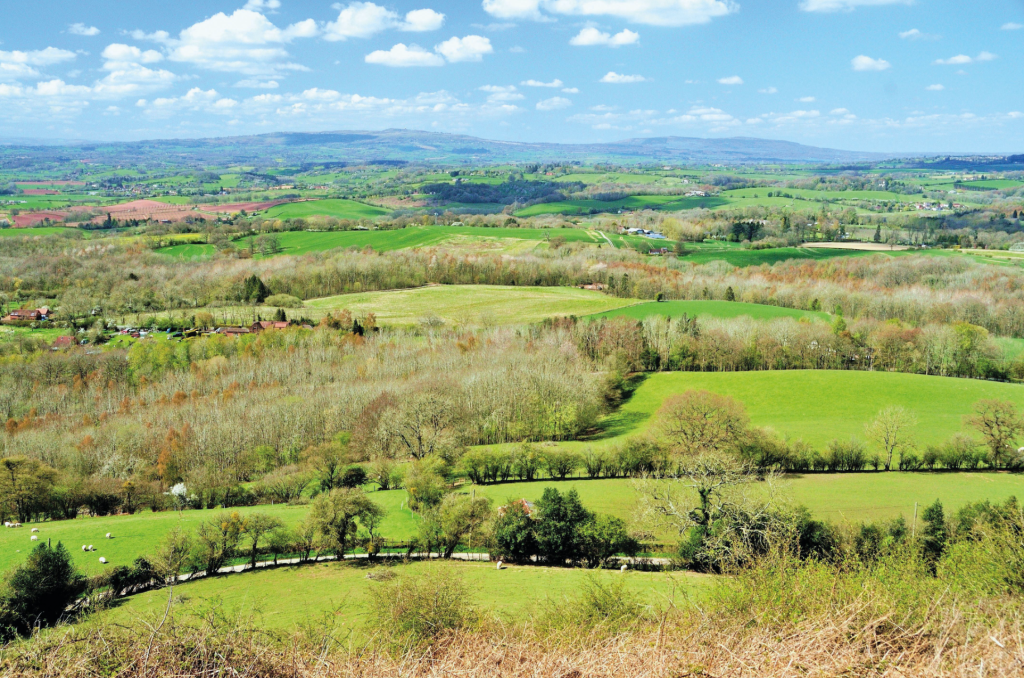
View looking south from near Pudford Hill. Credit: Roger Butler
2. SO740609: Walk north, past fishing pool on R, and go R at gap at top of field. Take stile on L, head to next gap, cross stile and pass Pudford Farm. Cross lane and take path/gate opposite, trending north through wood, to Pudford Hill. At junction of paths, go north on Worcestershire Way along crest of Rodge Hill. Follow waymarks, through more trees, to gate at lane.
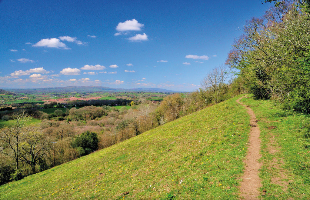
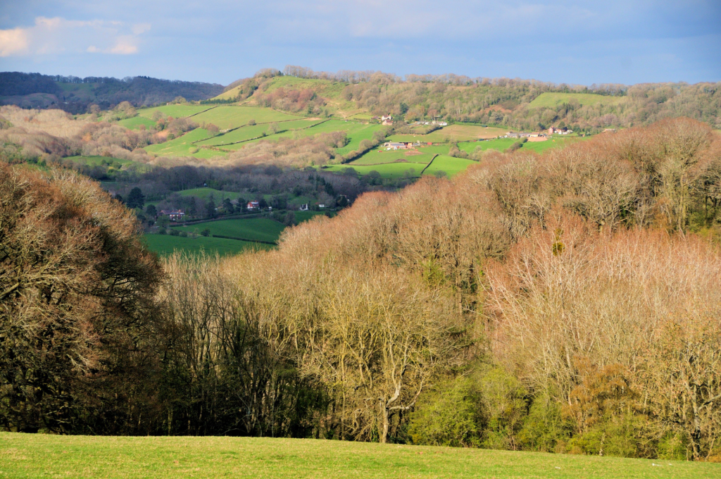
On the crest of Walsgrove Hill with the hills of Titterstone Clee and Brown Clee on the horizon. Credit: Roger Butler
3. SO742635: Turn R to a T-junction, with a former flooded quarry (no access) on L; turn L past Old Woodbury Farm. Continue around sharp bend and steep rise and take path on R immediately after private track. Walk to houses in wood at Birch Berrow and turn L, steeply downhill through wood, to lane. Turn R for 150m and take path on R, after cottages, to follow Worcestershire Way north, uphill through trees and across open clearings with a few gates, to top of Walsgrove Hill. Descend steeply to kissing gate and go R to B4203.
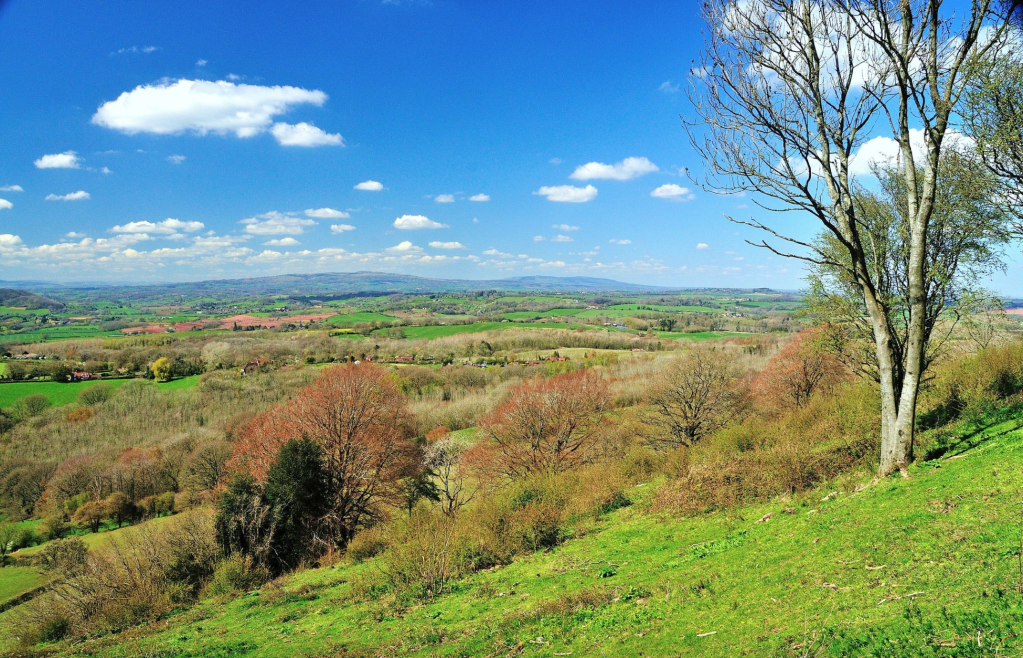
View looking north-west to Titterstone Clee and Brown Clee, in Shropshire, from Walsgrove Hill. Credit: Roger Butler
4. SO743661: Turn L and after 200m go through ornamental gates on R, onto an avenue of trees. Follow signs, turn L at school buildings and walk ahead for 800m, with prominent tower on R. Turn L at crossroads of paths by wood, cross stile and veer R to stile by cottage on edge of Ellbatch Wood – path soon runs along edge of valley and after stile and gate crosses field towards large barns at Lower Crundeland Farm. Turn L and follow right of way to descend to farm track in wooded valley. Turn L at the lane, fork R at pub after 100m and cross old road bridge to re-cross B4203 at Stanford Bridge.
Titterstone Clee and Brown Clee seen looking north-west from Walsgrove Hill. Credit: Roger Butler
5. SO714657: Take the lane on the other side of road, walk round two sharp bends and take the track on R to Noverton Farm. Turn L after 300m and enter wood after 350m. Join a narrow path, south-west and uphill, and leave trees at top of the escarpment. Fork L over field, past an old barn on L and continue to stile in trees by head of wooded valley. Cross stream and at junction of paths continue south-east on bridleway track, downhill through gates, to enter north side of wooded Devil’s Den.
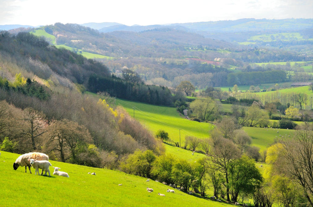
Walsgrove Hill seen looking north-east across the Teme valley from the steep path above Devil’s Den and Hell Hole. Credit: Roger Butler
6. SO714635: Paths are a little overgrown – descend steeply south through trees to another bridleway, cross stream at foot of valley and take narrow path/bridleway south-south-east through forestry, uphill, with dingle known as Hell Hole on L. Emerge at gate onto open fields and continue uphill, over fields, for 500m.Go L at stile, cross field to gap in hedge and follow right of way, over track, for 600m to junction of paths. Fork R and reach lane after 400m. Turn L to return into Clifton upon Teme.
Further information
Public Transport: Nearest stations Worcester – see www.travelinemidlands.co.uk for regular bus connections
Tourist Information: Worcester TIC, 01905 726311
Discover more walks in the South of England as mapped by our expert contributors.


