
Take on the short, sharp ascent of Kirk Fell to earn a pint on your return, says Francesca Donovan.
Kirk Fell is one of the mostly finely situated fells in Lakeland. At the head of Wast Water, nestled between Great Gable and Pillar, its prominence offers hillwalkers perhaps the best view of a lake’s full length in Cumbria. It’s comparable with the vision of Buttermere as seen from the oft-photographed Fleetwith Pike – but with fewer outdoorsfolk.
Plus, Kirk Fell provides a short but welcome challenge when the weather is grim and you need a quick warm-up. While you may approach via one the two passes which hug its heft on either side – Black Sail Pass to the west and Beck Head Pass in the east – in fine weather, there’s a noteworthy ‘quick’ route. The subject of an amusing cartoon penned by Wainwright, some claim it’s the Lake District’s most exhausting ungraded walk. Anyone who has whiled away an hour or so at the Wasdale Head Inn beer garden alongside Mosedale Beck will have looked up at Kirk Fell and noted the bold and brazen path up, up and up its southern ridge.
Follow the intrigue for a long slog up a scree path (an alternative to the low-grade scramble of Kirk Crags) and at the top you’ll be treated to panoramic views across the Scafell group and Gables Great and Green. You’ved earned your refreshment of choice back at the inn.
Kirk Fell via the Wasdale Head Inn: route description
Start/finish: Lake Head Car Park, Wasdale (GR: NY 1868 0853) | Ascent: 759m/2,490ft | Distance: 7.2km/4.5 miles | Duration: 3 to 4 hours | Maps: OS Explorer OL6 – The English Lakes: South-western Area (1:25k)
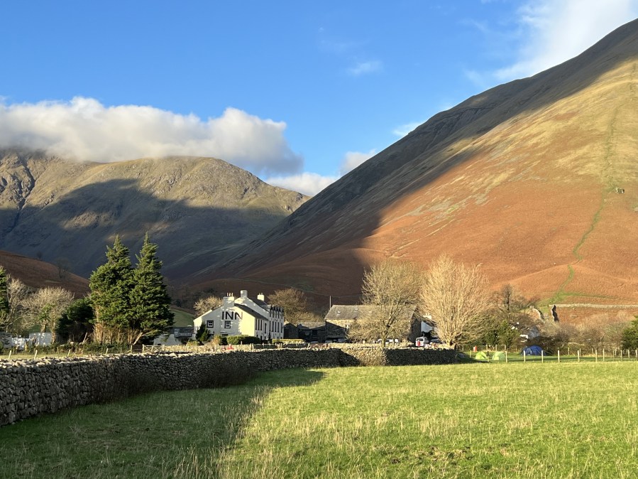
1. NY 1868 0853: From the car park, turn R and head N along the road for 200m enjoying the iconic view of the Wasdale Head Inn ahead of you, tucked at the foot of Kirk Fell. It’s the big white building emblazoned with the word ‘INN’ in bold, black lettering. In other words, you can’t miss it. Turn L at the inn, taking the path between Ritson’s Bar – named for Will Ritson, the most famous landlord of the hotel and a man still renowned as “The World’s Biggest Liar” – and the Barn Door Shop. Join the bridleway heading N along Mosedale Beck, passing by the picturesque packhorse bridge. Continue along the bridleway for another 350m until you reach a fork in two pathways.
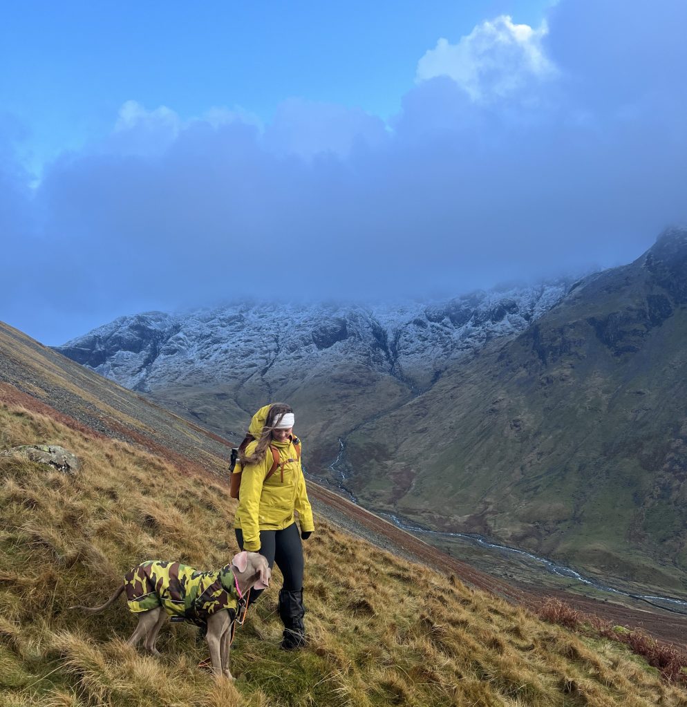
A local guides the way to the Kirk Fell ascent. Credit: Francesca Donovan
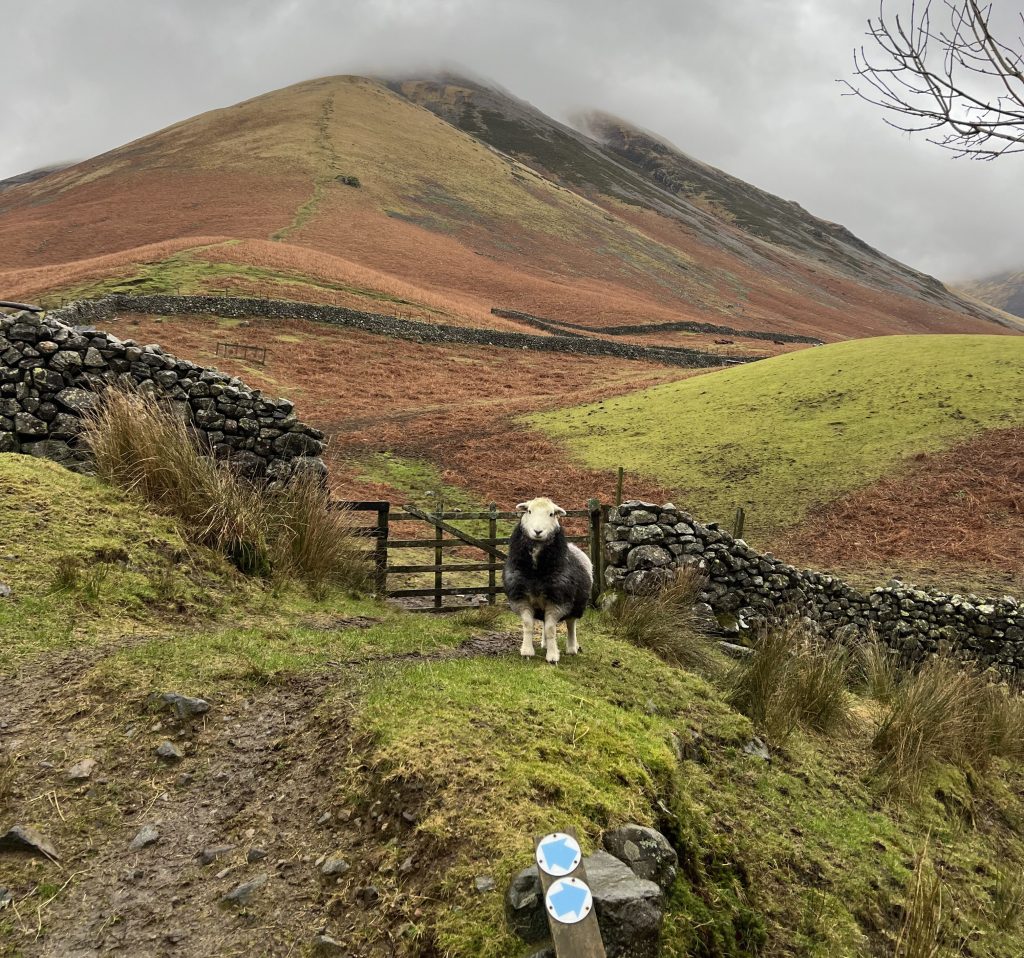
2. NY 1877 0914: Here, don’t take the obvious bridleway route of Black Sail Pass (unless, of course, you’re keen for the easy and short scramble of Kirkfell Crags – but that’s a route for another day). For those of you who like a challenge – or have a clumsy dog with a high centre of gravity incapable of the slightest climb – continue on the waymarked path heading NNE directly up Kirk Fell’s south ridge. Navigation is easy and the path is well-trodden.
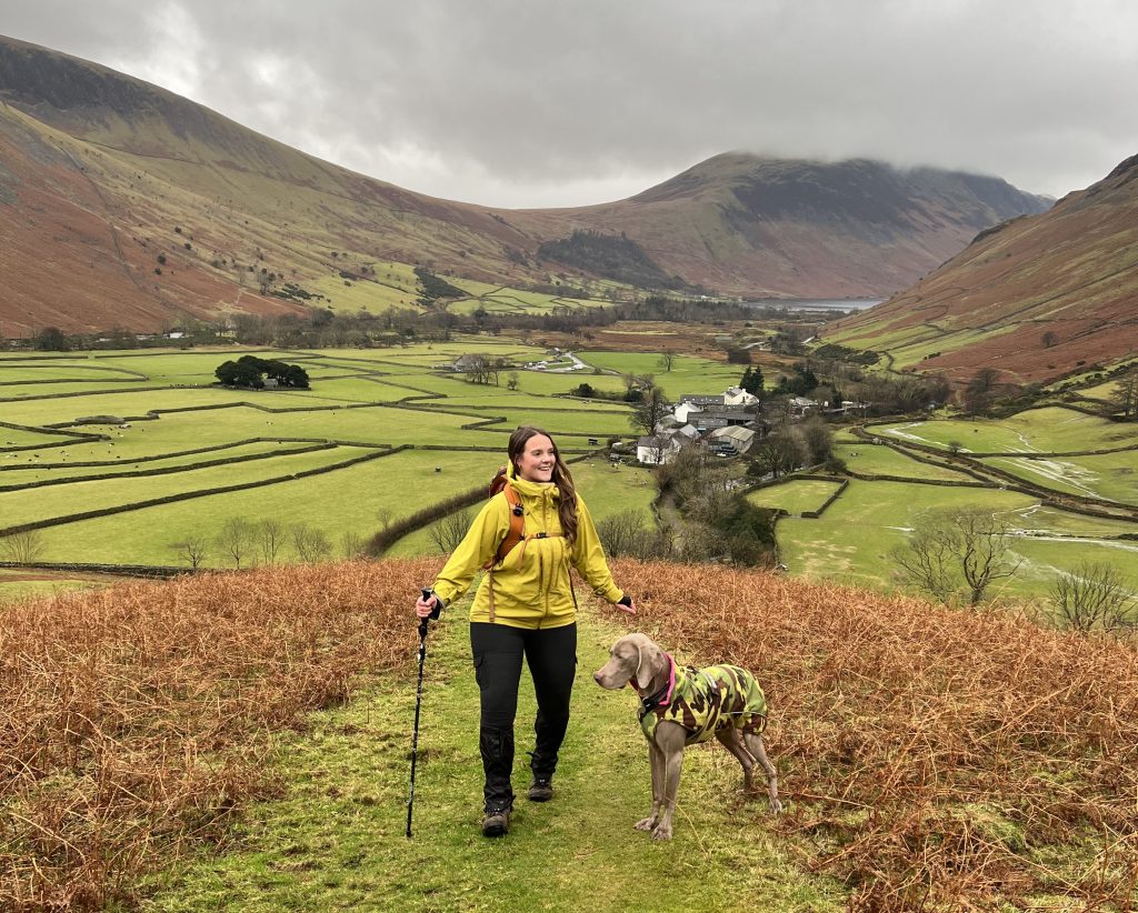
The initial ascent of Kirk Fell. Credit: Francesca Donovan
That is, until you reach the scree line at about 500m. Buckle in and continue upwards picking your most comfortable and secure underfoot route without veering too far off your NNE bearing. The scree starts to peter out at about 700m where you can then follow a clear path that winds the rest of the way up until Kirk Fell plateaus into a mercifully grassy top. The rocky summit itself is marked by a cairn.
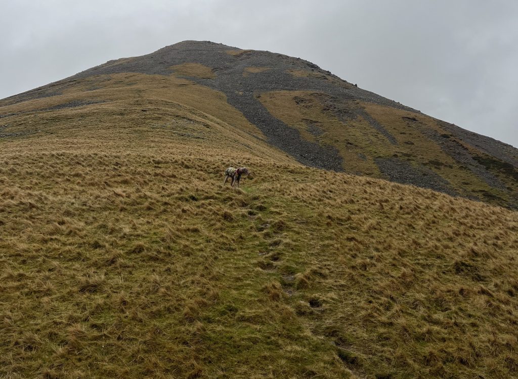
Looking up to the scree ascent of Kirk Fell. Credit: Francesca Donovan
3. NY 1948 1049: At the summit (802m) on a clear day, you can see as far as Skiddaw and Blencathra in the E and towards Helvellyn in the S. Should the day offer cloud and low visibility, fear not. The awesome sight of neighbouring Great Gable and Green Gable sitting alongside the Scafell group should suffice. Pat yourself on the back for the gruelling ascent and rest the legs a moment before beginning the descent off the summit in a NE direction. The descent is gentle and you’ll pass by helpful navigational tools such as the Pile of Stones marked on your OS map as well as Kirkfell Tarn to your R. From here, follow the path E for 500m. It can be boggy and there are babyheads a plenty so enjoy the soft ground but watch your step. Continue E descending Rib End towards Beckhead Tarn which you’ll reach in 300m. At Beck Head, continue 200m on the SE path until you reach a four-way junction in the footpaths.
On the descent. Credit: Francesca Donovan
4. NY 2064 1055: Turn R following the footpath heading SSW in the shadow of Great Gable and the iconic climber’s paradise of Napes Needle. The stony pathway is clear and well-trodden, leaving you to enjoy the sweeping views down Lingmell Beck as it reaches and wriggles southwards to join Wast Water. The path turns tussocky over Gavel Neese but it’s wholly pleasant walking. It’s 1.6km of descent until you reach the Moses’ Trod Path and the inn is within sight.

Looking down to Wast Water Credit: Francesca Donovan
5. NY 1996 0928: Continue along Moses’ Trod for 1.3km heading initially WSW and then wiggling along Fogmire Beck through farmed land, whereupon you’ll rejoin the bridleway.
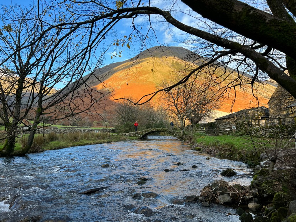
Kirk Fell as viewed through the trees from the Wasdale Head Inn beer garden. Credit: Francesca Donovan
6. NY 1876 0903: Retrace your steps back to the car park, bypassing the Wasdale Head Inn. Be sure to stop in and enjoy some fireside downtime at this historic hotel and public house that stakes a claim to being the birthplace of British climbing.
Further information
Tourist information: lakedistrict.gov.uk (01539 724555)
Public transport: None to start
Discover more walks in the Lake District as mapped by our expert contributors.


