
Roger Butler treads tussocky tops to The Calf via a 17th century temperance inn.
Alfred Wainwright once described the smooth contours of the Howgill Fells as ‘a huddle of squatting elephants’ and, on a good day, it’s quite easy to wander across these tussocky tops with your hands firmly in your pockets. The rolling horizons, and a complete lack of walls and fences, might encourage you to whistle whilst you walk but the skylarks will also provide a suitable serenade. This wriggling circuit includes breezy tops, deep valleys and dark crags and also passes over the broad summit of The Calf, the highest point in the range.
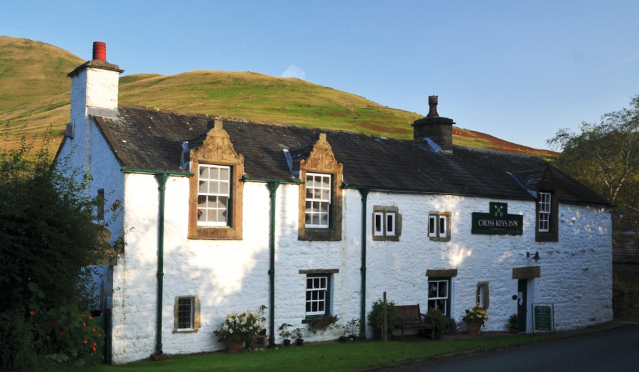
You’ll climb over several fells, look down into the great gulch of Bowderdale, walk along the high edge of Cautley Crag and descend a steep zig-zag path next to the tallest above-ground waterfall in England. And there’s a pub. The Cross Keys Inn, from where the walk starts and finishes, dates from the 17th century but doesn’t serve alcohol since it operates as a temperance inn. Try their nettle cordial – but you can also bring a bottle of wine if you’re going to eat there!
The Calf via The Cross Keys Inn: route description
Start/Finish: Lay-by next to the Cross Keys Inn, grid ref SD698969 | Map: OS Explorer OL19 (1:25k), OS Landranger 91 and 98 (1:50k) | Distance: 16km/10 miles | Ascent: 1015m/3325 feet | Duration: 8 hours
1. SD698969: From the lay-by next to the Cross Keys Inn, cross the footbridge over the River Rawthey and turn R on a good path above Backside Beck. Cross a ford/weir after 500m and bear R uphill, with wood on L and through two gates, to farm at Narthwaite. Go between first barns and turn L on bridleway track. Fork R at gate after 200m and walk uphill on old track, through gap in wall and another gate. Turn sharp L after 1km, by a ruined barn, and continue uphill for 300m to a stile at the junction of walls and fences. Go R and reach the small cairn on top of Wandale Hill after 1km.
2. SD705989: Keep ahead, head downhill and bear L to the south of walls at Adamthwaite. Cross the damp headwaters of Backside Beck and climb the slope ahead, with Stockless Gill on R. Bear L, south-west, to walk up ridge to cairn on top of Kensgriff.
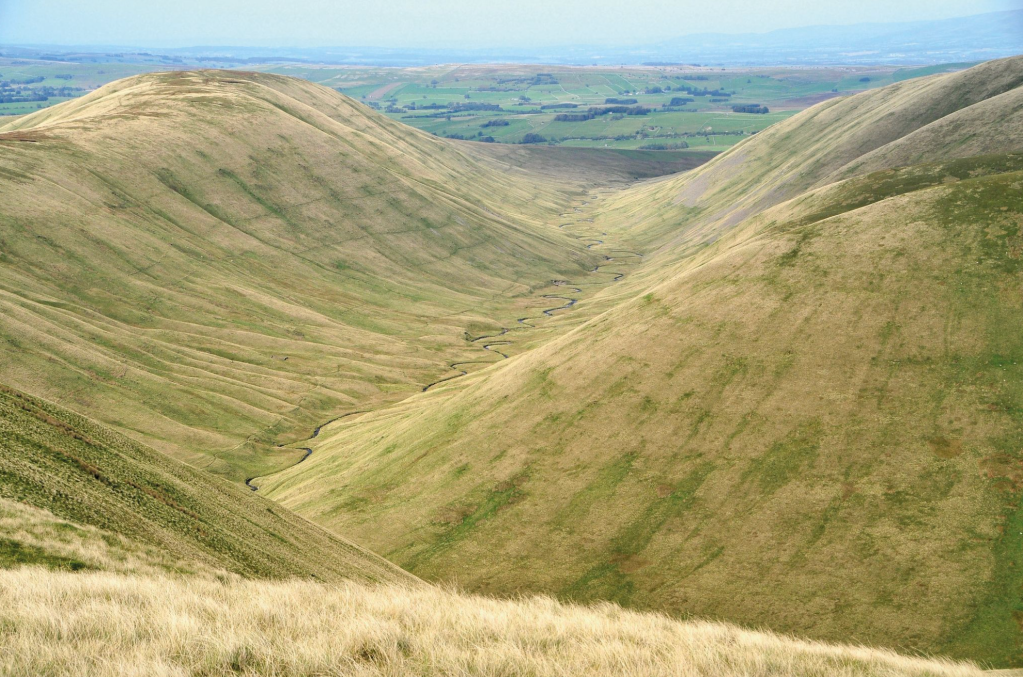
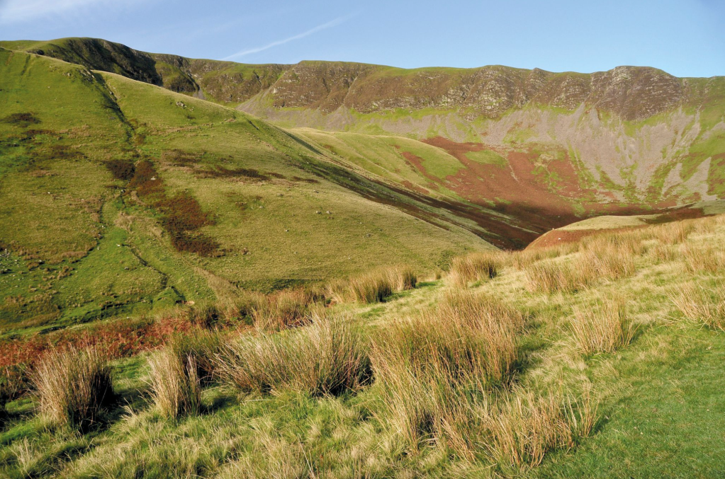
Photo 1: View looking north from Yarlside to the long glaciated valley of Bowderdale. Credit: Roger Butler
3. SD688992: Descend south to a col and climb steep scattterings of scree to the north end of Yarlside. Continue south over the summit and after 500m descend steeply west to Bowderdale Head. This col marks the south end of the long and empty glaciated Bowderdale valley, which seems to have come straight out of a school geography textbook. The meandering beck runs north to the River Lune.
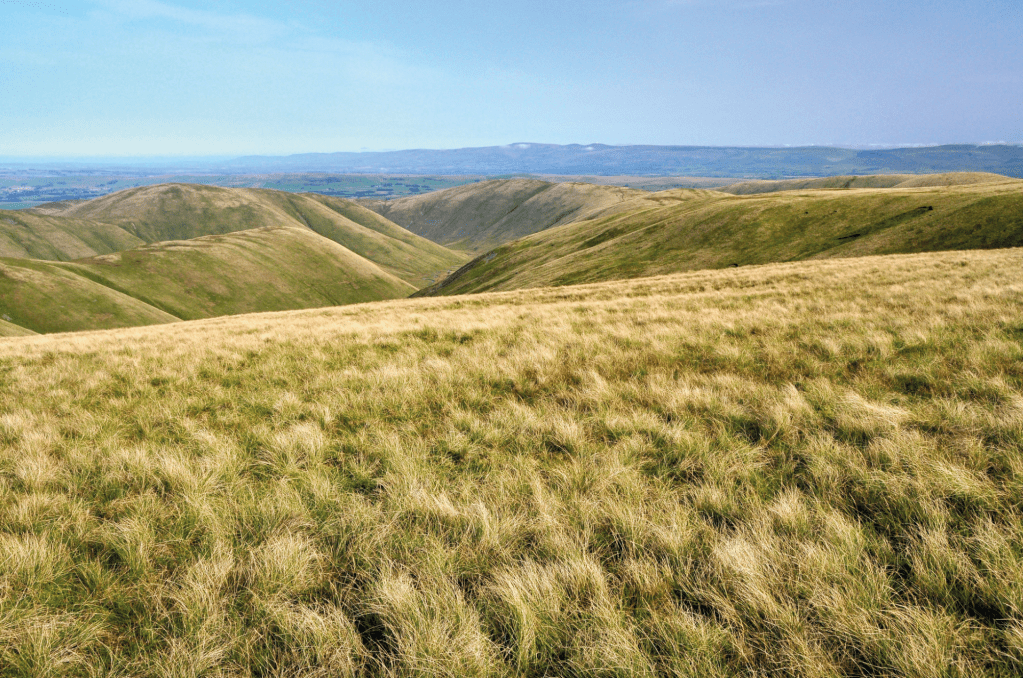
View looking north from The Calf with the North Pennines on the far skyline. Credit: Roger Butler
4. SD681979: Go straight over, climb to a spur named Hare Shaw and bear L above Swere Gill to join an indistinct bridleway. Continue up to a small pool by a junction with a grassy path (marked Dales High Way on OS map). Turn L for 600m to the trig pillar and pool on the plateau-like summit of The Calf. The views are extensive and include the North Pennines, the Lakeland Fells and even glistening Morecambe Bay.
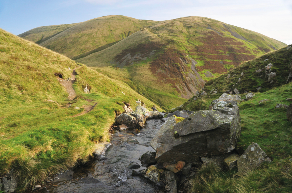
Yarlside seen from the top of the cascades at Cautley Spout. Credit: Roger Butler
5. SD667970: Walk south from the top, dip down to a col, pass Bram Rigg Top and continue to the cairn on Calders, just two metres lower than The Calf. Turn L over level ground to reach the broad top of Great Dummacks after almost 1km. Turn L on a rough path along the dramatic airy rim of Cautley Crag, with dark cliffs below and views east towards Wild Boar Fell. Descend gradually, then a little steeper, to cross Red Gill Beck and follow the path to cross Swere Gill after 100m.
The long line of Cautley Crag seen from the path below the waterfalls. Credit: Roger Butler
6. SD679975: The path then turns R and begins the steep descent along the north side of Cautley Spout. There are a number of zig-zags alongside the defile with opportunities to peer into the crashing cascades – often decorated with great icicles in winter.
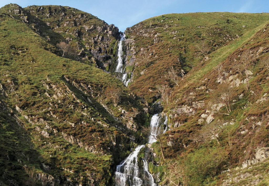
Cautley Spout. Credit: Roger Butler
Continue steeply downhill, with some stone steps, and join the path coming south from Bowderdale Head. Follow the path down the open valley for 1.25km and turn L at the River Rawthey – it’s now 600m back to the footbridge by the Cross Keys Inn.
Further information
Public Transport: Nearest town with station Kirkby Stephen – see www.westerndalesbus.co.uk for bus connections to the Cross Keys Inn
Tourist Information: Sedbergh TIC, 015396 21025
Discover more walks in the Howgill Fells as mapped by our expert contributors.


