
Vivienne Crow enjoys contrasting sides of the far eastern fells with a route over Barton Fell from The Sun Inn at Pooley Bridge.
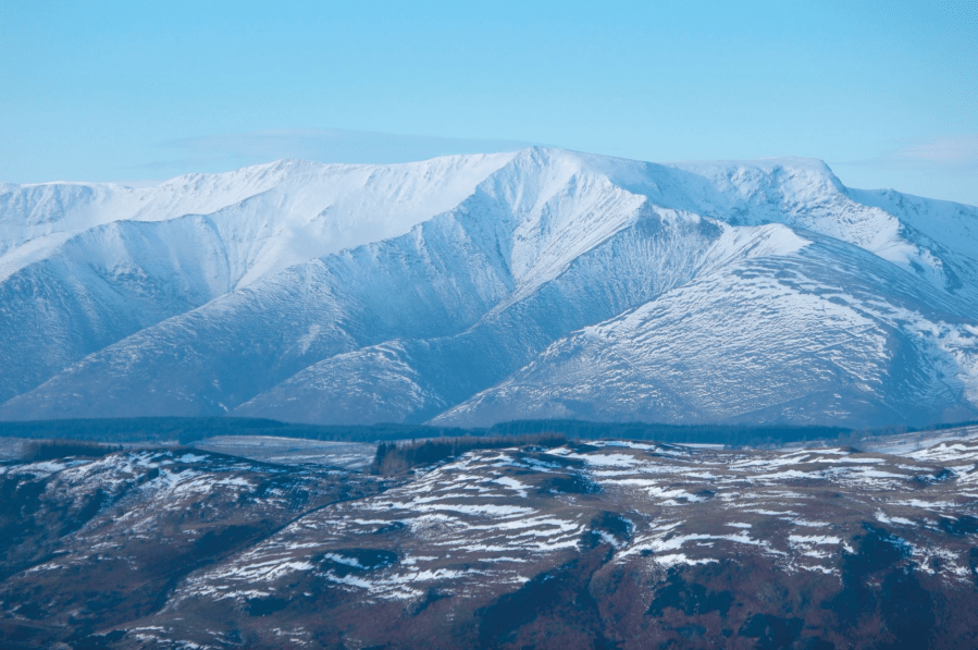
Lakeland’s eastern edge is dominated by gentle, rounded slopes and lengthy, whaleback ridges. It’s the sort of area I seek out when I want to hike for long, uninterrupted hours. Just occasionally though, you’ll come across something here that’s a little more interesting, something that’ll break your stride, maybe even stop you in your tracks. The north-western edge of Barton Fell does exactly that. While the ground to the south-east leads on to open, unassuming moorland, these craggy slopes plummet dramatically to a shelf of ancient enclosures, beyond which lies Ullswater. A faint trail skips along the escarpment edge, providing walkers with an uninterrupted view up the dark lake towards Helvellyn and its impressive neighbours. A place to linger…
The second half of the route, on the other hand, features that easy-going, skyline striding I mentioned earlier – along the ridge-top Roman road from Loadpot Hill. Resist the urge to march, legionary-like, if you can! Then, having enjoyed the best of both faces of these fells and with the winter wind still in your hair, warm up in one of Pooley Bridge’s pubs.
Barton Fell & Loadpot Hill via The Sun Inn: route description
START/FINISH: The Sun Inn, Pooley Bridge, GR NY471244 | MAPS: OS Explorer OL5 (1:25k), OS Landranger 90 (1:50k), Harvey 1:25,000 Superwalker Lake District East | DISTANCE: 16.9km/10.5 miles | ASCENT: 604m/1980ft | DURATION: 5-6 hours
1. NY471244: With your back to The Sun, turn left along the road, right at a small roundabout and then straight across at a crossroads. When the asphalt ends at Roehead go through the gate and continue along a track. About 1km beyond the gate, turn right at a cairn. This path later passes to the right of The Cockpit stone circle, one of many Bronze Age remains that are dotted over this moorland. Like other prehistoric stone circles in Cumbria, little is known about its origins, but it’s thought to have acquired its name in more recent history – when it was used for cock-fighting.
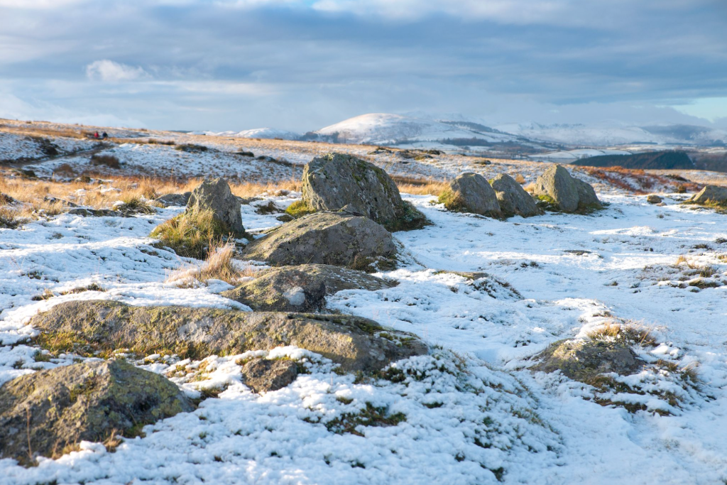
The Cockpit stone circle. Credit: Vivienne Crow
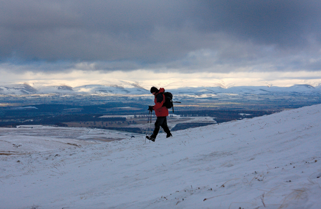
2. NY473219: After dropping to ford Aik Beck, fork left on climbing the other side and then turn sharp left on emerging from the gill. A long, gradual ascent of Barton Fell now begins. As you make your way up the grassy slope, bear right at a fork. The first of several mesmerising views of Ullswater and the Helvellyn range appear as you reach a cairn at the top of the rise. After the next cairn, bear right at a fork to keep to the faint path along the north-western edge of the fell. A little later, you’ll see a tall cairn to your right – down the slope slightly. Beyond this point, the path becomes less obvious, but you should continue along the edge of the high ground for now. The trail then begins swinging round to the south as it loses a little height to hug the eastern slopes of Swarthbeck Gill.
On the path between The Cockpit and Waypoint 2. Credit: Vivienne Crow
3. NY456202: Having crossed a subsidiary beck along the way, drop to ford Swarth Beck. At the top of the steep embankment on the west side, head west-south-west up the hillside to climb Bonscale Pike. A faint trail leads up to the cairn, passing above two tall stone columns along the way.
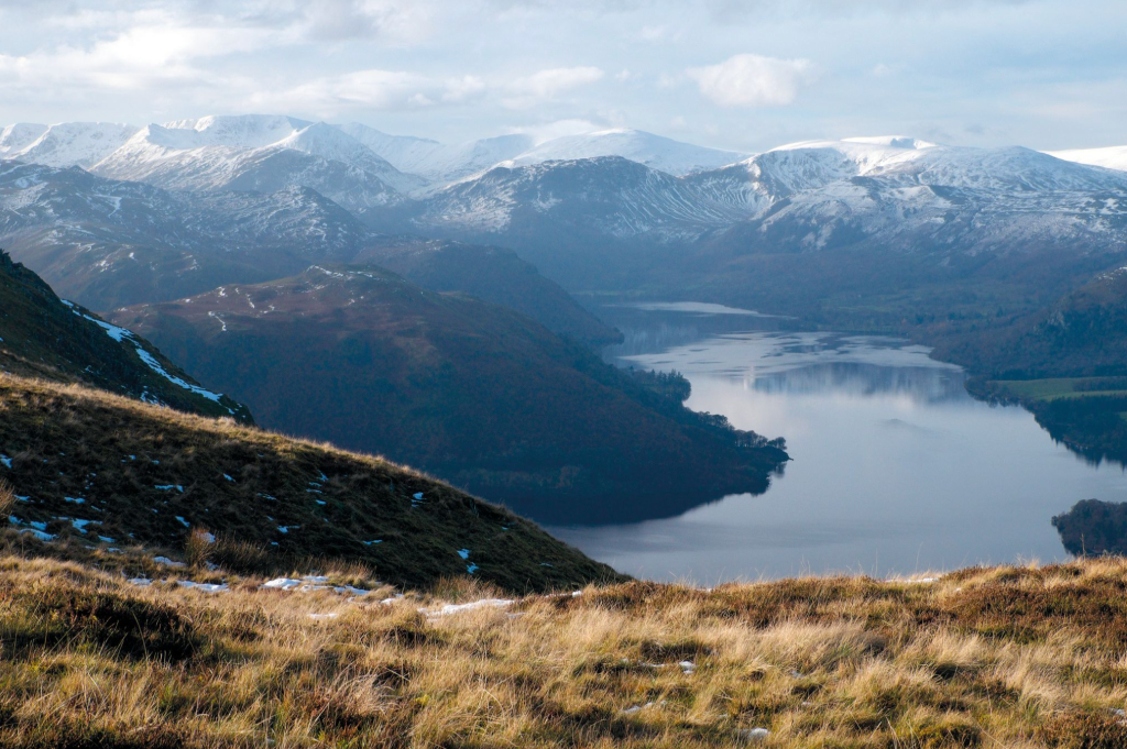
Looking up Ullswater towards the Helvellyn group. Credit: Vivienne Crow
4. NY453199: Still enjoying some airy views and with the ground dropping away steeply to the right, continue along the faint trail heading roughly south along the escarpment edge for now. Don’t be tempted by any trails heading down to the right. As well as the Helvellyn range, St Sunday Crag and Fairfield, the view now includes little Hallin Fell and most of the tops ringing Martindale. About 300m beyond Bonscale Pike, bear left at a fork to begin heading away from the edge. In another 800m or so, as you near the base of Loadpot Hill, bear left (east-south-east) at another fork. The trail later crosses a wider path and then climbs the fell’s north-western slopes.
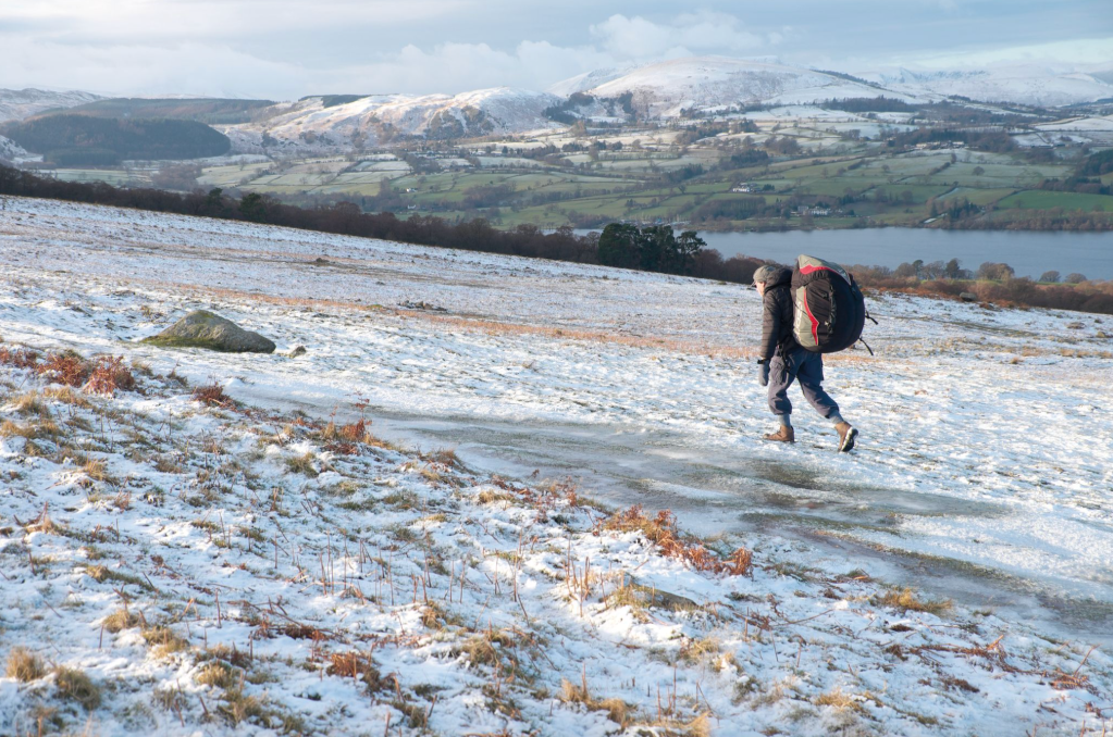
Descending from Loadpot Hill. Credit: Vivienne Crow
5. NY456181: From the trig pillar on Loadpot Hill, take the path heading north-north-east. At the bottom of the initial drop, join a track coming in from the left. You’re now following in the footsteps of the legionaries – along what was the highest Roman road in the country. About 40km long, it linked the forts at Ambleside (Galava) and Brougham (Brovacum) near Penrith.
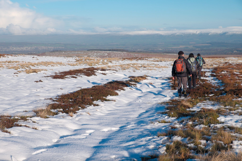
On the return path, with the North Pennines ahead. Credit: Vivienne Crow
6. NY460197: About 1.8km beyond the trig pillar on Loadpot Hill, bear right at a fork. As the route swings north-east, those impressive views of the high, craggy Helvellyn group become an increasingly distant memory; they’ve been replaced by a more extensive vista across the Eden Valley, with the Pennines filling the horizon to the east.
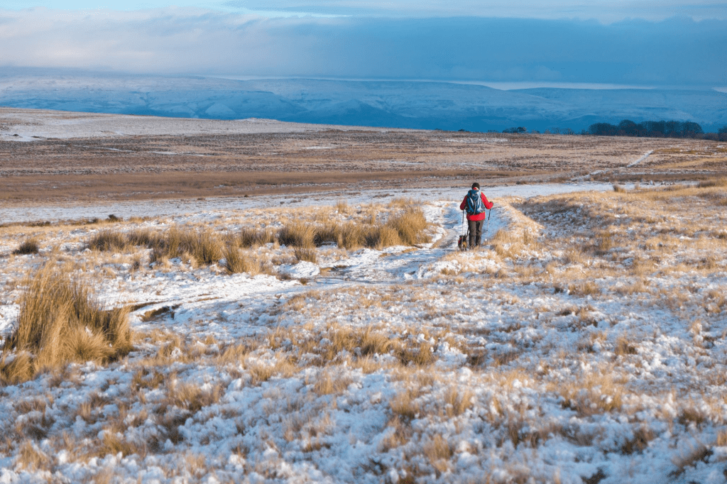
Heading towards The Cockpit after turning right at Waypoint 7. Credit: Vivienne Crow
Continue on roughly the same line, occasionally losing sight of the path on damp ground, for a further 3.3km – until you reach a T-junction.
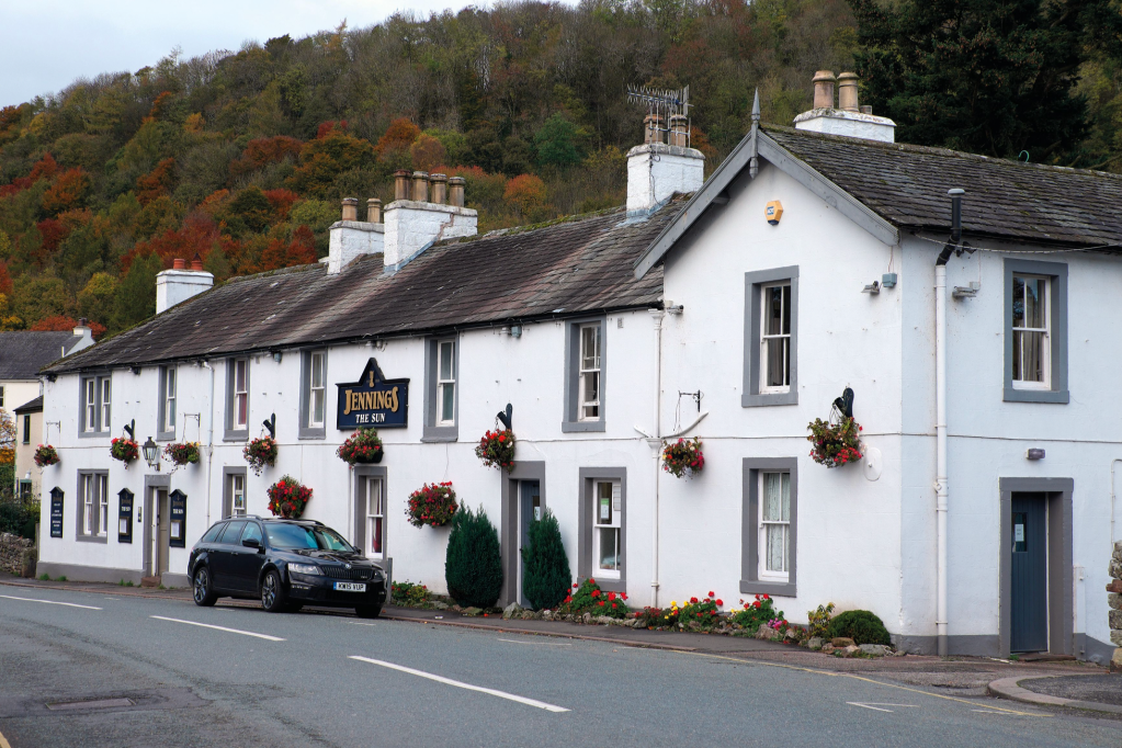
The Sun, Pooley Bridge. Credit: Vivienne Crow
7. NY478222: Turn right, heading roughly east and then swinging north as you retrace your steps past The Cockpit stone circle and back to Pooley Bridge.
Further information
PUBLIC TRANSPORT: Bus 508, Penrith to Patterdale
TOURIST INFORMATION: www.lakedistrict.gov.uk, 0845 9010845
Discover more walks in the Lake District as mapped by our expert contributors.


