

Francesca Donovan goes on a circular wander up to the ‘Welsh Matterhorn’, Cnicht, and finds a spectacularly underrated mountain.
Dare I say it? Cnicht is the finest peak in Eryri/Snowdonia. Despite its relatively modest 689m (2260ft), it offers spectacular panoramic views down to the Irish Sea and northwest to Yr Wyddfa/Snowdon itself on a short and sweet excursion. But here, despite the spoils, you’ll find far less foot traffic. Cnicht’s two tops and prominence of just 104m might mean it forgoes true mountain status. Yet, this peak – a perky pyramid befitting its nickname of ‘the Welsh Matterhorn’ – does allow you to get high in relative solitude.
While there are number of routes up Cnicht, this is especially true if you take a circular route from Croesor avoiding the major trails in favour of quieter footpaths where possible rather than taking a there-and-back option. In doing so, you will also experience much of what the Moelwynion has to offer: an abundance of flora and fauna, waterfalls trickling down slick slate, a short scramble, vast mountain llyns tucked behind tussocky ground, edge-of-your-seat walking along high ridges towards sea-to-sky views and incredible artefacts of recent mining history. Indeed, this route takes in a few miles of the Snowdonia Slate trail and The Cambrian Way – parts of which you may have to share with other walkers before you re-route on your own adventure.
Cnicht circular from Croesor: route description
Start/finish: Croesor car park (GR: SH631446) | Distance: 6.8 miles / 11km | Ascent: 2,093ft / 683m | Duration: 5 hours | Maps: OS Explorer OL17 (Snowdon/Yr Wyddfa)
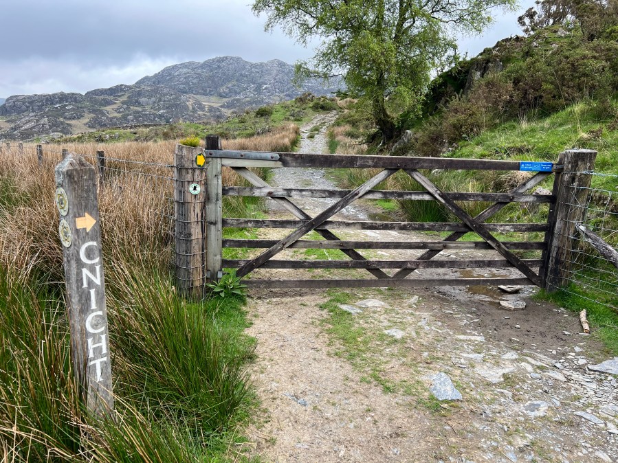
1. SH 631446: From the car park, cross the footbridge heading NW and then turn R to pick up the clear footpath. Take this keeping the pretty stream on your R. It’s probably too soon for a dip so simply soak in the easy start and the views to the mighty face of Cnicht on your L. If you’re lucky, you’ll encounter the local ponies on route. Keep going through the signposted gates on this path for 600m.
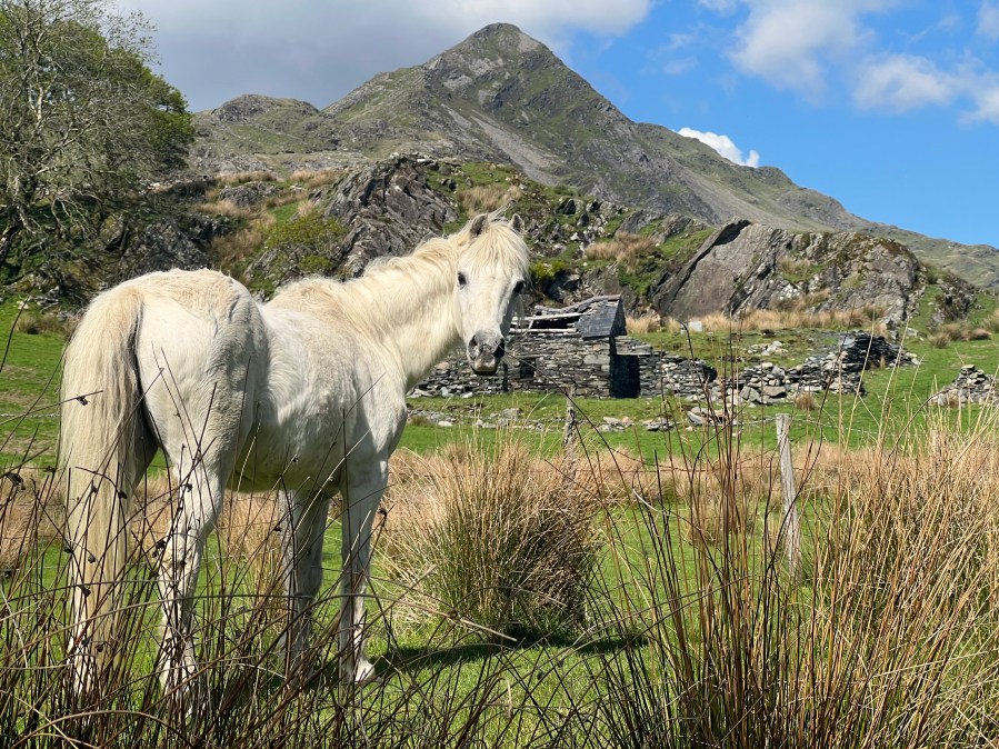
A local pony greeted us as we began our wander up the Welsh Matterhorn.
Credit: Francesca Donovan
2. SH 639452: Here, turn R off the main track and walk through the series of farm buildings taking care not to disturb livestock. You arrive at a footpath crossing the field in a WNW direction. Take this until you reach the stile. In terms of setting, it rivals the famed Pen yr Ole Wen stile perched before its backdrop of mighty Tryfan. Snap your photos and continue over the stile, keeping on the track and beginning your long and gentle ascent.
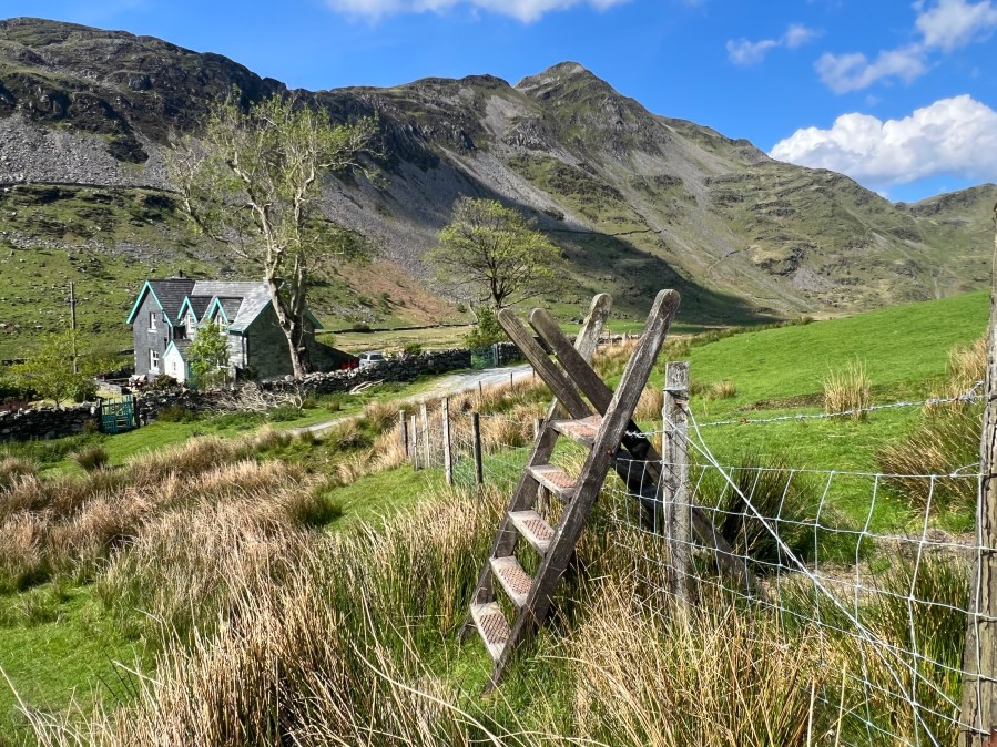
A photogenic stile with the backdrop of Cnicht.
Credit: Francesca Donovan
3. SH 643452: You’ll arrive at a fork in two tracks. Here, you have two options: stick to the Snowdonia Slate Trail or stay lower for a quieter amble. Both end up in the same place and are almost-equidistant. The higher allows you to pass through Croeor Quarry and by Llyn Croesor but requires extra elevation. With big packs, we opted to stay low and enjoy the sleepier slate paths, tumbling streams and views back down to the sea without seeing another soul.

On the Snowdonia Slate Trail.
Credit: Francesca Donovan
4. SH 665462: Rejoin the Slate Trail momentarily – saying hi to other hillwalkers – and then leave it again after 700m to skirt alongside Llyn Cwm-corsiog. Approximately your halfway point, it’s a picturesque place to stop and have a bite. However, the entry points are silty so it is not ideal for a swim.
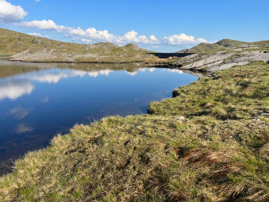
Llyn Cwm-corsiog.
Credit: Francesca Donovan
Regain the trail heading NW and follow this for 1.3km until you meet The Cambrian Way, making sure to stop and enjoy the vista past the dam of Llyn Cwm-y-Foel and beyond to Porthmadog, Cardigan Bay and the Irish Sea.
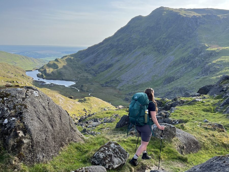
Strolling past sweeping views down to the Irish Sea with Cnicht ahead.
Credit: Francesca Donovan
5. SH 656477: Join The Cambrian Way for 1.5km. We passed campers who would call the banks of Llyn y Biswail their home under the stars for the night before reaching Cnicht’s North Top. Pick your way along the ridge to reach Cnicht, your destination peak. The walking and navigation here is simple and to be savoured with gasp-worthy views every way you turn.
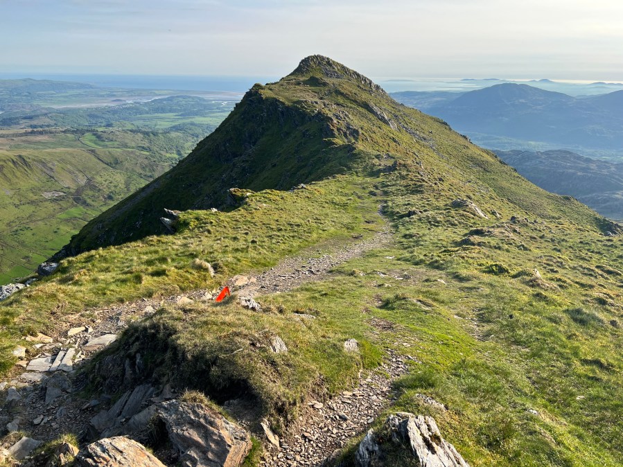
The summit of Cnicht adorned with an Ultra Marathon Snowdonia flag.
Credit: Francesca Donovan
6. SH 645466: From Cnicht, so begins the descent. It is an almost-straight shot on a clear route heading SW for 2.5km miles along the Cambrian Way. It does involve a very short scramble off the peak.

Walking off the down scramble of Cnicht.
Credit: Francesca Donovan
This section is not particularly challenging if you have sure-footedness and are familiar with rocky terrain but there are a few short moments where you’ll have to pack up your poles and allow your hands to guide movements. It makes for a cracking, quick descent with uninterrupted views to Yr Wyddfa on your R.
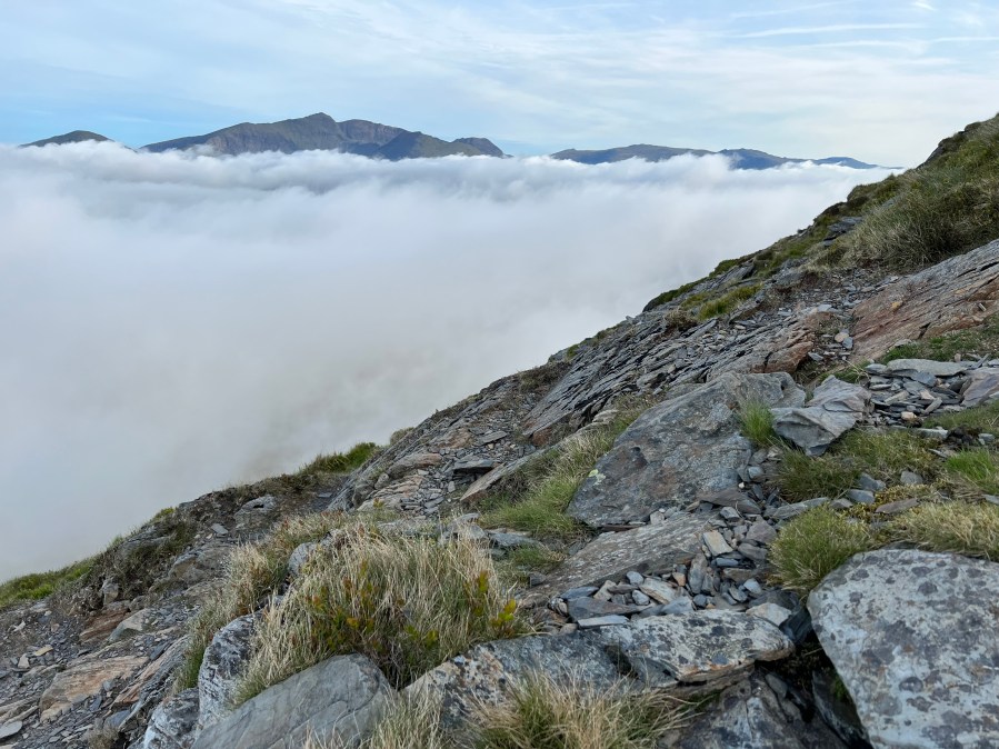
The descent of Cnicht offers uninterrupted views to Yr Wyddfa – as long as you’re above the clouds!
Credit: Francesca Donovan
It’s also an idea to map you route with the weather as it would be a shame to miss the vistas down to the sea. You can of course reverse this route if you’d prefer the short scramble on the ascent.
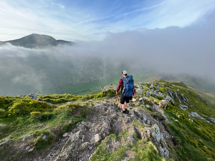
Further along the descent with Moelwyn Mawr poking out from behind the clouds.
Credit: Francesca Donovan
7. SH 628450: Rejoin the Snowdonia Slate Trail down a delightfully pretty woodland dappled path where you’ll likely meet other hillwalkers heading up.
Looking back to the Cnicht path.
Credit: Francesca Donovan
Here, rather than continuing along the trail that curves to the R, continue straight and head through the village of Croesor back to the car park.
Further information
Public transport: None to start
Tourist information: Beddgelert Information Centre (01766 890615) [email protected]
Nearest YHA: Snowdon Bryn Gwynant
Discover more walks in Eryri/Snowdonia as mapped by The Great Outdoors’ expert contributors.


