

Glencoe is packed with famous mountains, and the Pap of Glencoe (Sgòrr na Cìche), a pint-sized peak standing guard over its entrance, is one of the best, says Alex Roddie.
When I first started visiting the West Highlands, the Pap of Glencoe (Sgòrr na Cìche) was high on my list of mountains to climb, and for good reason: it’s genuinely iconic. And I’m not just saying that. Approaching Glencoe from the west, the Pap stands proud above the village, just begging to be climbed. The peak’s elevation is 742m (2,434ft) – not particularly high by Scottish standards, but it is isolated at the end of a long ridge and rises directly above a sea loch, lending its summit exceptional views.
The out-and-back climb is short but surprisingly sharp. Steep and eroded paths, and some boggy sections, are soon overcome, however. Although a degree of fitness is needed for this hike, it’s one of the easiest in Glencoe, and certainly offers some of the most impressive views for the effort required to climb it.
Hike Pap of Glencoe: route guide
START/FINISH: NN107588, car park on minor road between Glencoe Village and Clachaig Inn | MAPS: OS 1:25,000 Explorer sheet 384 (Glen Coe & Glen Etive), OS 1:50,000 Landranger sheet 41 (Ben Nevis), Harvey 1:40,000 British Mountain Map (Ben Nevis & Glen Coe) | DISTANCE: 6.9km / 4.3 miles | ASCENT: 685m / 2,247ft | DURATION: 3 to 4 hours
1. NN107588: Start at the car park about 500m along the minor road, past the bridge over the river. Don’t follow a forestry track uphill. Instead, take the Glencoe Orbital Path through woodland parallel with the road for about 400m until it joins the road again. A short distance later there are two gates and a track turning off to the left.
2. NN111586: Pass the first gate, go through the second, and follow the stony track steeply uphill for about 250m, gaining 50m in elevation. Soon another path splits off to the right.
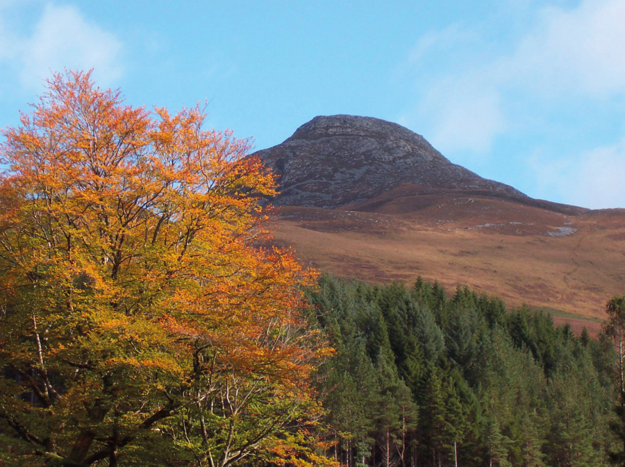
The Pap of Glencoe.
Credit: Alex Roddie
3. NN113587: Don’t continue straight uphill on the track you have been following; instead, take the right-hand turnoff. The path follows a gently rising traverse cutting across the hillside with views south into the glen (and some boggy bits).
4. NN116585: At the second of two easy stream crossings, the path abruptly turns to the left and begins climbing much more steeply uphill. In places the trail here is eroded and broad, and in wet conditions it can be muddy and boggy. There are a few increasingly rocky sections too. The path soon passes close to a gorge and then continues uphill in a broad zig-zag towards the bealach above, becoming less steep but more rocky. The terrain here is heathery and there are increasingly magnificent views looking down to the village – and, beyond it, Loch Leven and Loch Linnhe.
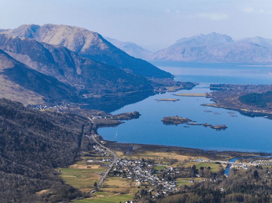
View to Glencoe village.
Credit: Alex Roddie
5. NN126591: The path does not go all the way to the small bealach beneath the Pap of Glencoe’s summit, but veers above it to the north after crossing a small stream. Careful navigation will be needed here in mist as there are several paths and not all are marked on the map. In particular, take care not to start climbing towards Sgorr nam Fiannaidh before reaching the bealach. The summit is a rounded dome rising above you with much rock breaking through the heather.
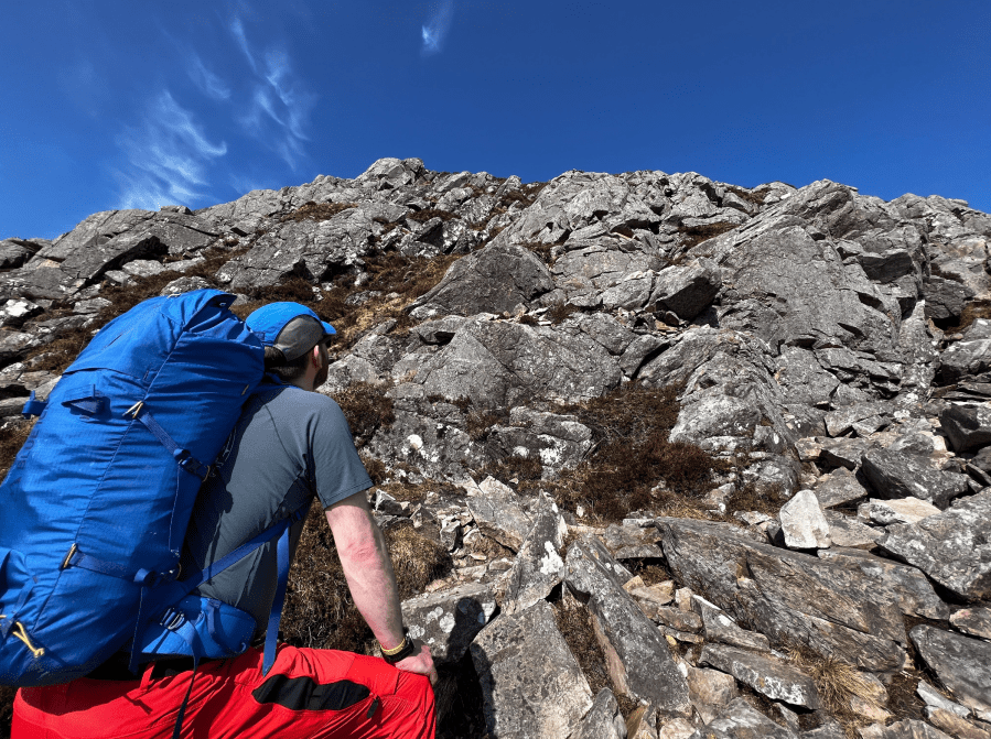
Davy on the summit scramble.
Credit: Alex Roddie
Although a direct climb is possible, straight up the southern flank, this firmly qualifies as scrambling terrain – some lines are easier than others, but all suffer from loose and often vegetated rock, and it’s easy to kick debris down by accident. Be mindful of other walkers on this popular hill! A more sensible route follows an obvious rocky path, contouring around to the northern side of the Pap’s summit – where there are sudden striking views down to Kinlochleven and the high peaks of the Mamores to the north – before making a final easy climb.

View from the summit of the Pap towards Kinlochleven.
Credit: Alex Roddie
6. NN125594: Reach the large summit cairn of the Pap of Glencoe. The cairn is set on a domed rocky plateau, giving it the ambience of a higher peak than you might expect. Views are exceptional in all directions, but particular scenic highlights include Ben Nevis away to the north, the lochs close at hand, and the peaks of the Ballachulish Horseshoe.
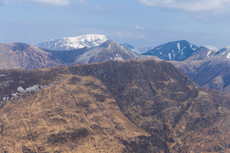
Looking north to Ben Nevis.
Credit: Alex Roddie
Unfortunately, the famous Aonach Eagach, of which the Pap of Glencoe is technically a northwesternmost extremity, is hidden behind the bulk of Sgorr nam Fiannaidh. After taking your time to enjoy this very special summit, return to the valley the way you came. In poor visibility, it’s recommended to take a compass bearing before beginning the descent due to steep slopes on several sides.
Further information
PUBLIC TRANSPORT: Scottish Citylink 915 coach to Glencoe village from Glasgow or Fort William; walk begins about 1km from bus stop
TOURIST INFORMATION: Visit Scotland or Fort William iCentre, 01397 701801
Discover more walks in Scotland as mapped by The Great Outdoors’ expert contributors.


