
Ian Battersby tackles a route to the mighty High Force waterfall – and its little brother – in search of unburied family jewels.
The River Tees cuts a sweeping path down a dale that has been shaped by glacial carving and meltwater scouring. The erosive conclusion has uncovered riches laid down many millions of years before the glacier was even a twinkle in the Pole’s eye. It was then that the planet’s crust yielded to pressure, leaking golden molten rock into subsequent underground voids.
There it cooled into the solid Whin Sill fault line until the glacier stripped away feeble capping layers only being halted by this durable dolerite, which now shapes the most prized diamonds of the vale. The river would be another steady stream of rippling precious stones but for this resolute band of confrontation. Instead, it is interrupted by violent torrents bellowing over Low Force – and if you think that’s good wait until you meet big brother High Force. Then you really should visit the dramatic Holwick Scar.
High Force & Crossthwaite Common: route description
Start/Finish: Bridge over the River Tees at Middleton-in-Teesdale (GR: NY947253) | Maps: OS Landranger 92 (1:50k) | Distance: 21.3 km / 13.3 miles | Ascent: 565m / 1853ft | Duration: 6 hours
1. NY947253: Cross the bridge over the River Tees, heading south-west past the auction mart to a gate on the right signposted Pennine Way. Through the gate the path takes a more direct line west-north-west than the wide, coiling river, which comes and goes.
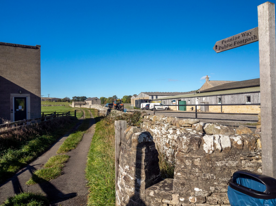
Pennine Way by the auction mart at Middleton-in-Teesdale.
Credit: Ian Battersby
Cross four fields with the wall on the right to a red painted sign indicating a wall stile. Over the stile continue with the wall on the left, high above the river, then thread between containing walls west-north-west past Knott Ford Hill into a narrowing field with a wall gap on the left. Cut west through two fields to Park Wood End. Now the Pennine Way travels upstream, shadowing the river closely to High Force. On the way the river evolves from rippling over glistening stones and round oval boulders to a distant rumble on approaching ever grander cascades.
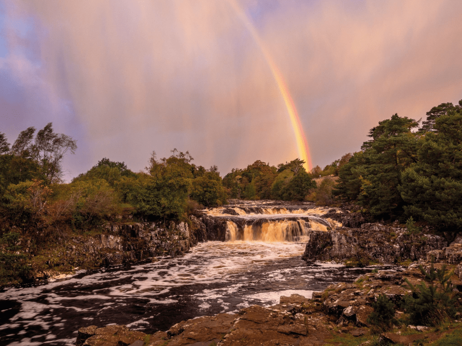
Rainbow at Low Force on the River Tees.
Credit: Ian Battersby
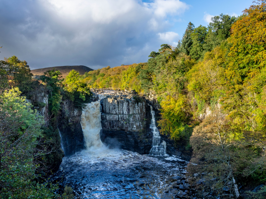
Low Force roars over a rocky shelf, and can be viewed from both banks using a superb suspension footbridge. Further on pass a second footbridge then climb suddenly on paved path to enter enthralling juniper and birch woodland. Look for a viewpoint on the right around 200m from High Force, then continue to the top of the falls, which seethe over the resilient Whin Sill fault line.
2. NY880284: Retrace steps back through the juniper to where the path drops to the aforementioned footbridge.
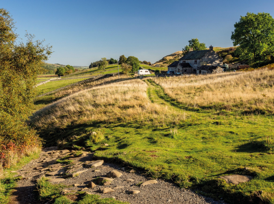
Holwick Head House.
Credit: Ian Battersby
3. NY888283: Continue contouring along a track heading east-south-east, passing left of Holwick Head House through a gate onto a stony track. The wide panorama of Teesdale is cut by walls, and the distant river runs below woodland crowding the far bank. Continue east-south-east past Hield House and the pine trees of Holwick Lodge, onto tarmac lane that turns south, climbing to Holwick Scar, built from more durable dolerite.
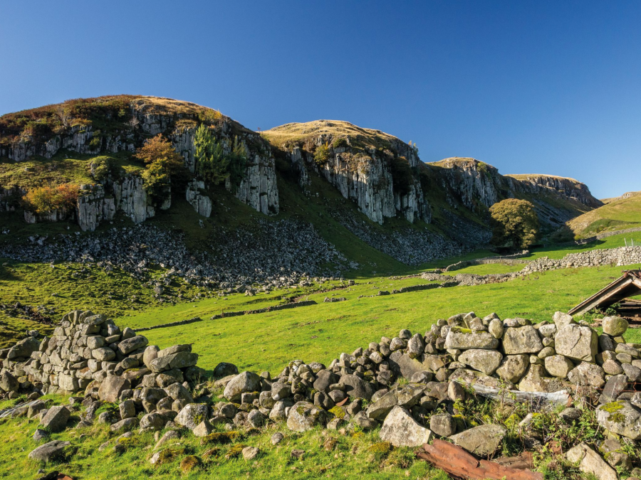
Holwick Scar.
Credit: Ian Battersby
4. NY904270: Turn right at the T-junction, heading west along a stony track, through a gate and past a house, climbing to the top of a grassy incline. A grassy path by a fallen wooden post drops steeply left crossing Scar Beck, then inclines west to a ghyll. Climb south, crossing a small stream to a gate in a fence. Continue along the path generally south between two wall fragments, through a gate on the skyline and crossing Eel Beck to Rowton Beck. Stepping stones hide to the right of the path, then climb to a gate. A dwindling path follows the wall south-west across grassy moorland, climbs to 470m, then veers south-east, contouring along a grassy terrace at Crooks o’ Green Fell to a gate. Now better quad bike tracks curve south then turn south-east to a gate. Turn right along a stony track then left, dropping to a black hut in Rake Gill. Climb out of the ghyll, heading south-south-east along a grassy track that drops to Merry Gill, turning south-east through two gates to a stony track that goes east to meet the Pennine Way at a gate at Wythes Hill.
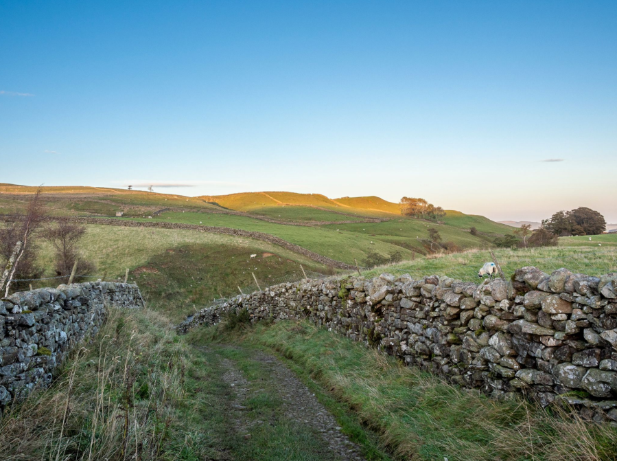
Pennine Way at Wythes Hill.
Credit: Ian Battersby
5. NY922229: Drop left over the beck, then climb north-east diagonally across two fields to a T-junction of stony tracks. Contour east through four gates. At Pin Gate the Pennine Way contours north-east, passing a ramshackle barn after which a good grassy track begins a long descent north-east through grassland and swathes of bracken in the lower reaches, joining forces with another path and bridleway to reach a gate by a house. Turn right and immediately left, dropping along the B6277 to return to the bridge.
Further information
Public transport: Bus X76 Max from Darlington to Barnard Castle then bus 96 to Middleton-in-Teesdale
Tourist information: Bowlees Visitor Centre (01833 622145)
Discover more walks in North England as mapped by The Great Outdoors’ expert contributors.


