
Vivienne Crow turns her back on the icons of the Lake District and enjoys the relative solitude on some less-frequented fells on the Whinlatter tops.
Don’t let anyone tell you it’s impossible to find a bit of peace and quiet in the Lake District. Okay, so you’re unlikely to have the summits of Scafell Pike or Helvellyn to yourself very often, but Graystones? Or Broom Fell? Both of these Whinlatter tops lie to the north of the Forest Park and, when combined with Lord’s Seat and Barf, provide a few hours of good ridge walking.
Far-reaching views across the Solway Firth dominate much of the first part of the walk, while the Skiddaw massif will have you hooked later on, particularly from Lord’s Seat which, at 552m, is the highest point on the hike. The return route takes to forest tracks and trails. You’ll probably encounter a few more people now, including the two-wheeled variety, but we stick largely to the higher, quieter paths – far from the visitor centre – where your companions are more likely to be birds.
Hike the Whinlatter tops: route guide
START/FINISH: Spout Force car park; GR NY181255. This is 2.9km west of the main Whinlatter car park, up a track to the right of the B5292 | MAPS: OS Explorer OL4 (1:25k), OS Landranger 89 (1:50k), Harvey 1:25,000 Superwalker Lake District North | DISTANCE: 11.8km / 7.3 miles | ASCENT: 665m / 2,180ft | DURATION: 4 hours
1. NY181255: Walk back down the track and turn right along the B5292. After the road crosses Scawgill Bridge, go through the gate on the right.
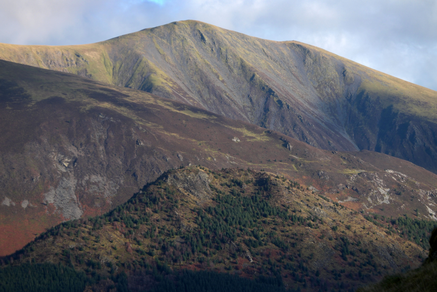
2. NY177258: Ignoring the path signposted to Spout Force straight ahead, follow the track left and, almost immediately, bear right along a faint trail. In just a few metres, this climbs loose ground and swings right. Don’t be tempted by trails heading left. Near the edge of the felled forest, the path swings left to climb beside a wall on your right. It’s a fairly steep ascent; steep enough to justify stopping every now and then to take a peek at the scene behind you – the most prominent summits belong to Grisedale Pike and Ladysike Pike.
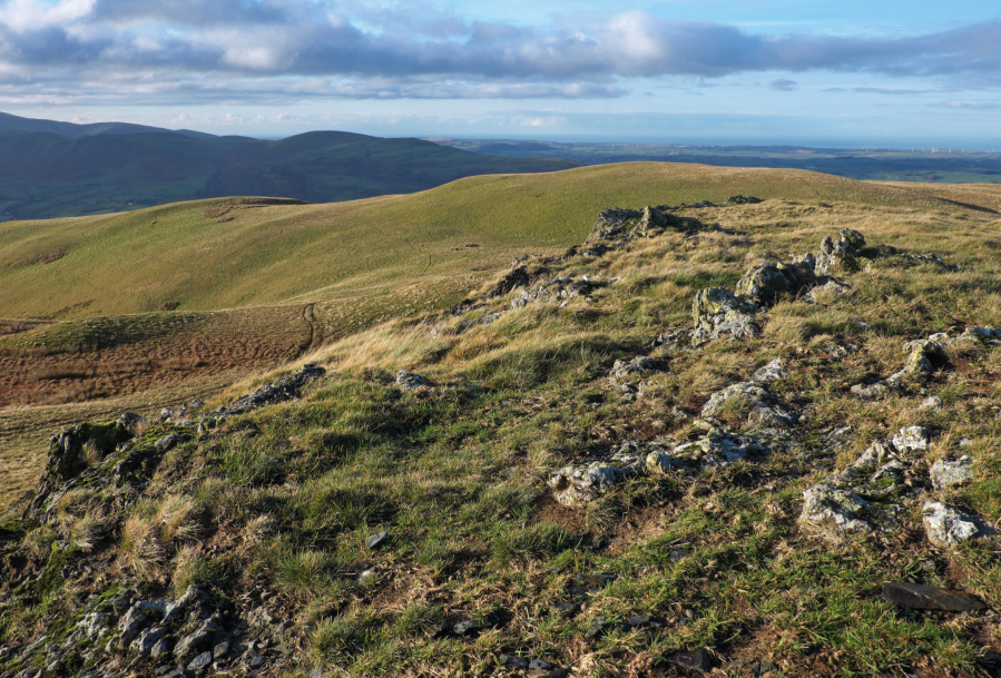
The view west from Graystones.
Credit: Vivienne Crow
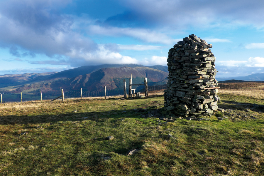
Nearing the top of the steepest part of the climb, a rock outcrop is reached. Pass to the left of it and continue straight up the fellside. The gradient soon eases and the views north begin to open out. Graystone’s true summit, marked by a small cairn, is a few metres to the east of the wall now. The main route, though, continues up the western side of the wall to a cairn-topped outcrop providing a far-reaching outlook to the north, including Criffel on the Scottish side of the Solway Firth.
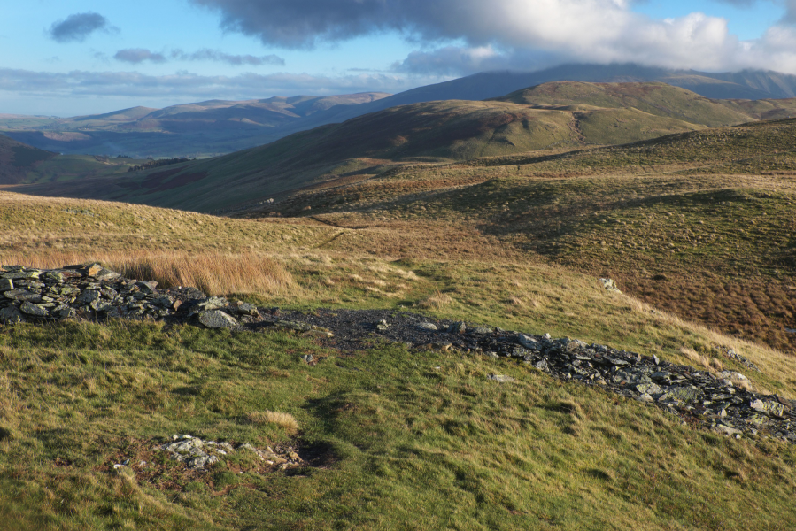
The trail heads NE across the remains of the wall.
Credit: Vivienne Crow
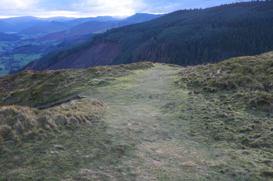
3. NY176266: From this cairn, take the trail crossing the remains of the wall (north-east) and bear left when it forks. You’re soon following a fence down to a meeting of walls and fences.
On Broom Fell.
Credit: Vivienne Crow
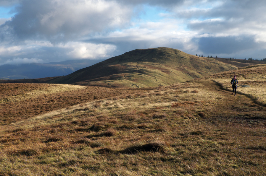
4. NY179268: Cross the stile here and then negotiate a dilapidated fence and wall to follow the clear, grassy path east beside the forestry’s northern edge. The security of this boundary is lost at a dip in the ridge. Head steeply up the slope straight in front of you. Keep left at a faint fork, along the most foot-worn route. Crossing boggy ground along the way, the trail winds its way to the tall cairn and shelter on top of Broom Fell, from where there is an uninterrupted view of Skiddaw.
The stile and cairn on Broom Fell.
Credit: Vivienne Crow
5. NY194272: Cross the stile in the fence and follow the path making directly for Lord’s Seat (south-east), always keeping to the clearest route. From the summit, take either of the paths down the fell’s eastern side. These unite to cross a peaty area between Lord’s Seat and Barf before forming a single, clearer trail. (Where they reunite, resist the trail on the right.)
Dropping from Barf.
Credit: Vivienne Crow
6. NY215267: From the cairn on Barf, descend right. Ignoring two trails to the left, follow the clearest path along the fell’s southern edge. After crossing Beckstones Gill, enter Whinlatter Forest Park via a stile. At a path junction in a few more metres, turn right and then, in another 110m, take the broad, grassy path on the left. (At the time of writing, fallen trees obscured this junction, but they were easily crossed.)
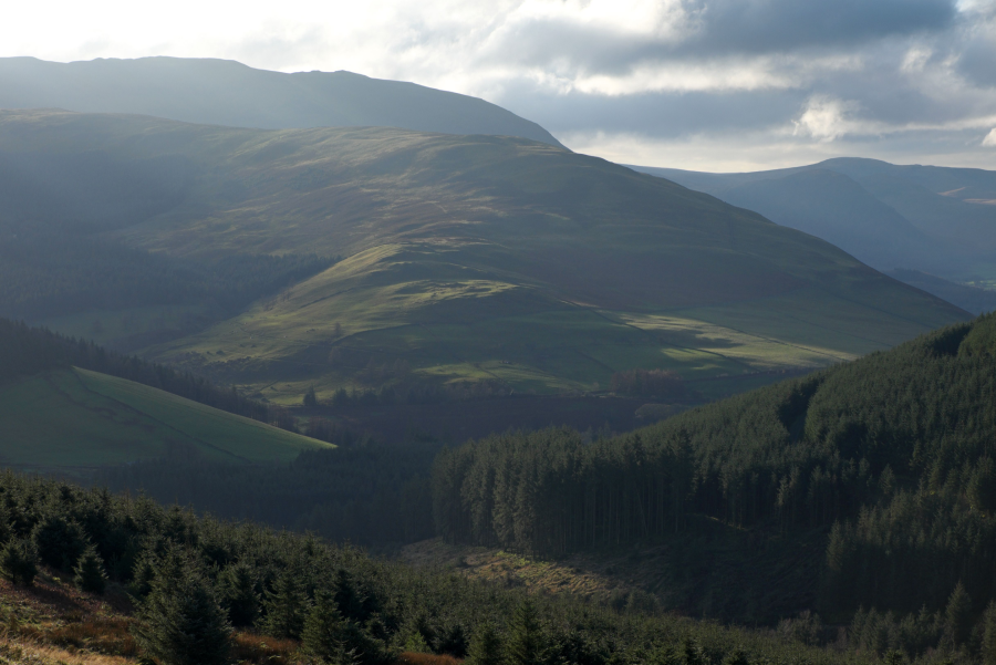
Looking across the forested slopes to Swinside.
Credit: Vivienne Crow
7. NY213261: Eventually, you’ll come up on to a surfaced path – at the forest park’s junction post number 7. Turn right here. Where the Altura bike trail heads left, keep straight ahead on a narrowing path and then go right at the next path junction.
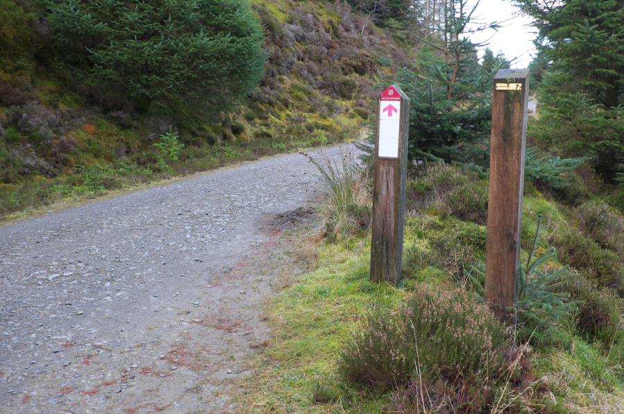
The surfaced forest path at junction post number 7.
Credit: Vivienne Crow
8. NY207263: In 80m, turn left along an unmarked peaty trail. Beyond a horribly boggy area near the trees, the path becomes more solid underfoot.
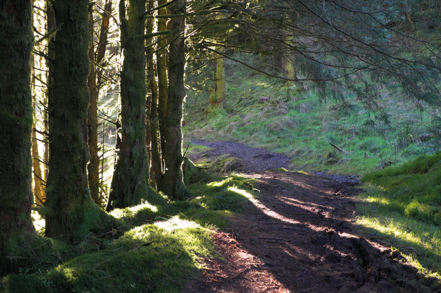
On a quiet trail through the forest.
Credit: Vivienne Crow
9. NY205259: Turn right after dropping onto a broad forest track. Go straight over at a crossing of tracks (junction post number 27). The track later passes just below the farmhouse at Darling How and then returns, about 300m later, to the parking area where the walk started.
Further information
PUBLIC TRANSPORT: Summer-only bus 77/77A
TOURIST INFORMATION: Visit Lake District, 0845 9010845
NEAREST YHA: YHA Buttermere
Discover more walks in the Lake District as mapped by The Great Outdoors’ expert contributors.


