
One of the most accessible mountains in the Northern Cairngorms, Meall a’ Bhuachaille, makes a fine short autumn hillwalk, says Alex Roddie.
The Cairngorms form a vast landscape of rolling plateaus, remote corries, rugged crags, and deep glens. It’s also a subtle place, and many find that only after repeated visits do they start to get a real feel for it.
While many of these mountains are big days out and require a good degree of fitness and experience, Meall a’ Bhuachaille, a Corbett rising north of Glenmore, is an exception. Although there is some steep walking on the way up, this is a relatively short hike by Cairngorms standards and far more accessible than, say, Braeriach. With parking and accommodation options at Glenmore, this hill is feasible in half a day – and the walk is truly varied, with beautiful forest views, a stunning lochan, and even a bothy.
Meall a’ Bhuachaille’s position as an outlier from the main Cairngorms gives it an uninterrupted panorama of the Northern Corries from the top. It’s a popular hill for ski touring in the winter, although it’s perhaps at its best in autumn, when the forest colours come to life.
Meall a’ Bhuachaille: route description
START/FINISH: NH978097, car park at Glenmore Visitor Centre. Further parking available just along the road | MAPS: OS 1:25,000 Explorer sheet OL57 (Cairn Gorm & Aviemore), OS 1:50,000 Landranger sheet 36 (Grantown & Aviemore), Harvey 1:40,000 British Mountain Map (Cairngorms & Lochnagar) | DISTANCE: 8.9km / 5.5 miles | ASCENT: 505m / 1,657ft | DURATION: 3 to 4 hours
1. NH978097: Begin at Glenmore – at one of the car parks, at the campsite, or the Cairngorm Lodge Youth Hostel, all clustered close together in the woods by the lakeshore. Walk SE along the road for a short distance to a left turn, signposted to Glenmore Lodge and the Cairngorm Reindeer Centre. Take this minor road, ignoring an immediate left turn.
Approaching Ryvoan Pass. Credit: Alex Roddie
2. NH986094: After following the road 1km through pine woodland, pass the Glenmore Lodge mountain centre on your right to arrive at a small parking area. Here the tarmac road ends and a good track, mostly flat and largely dry, continues in the same direction through the forest. In about 0.5km it crosses a footbridge over the Allt na Feithe Duibhe and continues on the other side, undulating gently. Good views are soon revealed across the open glen bottom to the wooded slopes of Creag Loisgte. Ahead is Ryvoan Pass – an old drove route that was once part of the Thieves’ Road, used by cattle raiders in the 17th and 18th centuries. Here the woodland becomes much more open and sporadic.
The green waters of An Lochan Uaine. Credit: Alex Roddie
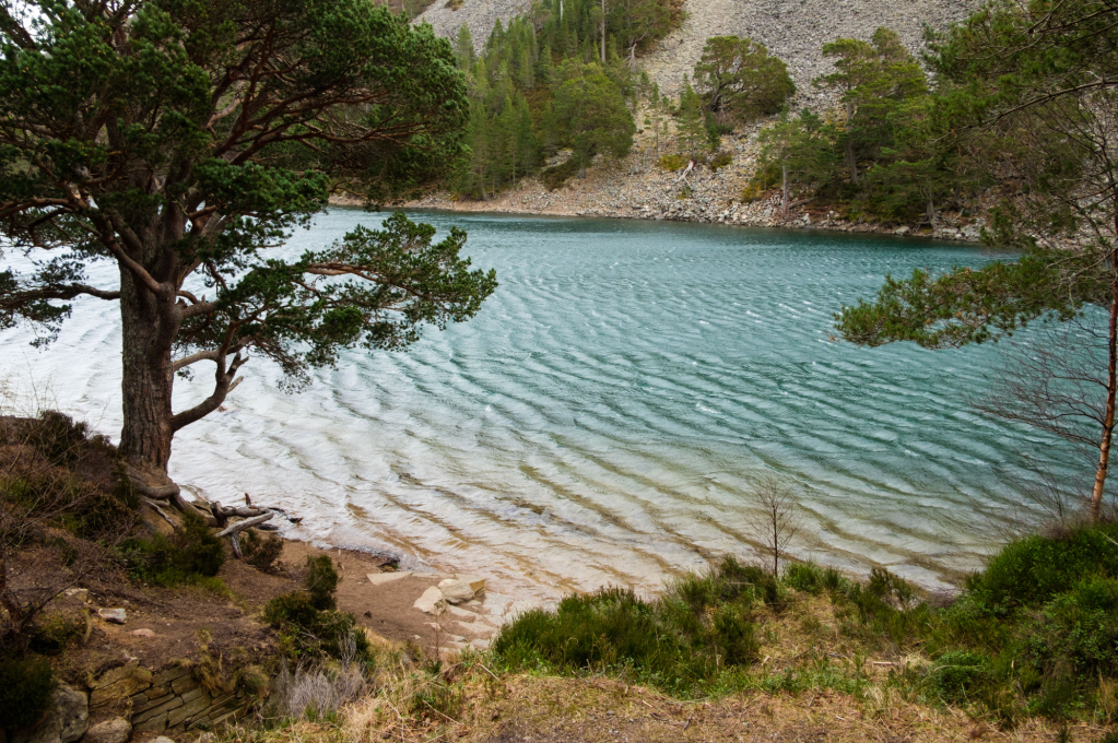
3. NJ000106: 1.4km after the footbridge, in largely open ground with patchy tree cover, pass An Lochan Uaine – the Green Lochan. This delightful small lake, surrounded by pine woodland and bordered on the far side by scree slopes, is a few metres lower than the level of the footpath, but steps lead down to a narrow gravel beach. It’s a peaceful spot, although has become more popular in recent years, so might be busy. Local legends assert that the green colour of the waters is caused by the sidhe, or fairies, who wash their green clothes at the site. After admiring the lochan, return to the path and continue gradually climbing to Ryvoan Pass, ignoring a right-hand junction after 0.6km.
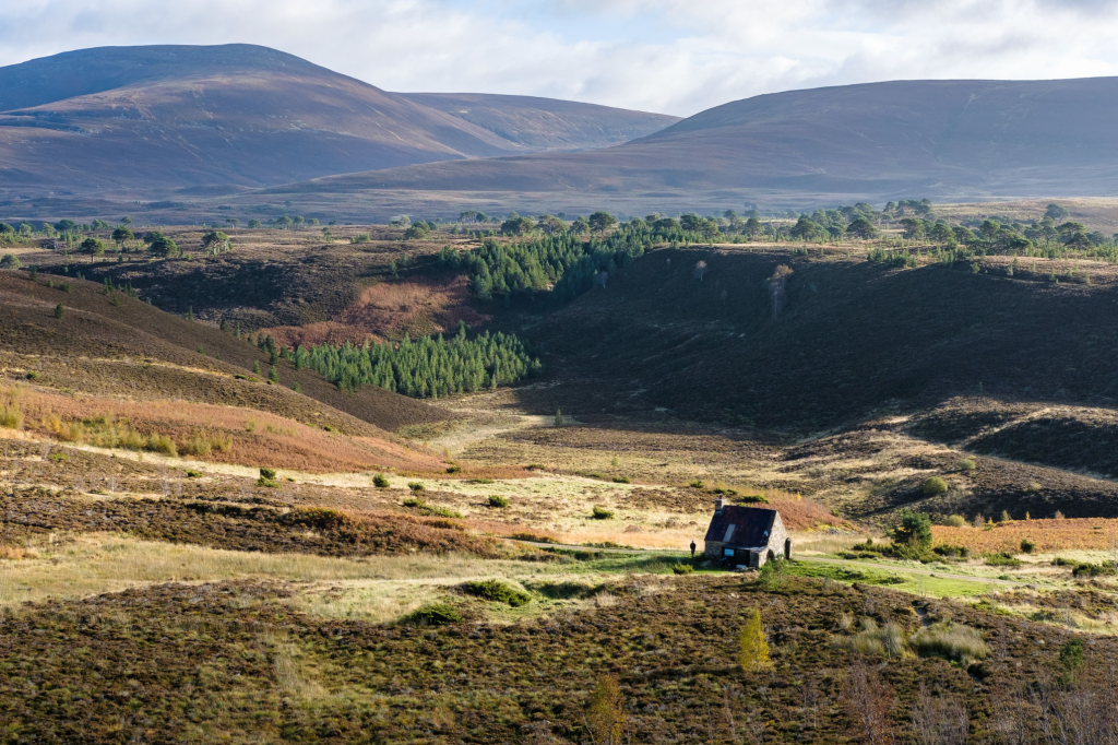
A wider view of the bothy from the route up to the summit. Credit: Alex Roddie
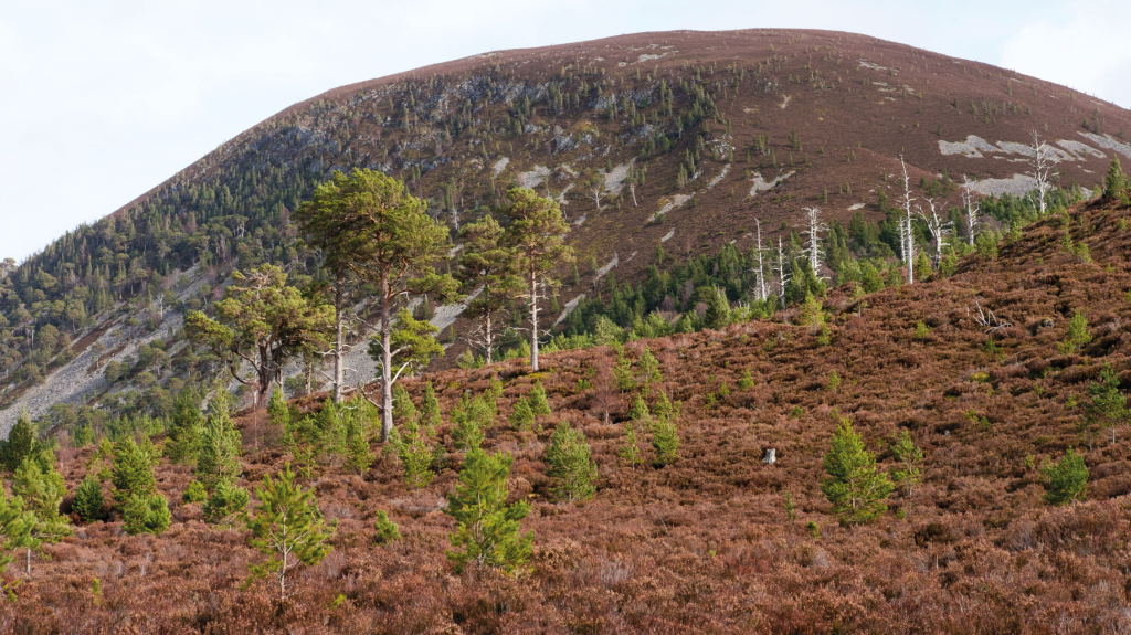
4. NJ006115: Another 0.6km beyond the path junction, after a few short rises, reach Ryvoan bothy. This former farm, abandoned in 1877, was restored by the Creag Dubh Climbing Club in the 1960s as a mountain shelter – and the Mountain Bothies Association took it over in 1972. Today it’s one of Scotland’s more popular bothies, with room for four on the sleeping platform and several more on the floor. Above and to the west rise the heathery slopes of Meall a’ Bhuachaille, with young tree growth beginning to sprout in lower areas. The path to the summit breaks away from the main track just outside the bothy and heads almost due W at first before veering SW. Climb the obvious path, with many zigzags, for 1.9km; the ascent from bothy to summit is 400m.
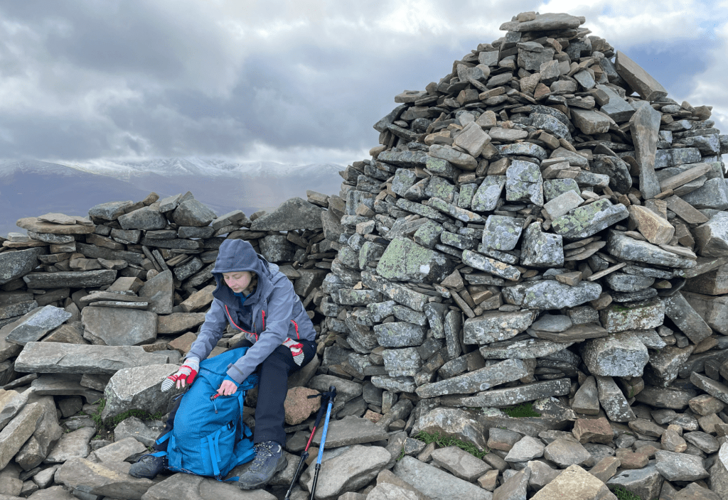
Pausing at the substantial cairn and shelter. Credit: Alex Roddie
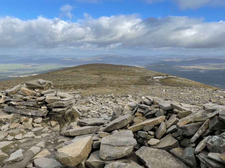
5. NH991115: The gradient eases just before the summit, revealing the large cairn and wind shelter at the highest point (810m). This makes an excellent viewpoint. Due south, the Northern Corries of Cairn Gorm can be seen prominently – this is perhaps the best place from which to view them. There are also excellent views back down to An Lochan Uaine and into Rothiemurchus. From the summit, continue on a clear path west down towards a bealach.
The descent of Coire Chondlaich. Credit: Alex Roddie
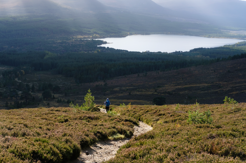
6. NH985116: Descending for 0.6km (145m vertical) from the summit leads to a path junction just before the bealach itself. Take the left fork and descend into Coire Chondlaich, at first directly towards distant Loch Morlich before veering left. At the time of writing there are some cleared areas of forestry before reaching dense woodland. A very clear marked track continues descending alongside a burn back towards Glenmore.
Further information
PUBLIC TRANSPORT: Regular buses (service 30) connect Aviemore town centre with Glenmore Visitor Centre
TOURIST INFORMATION: visitscotland.com, or Aviemore iCentre, 01479 810930
Discover more walks in Scotland as mapped by our expert contributors.


