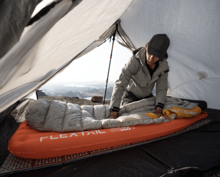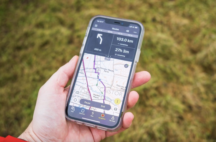
Hiking apps, for many of us, are here to stay in the hills. Most smartphones are reliable, waterproof, and with a few simple tricks (such as activating Airplane Mode and carrying a backup power pack) battery life is more than good enough. Here, we take a look at the best hiking apps to help you find your way in the mountains – and those designed to elevate your experience, from weather-forecasting to photo-taking.
Digital mapping and navigation hiking apps occupy various positions along a spectrum of use. Many people prefer to navigate with map and compass and only want a hiking app as a last-resort backup. Some like the convenience of route planning on hiking apps but still prefer a paper map for hill use. Others go all-in with digital navigation and the traditional nav kit remains in the pack as the backup system.
For the sufficiently experienced, each of these approaches is valid and can be done safely, so the first question is to ask yourself what role you’d like a mapping app to play in your mountain adventures. There are several advantages to using a digital mapping tool. Planning routes is often significantly quicker and easier, and will automatically calculate distance, total ascent, and other data.

You can zoom in and out on the map, and carry maps for the entire world in your pocket. Locations of interest can be saved as waypoints. Some of the best hiking apps enable you to show a huge amount of data on the screen at once, such as multiple planned routes (often colour coded) and large sets of waypoints (such as all the Munros).
Google Maps will not cut it for hiking. At a minimum, the best hiking apps must offer detailed offline topographical mapping. Although several good options exist, for many years ViewRanger was commonly recommended as the best choice however that was discontinued in 2022.
Editor’s note: We do not recommend that you rely solely on a smartphone app for mountain navigation. Always carry a paper map and compass and learn how to use them.
Why you can trust The Great Outdoors
The Great Outdoors is here to help you make the most of your time outside. We have been helping people to explore from sea to summit, valley to mountain top for over 40 years. Our gear tests remain completely impartial. If you are wary of websites that only review brands that advertise with them, or sceptical of social media accounts always singing the praises of their latest freebie, you’ve come to the right place! Our reviews rank #1 for rigour, trustworthiness, and independence, and our gear testing team is the most experienced in Britain. With over 200 years’ experience between us, we are professional mountain leaders and instructors, wildlife photographers and rangers, outdoor authors, guidebook writers and trail addicts.
Best hiking apps for digital mapping and more
| Quick List |
|---|
| Best all-rounder: Outdooractive (available from Outdoor Active) |
| Best international mapping: Gaia GPS (available from Gaia GPS) |
| Best for simplicity: OS Maps (available from Ordnance Survey) |
| Best for safety: OS Locate (now integrated into OS Maps, available from Ordnance Survey) |
| Best for weather: Met Office Weather App (available from Met Office) |
| Best for photographers: Photo Pills App (available on the App Store) |
Best all-rounder
Outdooractive
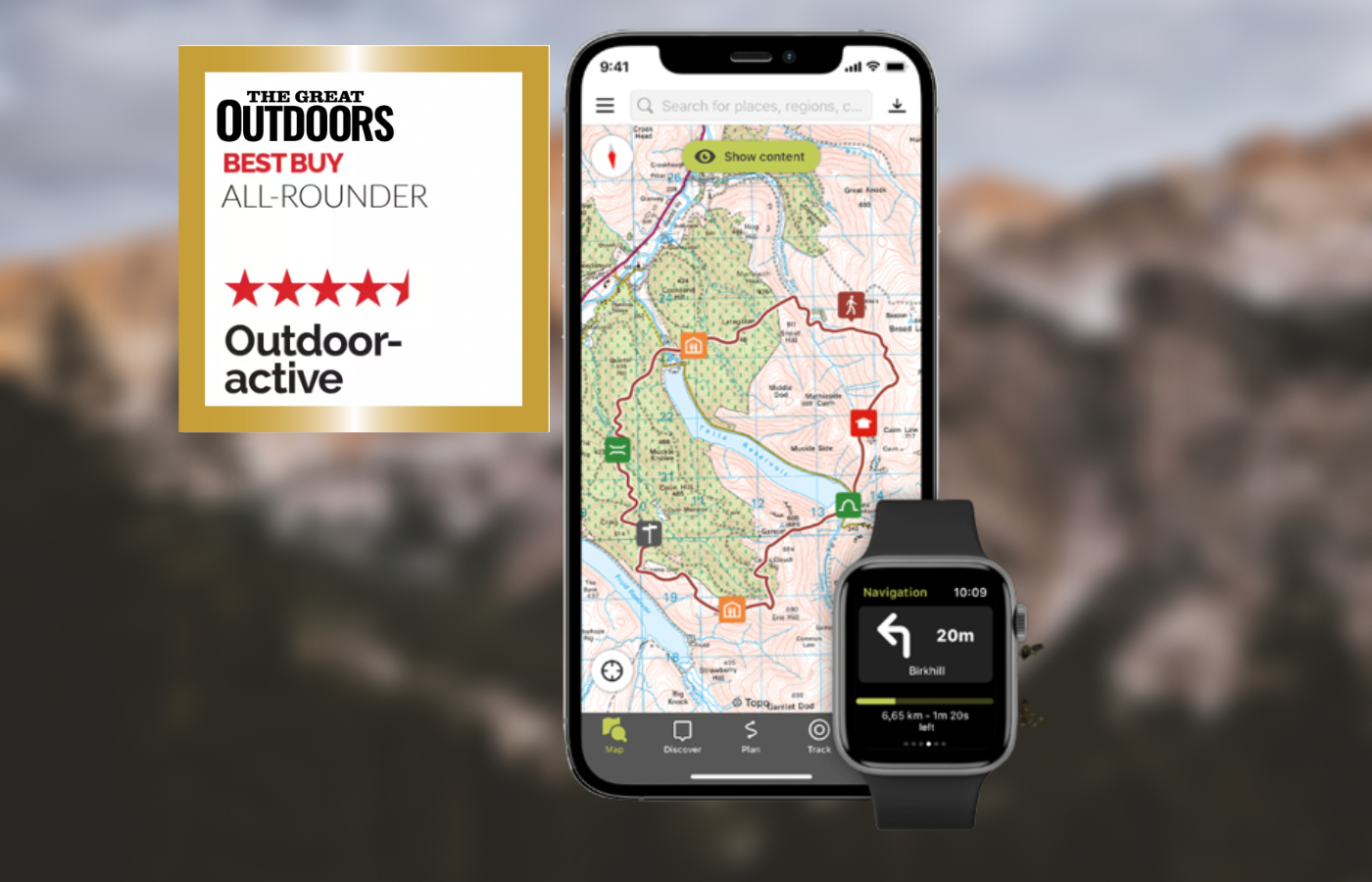
Alex Roddie’s Best in Test
Overall Outdooractive offers a comprehensive package that will do everything most users will ever need. The cost is also reasonable.- Great range of worldwide maps
- Easy and fast route planning
- Community routes
- Website planner
- Learning curve for ViewRanger
- OS Grid Ref not easy to use
- Minor bugs
| Quick specs |
|---|
| Cost: The contract period for Pro and Pro+ is 12 months each and can be terminated annually. The costs are $35.39 (Pro) and $70.79 (Pro+) per year / For UK users, basic use is free (no topo maps, ads); Pro is £2.23/month (OS & topo maps, no ads, offline); Pro+ is £4.45/month (Harvey & specialist Alpine maps, 3D planning) Platforms: iPhone, Android, web planner Maps: OS, Harvey, excellent range of international topo maps Features: route planning, OS grid ref, track recording, GPX import/export, community, augmented reality, 3D route preview Offline? paid version only. Two modes: either download map areas or download all maps for a planned route www.outdooractive.com |
At the time of writing most of ViewRanger’s features have now been added to the new app, although the interface is more complex and some features are more difficult to find. The main interface includes the map view, any planned routes or waypoints you’ve added to the special ‘My Map’ mode, and buttons for route discovery, planning, tracking, and ‘My page’ (your social profile on the app, including planned routes). To get a grid ref, you have to tap on a location, then tap through to ‘Details’ to get a list of coordinate formats (OS Grid listed near the bottom). This is much less convenient than ViewRanger’s approach.
Users signed up to the Pro or Pro+ membership are able to Outdooractive gain multiple benefits and discounts from brands such as Samsung, Helly Hansen, Garmin and more.
Read more: Outdooractive review
Topo GPS
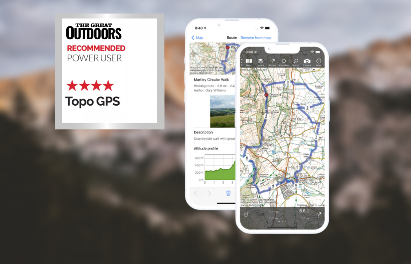
Alex Roddie recommends
The app has no social side or community features and there’s no website for planning. However, its simplicity, efficiency, stability and powerful features make it ideal for the advanced user.- Simple interface
- Reliability & speed
- Excellent planning tools
- Good range of international maps
- Colour coding great for complex GPX files
- No 1:50K OS mapping
- International map costs can get expensive
- No community features
- No website planner
| Quick specs | |
|---|---|
| Costs: Full access to the complete USTopo topographic maps of the United States costs $3.99 / UK basic use free (no topo maps); 1:25K OS maps available for £24.99/year subscription or £2.49 per 256km2 tile; other maps available with separate purchase Platforms: iPhone and Android Maps: 1:25K OS maps, OpenStreetMap (world), topo maps for many countries Features: route planning, OS grid ref, track recording, GPX import/export, geotagged photos Offline? yes, download areas of map to device www.topo-gps.com |
Topo GPS is a relatively simple app, yet is deceptively powerful. The interface is minimal and devotes maximum screen space to the map, including a central crosshair. At the bottom there’s a grid reference (this can be customised to OS Grid). In the UK, OS mapping is present, but you only get 1:250K overview or detailed 1:25K – no 1:50K at the time of writing. The subscription cost for OS mapping is reasonable although each map type worldwide has its own cost, which can make it expensive (for example, French IGN maps cost £17.99 a year).
Topo GPS was awarded “Walkers app of the year” in our TGO reader awards. They also recently celebrated 10 years of being on the app store.
Read more: Topo GPS review
Best international mapping
Gaia GPS
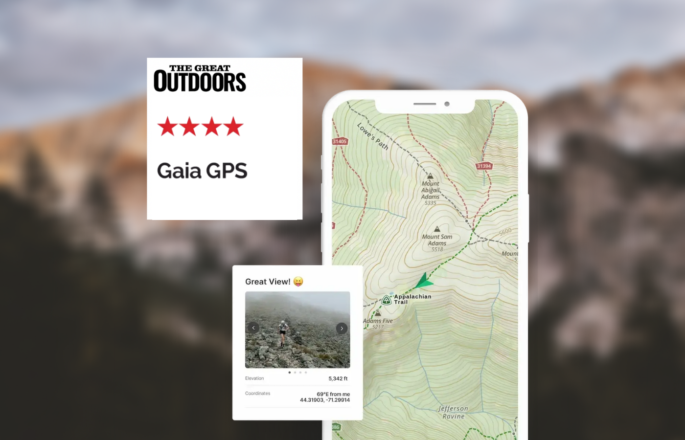
Alex Roddie’s verdict
If you mainly hike in the UK then Gaia GPS isn’t the app for you. However, it’s the best option for power users heading for trails abroad.- Great for international trekking
- Powerful route planner
- Advanced features
- No OS maps
- No OS grid ref
| Quick specs | |
|---|---|
| Costs: In the US, the iOS app is free but requires a yearly subscription while the Andriod app costs $19.99USD and does not require a subscription / in the UK, the app is free (basic use, no offline maps); £39.99/year (Premium, offline & worldwide topo map) Platforms: iPhone, Android, web planner Maps: Gaia Topo (worldwide), many international topo maps with Premium subscription Features: route planning, track recording, GPX import/export, community, geotagged photos, area calculator Offline? yes, download areas of map to device (large areas & multiple map types at once supported) www.gaiagps.com |
If you’re going trekking abroad and you need a lot of functionality, Gaia GPS is the app to look at. The standard Gaia Topo map is based on OpenStreetMap data but is quite clear, with contours, paths and hill shading (no cliffs marked). Although there’s no OS mapping, internationally Gaia GPS has most topo maps you could want, including USGS Topo (USA) and numerous European map sources. All can be downloaded for offline use (Premium only) and you can even overlay multiple map types with transparency (superb for border areas where two map types are needed).
Read more: Gaia GPS review
MapOut
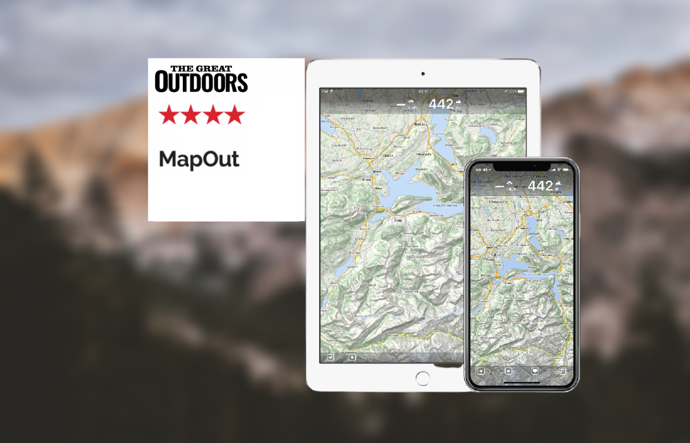
Alex Roddie’s verdict
Due to its simplicity and clear mapping, MapOut is excellent for getting an overall view of a complex route or group of routes.- Simple interface
- Fast & reliable
- Excellent route planner
- Great for organising libraries of routes
- No OS maps or OS grid ref
- No route sync
| Quick specs | |
|---|---|
| Costs: $4.99 USD / £4.49 one-off purchase Platforms: iPhone only Maps: worldwide basic topo map based on OpenStreetMap data Features: route planning, track recording, GPX import/export Offline? yes, download areas of map to device (large areas supported) mapout.app |
Due to its lack of support for OS mapping, MapOut won’t be your only app for UK use, but it can be useful as a sidekick app. The map is based on OpenStreetMap and covers the entire world. You get contours, footpaths, and basic topographical features, but it isn’t as detailed as a proper topo map and I wouldn’t recommend navigating off-path in the mountains with it. Where MapOut excels is its simple interface and efficiency, making it perfect for getting an overview on a complicated route or set of routes.
Read more: MapOut review
Memory-map for all
Alex Roddie Recommends
However, it is overly complicated for users with basic needs. The route-planning function also needs an overhaul, and it isn’t a great option for European topo maps.- Excellent map screening
- Flexible for power users
- High level of customisation
- Steep learning curve
- Route planning could be improved
- No Harvey maps
- Missing many European topo maps
| Quick specs | |
|---|---|
| Cost: Costs vary depending on mapping purchased in US / full OS mapping from £24.99/year Platforms: iOS, Android, Mac, Windows Maps: Europe Basemap and OS 1:250K Road Atlas (free); OS maps & small selection of international topo maps (paid) Features: route planning, track recording, GPX import/export, OS grid reference, viewing routes & waypoints on main map screen, extensive customisation Offline?: yes www.memory-map.com |
Memory-Map for All focuses on a map-viewing experience and managing your own library of routes. It lacks route recommendations and social features. The app features a large, uncluttered map view with buttons in the corners and edges, and a nested menu system. OS maps are available for purchase or subscription, with the cost reasonable for UK mapping. OS maps scroll and zoom quickly, with excellent clarity. The ‘List overlays’ menu allows users to control user data on the map screen.
Route planning is good, but snap-to-path is currently unusable. A better implementation is on the wishlist. GPX file import and export are easy and reliable, and route appearance can be controlled. For advanced users, the app offers powerful features but is overly complicated for basic needs and needs an overhaul. It is not a great option for European topo maps.
Read our full review on Memory-Map for all
Best for simplicity
OS Maps
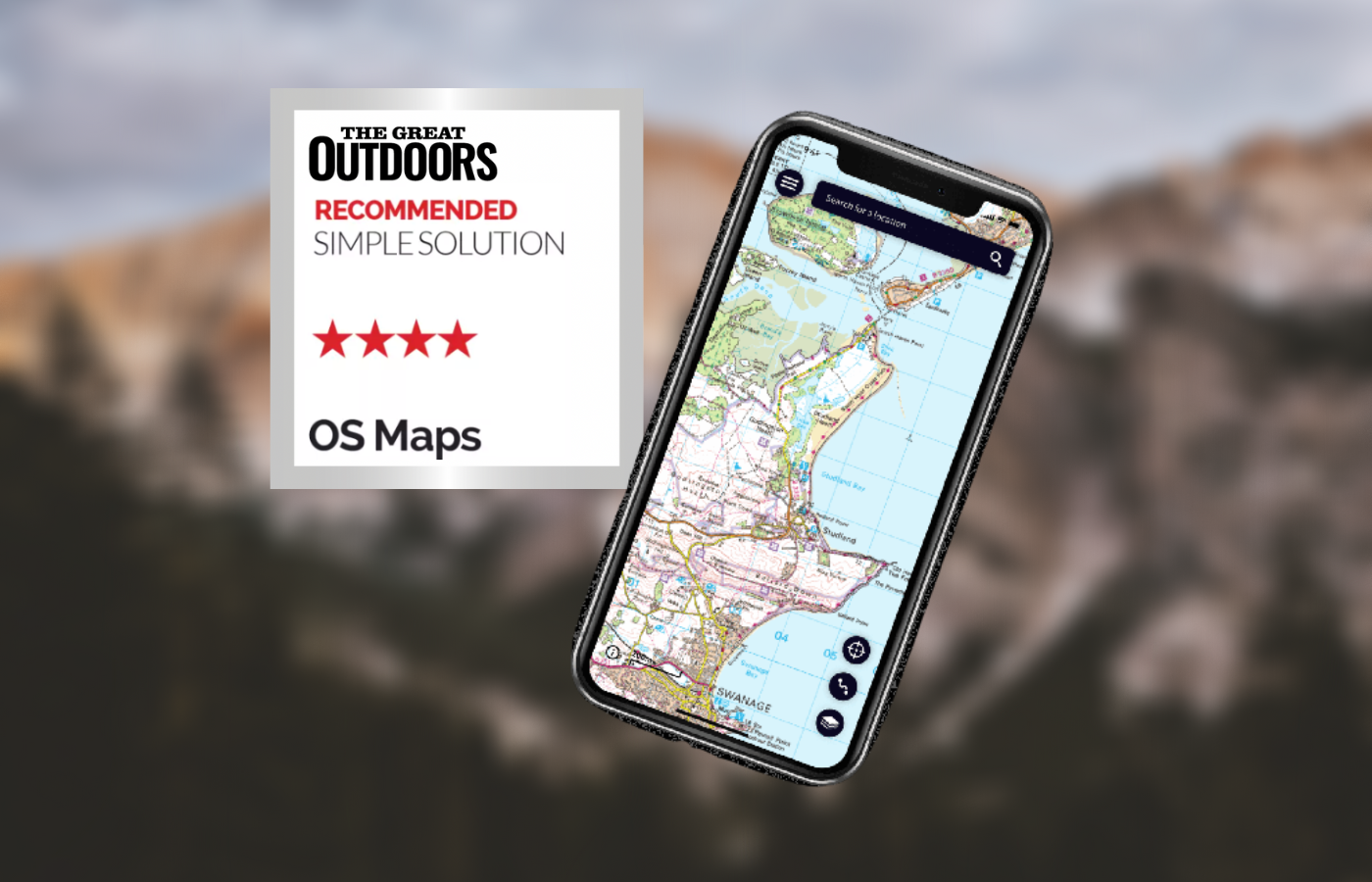
Alex Roddie Recommends
Despite a few absent features that power users may miss, OS Maps gets the basics right and may be all you ever want. It integrates well with paper maps and the price is reasonable.- Simple to use
- Excellent website planner with printable maps
- Good intergration with paper maps
- No waypoints
- Can’t show multiple routes on the map at once
- Snap to path only works in national parks
- Offline mode a little cumbersome
| Quick specs | |
|---|---|
| Costs: Not available i US / £29.99/year (OS Maps Premium) Platforms: iPhone, Android, web planner Maps: 1:25K & 1:50K OS, ‘standard’ (basic maps with contours & paths) Features: route planning, OS grid ref, track recording, GPX import/export, community, augmented reality Offline? yes, download areas of map to device, download maps for planned route, or download purchased paper maps www.ordnancesurvey.co.uk |
Editor’s note: The OS Locate App is now no longer available in App stores, although existing installations will continue to work. The OS Locate functions have been added to the OS Maps app. From the map screen, click the top menu (…) then select ‘Locate Me’.
OS Maps is the official smartphone app of the Ordnance Survey, offering basic mountain use features such as OS mapping, a clear interface, offline support, route creation, and OS grid references. It has improved recently and is stable and reliable in general use. However, planning routes is cumbersome, with snap to path only working within national parks. Planned routes are stored in a simple list with no support for folders, but searching works well. There is no support for waypoints.
The ‘Find Routes’ feature allows users to download public routes created by other users, but there is no way to show more than one route on the map at a time. Users can store offline maps, download map tiles, or redeem a code on a purchased paper map to download them. The web app for planning routes is excellent and integrates well with paper maps, making it a reasonable choice for those looking for a reliable hiking app.
Read more: OS Maps review
Komoot
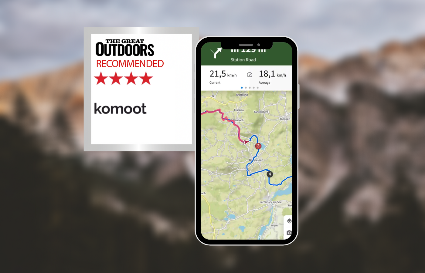
Alex Roddie’s verdict
While not ideal for complete control over route planning or off-path mountain use, Komoot is perfect for casual use and is the best app tested for sharing adventures with others.- Great for route discovery
- Social community
- No OS Maps or OS grid ref
- Limited manual control over route planning
| Quick specs |
|---|
| Costs: Prices start at $2.99 in US / in UK, free (basic use, no offline maps); €4.99/month (Premium, offline maps and other features) Platforms: iPhone, Android, web planner Maps: worldwide komoot map based on OpenStreetMap data with hiking and cycling layers Features: route planning, track recording, GPX import/export Offline? yes, download entire regions for offline use komoot.com |
Komoot is a unique app that combines social platform and route planner features for road cycling and mountain biking enthusiasts. The app’s default page is ‘Discover’, which displays a social feed and route highlights. Users can plan routes by selecting starting and finishing locations and a number of waypoints. The app intelligently plots routes based on the user’s sport and fitness level, making it suitable for lowland paths but lacking manual control for off-path mountain use.
The komoot map is based on OpenStreetMap data and features contours, paths, and hill shading. It also includes numerous ‘Hiking Highlights’ that can be included in routes. Offline use is effective and simple, downloading an entire county or region at once. The app can import and export GPX files, but requires an internet connection. When recording a tour, users can add their own highlights, geotagged locations with photos and descriptions.
While not ideal for complete control over route planning or off-path mountain use, Komoot is perfect for casual use and is the best app tested for sharing adventures with others.
Read more: komoot review
Best for safety
OS Locate
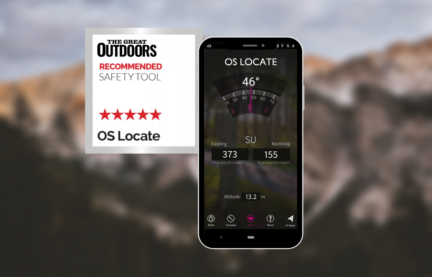
Alex Roddie’s verdict
For what it offers, the app is almost perfect and there is no reason why it should not be installed on your phone, even if you prefer to navigate with map and compass. It could save your life.- Instant access to OS grid reference
- Simple and reliable
- Nothing
| Quick specs | |
|---|---|
| Platforms: iPhone, Android Maps: none Features: OS grid ref, virtual compass, integration with OS Maps Offline? Yes www.ordnancesurvey.co.uk |
Editor’s note: The OS Locate App is now no longer available in App stores, although existing installations will continue to work. The OS Locate functions have been added to the OS Maps app. From the map screen, click the top menu (…) then select ‘Locate Me’.
OS Locate is a free app by the Ordnance Survey that provides position and elevation information. It is a simple and attractive interface with large, high-contrast digits within a compass rose. Users can select grid reference options, or display location as latitude and longitude. Both location and elevation are precise on their iPhone 12 device. The app also features a simulation of a baseplate compass, which can be used for bearings but may not be as accurate or reliable as a real compass. The app also has a button to direct users to the OS Maps app if installed. Overall, OS Locate is almost perfect for navigation and could potentially save lives in emergencies.
Read Alex Roddie’s full OS Locate review
UK Map App
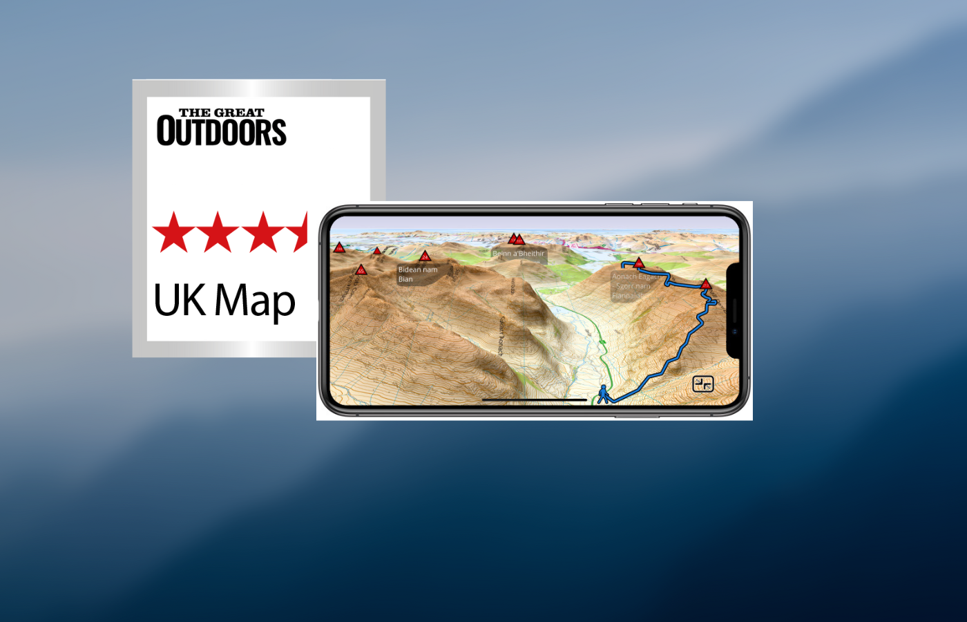
Alex Roddie’s verdict
If you can get past the somewhat confusing interface, don’t need maps for the entire UK, and prefer an old-school app with a focus on data and GPX files, this could be a good option for you.- Clear Map Screen
- Responsive
- Excellent handling on GPX files
- Affordable mapping with no subscription
- Confusing interface
- Cost can add up
- No snap to path
- No International maps
| Quick specs | |
|---|---|
| Platforms: not available in US / iOS Price: base maps are free and good enough for most uses; OS mapping from £1.99 per region Maps: free 1:25k and 1:10k UK maps based on OS VectorMap with footpaths superimposed from OpenStreetMap; paid OS maps at 1:50k and 1:25k scale Features: route planning, OS grid ref, track recording, GPS import/export, 3D route preview Offline?: yes, all functionality except downloading maps ukmapapp.com |
The main map screen is clear and uncluttered, with a few buttons around the edge. Zooming in and out is fluid, and contour shading for hills is on by default. The app allows for easy access to an OS grid ref and can search for locations offline. However, the interface feels confusing and cramped due to the custom interface. The downloadable free mapping is excellent quality, with contours, footpaths, and crags/rocks. Traditional OS 1:50k and 1:25k maps are available, but expensive for the entire UK. There is no subscription option. GPX file management is good, with the ability to import and export files offline, view elevation graphs and distances, and display multiple tracks and waypoints. Route planning is rudimentary, with no snap-to-path. While the app is an old-school navigation app with no social or online features, it may feel a bit too old-school for some users.
Read Alex Roddie’s full UK Map App review
Other outdoor apps
Best for photographers
Photo Pills App
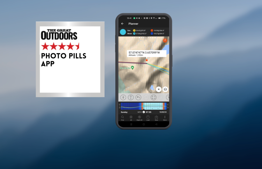
Chris Townsend’s verdict
Photo Pills does much more than this and is a very powerful and complex app. If you try it I recommend the online instructional videos as it’s not that easy to use.- sun, moon, milky way information
- No desktop app
- Basic maps, takes time to learn
- No desktop app
| Quick specs | |
|---|---|
| Costs: $12.99 USD / £9.49 Platforms: iOs, Android Maps: terrain, hybrid, satellite Features: planner; sun, moon, milky way positions, camera & lens settings calculators Offline: Yes www.photopills.com |
Photo Pills is an app that aids photographers in planning their photography locations by providing information on the sun, moon, and Milky Way, camera exposures, and depth of field. This information is particularly useful for wild camping, as it allows users to position their camp to receive the first rays of sunlight or avoid midsummer. The app also features calendars that display the rise and set times of the sun and moon for a week or more, along with daily details.
The maps are basic and designed for astronomical information, not navigation. Users can move a pin to a location to view the sun or moon’s rise and set times, which can be used to decide where to camp and to observe the sun or moon behind a feature like a summit or dip between high points. Plans can be downloaded for offline use.
Photo Pills is a powerful and complex app, but online instructional videos are recommended for ease of use. Overall, Photo Pills is a valuable tool for photographers and outdoor enthusiasts alike.
Read Chris Townsend’s full Photo Pills App Review
Best for weather
Met Office Weather App
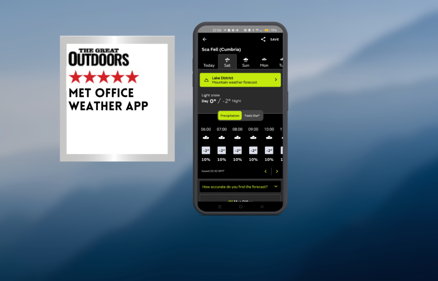
Chris Townsend’s verdict
Of course the forecast isn’t always correct, especially from hour to hour, but I’ve found it generally accurate. You need a phone signal too so it’s wise to check the forecast before heading out.- Daily and Hourly forecasts
- Mountain area forecasts
- Individual sumit forecasts
- Online only
| Quick specs | |
|---|---|
| Recommended for UK weather forecasts. Costs: Free Platforms: iOs, Android, website Maps: Weather map Features: Daily & hourly forecasts, mountain area forecasts, individual summit forecasts Offline: No www.metoffice.gov.uk |
Weather forecasts are crucial for hill walkers, especially in the Cairngorms. The Met Office app provides hourly local weather forecasts daily and three hourly forecasts for the next five days, including mountain summits. The app provides expected temperatures, wind chill, rain or snowfall, wind speeds, humidity, visibility, and pressure. It also offers general mountain forecasts for ten areas, including mountain weather hazards like gales and chill effects. The app also features an interactive rainfall radar map, pollen and pollution forecasts, a UV index, and real-time Severe Weather Warnings.
The Met Office app is quick and easy to move between locations and forecasts. Users can consult the app before any walk, especially in winter, to stay informed. They can save three locations for regular checking and add others. While the Met Office forecast is generally accurate, it requires a phone signal, so it’s important to check it before losing connection. Users should check the forecast both evening and morning before a walk.
Read Chris Townsend’s full Met Office weather app Review
Windy.com App
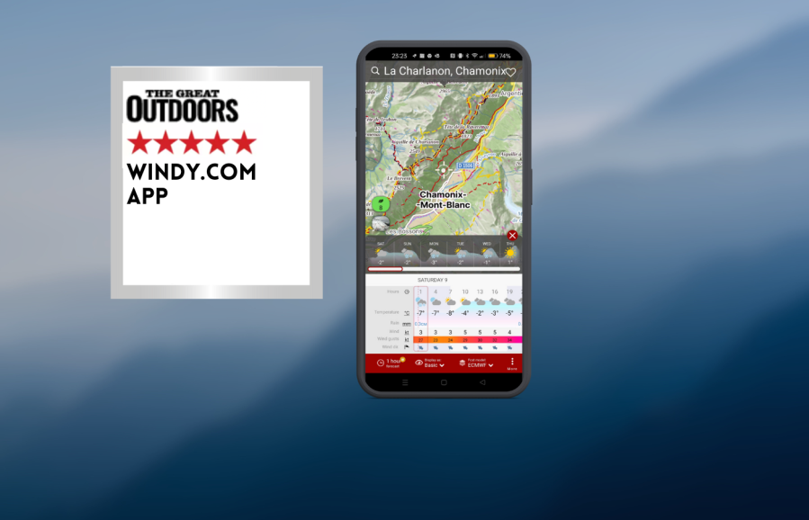
Chris Townsend’s verdict
Windy is a wonderful app for anyone interested in the weather worldwide. For walkers it’s a great way to find out what the weather is doing if you’re going overseas.- Comprehensive
- Online Only
| Quick specs | |
|---|---|
| Recommended for worldwide weather. Costs: Free for basic features, Premium €18.99 annual sub or €29.99 for one year Platforms: iOs, Android, desktop Maps: Worldwide Features: All weather data, layers Offline: No but this is in development www.windy.com |
Windy.com is a weather app that provides real-time forecasts and information on weather patterns in various locations. The app features colorful maps with moving streaks indicating speed and direction, as well as other weather data such as rain, thunder, temperature, and clouds. The free version offers a variety of data, while paid Premium plans offer 1-hour forecasts, 10-day forecast maps, and a route planner.
While UK forecasts are included, the Met Office app is easier to use and clearer. Windy.com can send alerts for specific places, which could be useful. The app is available online, but an offline option is in development. It is a valuable tool for anyone interested in global weather, especially for walkers planning trips overseas. While UK forecasts are included, Windy.com offers a more clearer and easier-to-use alternative.
Read Chris Townsend’s full Windy.com App Review
Blitzortung App
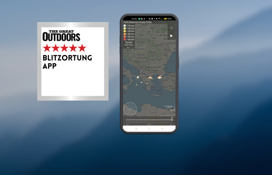
Chris Townsend’s verdict
I find this a fascinating app and love following the track of lightning strikes, preferably when I’m safe indoors. It is useful for making decisions when walking too.- Real time lightning map
- Free
- Online only
| Quick specs | |
|---|---|
| Recommended for lightning tracking. Costs: Free Platforms: iOs, Android, web Maps: Aerial, Open Street Map Features: Distance and time of lightning strikes anywhere in the world Offline: No www.blitzortung.org |
Lightning in the hills is a fearsome experience, and tracking the speed and direction of such storms is crucial. The Blitzortung app provides real-time updates on lightning strikes on a map, with details of the number and recent strikes. This app is useful for observing storms in cafes, waiting for them to pass, and deciding to head down by the nearest safe route. Sometimes, thunderheads build up without an app, even in overcast or misty conditions.
Blitzortung is international and offers a map of the world where lightning is present. Users can zoom in to their location and see how close any storm is. The time of strikes is color-coded for easy reading. The app is fascinating and useful for making decisions when walking, especially when safe indoors. Although it is not available offline, it is increasingly available in more places, especially on summits, where this information is most valuable. Overall, the app is a fascinating tool for monitoring lightning strikes and making informed decisions.
Read Chris Townsend’s full Blitzortung App Review
How we tested these hiking apps
Alex Roddie
Alex has been a hillwalker, mountaineer, and backpacker since 2003, cutting his teeth winter climbing while working as a barman in the famous Clachaig Inn in Glen Coe, before backpacking extensively throughout Britain and Europe. He’s the author of several books and an editor, writer, and photographer across outdoor media. He’s been part of the review team for The Great Outdoors since 2016, and is based in Scotland.
Chris Townsend
Our equipment editor Chris Townsend is known globally as a writer on hiking and backpacking skills and equipment, the author of 25 books – many of them award-winning – and as a record-setting long-distance hiker. He was the first person to complete a continuous round of all the Scottish Munros and Tops and the first person to complete a continuous walk the length of the Canadian Rockies. He has also walked the Scottish Watershed and walked coast-to-coast across Scotland 18 times.
Hiking app features to look out for
Maps
Look for detailed topo maps of the country you’ll be walking in.
Offline use
The app must let you download maps and planned routes for use offline. You should be able to plan routes when offline too.
Planning
The best hiking apps for route planning let you ‘snap to path’, automatically tracing the lines of paths on the map. This saves a lot of time!
Grid reference
Although not essential, a quick OS grid ref is very useful, especially if you also use paper maps.
Website
A companion website lets you plan routes on your computer and may even let you print maps to scale.
Recording
Most apps let you record your walk for future analysis (or save it as a route to follow again later).
Compass
A phone compass is rarely as accurate as a magnetic compass; use for general guidance only.
GPX import/export
Easily exchange routes with other apps thanks to the cross-platform GPX file format.
Community features
Some apps act like a social network, letting you share routes, see where others have been walking, and download new routes for instant use.
Cost
Most apps have a free trial, but to get the features you need you’ll usually have to pay. A monthly or yearly subscription is now the norm.
Find out more in our guide on how to use GPS for hiking navigation.