
Simple and powerful with an excellent route planner, the Topo GPS app performed well in Alex Roddie’s review of digital mapping and apps.
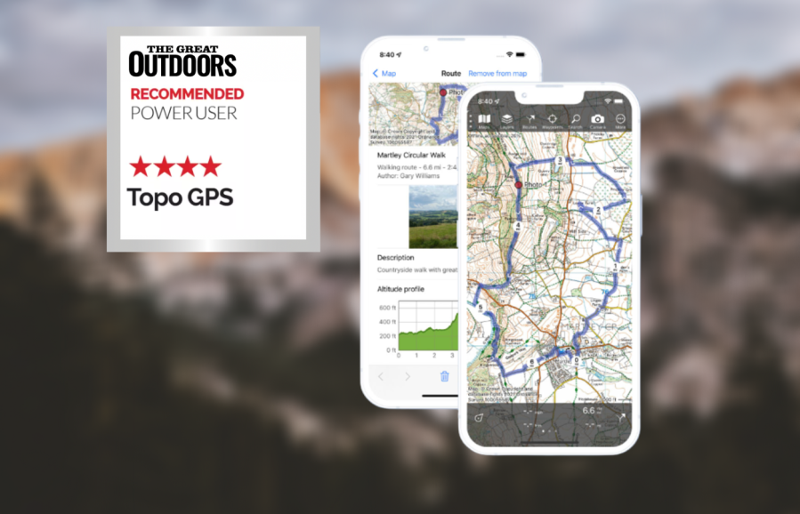
Topo GPS is a relatively simple hiking app, yet is deceptively powerful. The interface is minimal and devotes maximum screen space to the map, including a central crosshair. At the bottom there’s a grid reference (this can be customised to OS Grid). In the UK, OS mapping is present, but you only get 1:250K overview or detailed 1:25K – no 1:50K at the time of writing. The subscription cost for OS mapping is reasonable although each map type worldwide has its own cost, which can make it expensive (for example, French IGN maps cost £17.99 a year).
The app is fast and fluid. Once you’ve downloaded an area for offline use, all parts of the app work offline, including GPX import and export. It is also stable, even with hundreds of complex GPX files. This makes it ideal for the power user with advanced needs.
The route planner is excellent; not only does it offer snap to path worldwide, it also lets you colour code routes, organise them into folders, and show/hide them from the map page. You can configure route traces to show kilometre or mile markings. Waypoints can be configured with custom icons and also organised by folder and shown/hidden from the map.
The app has no social side or community features and there’s no website for planning. However, its simplicity, efficiency, stability and powerful features make it ideal for the advanced user.
topo-gps.com


