Main image: Hiking apps are now a part of our outdoor everyday | Credit: Jacob Lund / Shutterstock
There is an ever-growing number of hiking apps, and they vary hugely in their scope. While some only provide simple digital navigation, others allow precise route planning on detailed topographic maps, and a range of social and safety features. If you are mindful of battery life and ensure you have a fully charged power brick with you, smartphone navigation is now far safer and more reliable than it was only a few years ago. However, we still think it’s important to have a backup, in the form of paper map and compass, and the skills to use them.
Undoubtedly, hiking apps have helped make it easier than ever to find inspiration for routes, to plan and to share our experiences. Detailed, current information is more accessible than ever before. Consider what you really want or need. Many apps offer free versions with limited functionality, but you are likely to need to pay for a subscription for more advanced features.

Mountain weather forecasting has never been more accurate. However, weather in the mountains is often unpredictable, and forecasting models can struggle with chaotic systems. It’s tempting to look at forecasts on multiple apps and choose to believe the one showing you what you want to see. In some cases, less is more!
It’s also worth considering what kind of experience you’re aiming for while outside. The social features of some apps are now an integral part of the outdoor experience for many people, and can provide much needed motivation. For others however, hiking apps might just be a further extension of an already overwhelming digital presence in our everyday lives. No matter where you find yourself on that scale, it is worth being mindful about how much you use your phone outdoors, and to focus on where you are in the moment.
Editor’s note: Google Maps will not cut it for hiking. At a minimum, the best hiking apps must offer detailed offline topographical mapping. We do not recommend that you rely solely on a smartphone app for mountain navigation. Always carry a paper map and compass and learn how to use them.
Why you can trust The Great Outdoors
The Great Outdoors is here to help you make the most of your time outside. We have been helping people to explore from sea to summit, valley to mountain top for over 40 years. Our gear tests remain completely impartial. If you are wary of websites that only review brands that advertise with them, or sceptical of social media accounts always singing the praises of their latest freebie, you’ve come to the right place! Our reviews rank #1 for rigour, trustworthiness, and independence, and our gear testing team is the most experienced in Britain. With over 200 years’ experience between us, we are professional mountain leaders and instructors, wildlife photographers and rangers, outdoor authors, guidebook writers and trail addicts.
Best hiking apps for digital mapping and more
| Quick List |
|---|
| Best in test: Hiiker (available from Hiiker) |
| Best saftey features: OS Maps (available from Ordnance Survey) |
| Best value: MapOut (available from the App Store) |
| Best for Munro bagging: Walkhighlands (available from the App Store) |
| Best for offline maps: Topo GPS (available from the App Store) |
| Best all-rounder: Outdooractive (available from Outdoor Active) |
| Best international mapping: Gaia GPS (available from Gaia GPS) |
| Best for weather: Met Office Weather App (available from Met Office) |
| Best for photographers: Photo Pills App (available on the App Store) |
Best in Test
Hiiker
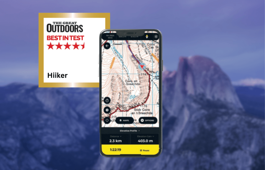
James Roddie’s Best in Test
Overall, this is now a well-rounded and powerful app for navigation and route-planning, with a wealth of detailed mapping and useful features.- Wide range of topographic maps
- Heavily customisable
- Excellent customer support
- Some map overlays (e.g weather) in need of improvement
| Quick specs |
|---|
| Cost: Free, or £20.99 for first year, £29.99 annually thereafter. £4.99 monthly (available from Hiiker) Platforms: iOS, Android, Web browser Maps: Topographic and hiking maps for Europe, USA and New Zealand. Aerial layer, 3D mapping, historical OS maps. OpenStreetMap. Features: Route-planning with trail stages, track recording, offline map/route downloads, off-route alerts, GPX import/export, curated route database. Sync with smartwatches. Offline? Yes. No snap-to-path while offline. hiiker.app |
There have been a number of significant updates to the Hiiker app since our last review in 2023, resulting in an excellent hiking app. Previously the rendering of the Ordnance Survey map layer was poor, but it is now as detailed as you will find anywhere. The route planning system has been overhauled, allowing more detailed planning with features such as route stages. This now makes it a powerful app for planning complex long-distance routes. The entire user interface feels modernised and smoother to use, and importing GPX files is now a simpler experience.
A stand-out feature is the sheer range of topographic and hiking maps available for much of Europe, and other regions including the USA and New Zealand. These include OS, Harveys, Swiss Topo, IGN, USGS and Kompass. Cartophiles will also love the addition of a historical OS map layer. It’s also heavily customisable. I like the ‘quick action’ function, allowing you to assign any action to a map button. Other useful features include 3D mapping, a live locator function and off-route alerts.
Read more: James’ full Hiiker app review
Best safety features
OS Maps
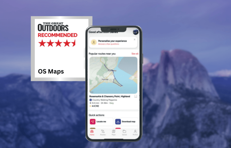
James Roddie recommends
With a subscription this is an excellent navigation app, which is justifiably popular with many walkers in the UK.- Offline downloads of 1:25,000 mapping for the entire UK
- ‘Locate Me’ safety function
- Intuitive use
- Free version is quite limited
| Quick specs |
|---|
| Cost: Free, or £34.99 annually, or £2.92 monthly (available from the App Store) Platforms: iPhone, Android, Web browser Maps: Ordnance Survey Standard Mapping, 1:50K and 1:25K layers. Aerial layer. Features: Route planning, track recording, offline locate feature, offline map downloads, GPX import/export, report hazard function. Offline? Yes, with paper map download code, or with Premium subscription. explore.osmaps.com |
A subscription to OS Maps gives you access to the entirety of the Ordnance Survey’s topographic leisure maps of the UK. For many people this will be justification enough for the £34.99 annual cost. A subscription allows access to a variety of other features, but perhaps the most crucial being the ability to download any map area for offline use at 1:25,000 scale. The free version of the app is far more limited in function. If you already own paper OS Maps, then you are able to download offline versions of these on the app for free using a code. Route plotting and activity tracking is intuitive and accurate. It is easy to import/export GPX files, as well as save routes for private, public or ‘link-only’ view.
Whilst the app has a wide variety of functions it feels largely self-explanatory and uncluttered. I really like the ‘Locate Me’ function, which gives you an accurate, full-screen compass and GPS readout without phone signal being needed. As of mid-2025, you can report hazards along routes for public view, and see those marked by others. The new ‘Retrace’ function for plotting is useful, allowing you to quickly plot your return journey along precisely the same route.
Read more: James’ full OS Maps app review
Best Scottish walking app
Walkhighlands
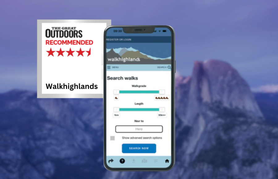
James Roddie recommends
You would be hard pressed to find a more comprehensive free source of inspiration for walking in Scotland.- no cost
- huge database of Scottish walks
- peak bagging maps
- active forum
- no route track recording
| Quick specs |
|---|
| Cost: Free (available from the App Store) Platforms: iPhone, Android, Web browser Maps: Up to 1:17500 scale – combination of OS and OpenStreetMap data. Features: GPX export, forum, public walk reports, peak bagging maps, offline route downloads. Offline? Downloadable offline route descriptions/maps. walkhighlands.co.uk |
The main focus of the Walkhighlands app is route inspiration. At the core of the app is a comprehensive database of walking routes throughout Scotland. This is growing by the year, and includes everything from short and easy lowland walks, to serious multi-day mountain expeditions and long-distance trails. The descriptions are detailed and regularly updated and each route comes with an accurate route map. A recent update (December 2025) added a ‘Big Map’ of all routes. This allows you to more easily browse routes in an area and visualise how you can link up routes. It really is an impressive resource, particularly considering it is free of charge.
Many people will come to the app for the hill bagging maps. These colour coded maps are great for monitoring your progress on a hill round. There is a thriving social side to Walkhighlands, with an active forum and countless public walk reports. Also included are listings of accommodation and guides, and articles on a wide range of subjects. You can download any route description and map for offline use. The maps go up to 1:17500 scale, and combine data from OS topographic maps and OpenStreetMap. These are already highly detailed, but improved versions will be coming to an updated version of the app at some point in 2026.
Read more: James’ full Walkhighlands app review
Best value
MapOut
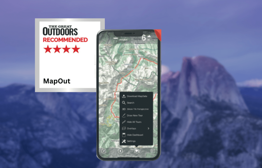
James Roddie’s Best Value
This is a really good app for navigation if you don’t need detailed topographic maps, and it works brilliantly while fully offline.- Low cost
- Simple interface
- Excellent for offline use
- No detailed topographic map layers
- iOS only
| Quick specs |
|---|
| Cost: £4.99 one off purchase (available from the App Store) Platforms: iOS Maps: OpenStreetMap Features: Track recording, offline map tile downloads, GPX import/export, 3D tilt perspective, customisable waypoint icons. Offline? Fully functional offline once map tiles downloaded mapout.app |
Mapout is available as a one-off hiking app purchase for £4.99, after which you have unlimited map tile downloads for no additional cost. For use on marked trails or in situations when you don’t require detailed topographic data, there is a lot to recommend about this app. Offline usage is excellent. The app is fully functional offline once you have downloaded the map tiles you require. You can record and plot routes whilst offline, and they will be saved even if you close the app without signal. The snap to path/road plotting function also works perfectly offline, which is not the case with some apps. Route plotting is intuitive and simple.
The interface is uncluttered and consistently operates smoothly. I like the ability to assign different icons to waypoints, as this can help to visualise distances between priority locations such as campsites or food re-supply points. You can also add notes and keywords to waypoints, but there is no option to add photos. Another feature I enjoy the is the 3D tilt function. By tilting your phone you can instantly get a feel for the topography of the landscape.
Read more: James’ full MapOut app review
Best for offline maps
Topo GPS
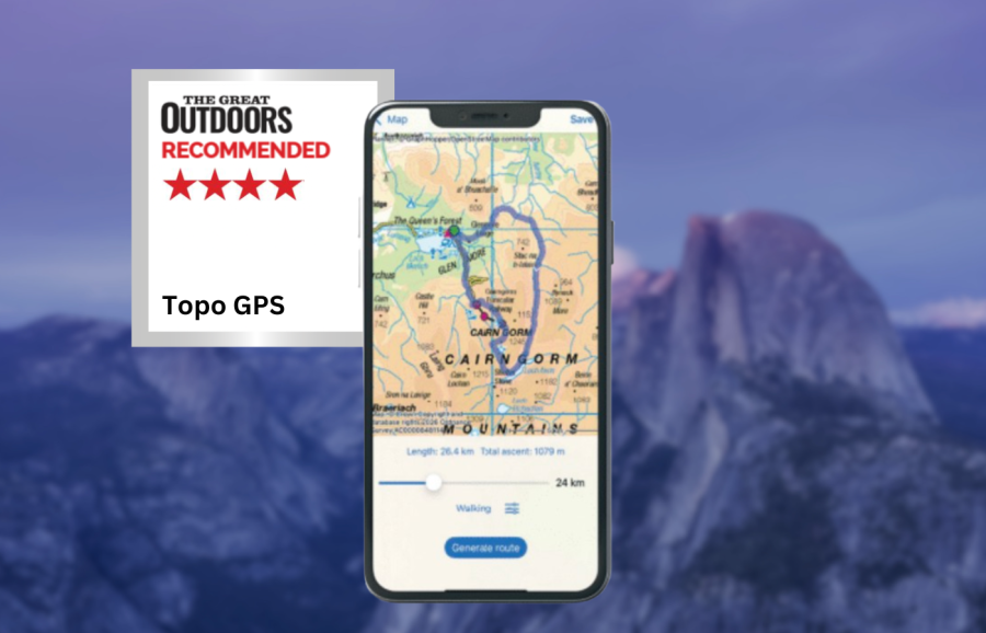
James Roddie recommends
If you don’t require social features, this is a powerful app which can be a highly affordable option in many use cases.- no subscription required
- simple interface
- stability
- cost can add up if used in multiple countries
- no social features
| Quick specs |
|---|
| Cost: Varies by country. Individual map tiles available to purchase for UK and Belgium (available from the App Store) Platforms: iOS, Android Maps: OS 1:50K and 1:25K. Topographic maps for much of Europe. OpenStreetMap. Features: Track recording, offline map tile downloads, GPX import/export, off-route alerts, generate route function, add photos to waypoints. Offline? Yes. No snap-to-path whilst offline. topo-gps.com |
The user interface is fairly simple – this does not have the modernised aesthetic of some navigation apps, and some users may not find it intuitive to use in comparison. However, it doesn’t take long to find your way around, and it quickly becomes very easy to use. Topo GPS has a deserved reputation for stability, and this may in part be due to the ‘stripped down’ interface. A standout feature of Topo GPS is the ability to purchase individual map tiles, rather than being forced into a subscription. If you mainly hike in one area, Topo GPS can be a highly affordable option for detailed topographic mapping. This option only applies to the UK and Belgium however.
This is an excellent app for offline usage. I appreciate that the app clearly informs you of the size of map downloads, your current use of storage, and your available space. Route plotting feels precise and straightforward. The location search function is superior to that found in some competitors, and it will compensate for spelling errors in many cases. The ‘generate route’ function is useful. This automatically generates circular routes of customisable distance from any chosen point and is useful for inspiration.
Read more: James’ full review of Topo GPS
Outdooractive
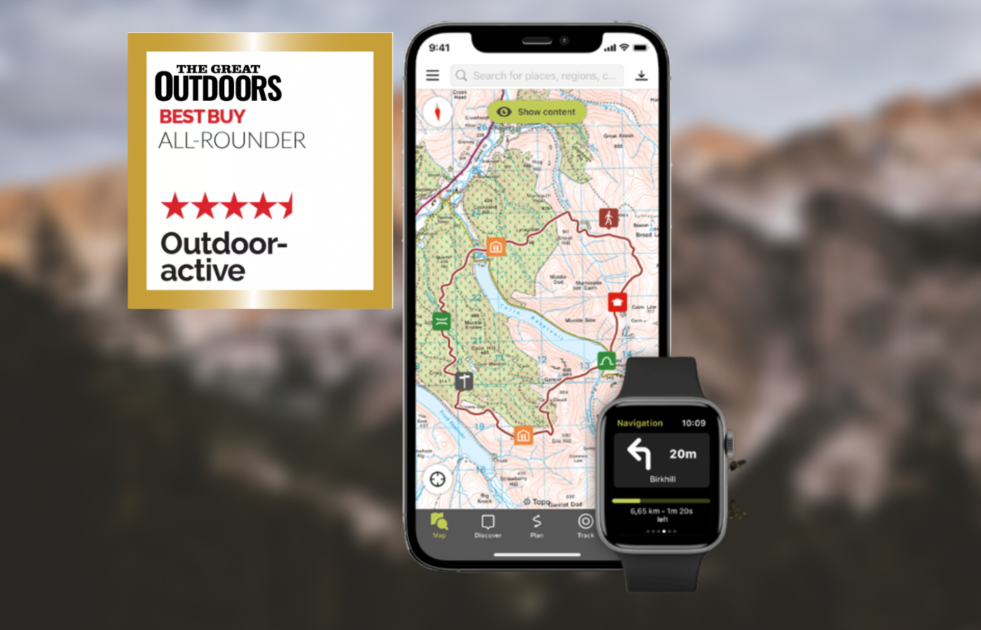
Alex Roddie’s Best in Test
Overall Outdooractive offers a comprehensive package that will do everything most users will ever need. The cost is also reasonable.- Great range of worldwide maps
- Easy and fast route planning
- Community routes
- Website planner
- Learning curve for ViewRanger
- OS Grid Ref not easy to use
- Minor bugs
| Quick specs |
|---|
| Cost: The contract period for Pro and Pro+ is 12 months each and can be terminated annually. The costs are $35.39 (Pro) and $70.79 (Pro+) per year / For UK users, basic use is free (no topo maps, ads); Pro is £2.23/month (OS & topo maps, no ads, offline); Pro+ is £4.45/month (Harvey & specialist Alpine maps, 3D planning) Platforms: iPhone, Android, web planner Maps: OS, Harvey, excellent range of international topo maps Features: route planning, OS grid ref, track recording, GPX import/export, community, augmented reality, 3D route preview Offline? paid version only. Two modes: either download map areas or download all maps for a planned route www.outdooractive.com |
At the time of writing most of ViewRanger’s features have now been added to the new app, although the interface is more complex and some features are more difficult to find. The main interface includes the map view, any planned routes or waypoints you’ve added to the special ‘My Map’ mode, and buttons for route discovery, planning, tracking, and ‘My page’ (your social profile on the app, including planned routes). To get a grid ref, you have to tap on a location, then tap through to ‘Details’ to get a list of coordinate formats (OS Grid listed near the bottom). This is much less convenient than ViewRanger’s approach.
Users signed up to the Pro or Pro+ membership are able to Outdooractive gain multiple benefits and discounts from brands such as Samsung, Helly Hansen, Garmin and more.
Read more: Outdooractive review
Best international mapping
Gaia GPS
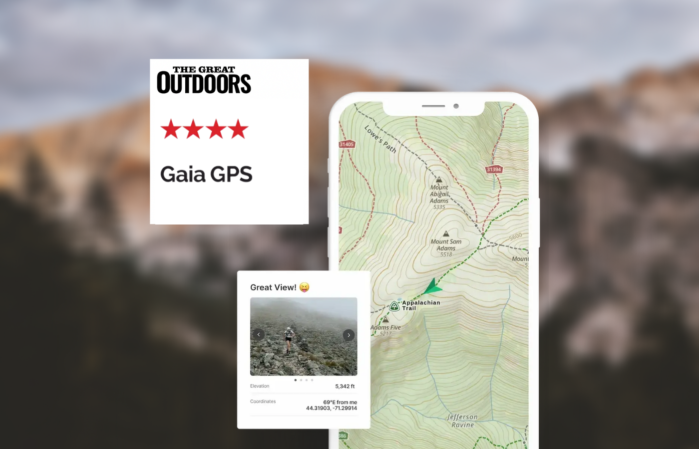
Alex Roddie’s verdict
If you mainly hike in the UK then Gaia GPS isn’t the app for you. However, it’s the best option for power users heading for trails abroad.- Great for international trekking
- Powerful route planner
- Advanced features
- No OS maps
- No OS grid ref
| Quick specs |
|---|
| Costs: In the US, the iOS app is free but requires a yearly subscription while the Andriod app costs $19.99USD and does not require a subscription / in the UK, the app is free (basic use, no offline maps); £39.99/year (Premium, offline & worldwide topo map) Platforms: iPhone, Android, web planner Maps: Gaia Topo (worldwide), many international topo maps with Premium subscription Features: route planning, track recording, GPX import/export, community, geotagged photos, area calculator Offline? yes, download areas of map to device (large areas & multiple map types at once supported) www.gaiagps.com |
If you’re going trekking abroad and you need a lot of functionality, Gaia GPS is the app to look at. The standard Gaia Topo map is based on OpenStreetMap data but is quite clear, with contours, paths and hill shading (no cliffs marked). Although there’s no OS mapping, internationally Gaia GPS has most topo maps you could want, including USGS Topo (USA) and numerous European map sources. All can be downloaded for offline use (Premium only) and you can even overlay multiple map types with transparency (superb for border areas where two map types are needed).
Read more: Gaia GPS review
Memory-map for all
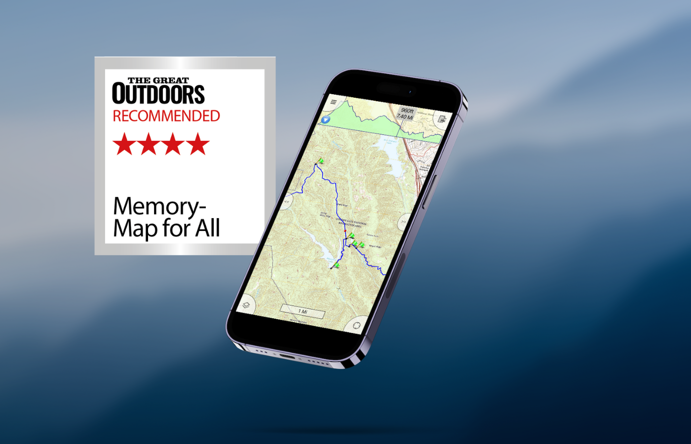
Alex Roddie Recommends
However, it is overly complicated for users with basic needs. The route-planning function also needs an overhaul, and it isn’t a great option for European topo maps.- Excellent map screening
- Flexible for power users
- High level of customisation
- Steep learning curve
- Route planning could be improved
- No Harvey maps
- Missing many European topo maps
| Quick specs | |
|---|---|
| Cost: Costs vary depending on mapping purchased in US / full OS mapping from £24.99/year Platforms: iOS, Android, Mac, Windows Maps: Europe Basemap and OS 1:250K Road Atlas (free); OS maps & small selection of international topo maps (paid) Features: route planning, track recording, GPX import/export, OS grid reference, viewing routes & waypoints on main map screen, extensive customisation Offline?: yes www.memory-map.com |
Memory-Map for All focuses on a map-viewing experience and managing your own library of routes. It lacks route recommendations and social features. The app features a large, uncluttered map view with buttons in the corners and edges, and a nested menu system. OS maps are available for purchase or subscription, with the cost reasonable for UK mapping. OS maps scroll and zoom quickly, with excellent clarity. The ‘List overlays’ menu allows users to control user data on the map screen.
Route planning is good, but snap-to-path is currently unusable. A better implementation is on the wishlist. GPX file import and export are easy and reliable, and route appearance can be controlled. For advanced users, the app offers powerful features but is overly complicated for basic needs and needs an overhaul. It is not a great option for European topo maps.
Read our full review on Memory-Map for all
Komoot
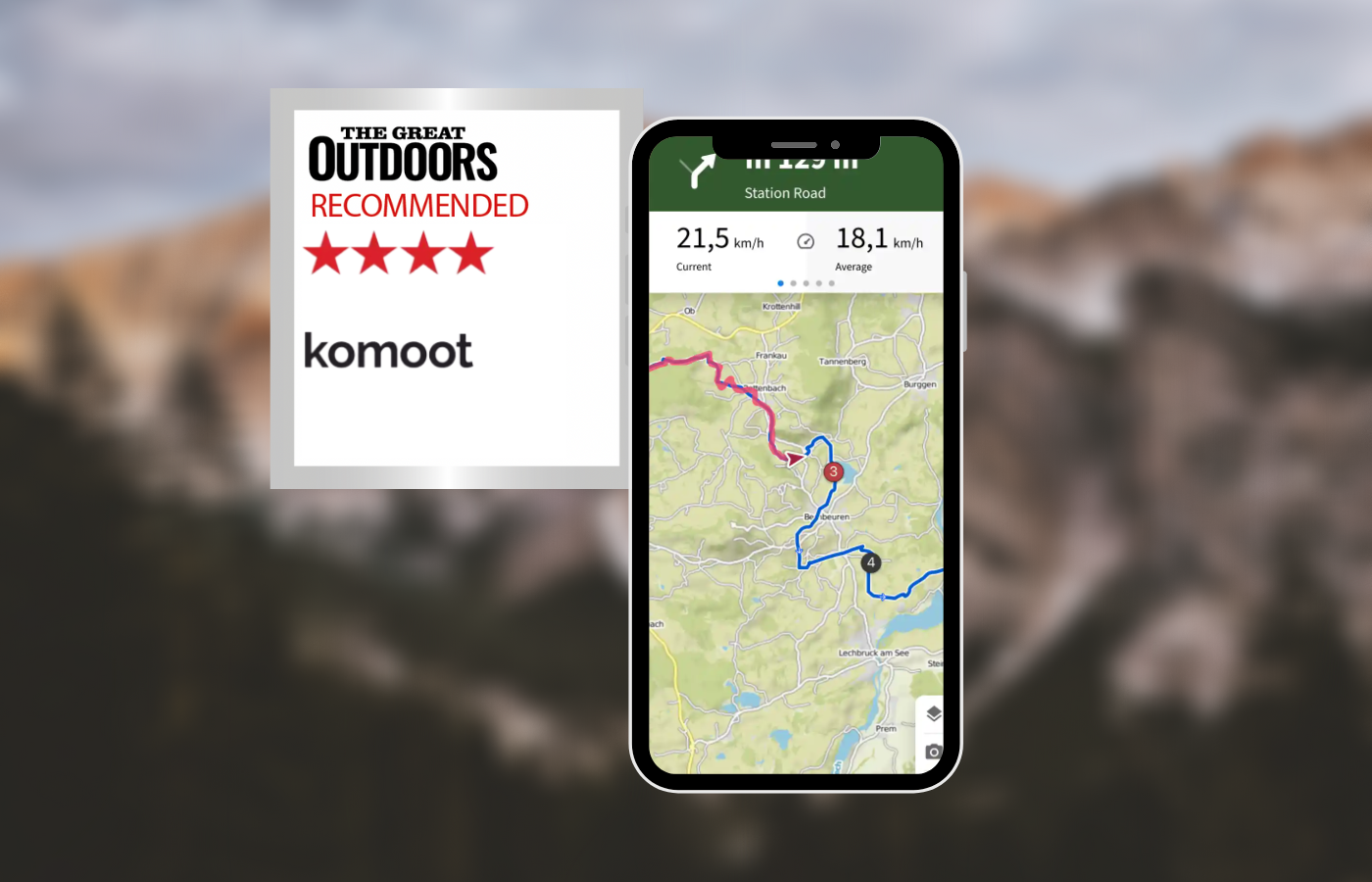
Alex Roddie’s verdict
While not ideal for complete control over route planning or off-path mountain use, Komoot is perfect for casual use and is the best app tested for sharing adventures with others.- Great for route discovery
- Social community
- No OS Maps or OS grid ref
- Limited manual control over route planning
| Quick specs |
|---|
| Costs: Prices start at $2.99 in US / in UK, free (basic use, no offline maps); €4.99/month (Premium, offline maps and other features) Platforms: iPhone, Android, web planner Maps: worldwide komoot map based on OpenStreetMap data with hiking and cycling layers Features: route planning, track recording, GPX import/export Offline? yes, download entire regions for offline use komoot.com |
Komoot is a unique app that combines social platform and route planner features for road cycling and mountain biking enthusiasts. The app’s default page is ‘Discover’, which displays a social feed and route highlights. Users can plan routes by selecting starting and finishing locations and a number of waypoints. The app intelligently plots routes based on the user’s sport and fitness level, making it suitable for lowland paths but lacking manual control for off-path mountain use.
The komoot map is based on OpenStreetMap data and features contours, paths, and hill shading. It also includes numerous ‘Hiking Highlights’ that can be included in routes. Offline use is effective and simple, downloading an entire county or region at once. The app can import and export GPX files, but requires an internet connection. When recording a tour, users can add their own highlights, geotagged locations with photos and descriptions.
While not ideal for complete control over route planning or off-path mountain use, Komoot is perfect for casual use and is the best app tested for sharing adventures with others.
Read more: komoot review
UK Map App
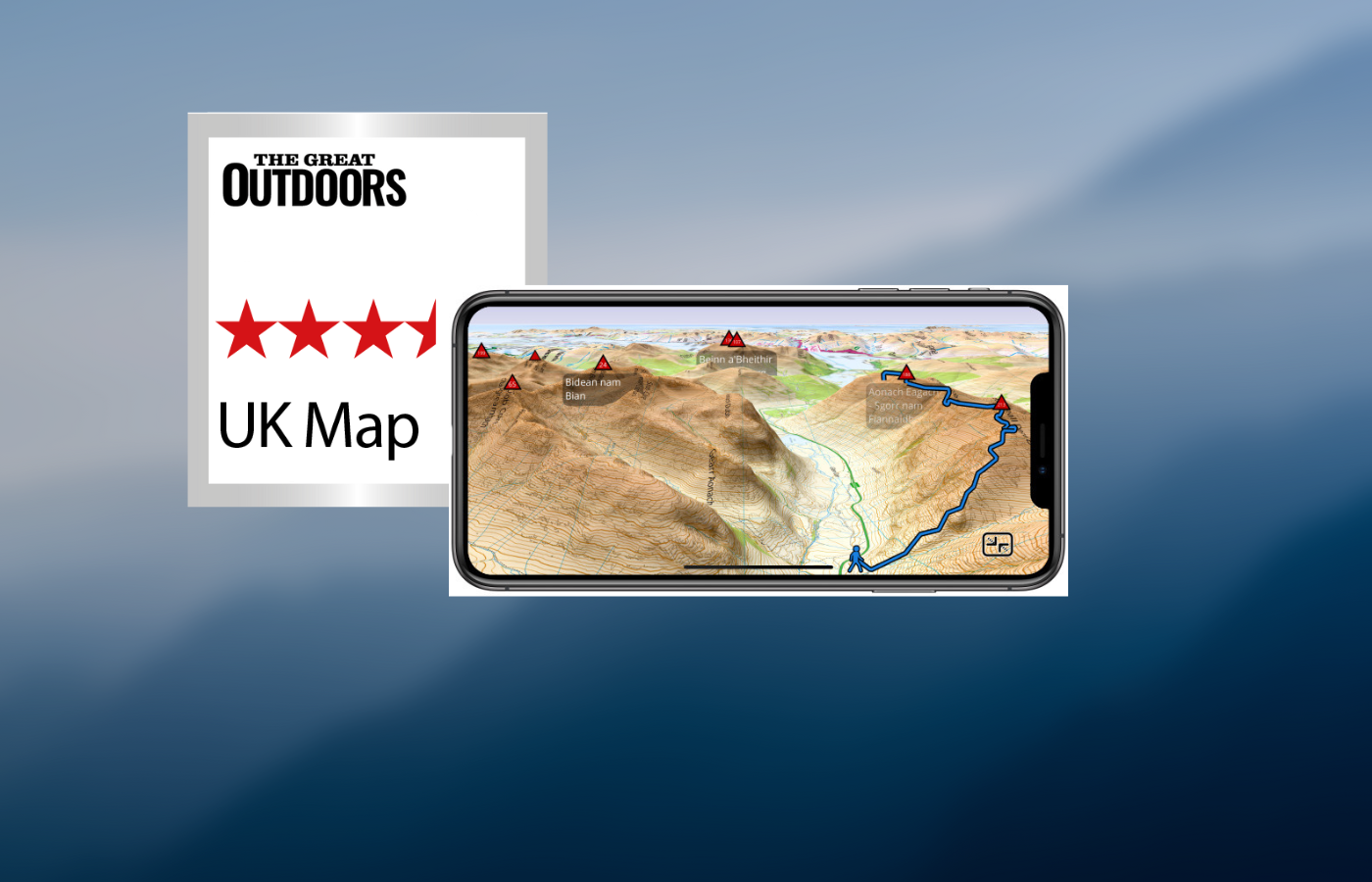
Alex Roddie’s verdict
If you can get past the somewhat confusing interface, don’t need maps for the entire UK, and prefer an old-school app with a focus on data and GPX files, this could be a good option for you.- Clear Map Screen
- Responsive
- Excellent handling on GPX files
- Affordable mapping with no subscription
- Confusing interface
- Cost can add up
- No snap to path
- No International maps
| Quick specs | |
|---|---|
| Platforms: not available in US / iOS Price: base maps are free and good enough for most uses; OS mapping from £1.99 per region Maps: free 1:25k and 1:10k UK maps based on OS VectorMap with footpaths superimposed from OpenStreetMap; paid OS maps at 1:50k and 1:25k scale Features: route planning, OS grid ref, track recording, GPS import/export, 3D route preview Offline?: yes, all functionality except downloading maps ukmapapp.com |
The main map screen is clear and uncluttered, with a few buttons around the edge. Zooming in and out is fluid, and contour shading for hills is on by default. The app allows for easy access to an OS grid ref and can search for locations offline. However, the interface feels confusing and cramped due to the custom interface. The downloadable free mapping is excellent quality, with contours, footpaths, and crags/rocks. Traditional OS 1:50k and 1:25k maps are available, but expensive for the entire UK. There is no subscription option. GPX file management is good, with the ability to import and export files offline, view elevation graphs and distances, and display multiple tracks and waypoints. Route planning is rudimentary, with no snap-to-path. While the app is an old-school navigation app with no social or online features, it may feel a bit too old-school for some users.
Read Alex Roddie’s full UK Map App review
Other outdoor hiking apps
Best for photographers
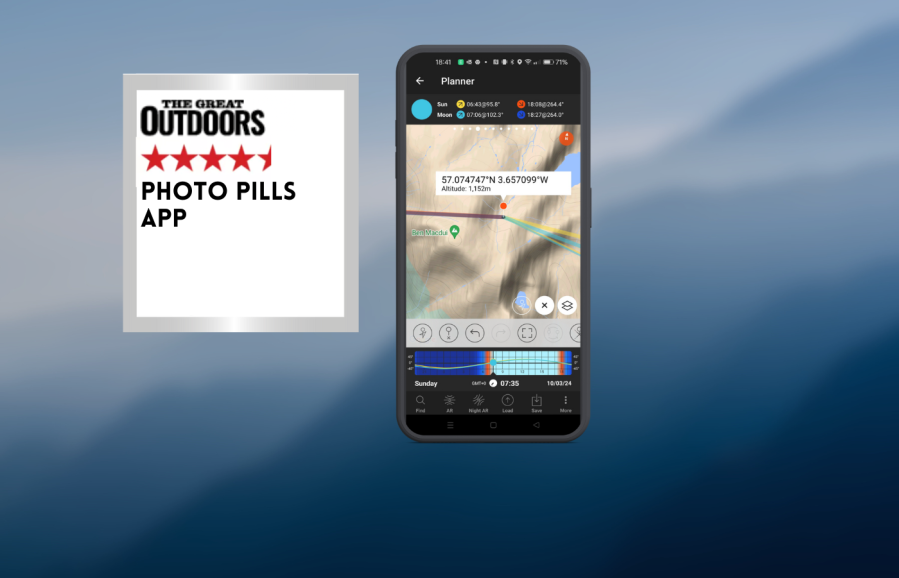
Photo Pills App
Chris Townsend’s verdict
Photo Pills does much more than this and is a very powerful and complex app. If you try it I recommend the online instructional videos as it’s not that easy to use.- sun, moon, milky way information
- No desktop app
- Basic maps, takes time to learn
- No desktop app
| Quick specs | |
|---|---|
| Costs: $12.99 USD / £9.49 Platforms: iOs, Android Maps: terrain, hybrid, satellite Features: planner; sun, moon, milky way positions, camera & lens settings calculators Offline: Yes www.photopills.com |
Photo Pills is an app that aids photographers in planning their photography locations by providing information on the sun, moon, and Milky Way, camera exposures, and depth of field. This information is particularly useful for wild camping, as it allows users to position their camp to receive the first rays of sunlight or avoid midsummer. The app also features calendars that display the rise and set times of the sun and moon for a week or more, along with daily details.
The maps are basic and designed for astronomical information, not navigation. Users can move a pin to a location to view the sun or moon’s rise and set times, which can be used to decide where to camp and to observe the sun or moon behind a feature like a summit or dip between high points. Plans can be downloaded for offline use.
Photo Pills is a powerful and complex app, but online instructional videos are recommended for ease of use. Overall, Photo Pills is a valuable tool for photographers and outdoor enthusiasts alike.
Read Chris Townsend’s full Photo Pills App Review
Cairns

James Roddie’s verdict
Overall, this is a really handy app for hill-baggers which you can customise easily.- intuitive interface
- offline functionality
- ad free and no data collection
- good accessibility features
- map prone to glitches
- only iOS compatible
| Quick specs |
|---|
| Cost: Free, or £9.99 annually, £0.99 monthly, or £24.99 lifetime (available from the App Store) Platforms: iOS Maps: OpenStreetMap hill-bagging map. Features: Interactive hill-bagging map, GPX import, CSV import, Apple Health compatibility. Offline? Yes, except map Search in App Store |
The Cairns app acts as a comprehensive hill-bagging logbook for the UK. There are over 20,000 hills available to log, ranging from the most popular lists (e.g Munros) to obscure collector’s pieces such Administrative County Tops of 1974-96. You can customise things easily, creating a Favourites list for those of interest. Every hill is listed with essential information such as elevation and a grid reference. Logging your outings is extremely easy and you can either do this by simply ticking them off in a list, or by adding notes, photos, companions and dates. You can also automatically import climbs from a CSV file, GPX files, photo meta data or Apple Health. Testing this on GPX imports resulted in the app accurately analysing the files quickly, and correctly identifying which summits were bagged on the route. You can then quickly tick them off in the logbook.
The interface is immediately self-explanatory, and there are no adds even on the free version of the app. There are some good accessibility features, such as increased contrast and voice control Most of the app’s functions are free, but a subscription allows you to add unlimited photos and notes to your climbs. I appreciate the option to select a summit and then go straight to that location in a variety of other apps – most usefully OS Maps and Walkhighlands.
Read more: James’ full review of the Cairns app
Best for weather
Met Office Weather App
Chris Townsend’s verdict
Of course the forecast isn’t always correct, especially from hour to hour, but I’ve found it generally accurate. You need a phone signal too so it’s wise to check the forecast before heading out.- Daily and Hourly forecasts
- Mountain area forecasts
- Individual sumit forecasts
- Online only
| Quick specs | |
|---|---|
| Recommended for UK weather forecasts. Costs: Free Platforms: iOs, Android, website Maps: Weather map Features: Daily & hourly forecasts, mountain area forecasts, individual summit forecasts Offline: No www.metoffice.gov.uk |
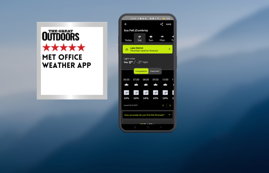
Weather forecasts are crucial for hill walkers, especially in the Cairngorms. The Met Office app provides hourly local weather forecasts daily and three hourly forecasts for the next five days, including mountain summits. The app provides expected temperatures, wind chill, rain or snowfall, wind speeds, humidity, visibility, and pressure. It also offers general mountain forecasts for ten areas, including mountain weather hazards like gales and chill effects. The app also features an interactive rainfall radar map, pollen and pollution forecasts, a UV index, and real-time Severe Weather Warnings.
The Met Office app is quick and easy to move between locations and forecasts. Users can consult the app before any walk, especially in winter, to stay informed. They can save three locations for regular checking and add others. While the Met Office forecast is generally accurate, it requires a phone signal, so it’s important to check it before losing connection. Users should check the forecast both evening and morning before a walk.
Read Chris Townsend’s full Met Office weather app Review
Windy.com App
Chris Townsend’s verdict
Windy is a wonderful app for anyone interested in the weather worldwide. For walkers it’s a great way to find out what the weather is doing if you’re going overseas.- Comprehensive
- Online Only
| Quick specs | |
|---|---|
| Recommended for worldwide weather. Costs: Free for basic features, Premium €18.99 annual sub or €29.99 for one year Platforms: iOs, Android, desktop Maps: Worldwide Features: All weather data, layers Offline: No but this is in development www.windy.com |
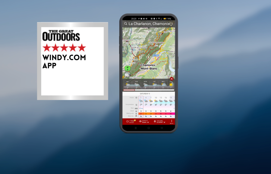
Windy.com is a weather app that provides real-time forecasts and information on weather patterns in various locations. The app features colorful maps with moving streaks indicating speed and direction, as well as other weather data such as rain, thunder, temperature, and clouds. The free version offers a variety of data, while paid Premium plans offer 1-hour forecasts, 10-day forecast maps, and a route planner.
While UK forecasts are included, the Met Office app is easier to use and clearer. Windy.com can send alerts for specific places, which could be useful. The app is available online, but an offline option is in development. It is a valuable tool for anyone interested in global weather, especially for walkers planning trips overseas. While UK forecasts are included, Windy.com offers a more clearer and easier-to-use alternative.
Read Chris Townsend’s full Windy.com App Review
Blitzortung App
Chris Townsend’s verdict
I find this a fascinating app and love following the track of lightning strikes, preferably when I’m safe indoors. It is useful for making decisions when walking too.- Real time lightning map
- Free
- Online only
| Quick specs | |
|---|---|
| Recommended for lightning tracking. Costs: Free Platforms: iOs, Android, web Maps: Aerial, Open Street Map Features: Distance and time of lightning strikes anywhere in the world Offline: No www.blitzortung.org |
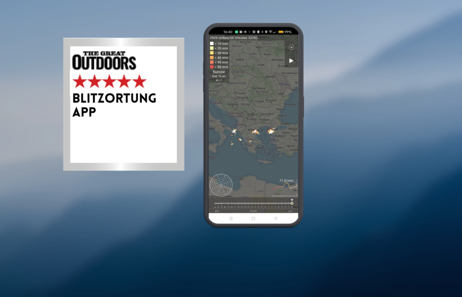
Lightning in the hills is a fearsome experience, and tracking the speed and direction of such storms is crucial. The Blitzortung app provides real-time updates on lightning strikes on a map, with details of the number and recent strikes. This app is useful for observing storms in cafes, waiting for them to pass, and deciding to head down by the nearest safe route. Sometimes, thunderheads build up without an app, even in overcast or misty conditions.
Blitzortung is international and offers a map of the world where lightning is present. Users can zoom in to their location and see how close any storm is. The time of strikes is color-coded for easy reading. The app is fascinating and useful for making decisions when walking, especially when safe indoors. Although it is not available offline, it is increasingly available in more places, especially on summits, where this information is most valuable. Overall, the app is a fascinating tool for monitoring lightning strikes and making informed decisions.
Read Chris Townsend’s full Blitzortung App Review
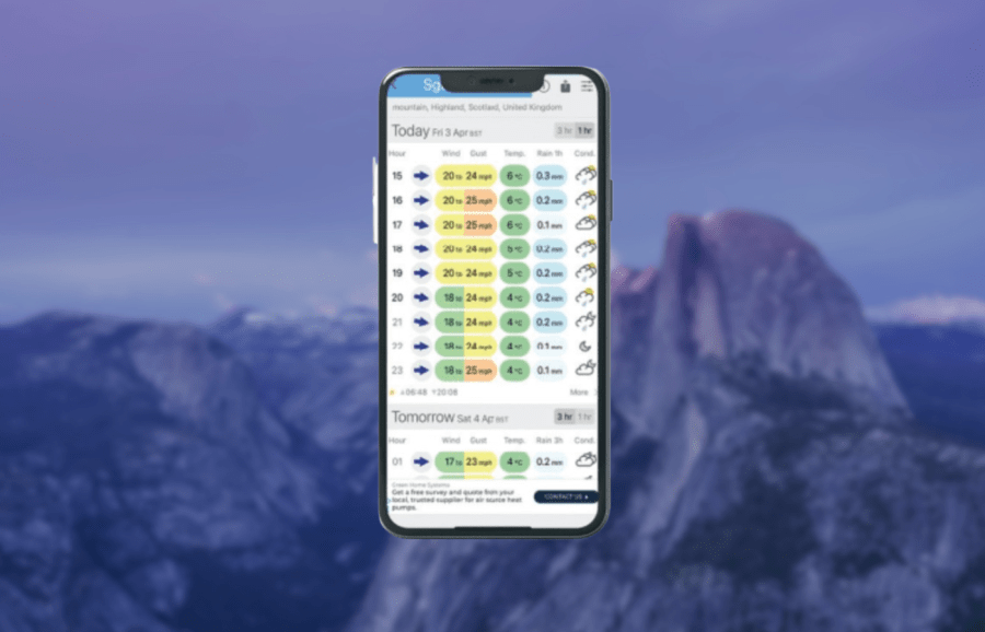
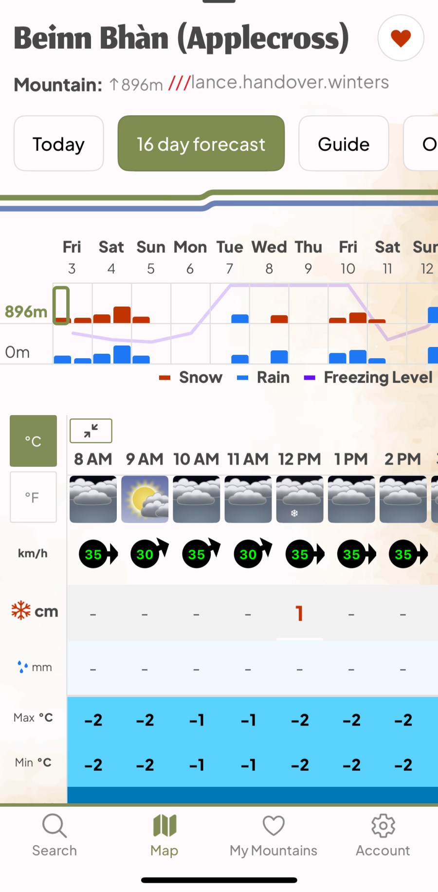
Mountain-Forecast
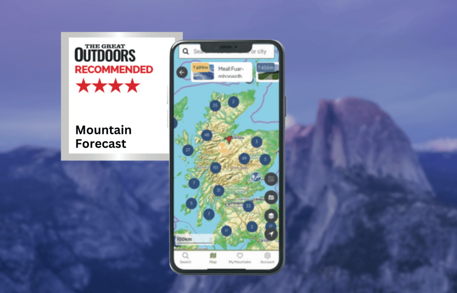
James Roddie recommends
Overall, this is an excellent forecast app that can be used to great effect in many areas of the world.- Reliable forecasting
- Forecasts for a huge number of summits globally
- Navigation features
- No weather radar map
- Uneven distribution of forecast locations
| Quick specs |
|---|
| Cost: Free (6 day forecasts). £24.99 yearly or £3.99 monthly subscription for 16 day forecasts and offline forecasting/mapping (available from the App Store) Platforms: iPhone, Android, Web browser Maps: OpenStreetMap with terrain and satellite layers. Features: Individual summit forecasts globally. Hourly forecasts. Offline mapping available with subscription. Offline? Yes, with subscription mountain-forecast.com |
The Mountain-Forecast app is a weather app specifically aimed at people spending time in the mountains, with a huge number of forecasts available for summits across the world. While all of the forecast locations given are summits, I was surprised for find forecasts for ‘summits’ as low as 50m above sea level in the English Midlands. As a result, this app can also be used for weather forecasting for low-lying, non-mountainous areas, but only in regions with a high density of forecast locations. Forecasts are also given for summit and mid-level altitudes of many mountains. This is really handy for backpacking in mountainous areas, where you might not visit any summits, but be moving through mid-level terrain.
I have found forecasting to be generally very reliable, particularly for wind speed and freezing levels. This app seems to accurately predict significant weather changes or poor weather ‘events’ with great accuracy in my experience. The free version of the app provides 3 hourly forecasts for up to 6 days ahead, with a more detailed hourly forecast for the current date. Online OpenStreetMap mapping is also available internationally. The paid subscription costs £24.99 annually or £3.99 monthly. It gives hourly forecasts for 6 days ahead, and then 3 hourly forecasts for an additional 10 days, along with offline forecasts and map downloads.
Read more: James’ full Mountain-Forecast app review
XCWeather
James Roddie’s verdict
This is a helpful app, particularly with regards to forecasting wind at sea level locations, but it must be used alongside a mountain-specific forecast for safe use when hillwalking.- free
- simple interface
- no weather radar map
- mountain forecasts commonly unreliable
| Quick specs |
|---|
| Cost: Free (available from the App Store) Platforms: iPhone, Android, Web browser Maps: none Features: Forecasts for 7 days. Customisable forecast readout. Offline? no xcweather.co.uk |
The immediate appeal of the XCWeather app is the simplicity of the interface. Some weather apps can include an overwhelming amount of forecast information, but that is not the case here. I really like that you can customise the forecast readout, and if preferred, you can strip things back to only display the wind direction and speed, temperature, rain amount and an overall condition icon. This can be a real advantage for people who only want the most basic forecasting information. This app has become a favourite amongst many people working on fishing boats and ferries, as it has developed a reputation for reliability for its wind forecasts.
While would agree that it largely does an excellent job for locations close to sea level, the same cannot be said with regards to wind speeds in the mountains. This app is not specifically designed for forecasting mountain weather, and as such it cannot be recommended for this purpose. This is a helpful app, particularly with regards to forecasting wind at sea level locations, but it must be used alongside a mountain-specific forecast for safe use when hill walking and mountaineering.
Read more: James’ full XCWeather app review
How we tested these hiking apps
James tested these apps across the Scottish Highlands, Patagonia and the Balkans. Tests were performed on an iPhone with an up-to-date version of iOS. Weather forecasting apps were tested in both mountainous and lowland locations.
Alex has been a hillwalker, mountaineer, and backpacker since 2003, cutting his teeth winter climbing while working as a barman in the famous Clachaig Inn in Glen Coe, before backpacking extensively throughout Britain and Europe. He’s the author of several books and an editor, writer, and photographer across outdoor media. He’s been part of the review team for The Great Outdoors since 2016, and is based in Scotland.
Chris is known globally as a writer on hiking and backpacking skills and equipment, the author of 25 books – many of them award-winning – and as a record-setting long-distance hiker. He was the first person to complete a continuous round of all the Scottish Munros and Tops and the first person to complete a continuous walk the length of the Canadian Rockies. He has also walked the Scottish Watershed and walked coast-to-coast across Scotland 18 times.
Hiking app features to look out for
Mapping
For precise navigation, look for detailed topographic maps, such as Ordnance Survey, Harveys or Swiss Topo. Subscriptions may offer topo’ maps for an entire country, or you may be able to pay for individual map tiles. Many will offer OpenStreetMap data, not as detailed as topo’s. Some will also offer an aerial layer, 3D mapping, and historic maps.
Offline use
You should be able to download maps for offline use and be able to print sections of map. Many apps will also allow you to plan routes whilst offline.
Platform
Many apps can be used on both iOS and Android, but some are platform specific. It is useful if the app also has a web browser version for planning at home.


Route tracking
Many apps offer the ability to record route data as you walk. These can then be saved as routes, exported as GPX files or shared publicly.
Safety features
A live locator function will show your precise location as a grid reference, and may allow you to share it via social media or a text message. Some apps also offer off-route alerts, should you veer off course.
Compass
App compasses vary in their accuracy and should generally only be used for reference rather than precise navigation. Carry a physical compass with you at all times.
GPX import/export
This allows you to exchange routes with other apps and websites.
Smartwatch syncing
Some apps offer a version available on Garmin or Apple Watch, for example, and some also allow data to be shared with Apple Health or other apps for route recording.
Community features
These can include the ability to share routes for public view, rating and commenting on routes, community forums, and public profiles.
Cost
Some apps are entirely free. Many will have limited free functionality, and full functionality with a subscription. Subscriptions may be monthly, yearly or lifetime. Some apps offer a free trial.
Find out more in our guide on how to use GPS for hiking navigation.