
Outdooractive offers a comprehensive package that will do everything most users will ever need for a reasonable cost.
Outdooractive replaced the original ViewRanger in 2022. Last time I reviewed it, I found that most of ViewRanger’s features had been ported over, and mentioned that most of the initial bugs had been squashed. So how has the situation changed over the last year?
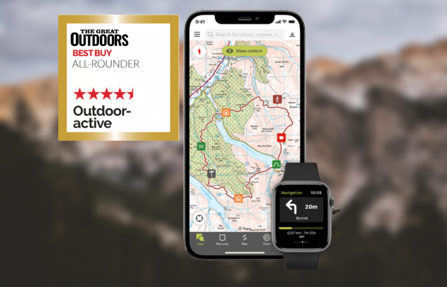
Some features are still difficult to find. The main interface includes the map view, any planned routes or waypoints you’ve added to the ‘My Map’ mode, and buttons
for route discovery, planning, tracking, and ‘My page’. Getting a grid reference has been improved since the last version I tested.
For subscribers, the app offers OS mapping at both 1:50k and 1:25k plus comprehensive international maps. You can save sections of any map for offline use or click through to a planned route and then download all the necessary maps. You can display multiple routes and waypoints simultaneously on the map using the ‘My Map’ mode.
Route planning is excellent, thanks to a reliable snap-to-path mode that works worldwide. The app will also reliably record your walk and you can import and export GPX files (although this needs an internet connection). There’s a large library of community routes you can access, and you can optionally publish your own for friends
to use. Other features include Skyline augmented reality (see peaks around you in real time), a 3D preview of your route, and much more. There is a good website for planning on your computer. You can also display a layer showing national long-distance trails.
I would still like to see more advanced control over points of interest, display of distance to route start/finish and offline GPX import/export. Managing offline maps and GPX files is more fiddly than it should be. However, overall Outdooractive offers a comprehensive package that will do everything most users will ever need. The cost is also reasonable.
Compare Outdooractive with others in our guide to the best hiking apps.

Testing conditions
Alex tested these apps throughout spring and summer 2023 on a variety of day hikes and backpacking trips throughout the UK and Ireland, in most cases testing both the Android and iPhone version of the app where available.
NOTE: We do not recommend that you rely solely on a smartphone app for mountain navigation. Always carry a paper map and compass and know how to use them.


