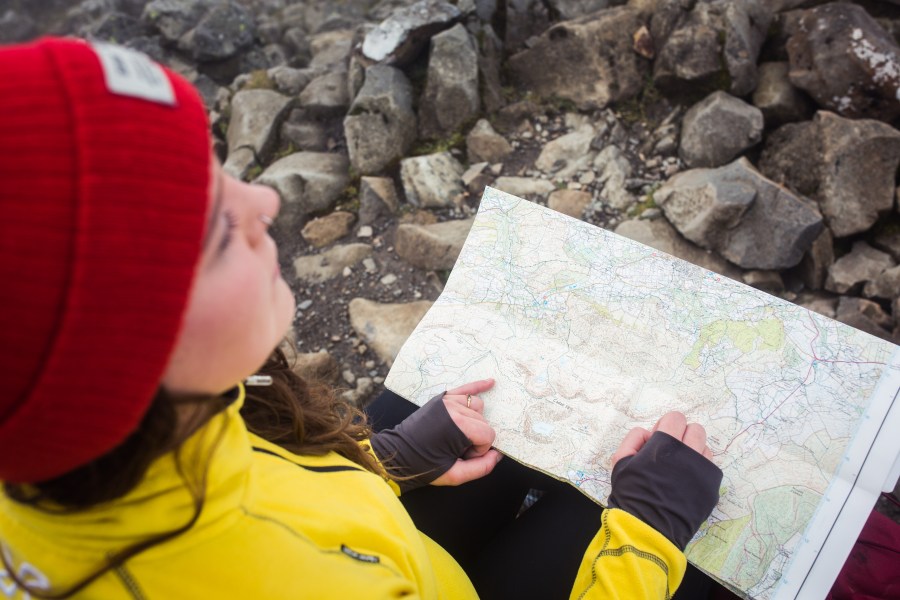
Learning how to utilise GPS for hiking navigation might be a valuable addition to your outdoor arsenal. While no single navigational tool is a ‘magic bullet’ for navigating in the outdoors (you should always have an array of skills and tools at your disposal, including the ability to navigate with a ‘traditional’ paper map and compass), GPS devices deliver a quick and accurate way of pinpointing your location using satellite technology.
This functionality can be useful as a navigational tool, but it can also literally be a lifesaver in certain emergency situations.
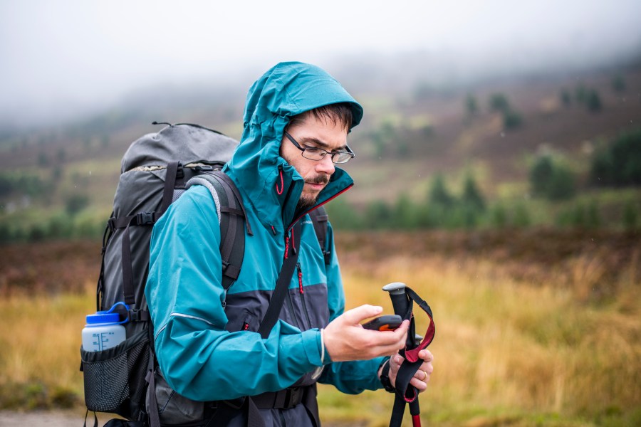
Main image: Navigating in the Scottish Highlands | Credit: James Roddie
There are many devices with in-built global positioning systems or compatible apps. The example you’ll likely use most regularly for finding the nearest petrol station or locating a coffee shop on foot is your smartphone.
But there is also a plethora of GPS devices designed for outdoor activity, from handheld tech with advanced battery lives and at-a-glance navigation capabilities to lightweight and durable wearables that sit neatly on your wrist.
How does GPS work?
Your GPS device works by receiving information from a network of satellites that circle the earth. GPS devices are useful when walking as they receive location in latitude, longitude, and altitude, as well as the time, from this network’s constant radio signals.
These vital pieces of information are garnered by your GPS device by measuring the time the radio signals from at least four satellites take to reach the device. This is called triangulation.
Your GPS device will show you your location by displaying coordinates and, if your device is capable of showing maps, pinpointing your place on a base or topo map, depending on your device’s features.
If you choose to track your walk, your device will lay digital breadcrumbs at regular intervals that you can later use to look back on the route you took including duration, distance and elevation. Likewise, you can choose to follow previously plotted waypoints shared with your GPS device.

But it’s not a totally perfect system. At times, gravity can pull satellites slightly out of orbit and the Earth’s atmosphere can distort radio signals.
There are further considerations in the mountains, also, where terrain features such as cliffs, steep slopes, deep valleys and tree cover, can sometimes cause inaccurate readings in the mountains. If you are using a GPS, look for devices that can connect to multiple satellite constellations as these will fare better.
The tougher conditions in the mountains are just another reason why, for hikers, a map and compass should be in your pack as a mode of navigation.
GPS devices for navigating outdoors
So, now you know the basics of how global positioning systems work, here are the types of devices you can use to locate and navigate outdoors.
- Handheld GPS devices
When you think of GPS devices fit for the outdoors, a purpose-built handheld device will likely come to mind as the classic option for difficult navigation. These are built to withstand the elements over long days on the hills with long battery life and accurate positioning, depending on the quality of the model. Examples include the Satmap Active 20 GPS, or the Garmin eTrex 22X Handheld GPX.
Not all handheld devices which use GPS are capable of displaying maps; typically, older or cheaper devices, for example, may simply show you a set of coordinates that you can cross-reference with a paper map. Some products may be aimed more at emergency communication than navigation; the Garmin inReach Mini 2, for example, can show you a plotted route and allow you to send messages without a phone signal, but it does not display full topographic maps.
- GPS watches
These wearable devices have many of the capabilities of handheld devices and can be built tough enough to withstand difficult conditions outdoors. They have the added bonus of being wearable and are therefore more conveniently used than some handheld devices, but they tend to be more costly as a result, and they often don’t come with actual displayed mapping. However, some do display mapping, like the Garmin Fenix 6 Pro Solar.
- Smartphone GPS
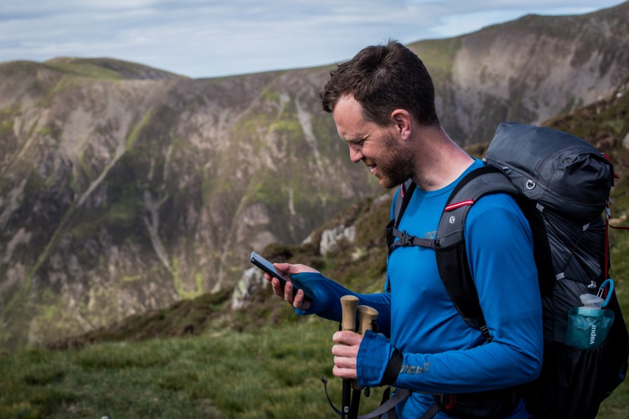
Most smartphones have in-built GPS which can be turned on or off in your settings, and can be turned into a useful navigational tool with the addition of digital mapping (check out our review of the best hiking apps for mapping). Most mid-range to high-end modern smartphones are quite ‘mountain-proof’ if used correctly – and can be bolstered by a tough case and glass screen protectors – but it’s important to check the specs of your device. Likewise, the limited battery life of a smartphone will need the added backup of a power bank when in the hills or on big mountain days.
Features to look for in GPS devices for the outdoors
- Accuracy
The more satellites your device connects to the better. Devices designed for outdoor navigation are preferable in this sense, but there is variation among the market leaders. Generally speaking, the more affordable devices connect to fewer satellites.
- Battery life
There’s no point in having an accurate device for a long expedition if you also have to weigh down your pack with plenty of batteries. You could either look for long-life field-replaceable battery-operated systems for backpacking or seek out rechargeable wearable or handheld options. Some wearables now have the added feature of solar charging but it’s worth noting that this won’t offer enough power to fully charge your device so you’ll always need to carry a power bank on longer excursions in the hills.
- Durability
Likewise, a broken GPS device is of no use to you in the hills. For this reason, a durable and weatherproof device is likely to be preferable to your smartphone for navigation if you’re walking all year round in the Great British weather.
- Usability
Most prefer to have a larger screen in order for the GPS map to be read easily and at a glance and, especially in the winter months, it’s ideal for this to include sensitive buttons. Consider the fact that, in winter, you’ll need touchscreen-compatible gloves if the GPS device is touchscreen only. It’s also a good idea to try a few devices before investing and to choose one that ergonomically fits with your hand or on your wrist.
- Weight
For ultralight enthusiasts and backpackers, weight will be an important consideration. Balancing this with the readability of the screen, and thus the size of the device is entirely up to you.
- Extra features
A unit with a barometer/altimeter provides more accurate elevation readings and lets you gauge weather trends. Some devices also have an electronic compass, geocaching features and satellite messaging services, but these extra features come at a cost.
How to use GPS for directions when hiking
Each device will have its own features and instructions for getting the best out of them and it’s a broad spectrum. For this reason, it is best to get to know the workings of your own device thoroughly by reading the manual. Familiarise yourself with it in safe and familiar spaces before venturing into landscapes you don’t know.
Generally, advanced GPS devices for use in the outdoors work by directing you from waypoint to waypoint and, with the combination of topographical mapping, this can provide an in-depth navigational tool for you to follow. Of course, it’s best not to follow waypoints into what you can see is unsafe territory, so make sure to take your common sense – as well as your other navigational tools such as a map and compass – with you into the hills alongside your GPS. More basic models without mapping work by giving grid references and a compass bearing. Without the addition of in-built or add-on maps, this function will simply give you a direction in which to head.
This is sometimes sufficient for hillwalkers who simply use their GPS devices for a quick reference or as backup to other navigational tools without using the full feature capabilities. After all, no navigational tool is 100% reliable so if you want to keep your navigation skills sharp, you could avoid following a plotted route even on a GPS with built-in mapping – and make sure you’ve got plenty of other tools in the toolbox.
If you’re not confident in your map reading skills, The Great Outdoors’ tech expert Alex Roddie has tested and reviewed the six best hiking apps to help you navigate.