From starter scrambles to the loftiest hands-on-rock time you can ask for, The Great Outdoors presents some of the best scrambling routes in the UK.
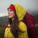
Scrambling, so they say, is the most fun you can have on a mountain without taking your ropes up. A sort of halfway house between hiking and climbing, scrambling requires you to put hands on rock – sometimes along exposed ridges or up waterfalls and down gullies. The adrenaline, freedom and lofty heights gained on some of the best scrambling routes in the UK, however, do require sure-footedness and upper body strength, a good grasp of navigation, a decent pair of hiking boots or approach shoes, as well as the obligatory gear and safety kit required for the grade.
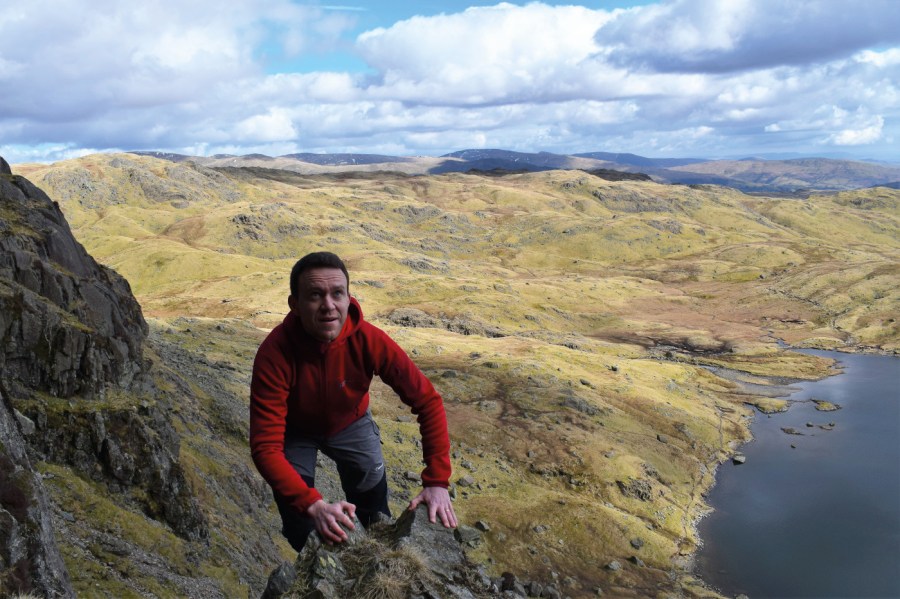
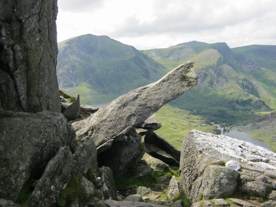
Main image: Sharp Edge on Blencathra | Photo: Ian Battersby
Scrambles are categorised into grades dependent on difficulty, so if you’re interested but that all sounds a bit intimidating, fear not. Start with an easy grade one scramble (which typically aren’t attempted with the deliberate use of ropes or climbing gear), then work your way up to the grade two scramble routes. Before you get going, read up on our expert tips on scrambling and ensure you know what to do in a mountain emergency.
Some of the best scrambling routes in the UK – plus route maps
So, without further ado, here are some of the best scrambling routes in the UK, as selected by The Great Outdoors contributors.
- Aonach Eagach, Glen Coe – grade 2/3
- An Groban, Northwest Highlands – grade 2
- Beinn Eighe, Torridon – grade 1/2
- The Saddle via Forcan Ridge – grade 2
- Ben Nevis via the CMD arête – grade 1
- Liathach – grade 1/2
- Crinkle Gill, Lake District – grade 1
- Jack’s Rake, Lake District – grade 1
- Blencathra via Sharp Edge and Hall’s Fell ridge, Lake District – grade 1
- Pillar Rock via the Shamrock Traverse, Lake District – grade 1
- Yewbarrow, Lake District – grade 1
- Bochlwyd Horseshoe via Tryfan North Ridge, Eryri/Snowdonia – grade 1
- The Nantlle Ridge, Eryri/Snowdonia – grade 1
- Pen yr Ole Wen, Eryri/Snowdonia – grade 1
- The Tower at Alport Castles, Peak District – grade 1
Aonach Eagach, Glen Coe – grade 2/3
James Roddie takes on a big route with a big rep – plus the obligatory Clachaig pub stop!
Start/finish: NN 1710 5688 – The Lost Valley carpark on the A82 | Ascent: 5729ft/1609m | Duration: 8-12 hours | Distance: 10.6 miles/17km | Maps: OS Explorer 384 – Glen Coe and Glen Etive

A stiff downclimb on the ridge. Credit: James Roddie
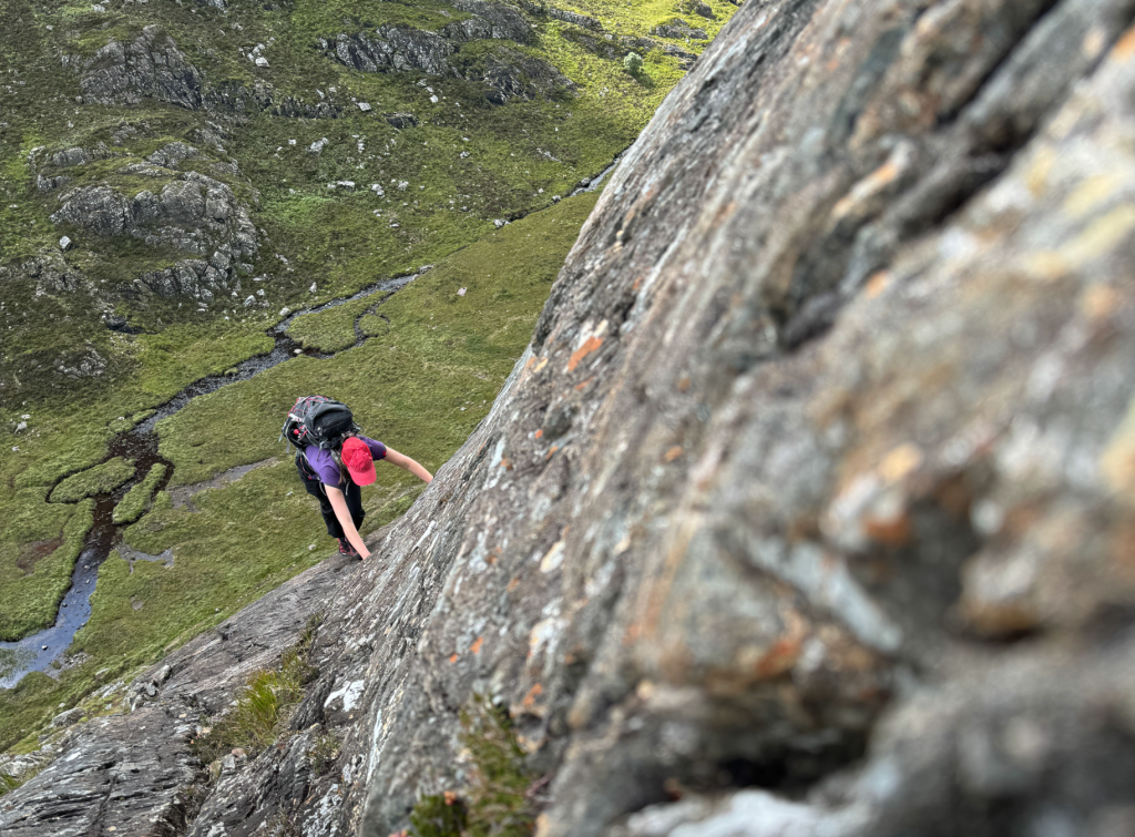
The Aonach Eagach is a big route with an even bigger reputation. This is as good as it gets in Scotland – a pinnacled, narrow ridge linking two Munros, with excellent scrambling and exceptional views. Unlike most of the scrambling on the Liathach and An Teallach ridge traverses, the main technical difficulties on the Aonach Eagach cannot be safely bypassed. It is a committing undertaking which should not be underestimated, involving exposed Grade 2/3 scrambling over a considerable distance.
Route-finding is largely straightforward, as following the crest of the ridge itself is usually the best option. If you have any doubts about your scrambling abilities or head for heights, hire a professional mountain guide. Leave it for a dry day if you can and enjoy it – days in the hills don’t get much better than this.
As a rewards, Clachaig Inn provides a welcome stop for refreshments on the return walk. If you are lucky, you may be able to get a lift from other walkers driving from the Clachaig back towards the start of the route.
Here is the detailed route description for Aonach Eagach.
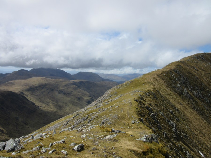
An Groban, Northwest Highlands – grade 2
Alex Roddie goes for a short scrambling day on the delightful An Groban near Gairloch.
START/FINISH: NG810752 Flowerdale Glen Car Park about 2km S of Gairloch | MAPS: OS 1:25,000 Explorer sheet 434 (Gairloch & Loch Ewe), OS 1:50,000 Landranger sheet 19 (Gairloch & Ullapool), Harvey 1:40,000 British Mountain Map (description) | DISTANCE: 7.9km / 4.9 miles | ASCENT: 553m / 1,814ft | DURATION: 3 to 4 hours
Scrambling on Humpback Buttress. Credit: Alex Roddie
You don’t have to head to the biggest mountains to find enjoyable rock for scrambling. One such hill is An Groban, a rugged and rocky peak of 383m that punches far above its weight. It’s situated above the delightful Flowerdale Glen, well known for its waterfall and wildflowers. The peak is mostly rock, and home to a number of climbs as well as some easier scrambles thanks to its friendly slabby rock.
The route described links up two of the main scrambles on the SW face: Right Hand Slabs and Humpback Buttress. Both are Grade 2 scrambles – or 3, depending on which guidebook you believe, but they are nowhere near as difficult or serious as most big mountain Grade 3 scrambles. Although some isolated moves are tricky, exposure is nowhere great, the rock is fantastic, and they feel non-serious thanks to a good range of lines. However, careful route-finding is essential and novice scramblers should go with an experienced friend. The easy descent makes a good alternative route to the top.
Here is the detailed route description for An Groban.
Beinn Eighe, Torridon – grade 1/2
One of the more accessible mountains in Torridon, Alex Roddie finds that Beinn Eighe makes for a memorable adventure visiting two Munros.
Start/Finish: Glen Torridon car park (GR: NG957568) | Distance: 19.6km/12.2 miles | Ascent: 1191m/3907ft | Duration: 7 – 9 hours | Maps: OS 1:50,000 Landranger sheets 19 and 25 (Gairloch & Ullapool and Glen Carron & Glen Affric); OS 1:25,000 Explorer sheet 433 (Torridon); Harvey British Mountain Map XT40 Torridon & Fisherfield
This straightforward grassy ridge leads to Ruadh-stac Mor. Credit: Alex Roddie
For hillwalkers in the Highlands who like their mountains rugged, the cluster of peaks north of Glen Torridon holds a special allure. Beinn Alligin and Liathach are shapely and distinctive. They’re also challenging, with sections of exposed scrambling. All of these factors add up to make Torridon one of the best bases in Scotland for hillwalking. But what if I told you that Torridon’s greatest mountain is neither of the above – and that it’s easier to climb than either, whilst still retaining a good level of challenge? Beinn Eighe is that mountain.
It’s huge but intricate. It has two Munro summits and a clutch more tops. There are enigmatic corries, craggy escarpments, a high-level loch and the legendary Triple Buttress with its climbing heritage. With well over 1000m of ascent and plenty of rough terrain to cover, this is a full day’s hill walk – with one short section of easy, ungraded scrambling. And the views will captivate you, especially southwest to Liathach. In my opinion, Beinn Eighe is one of Scotland’s best mountains.
Here is the detailed route description for Beinn Eighe in Torridon.
The Saddle via Forcan Ridge – grade 2
Emily Woodhouse scrambles a Glen Shiel horseshoe affectionately known by friends as ‘Straddling The Saddle’.
START/FINISH: Layby near Malagan Bridge; NG 967 144 | MAPS: OS 414 Glen Shiel & Kintail (1:25k) + OS 413 Knoydart for full route coverage, OS Landranger 31 Loch Alsh, Glen Shiel & Loch Hourn (1:50k), Harvey Superwalker Knoydart: Kintail & Glen Shiel (1:25k) | DISTANCE: 17 km / 10.5 miles | ASCENT: 1500 m / 4900ft | DURATION: 7 to 8 hours
End of ridge views.
Credit: Emily Woodhouse
The Forcan Ridge is a fantastic grade 2 scramble in Glen Shiel, with small buttresses, a knife edge ridge and a famously long awkward step. Plus, it takes in The Saddle, a 1011m Munro. While you’re at it, it would be rude not to walk the whole horseshoe. This route was known affectionately by my university hillwalking group as “Straddling The Saddle”.
This is a big day out and best enjoyed in good weather – the sort of endless summer day that Scotland can occasionally provide. The main appeal of this ridge is really the views, so save it for a day when you’re not clinging to damp rock in the cloud, with all of the airy feeling but none of the pay-off!
This route can be done in winter, but it’ll be head torches at one end or the other. In winter, it makes sense to do the shorter circuit instead, which turns left after the Forcan Ridge for Sgùrr na Sgine.
Here is the detailed route description for the Saddle.
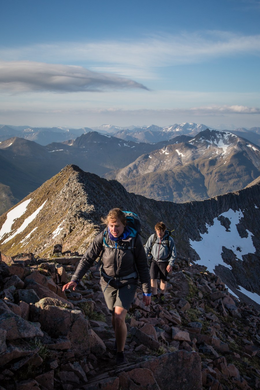
Ben Nevis via the CMD arête – grade 1
A classic day out in the mountains: Emily Woodhouse leads us through this Grade 1 ridge scramble to Scotland’s highest summit.
START/FINISH: North Face Car park near Torlundy; NN 145 762 | MAPS: OS 392 Ben Nevis & Fort William (1:25k), OS 41 Fort William & Glen Coe (1:50k), Harvey British Mountain Map Ben Nevis & Glen Coe (1:40k) | DISTANCE: 16.5km/10 miles | ASCENT: 1500m/4,900ft | DURATION: 10 hours
Two walkers tackling Càrn Mòr Dearg Arête, Ben Nevis.
Credit: Dougie Cunningham
It is a truth universally acknowledged that a hillwalker, who has climbed Ben Nevis at least twice, must be in want of a scramble. As impressive as it is to stand on top of the highest point in the UK, there are only so many times you can walk the Pony Track without wondering about the other side of the mountain. The Càrn Mòr Dearg (pronounced like ‘caarn more jerrack’) arête, the CMD arête to its friends, is a sweeping arc of a ridge that swoops up to the east side of Ben Nevis.
It’s a slightly quieter side of the mountain – although the North Face car park will be full of climbers by 8:30 am most of the year round. But you’ll get a much more varied and interesting ascent, both visually and underfoot, than the west side of Ben Nevis.
Here is the detailed route description for Ben Nevis via CMD arête.
Liathach – grade 1/2
Find your thrill among giants and airy ledges of Liathach a kilometre above the road, says Craig Weldon.
START/FINISH: Coire Mhic Nobuilcar park; NG869576/Liathach east car park; NG936566 | MAPS: OS Explorer433(1:25k), OS Landranger19, 24, 25(1:50k), HarveyUltramap Torridon (1:40k), Harvey Superwalker Torridon (1:25k) | DISTANCE: 16km /10miles | ASCENT: 1,370m /4,500ft | DURATION: 8 hours
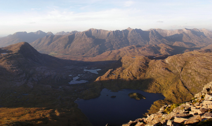
Liathach from Maol Chean-dearg across Glen Torridon.
Credit: Craig Weldon
You may have ‘ooh’ed and ‘aah’ed as you travelled up the north-west of Scotland for the first time, the long ridges of Affric and Kintail impressive enough. But then the road rounds Loch Torridon from Shieldaig, and you can’t help but stop the car to get out and gawp. Torridon possesses star quality. And in this landscape of individual giants, Liathach stands out as the most exciting and intimidating of them all.
Its massive wall above Glen Torridon shows few weaknesses, and the traverse between its two Munros over the Am Fasarinen pinnacles is famed – and feared – in hillwalking circles. But closer inspection reveals a route to thrill rather than terrify the experienced scrambler. Who knows? This may just whet your appetite for Liathach’s other routes – Stùc a’ Choire Duibh Beag’s east ridge, the north-west ridge of Spidean a’ Choire Lèith, and most difficult of all, the Northern Pinnacles of Mullach an Rathain via Meall Dearg, the most difficult Munro top on the mainland.
Liathach: it doesn’t do easy.
Here is the detailed route description for Liathach.
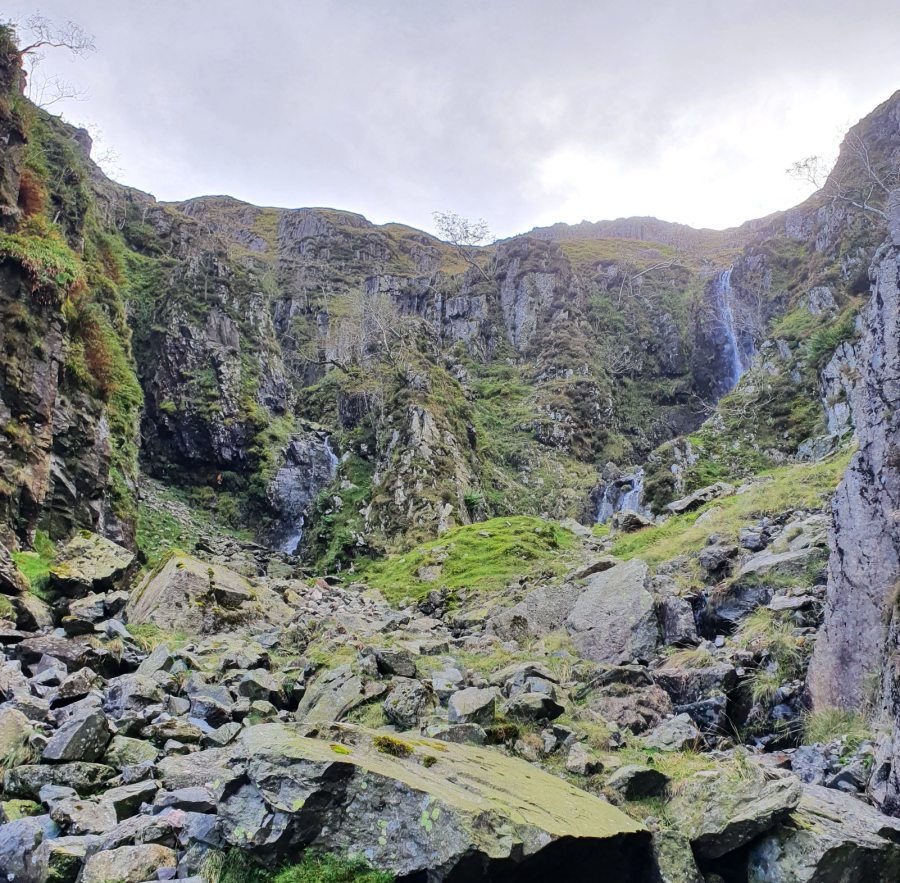
Crinkle Gill, Lake District – grade 1
The dark gash splitting the Oxendale face of Crinkle Crags makes an excellent warm weather route to the top, says Norman Hadley.
START/FINISH: Old Dungeon Ghyll Hotel NY286060 | MAPS: OS Explorer South-western Lake District OL6 (1:25k), Harvey Ultra Map Lake District West (1:40k) | DISTANCE: 10.3km / 6.4 miles | ASCENT: 790m / 2,590ft | DURATION: 4 hours, or more if splashing about in the gill
The intimidating amphitheatre Escape may be possible up the central prow.
Credit: Norman Hadley
The adventurous ravine of Crinkle Gill will make you feel like a Victorian explorer discovering the source of a jungle river, or a salmon fighting upstream on the ceaseless quest, but with significantly less risk from poison darts or grizzly bears. Like many of the world’s other great religions and philosophies, the key teaching in gill-scrambling is acceptance: your day truly begins when you commit to the first knee-deep wade. Technically, you could walk parallel to the gill and stay dry but you’d be missing out on a whole heap of immersive fun. In hot weather, the cooling presence of water to three-quarters height makes attaining the ridge a lot more enjoyable.
Difficulties are generally avoidable but be aware that gill-scrambling comes with inherent risks: wet, mossy, slippery rock-steps and a surprisingly remote feel. Despite the campsite being visible in the valley, the enclosed situation means you’d be unlikely to get a mobile signal in an emergency.
Here is the detailed route description for Crinkle Gill.
Jack’s Rake, Lake District – grade 1
If you’re looking to add a touch of adventure and adrenaline to your Langdale Pikes hike, look no further than Jack’s Rake, says James Forrest.
Start/Finish: National Trust’s Stickle Ghyll car park, Great Langdale (GR: NY294063) | Distance: 7.3km/4.5miles | Ascent: 824m/2,703ft | Duration: 4-5hours | Maps: OS Explorer OL6 (1:25k), OS Landranger 89 & 90 (1:50k), Harvey British Mountain Map Lake District (1:40k)
Scrambling up Jack’s Rake.
Credit: James Forrest
It is a quirk of Lakeland that Pavey Ark – a fearsome cliff rising vertically out of Stickle Tarn into the Langdale Pikes skyline – can be climbed by the average hillwalker. How can this be possible? The answer is Jack’s Rake, a nerve-jangling (yet achievable) scramble up a rocky groove dissecting the precipitous crag. Guidebook writer Alfred Wainwright described it as “just about the limit that the ordinary fell walker may be expected to attempt”, with some “difficult and awkward” sections – but he also waxed lyrical about the rewards for those hikers brave enough to venture up the rake. “The humble walker is…afforded a rare opportunity to enter the realm of the climber, and the rock scenery is magnificent throughout.”
Jack’s Rack is a grade one scramble – a route that requires a degree of rock climbing, employing both hands and feet, without being technical. It is essentially an exposed walking route. But do not underestimate it. The scramble is an accident hotspot that has tragically claimed many lives. The rock is often greasy and wet, and in some places, the terrain is very exposed. Take it on, however, and you will be blessed with an adrenaline-inducing, memorable experience. You will scramble up a rocky groove, which mercifully shelters you from sheer precipices; haul yourself over rocky steps and up narrow chimneys; tiptoe along grassy terraces with dizzying views; and, ultimately, stand atop Pavey Ark feeling like a real adventurer. It might just be the only way to improve a near-perfect day of hill-walking in the Langdale Pikes.
Here is the detailed route description for Jack’s Rake in the Lake District.
Blencathra via Sharp Edge and Hall’s Fell ridge, Lake District – grade 1
Ian Battersby waits for a good weather forecast to scramble both up and down Blencathra but remembers mountains make their own microclimate.
START/FINISH: Small layby on A66 just west of Scales; NY340268 | MAPS: OS Explorer OL5 (1:25k), OS Landranger 90 (1:50k), Harvey British Mountain Map Lake District (1:40k) | DISTANCE: 7.6km / 4.7 miles | ASCENT: 750m / 2,460ft | DURATION: 4.5 hours
Scrambling across Sharp Edge.
Credit: Ian Battersby
Blencathra is an awe-inspiring peak, much-loved among many, not least because it is home to not one, but two of Lakeland’s most sought-after grade 1 scrambles. This popularity brings additional problems for the scrambler. You may not be alone, and if having the pressure of more confident scramblers behind you is not to your liking an early start is recommended.
Secondly, the rock has been polished smooth by the passage of countless boots (and bums) in the narrowest and therefore most hazardous areas. This affects both scrambles, but Sharp Edge in particular is best avoided in the wet. Windy weather also presents a danger on these exposed ridges, and Blencathra is known for generating its own wind defences in an otherwise calm forecast. There are nearby alternative routes up Blencathra if this proves to be the case, but otherwise, prepare for one of the Lake District’s most prized adventures.
Here is the detailed route description for Blencathra via Sharp Edge and Hall’s Fell Ridge.
Pillar Rock via the Shamrock Traverse, Lake District – grade 1
Want to gaze over Lakeland’s most handsome crag? This adventurous hike’n’scramble via the High Level Route and Shamrock Traverse is the finest way to experience Pillar Rock, says James Forrest.
START/FINISH: Gatesgarth Farm pay and display car park (NY194149) | MAPS: OS Explorer OL04 (1:25k), OS Landranger 89 (1:50k), Harvey British Mountain Map Lake District (1:40k) | DISTANCE: 13.9km / 8.6 miles | ASCENT: 1,395m / 4,577ft | DURATION: 6 hours
Gazing out over Pillar Rock with Pisgah and Jordan Gap clearly visible. Credit: James Forrest
Alfred Wainwright described this adrenaline-inducing scramble up Pillar from Buttermere as a “glorious walk…for strong walkers only”. A trio of passes – twice up Scarth Gap and once up Black Sail Pass – are to blame for the exertion, but the reward is worth the graft. You’ll get up close and personal with Pillar Rock – a seemingly impenetrable tower of rock that juts out of Pillar’s north face like a dark, craggy cathedral. The summit of Pillar Rock is the preserve of rock climbers, but this route enables hillwalkers to get close to the action. From its start, west of Looking Stead, the High Level Route is a rough trod over rugged terrain via Robinson’s Cairn, while the Shamrock Traverse is a tilted rake featuring a heart-in-mouth shuffle across a slab of rock with precipitous drops on one side.
It’s a tricky walk with some exposure and sections of rocky scrambling. Losing the trod could be fatal. But nowhere is it technically difficult and the views of Pillar Rock are something to behold.
Here is the detailed route description for the Shamrock Traverse.
Yewbarrow, Lake District – grade 1
A simple slice of starter spice can be found just east of the Scafells beyond the Great Door to Yewbarrow, says Francesca Donovan.
Start/finish: Overbeck Bridge car park (GR: NY 167 068) | Distance: 4 miles/6.4km | Duration: 3 to 4 hours | Ascent: 601m/1,972ft | Maps: OS Explorer OL7 – English Lakes, South Eastern area (1:25k)
Looking southwest beyond Bell Rib to Wast Water.
Credit: Francesca Donovan
Yewbarrow is your best bet for a taste of starter spice above Wast Water. Sandwiched between adrenaline-pumping Pillar to the north and lofty Lord’s Rake to the east, this fell offers easier navigation and docile rambling to bookend your short but sweet time on rock. Yet, Dropping Crag and the optional Bell Rig jaunt offer good grade 1 scrambling before you plod along the plateau of Yewbarrow, so called for its resemblance to an upturned boat hull, saying hello to Herdwicks who found their own route up. After the nursery slopes, the excitement begins at Great Door. Put the poles away and push yourself up.
If this ascent is plenty, the route gives an escape route west off Yewbarrow for those avoiding the scramble down Stirrup Crag. (But, if you’re up to it, expansive views of the Scafells await you on breaks to catch your breath.) Returning along the falls of Over Beck offers the perfect opportunity to plunge and de-spice before heading to the pub.
Here is the detailed route description for Yewbarrow.
Bochlwyd Horseshoe via Tryfan North Ridge, Eryri/Snowdonia – grade 1
Classic scrambles don’t come much better than the North Ridge of Tryfan – and Glyder Fach’s Bristly Ridge and Y Gribin make a fine coda, says Alex Roddie.
Start/finish: Milestone Buttress car park beside Llyn Ogwen in Ogwen Valley (GR: SH659602) | Distance: 6.7km/4.2 miles | Ascent: 869m/2,851ft | Duration: 5 to 6 hours | Maps: OS 1:25,000 Explorer sheet OL17 (Snowdon/Yr Wyddfa), OS 1:50,000 Landranger sheet 115 (Snowdon/Yr Wyddfa), Harvey 1:40,000 British Mountain Map (Snowdonia North)
The Cannon Stone. Credit: Alex Roddie
There are many scrambling opportunities in North Wales, and especially around the Ogwen Valley, but nothing has the cachet as Tryfan. This blade of rock, with a summit at 917m (3,009ft), rises in a sheer stepped ridge from the valley, and it’s this prominent North Ridge that offers one of the finest easy scrambling experiences in Britain. At Grade 1, it’s exposed enough to be exciting, but easy enough to be within the capabilities of most fit and experienced hillwalkers. The logical continuation of the Bochlwyd Horseshoe over Bristly Ridge to Glyder Fach (994m / 3,261ft) and down to Cwm Bochlwyd via Y Gribin also involves plenty of easy Grade 1 scrambling for some hands-on-rock excitement.
It is a route to be savoured – but wait for good weather, as these mountains can feel a lot more intimidating in poor visibility, high winds, or with wet rock.
Here is the detailed route description for Tryfan North Ridge.
The Nantlle Ridge, Eryri/Snowdonia – grade 1
Andrew Galloway scrambles the Nantlle ridge to the most westerly mountain in Wales.
Start/finish: Car Park at Rhyd Ddu Welsh Highland Railway station (GR: SH709525)/Crossroads in the centre of the village of Nebo (GR: SH478505) | Distance: 13.6 km / 8.5 miles | Ascent: 983m / 3,225ft | Duration: 7 hours | Maps: Ordnance Survey 1:25,000 Yr Wyddfa/Snowdon OL17
The Nantlle Ridge seen from Craig Cwm Silyn.
Credit: Andrew Galloway
For many years Mynydd Graig Goch languished in obscurity at the far western end of one of the finest ridge walks in Parc Eryri. Popular guidebooks recommended an about-turn on Garnedd-goch, the “final” summit of the Nantlle Ridge, to avoid the dilemma of having to arrange return transport. This all changed in 2008 when a group of enthusiast hillwalkers carried out a detailed GPS survey of the hill. The official height was recorded as 609.75 meters, thus confirming the craggy eminence not merely as a mountain, but the most westerly mountain in Wales.
Having successfully negotiated the rollercoaster challenge of the Nantlle Ridge, it was a pleasure to sit among the frost-shattered tors of Mynydd Graig Goch, bathed in the diffuse light of evening, and watch the sun sink into the shimmering waters of Caernarfon Bay. For this moment alone, the taxi fare from Nebo to Rhyd Ddu was a small price to pay.
The Nantlle Ridge route is classified in guidebooks as a three-star grade one scramble. In good weather, there are excellent views across Parc Eryri with good paths traversing grassy slopes punctuated by a few sections of rocky scrambling. Exposure is never critical but may be unnerving in places to the uninitiated. Previous experience of grade-one scrambles is recommended.
Here is the detailed route description for the Nantlle Ridge.
Pen yr Ole Wen, Eryri/Snowdonia – grade 1
Francesca Donovan takes a walk on the quiet plateaus of Eryri to the Carneddau via the famous stile of Pen yr Ole Wen for a short but sweet scramble.
Start/Finish: A5 layby parking (GR: SH 668605) | Maps: OS Explorer OL17 Snowdon/Yr Wyddfa (1:25k) | Ascent: 2,925ft/1008m | Distance: 9.1 miles/14.7km | Duration: 6 hours
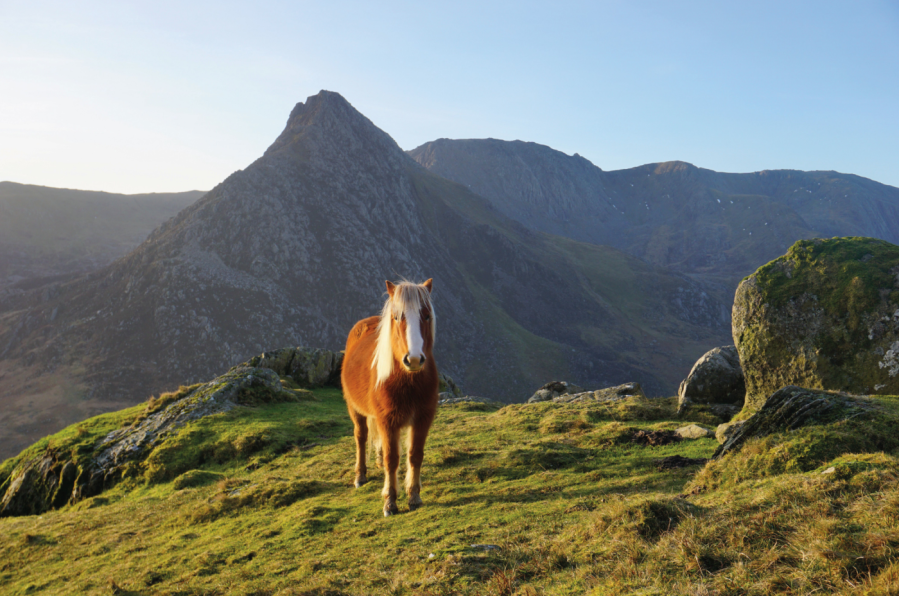
One of the Carneddau ponies poses in front of Tryfan.
Credit: Francesca Donovan
Here’s my unpopular opinion: I think Tryfan is best experienced from the “other” side of the Nant Ffrancon. If you’re looking for a big mountain day with space to roam, reach out and touch the sky, the Carneddau mountain range offers a charming, if less rugged, alternative just a stone’s throw away from the Glyderau’s imposing crags. And yet, ascending via Pen yr Ole Wen from the east (avoiding the relentless scree of its south face) still offers a decent little scramble up to those high, wide plateaus.
Here, on a calm, bluebird day you’ll be treated to views north out to sea as well as the summit of Yr Wyddfa to the south, beyond layer upon layer of mountain magnificence. Towering above Ffynnon Lloer, the Cambrian Way paves an expanse that allows you to stay high for longer. Passing the Ffynnon Llugwy reservoir on your return, you might even catch a glimpse of your altitude-induced grin in a mirror reflection as you descend back down into the crowds along the A5 and towards Ogwen Cottage.
Here is the detailed route description for Pen yr Ole Wen.
The Tower at Alport Castles, Peak District – grade 1
Starting your scrambling journey? Take a jaunt up The Tower at Alport Castles for some low-stakes family-friendly fun, says Francesca Donovan.
Start/finish: Haggwater Bridge car park (GR: SK 162 886) | Maps: OS Explorer OL1, The Peak District – Dark Peak area (1:25k) | Distance: 10 miles/17km | Duration: 6 hours | Ascent: 522m/1,713ft
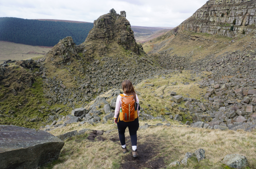
Walking down to The Tower base past Little Moor.
Credit: Francesca Donovan
The Peak District isn’t well-known for scrambling. The gritstone edges are favoured instead by boulderers and climbers and scrambling the cloughs up to Kinder can be tricky in wet weather. But there’s another spot where you can cut your teeth; Alport Castles. Here sits The Tower, the geologically impressive consequence of a huge landslide, the causes of which are still debated. This area is well-trodden by walkers who skirt the gritstone boulders lying dormant below Alport Moor, admiring The Tower from afar. Here, you can spend some time with hands on rock.
The scrambling is very easy grade 1 (a grade 0.5, if you like) if you stick to the obvious east route up The Tower. Or pick your own route, tackling it straight on for a vertical ascent from Little Moor. Keep an eye out for the resident peregrine falcons who nest in the layers of rock over on the other side of the landslide site. It’s a short scramble but there’s plenty of chance to scamper through the boulder fields before heading back above the farmland with views over to The Great Ridge.
Here is the detailed route description for The Tower at Alport Castles in the Peak District.
Discover more of the UK’s best scrambling routes and check out our tips for getting started in scrambling before you try your hand at one of these beginner scrambles.