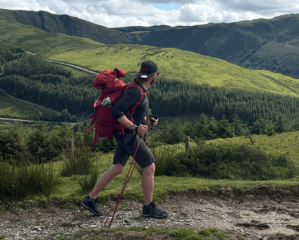
Starting your scrambling journey? Take a jaunt up The Tower at Alport Castles for some low-stakes family-friendly fun, says Francesca Donovan.
The Peak District isn’t well-known for scrambling. The gritstone edges are favoured instead by boulderers and climbers and scrambling the cloughs up to Kinder can be tricky in wet weather. But there’s another spot where you can cut your teeth; Alport Castles. Here sits The Tower, the geologically impressive consequence of a huge landslide, the causes of which are still debated. This area is well-trodden by walkers who skirt the gritstone boulders lying dormant below Alport Moor, admiring The Tower from afar. Here, you can spend some time with hands on rock.
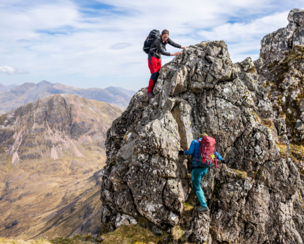
The scrambling is very easy grade 1 (a grade 0.5, if you like) if you stick to the obvious east route up The Tower. Or pick your own route, tackling it straight on for a vertical ascent from Little Moor. Keep an eye out for the resident peregrine falcons who nest in the layers of rock over on the other side of the landslide site. It’s a short scramble but there’s plenty of chance to scamper through the boulder fields before heading back above the farmland with views over to The Great Ridge.
Scramble The Tower, Alport Castles: route description
Start/finish: Haggwater Bridge car park (GR: SK 162 886) | Maps: OS Explorer OL1, The Peak District – Dark Peak area (1:25k) | Distance: 10 miles/17km | Duration: 6 hours | Ascent: 522m/1,713ft
1. SK 162 886: From the car park – which is only big enough for about six cars so arrive early – head south down through woodland and cross Haggwater Bridge. Then, take the path turning R in an E direction following the track between the stream and the constructed waterway. After 1.5km, keeping Low Barn on your left, take the track on the L heading upwards. In another 1km, you’ll reach a ford. Cross this – gaiters might be useful to keep your feet dry in high water levels – and follow the track along the stream back up to Snake Pass.
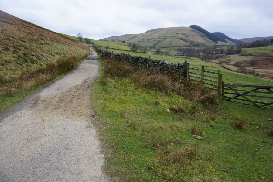
You’ve got a fair amount of mileage through farmland.
Credit: Francesca Donovan
2. SK 141 895: Cross the busy road at Snake Pass and go through the waymarked gate onto the public footpath. Follow this through farmland for 2km, passing through the Alport Farm buildings and down to the stream. Here, you can ford the stream in low water but there’s also a footbridge 100 yards further along, if the levels are too high. After crossing, head in an ENE direction skirting the wall of Castles Wood on your R to begin your ascent up to Alport Castles.
Looking over to Hope Forest and Alport Dale.
Credit: Francesca Donovan
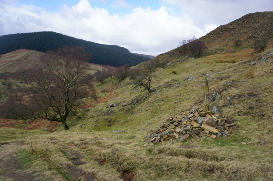
Along this path you’ll pass a cairn, but navigation on this route is relatively simple thanks to the geographical features you can use to locate yourself and your direction of movement. Follow the pathway upwards and walk around Little Moor taking the path on the L.
Gritstone boulders to the right of Little Moor.
Credit: Francesca Donovan
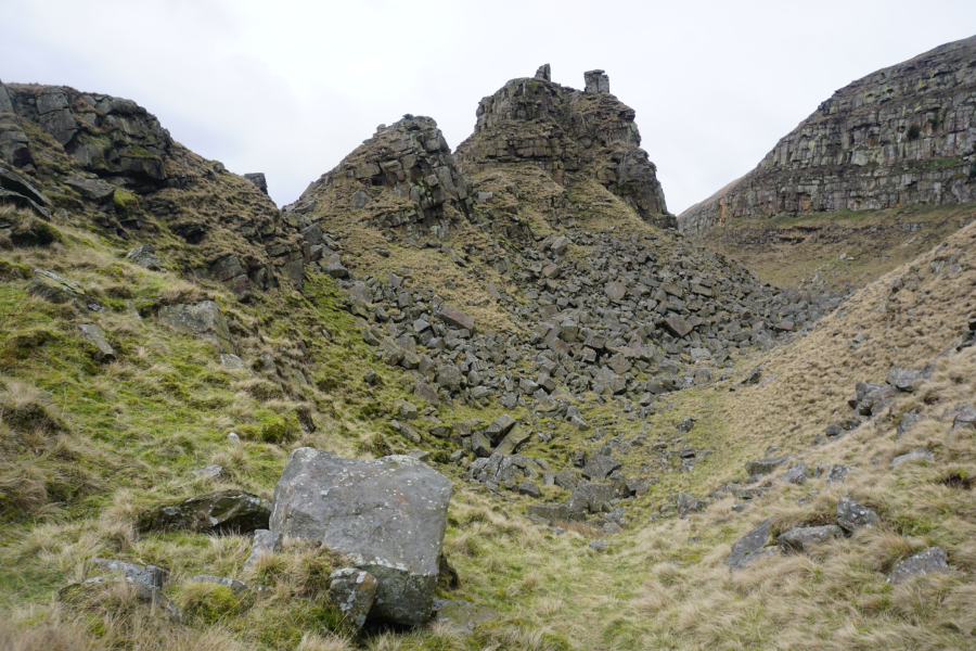
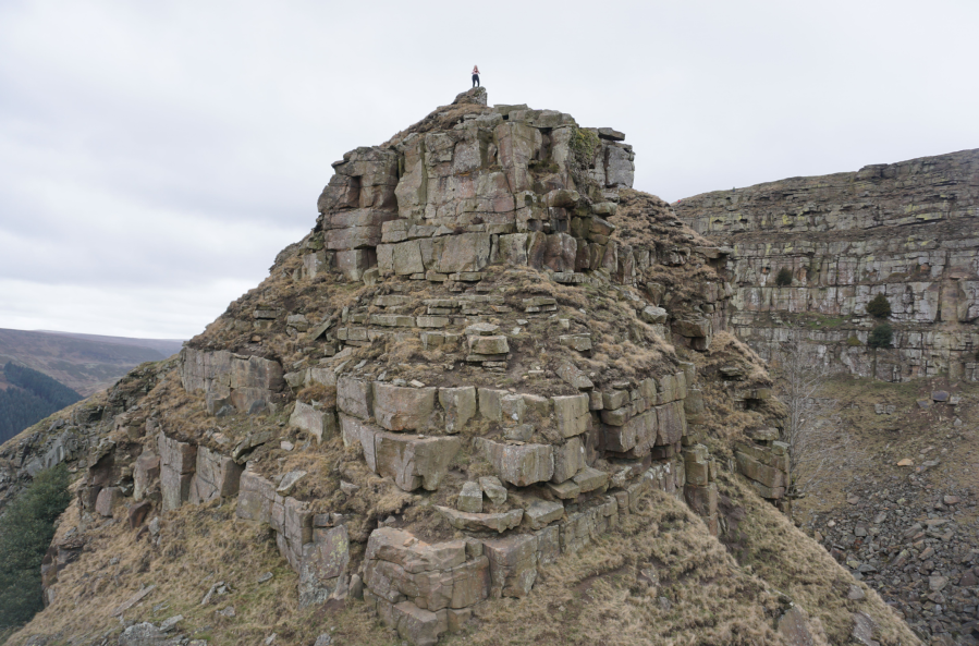
3. SK 145 911: To the E of Little Moor, the pathway forks into two, one option heading up on the moors and another dipping down into the landslide debris. Take the pathway heading NW down that weaves into the boulder field. From the path, head off the beaten track into the boulder field and up onto the ledges of Little Moor for a great view of The Tower.
Walking along Little Moor towards The Tower scramble.
Credit: Francesca Donovan
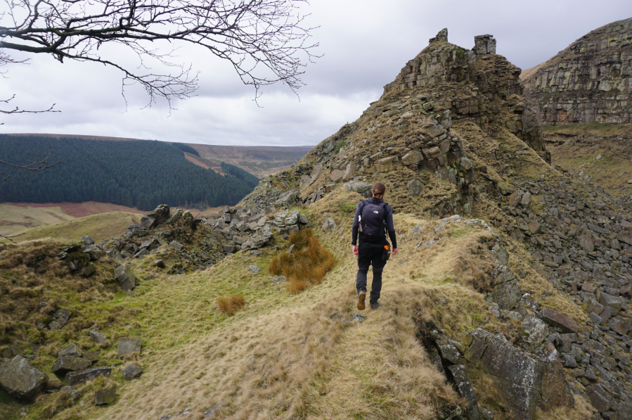
Scramble down the rocks from Little Moor and head up The Tower on the eastern side for an easy scramble. With plentiful footholds and not too much stretch necessary. This is a great starter scramble – perhaps one to introduce a fit and sure-footed hillwalker to some spice. Alternatively, you can tackle The Tower straight on for a more vertical and technical ascent.
After a successful scramble up The Tower.
Credit: Francesca Donovan
4. SK 141 914: Take a breather atop one of the two pinnacles and admire the views, making sure to look out for the nesting peregrine falcons in the layered ledges of rock to the E below Alport Castles. Head back into the valley on your choice of down scramble and return to the path skirting Little Moor.
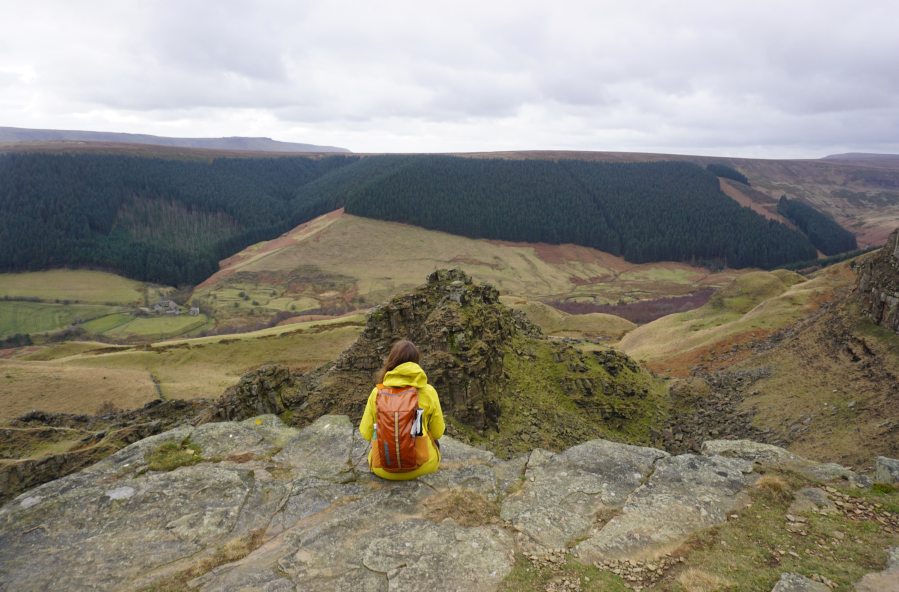
Looking at The Tower from Alport Castles.
Credit: Francesca Donovan
5. SK 142 913: Take this SE up onto the Birchinlee Pasture to enjoy the views down to The Tower from the ridge at Alport Castles, walking NW along the path after a L turn. From here, walkers do have the choice to bag a trig. To do so, continue along this path and head onto Westend and Alport Moor. The trig lies nearly 2km away (adding 4km in total on a there-and-back bagging mission).
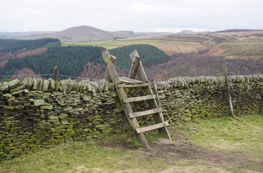
A stile with views over to Lose Hill and Mam Tor.
Credit: Francesca Donovan
If you’d like to cut the walk short, simply retrace your steps back along the Alport Castles ridge, taking the stone-flagged pathway heading SE. See if you can spot The Great Ridge and the edges above Ladybower as you head over the moorland.

Take the middle path with views over to Lose Hill.
Credit: Francesca Donovan
6. SK 161 894: In 3km, take the middle pathway down into Woodcock Coppice and follow the switchback path down in a SW direction all the way back to the car park.
Further information
Public transport: The Hulleys of Baslow X57 bus runs between Sheffield, Ladybower Reservoir, Glossop and Manchester along Snake Pass and stops by the starting point.
Tourist Information: Upper Derwent Visitor Centre, 01433 650953
Nearest YHA: Edale, Castleton or Hathersage