
Ian Battersby waits for a good weather forecast to scramble both up and down Blencathra but remembers mountains make their own microclimate.
Blencathra is an awe-inspiring peak, much-loved among many, not least because it is home to not one, but two of Lakeland’s most sought-after grade 1 scrambles. This popularity brings additional problems for the scrambler. You may not be alone, and if having the pressure of more confident scramblers behind you is not to your liking an early start is recommended.
Secondly, the rock has been polished smooth by the passage of countless boots (and bums) in the narrowest and therefore most hazardous areas. This affects both scrambles, but Sharp Edge in particular is best avoided in the wet. Windy weather also presents a danger on these exposed ridges, and Blencathra is known for generating its own wind defences in an otherwise calm forecast. There are nearby alternative routes up Blencathra if this proves to be the case, but otherwise, prepare for one of the Lake District’s most prized adventures.
Blencathra via Sharp Edge and Hall’s Fell ridge: route guide
START/FINISH: Small layby on A66 just west of Scales; NY340268 | MAPS: OS Explorer OL5 (1:25k), OS Landranger 90 (1:50k), Harvey British Mountain Map Lake District (1:40k) | DISTANCE: 7.6km / 4.7 miles | ASCENT: 750m / 2,460ft | DURATION: 4.5 hours
1. NY340268: A small layby between two houses marks the start of this route, but use the larger layby 100m west of here for parking. Follow the signposted footpath north through trees to a gate. After the gate the path veers east-north-east alongside the intake wall and past pine trees. The path and wall curve gently north to reach a fork in the path after 500m. Veer Left, and left again at the next fork, heading north to reach the steep edge of Mousthwaite Comb. The path follows the edge north-west then north past the drop, before veering north-west into the Glenderamackin River valley with Brunt Knott and Sharp Edge appearing on the left. After 900m the path forks left, climbing west alongside waterfalls to reach Scales Tarn nestled beneath soaring crags with Sharp Edge on the right. Just before the tarn the path forks right, but continue to where Scales Beck flows out of the tarn for the finest view.
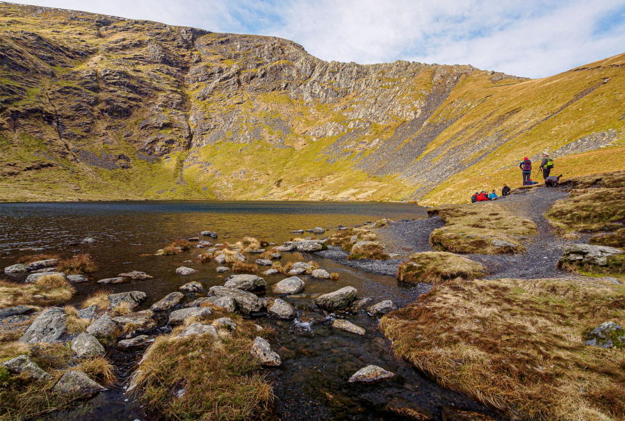
Scales Tarn.
Credit: Ian Battersby
2. NY330281: Head north to re-join the path which climbs north-west to reach the crest of the ridge tapering to the knife edge that is Sharp Edge. There are sporadic paths that miss short sections of exposed ridge, but not all of it, and essentially the scramble follows the very top of the ridge. Start by climbing up steep but easy groove in the rock to the narrow crest, where the gradient eases, but the exposure increases across a section comparable with the apex of a roof.
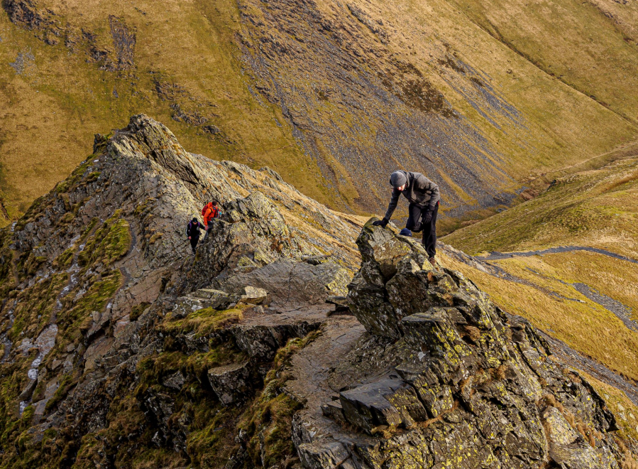
The Bad Step.
Credit: Ian Battersby
Then scramble steeply up and over a small pinnacle, climbing once more to “The Bad Step”, which sounds worse than it is, although the rock is unnervingly smooth here when wet. Drop down into a notch, then another short section of ridge bridges across to the main mountain. Either climb the slabby rock straight up or traverse right 10m into an easier gully, which can be climbed to safer ground. As the ridge broadens a path leads south along the edge of Tarn Crags, with a spectacular view of Scales Tarn and Sharp Edge, then climbs south-west to the circular concrete OS trigonometrical station at the summit.
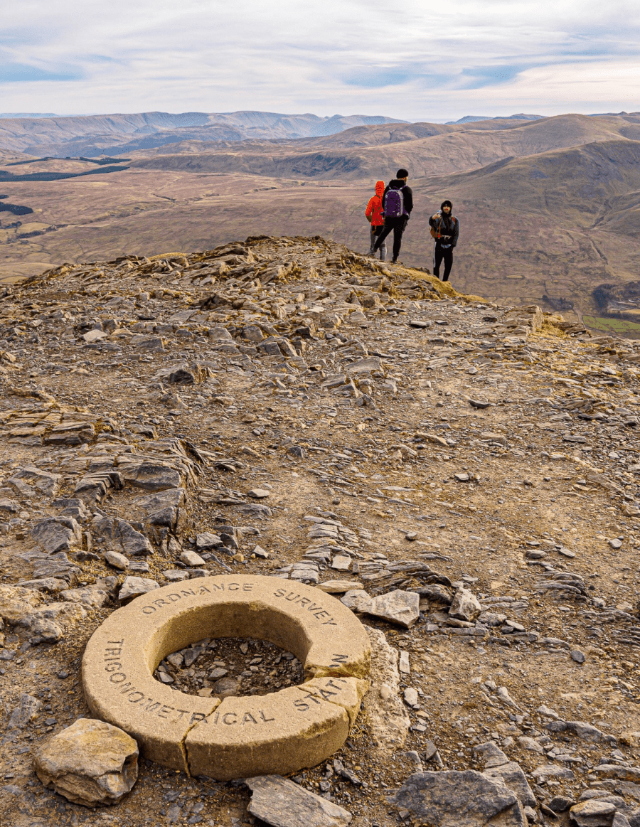
Hall’s Fell Top.
Credit: Ian Battersby
3. NY323277: Hall’s Fell ridge is the obvious descent for covetous scramblers who want for more. This ridge is sharp and smooth in a few places, and can be slippery when wet, but there are more alternatives available than on Sharp Edge, with paths that ease around difficulties. Skilled scramblers will revel along the crest, while others will prefer descending to the side where available.
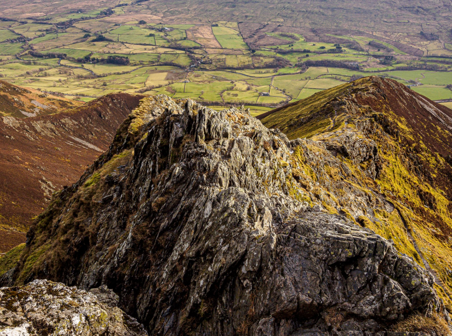
Hall’s Fell.
Credit: Ian Battersby
Scrambling begins as the ridge drops suddenly south-east away from the summit down to where the ridge narrows at an awkward and exposed flaw in the ridge. This can be bypassed on the right although loose stone on steep ground brings a different kind of problem. Continue over a series of rocky outcrops, which present a succession of hurdles until the ridge broadens and the path drops through steep grass and heather to the intake wall at Gate Gill.
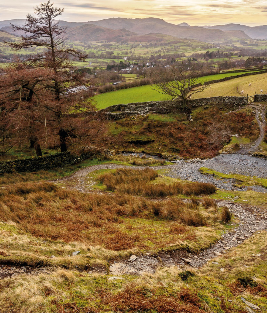
Path junction at Gate Gill below Blencathra.
Credit: Ian Battersby
4. NY325262: The path follows the wall east-north-east to Doddick Gill, where it climbs sharply north just after the beck, continuing east-north-east to Scaley Beck where a short but awkward scramble crosses the gill. Continue to contour alongside the wall for another 300m to a junction of paths. Turn right, dropping south to meet the first path at the gate. Drop south to the layby.
Further information
PUBLIC TRANSPORT: No public transport to start, however, Stagecoach buses X4 and X5 stop at Threlkeld only a short distance from the route.
TOURIST INFORMATION: Keswick, 0845 901 0845
NEAREST YHA: YHA Skiddaw Bunkhouse


