
Walk the coastline of an entire island nation spilling over with wildlife, mythology, rollercoaster sea-to-summit days and ambles along quaint seaside towns on the Isle of Man’s Raad ny Foillan – the Way of the Gull. Francesca Donovan is your guide to circumnavigating this treasure island.
Raad ny Foillan is the closest you’ll get to that carefree holiday feeling while journeying miles and miles on foot every day. Part rambling adventure, part waterside rest, The Way of the Gull – the official Manx coastline walking route which celebrates its 40th birthday this year – is a summertime adventure for grown-ups who don’t want to feel too grown up.
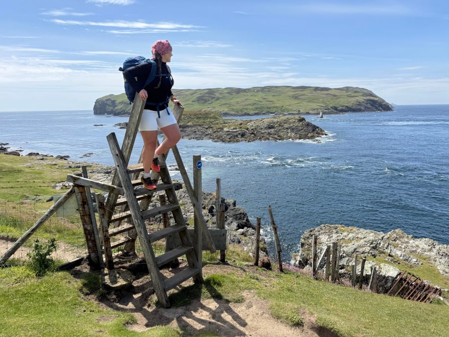
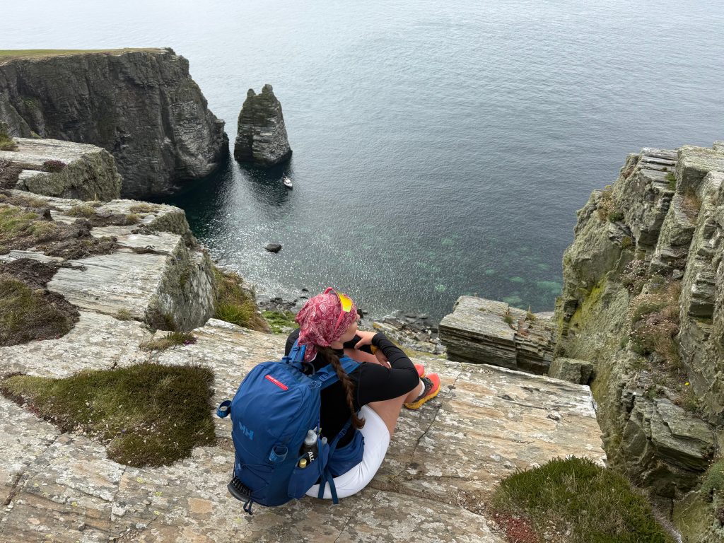
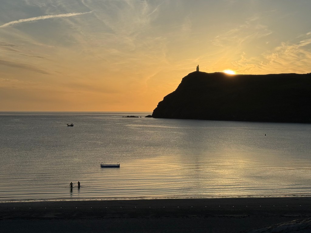
Main image: Walking past the Calf of Man on the southern edges of Raad ny Foillan | Credit: Francesca Donovan
Raad ny Foillan’s route has the potential to make even the most dedicatedly stoic hillwalker feel as though they’ve stepped onto the pages of The Famous Five. And when you delve a little deeper into the island’s history, it’s easy to understand why. When smuggling fell out of fashion, the Isle of Man turned to tourism. Thus, the 100-mile (160km) coastline, dotted with wild sea-carved caves cut into towering Manx slate cliffs, is also home to pockets of civilisation guaranteeing you a warm welcome at the end of a long day’s walk.
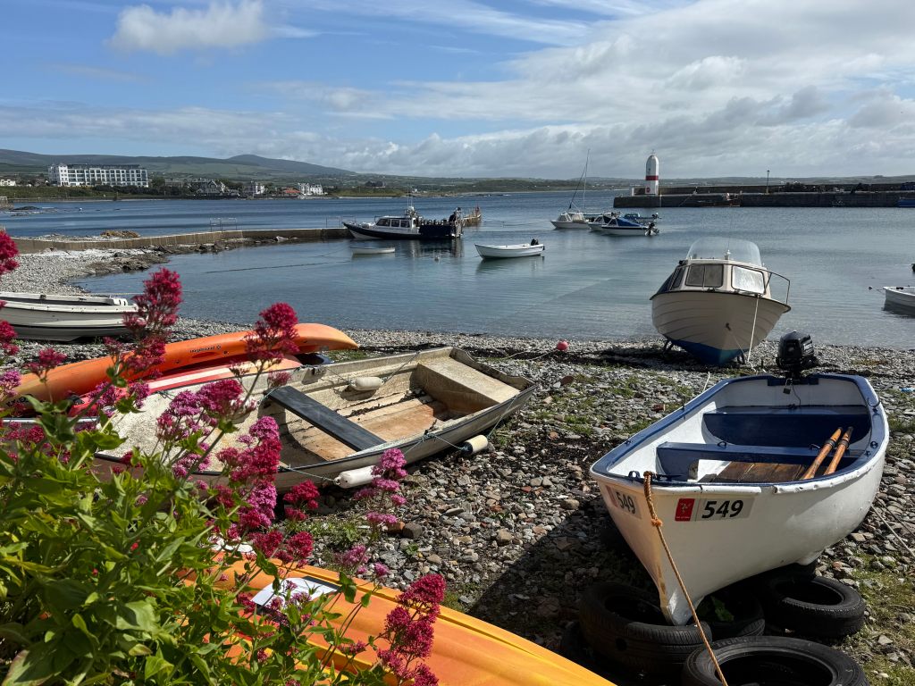
For some, life on the island still centres around colourful fishing villages like Port St Mary. Credit: Francesca Donovan
From the rolling green hills reminiscent of mid-Wales by way of turquoise waters lapping at stoney beaches beyond colourful bayside towns the likes of which wouldn’t look out of place on a postcard from the Scotland islands, Raad ny Foillan feels decidedly un-English in the best possible way – although the heathery hills and peatland did remind me of my Peak District home.
Politically independent from the UK, the Isle of Man is a fact-finder’s dream – a place of firsts. It is the first entire jurisdiction in the world to be named a UNESCO Biosphere Reserve, and with marine nature reserves covering 11% of Manx waters, this is birding and wildlife watching paradise.
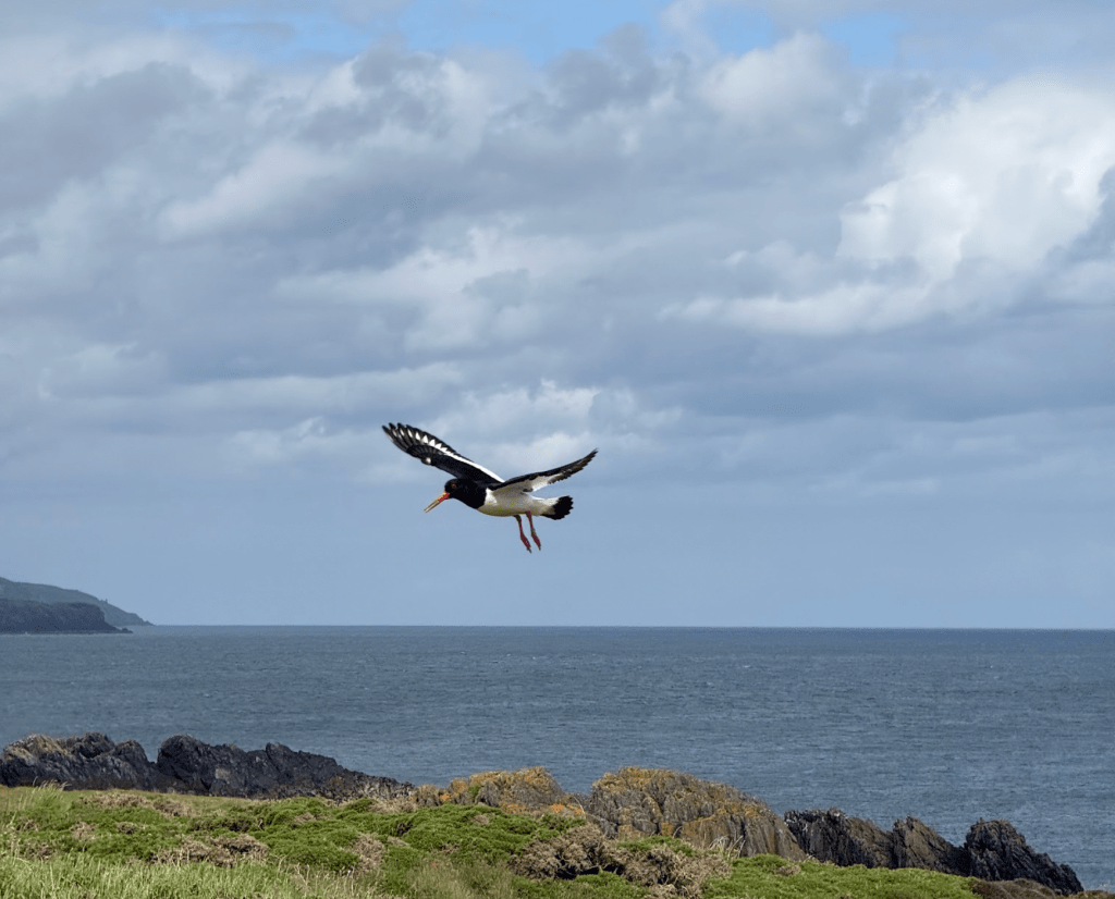
An oystercatcher flies over Langness Nature Reserve, managed by Manx BirdLife. Credit: Francesca Donovan
If it’s human history you’re keen on, the Isle of Man’s heritage far exceeds the expectations of its square footage. It is home to its own parliament called Tynwald – said to be the oldest continuous parliament in the world thanks to the Viking settlers who dropped in from the Irish Sea over 1000 years ago. Isle of Man was also the first to give women (albeit only those who owned land) the vote in 1881.
Moreover the Manx dedication to folklore and mythologies which still shape modern living – more on those later – will enliven your curiosity along Raad ny Foillan as well as your calf muscles as you move through this treasure of an island.
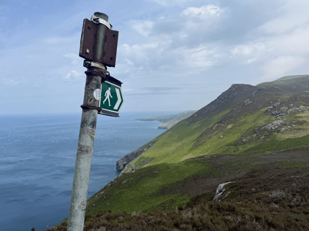
The distinctive gull signposts the way from Lihiattee ny Beinnee to Crock ny Arrey Laa. Credit: Francesca Donovan
Here’s The Great Outdoors‘ guide to Raad ny Foillan, featuring helpful tips on the following:
- Route details
- When to go
- Myths and legends
- Transport
- Accommodation
- Resupply
- Essential gear
- Useful Manx phrases
- Further resources
Raad ny Foillan: at a glance
Start/Finish: Douglas, Isle of Man | Distance: 100 miles / 160km | Ascent: 13,195ft / 4022m | Duration: 8-12 days | Maps: OS Landranger – sheet 95 – Isle of Man (1:50k) or HARVEY Superwalker – Isle of Man (1:30k)
The Route
If variety be the spice of life, Raad ny Foillan is coastal walking at its most seasoned. From one day to the next, you might find yourself on vast swathes of remote beach, walking high on heathered hills, swimming in a secluded crystal-watered bay, or enjoying a lunch break at a bustling harbour hostelry.
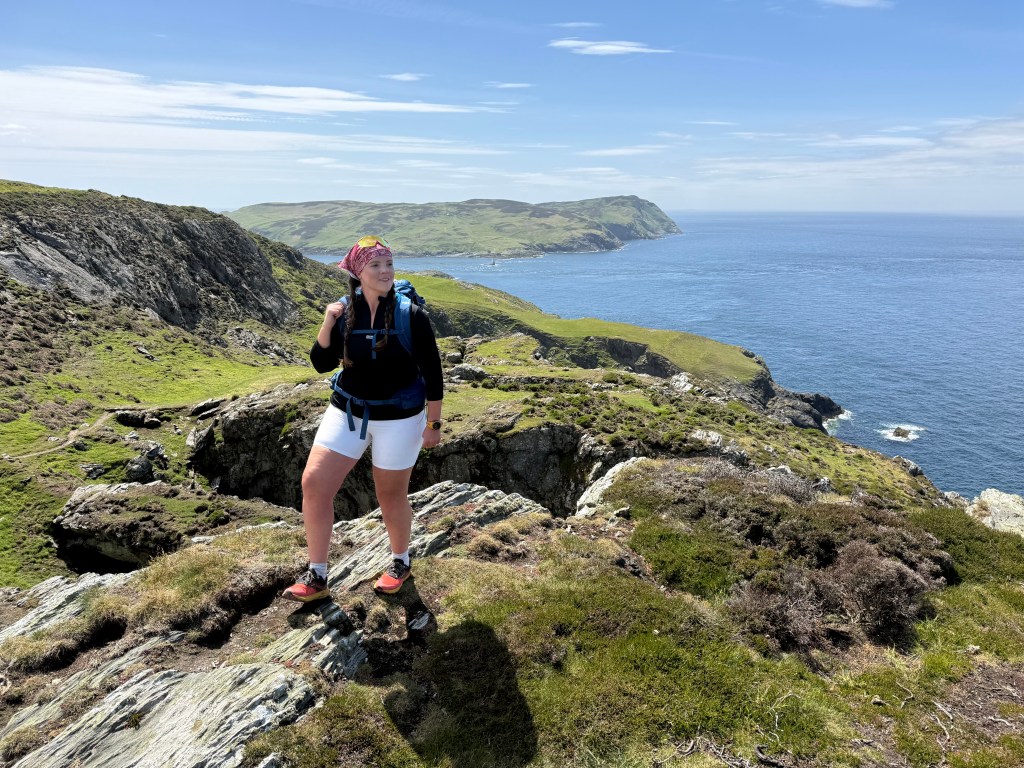
The route is broken down into 12 day walks – but you could easily tack a shorter mileage day onto another to compress your schedule. Raad ny Foillan is usually walked clockwise starting in the capital of Douglas – although the island isn’t as wide as it is long so it’s relatively straightforward to choose your own adventure and pick the sections which feel right for you.
Looking down on the Sugarloaf. Credit: Francesca Donovan
Head south for birdwatching at Derbyhaven and brightly-coloured bayside Victorian terraces in Port St Mary. The island’s coast is a haven for kayakers and paddleboarders but you’ll get a bird’s eye view of the sea caves and stacks they like to explore from land, too. The Anvil and the Sugarloaf are worth taking time to admire on your steep ascent to the Chasms as you head further south from Port St Mary. The thousands of birds that call these stacks home will whet your appetite for wildlife watching to come at the Calf of Man, the southernmost tip of the island.
A word to the wise for your four-legged companions: the section from The Calf of Man northwards into Port Erin is a permissive path on which the landowner has prohibited dogs.
Raad ny Foillan runs underneath Meayll Hill along some exhilarating sea cliff paths – but dogs are not permitted on this section. Credit: Francesca Donovan
There is no alternative route but for an A road with no pavement. This is a shame as its one of the most exhilarating sections of the Raad ny Foillan, peppered with volcanic limestone rock formations over which to clamber as, on a clear day, you enjoy views to the Mourne Mountains.
Contemporary beachfront living awaits at Port Erin – so you can rest up before you hit the rollercoaster of hill and cliff paths along the west coast where you’ll reach the highest point of the Raad ny Foillan: Cronk ny Arrey Laa (421m). Head down to sea level to sit and swim a while at the breathtakingly beautiful pebbly bay at Niarbyl, before continuing north into Peel, where one of the many well-preserved castles on the island looms large over the beach town.

A cool-off in Niarbyl Bay. Credit: Francesca Donovan
Continue northwest with the Irish sea on your left and deep glens to your right through Kirk Michael, Jurby and on into the Ayres, a nature haven for ground nesting birds. Along beaches and boardwalks, you’ll journey up to the Point of Ayre lighthouse. The northernmost tip of the island, it is a particularly peaceful place.
If history and heritage is your thing, you’ll enjoy the latter quarter of the clock face from Ramsey into Maughold – the area most associated with Viking settlers – and then onto Laxey, a popular beach day trip for Douglas residents. Besides the beach, it’s also home to the Victorian-era Great Laxey Wheel, the largest working water wheel in the world.
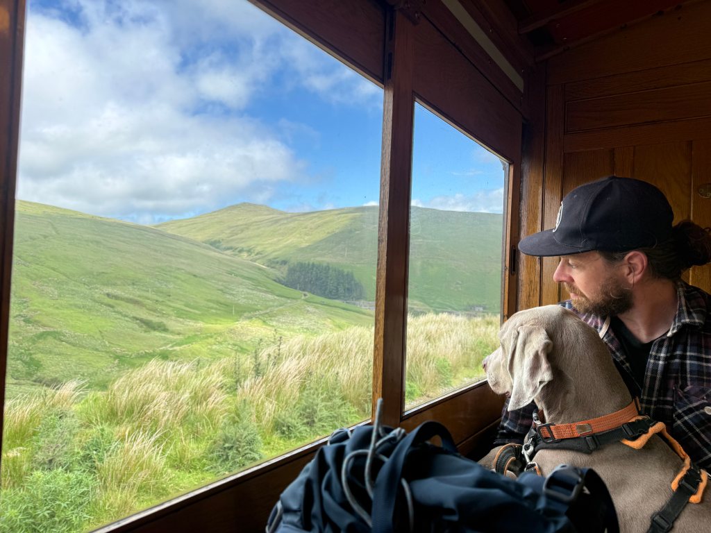
A jaunt up to the island’s high point via electric rail. Credit: Francesca Donovan
When to Go
I walked the Raad ny Foillan just a week after the world-renowned Isle of Mann TT (Tourist Trophy), a motorbike time trial spectacle featuring top speeds of 140mph. While the event duration is to be avoided – the island closes off some of the road sections along the route – the ensuing downtime is a boon for walkers on a go-slow mission!
Spring and summer on Raad ny Foillan are idyllic. While the weather on this maritime island is ever-changeable, this is your best shot at getting out from under Manannán’s Cloak – the name given to the sea mists that roll onto the island by locals even today. According to Manx folklore – and the brilliantly quick-witted landlady at The Castle Inn in Castletown – Manannán mac Lir is the sea god, guardian of the Isle of Man, and a master of trickery who throws this shroud over his kingdom to protect it from evil. It’s a charming way to look on the bright side of gloomy weather, in my opinion.
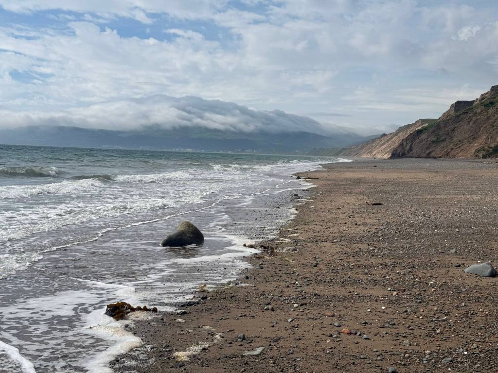
The five-mile-long stretch of beach along Ramsey Bay, Snaefell under Manannan’s Cloak in the distance. Credit: Francesca Donovan
While some islanders joke that the gorse will cease to glow yellow when kissing goes out of fashion, springtime also sees the uplands spotted with bog cotton. Listen out for the peeps of oystercatchers, cormorants drying their feathers on the volcanic rock shores, and herons gliding over sands. Seal spotting is made simple by the vast colonies at the Calf of Man and much of the volcanic southern coast. Watch them sunbathe and swim, their honks easily heard over the sound of waves crashing. Basking sharks can also be spotted from shore when the waters warm.
If you have enough time to venture off the trail and into the islands’s 18 abundant national glens, head there for spring bluebells and woodpeckers or wait until the autumnal colours and rushing falls will delight the senses.
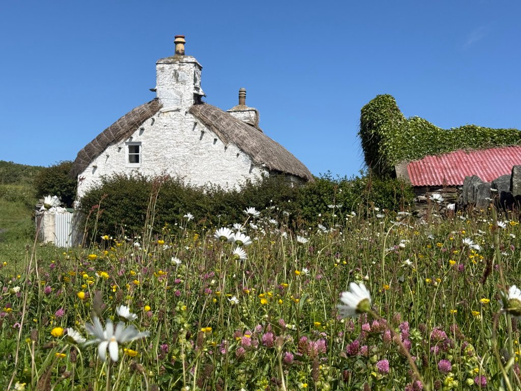
One of the thatched cottages at Creagneash. Credit: Francesca Donovan
Autumn is also a special time culturally, as people celebrate Hop tu Naa – or Manx Halloween – which is thought to be the oldest continually observed tradition on the island. Linked to Samhain, the celebratory singing and dancing takes place at Cregneash, a tiny village of lovingly-restored National Heritage thatched houses, some of which now host a cast of characters at the living museum. This charming hilltop Manx stronghold is well worth stepping off the trail to visit, if only for the views over the Calf of Man.
A wild and windswept winter Raad ny Foillan may draw you in. You’ll still have the chance to see rare choughs all year round as well as harbour porpoises, bottlenose dolphins, the iconic Tailless Manx cat – stumpies or rumpies, depending on the length of their short or non-existent tails – as well as the four-horned Manx Loaghtan sheep, a living relic of the livestock brought over by Viking settlers. But beware of wind gusts and wild weather on the vertiginous west coast cliffs.
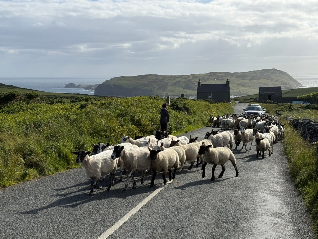
Traffic at Cregneash. Credit: Francesca Donovan
Myths & Legends
You’ve probably heard of the Fairy Bridge on the road out of Douglas. It is bad luck (and bad manners!) should you fail to say hello to the mooinjer veggey (translated from Manx to mean little people) who are said to live here. You may even have heard of the Moddey Dhoo, the phantom black dog and a harbinger of death who supposedly haunts Peel Castle. But the myths and legends go so much deeper for the warm, hospitable people I met on this island nation.
Many of the traditions and folkloric stories, based on the island’s rich Norse history, still shape daily life here. The island’s flag itself has a unique story to tell. A triskelion – three armoured legs with golden spurs arranged into a ceaseless march – is accompanied by a phrase translating loosely to: “Wherever you throw it, it will stand”. It’s one to keep in mind if you’re needing to channel the Manx resilience on your big walk.
Coming into Douglas on the Steam Packet. Credit: Francesca Donovan
Transport
For those who like to be on the sea as well as alongside it, travelling by ferry on the Steam Packet from Liverpool (boats also sail from Heysham) kicks off your adventure with a dash of nostalgia. But if you really want to sail back through time to yesteryear, the east coast is served by a variety of heritage electric tramways and steam trains.
Should you be tired of walking by the end of your circuit, the journey from Laxey into Douglas – by way of Snaefell, the island’s highest point at a modest 621m – is a charming alternative. For those in need of speedier transport, the island is well served by busses and taxis. I used the responsive OPUL taxis – and as always, local cabbies provided insight far beyond that found in any guidebook.
Walking down into Port Erin, South Barrule beyond. Credit: Francesca Donovan
Accommodation
Raad ny Foillan drops you down to sea level at the end of each day section. With one or two more remote exceptions (Niarbyl, Jurby, Point of Ayre and Maughold) these fishing villages and thriving towns offer plentiful accommodation options, from self-catered apartments and cottages by way of BnBs, guesthouses and pub rooms. There are plenty to choose from via Island Escapes. It would be simple enough to tackle Raad ny Foillan with a twin or triple centre approach, walking out from your accommodation each day.
Wild camping is illegal but mostly tolerated if you are discreet and follow Leave No Trace principles. Campsites are also dotted along the coastline, if sometimes a little way inland.
End of day at Port Erin. Credit: Francesca Donovan
Resupply
You’re never too far from a cafe, groceries, or an eatery on Raad ny Foillan, especially on the east coast. It’s worth stopping off at one of the many coastal pubs to sample local fare. Manx kippers and Queenies (a small scallop) doused in butter will hit the spot post-walk.
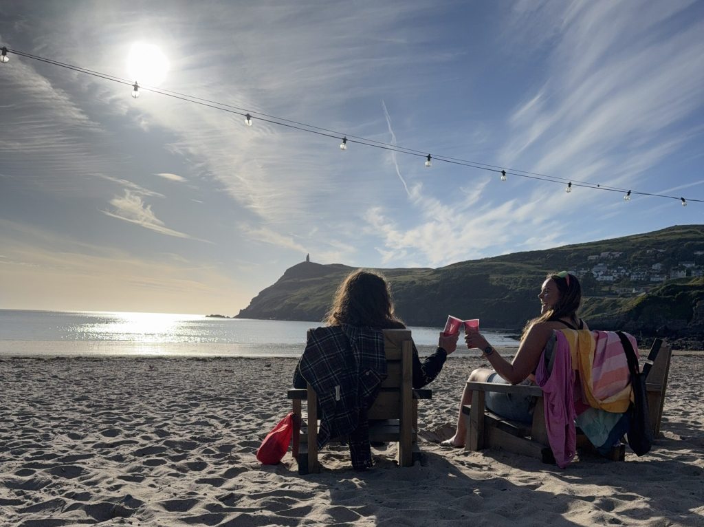
Sundowners courtesy of Foraging Vintners (at the Cosy Nook). Credit: Francesca Donovan
Recommended waterside watering holes are Foraging Vintners (at the Cosy Nook) on Port Erin for sundowners and The Creek Inn at Peel for great local food. Winter opening hours across the island will affect your ability to resupply so keep this in mind for an out-of-season Raad ny Foillan.
Essential Gear
This is not a technical trail. The Way of the Gull is accessible to most walkers with good hill fitness, sure-footedness, and a head for heights in order to tackle the rollercoaster of cliff paths on the west coast. I walked the Way in trail runners which kept me sufficiently nimble and airy on long 20-mile days with elevations of up to 4000ft.
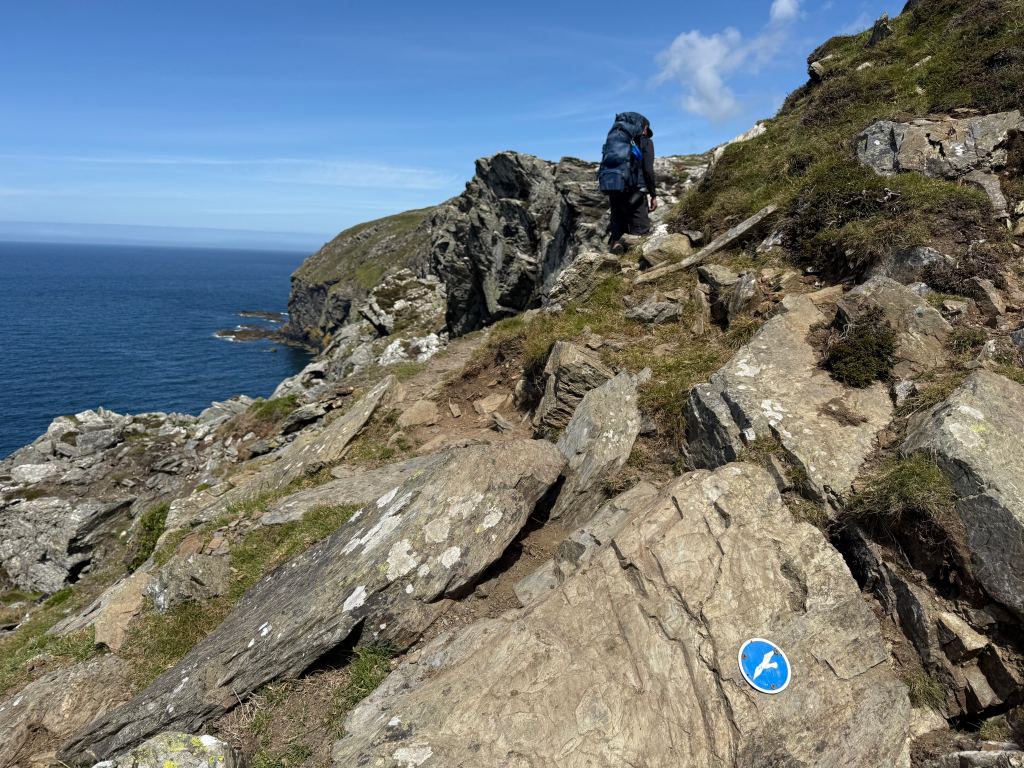
The most technical terrain is short-lived above Aldrick. Credit: Francesca Donovan
Others may prefer traditional walking boots for occasional stoney beaches and peaty uplands. There are long stretches of coastal road walking as well as boardwalks in the north so it’s essential you break in your footwear.
A wind and waterproof jacket and ideally trousers must be carried. There is no summit forecasting from the Met Office – but for a few webcams you can check – and conditions can change dramatically from one side of the island to the other so be prepared for any weather eventuality. The air is clear here so suncream is essential – those UV rays can get to you even on cloudier days.
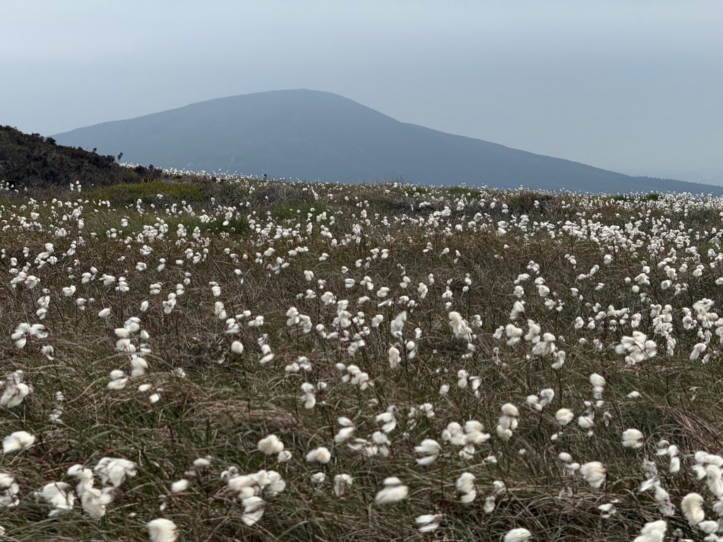
The trig on Crock ny Arrey Laa, strewn with cotton grass, South Barrule beyond. Credit: Francesca Donovan
If backpacking, you’ll need to test your sleep system and shelter in advance and ensure it can withstand wind gusts. As always, when carrying heavy loads, I’d recommend trekking poles to ease joint pain on the long days. While resupply options are good on some day sections, you’ll still need to ensure you pack enough water and food.
While you may assume that route finding is simple (“just keep the water on your left!”) a map and compass – or your navigational tool of choice – is essential. Sporadic waymarkers do help but, as the path celebrates its fourth decade, some are a bit weather beaten and Raad ny Foillan doesn’t always follow the obvious route along the true coast.
Manx phrases to use on the Raad ny Foillan
- Moghrey mie (morr-a my) = good morning
- Fastyr mie (fass-ter my) = good afternoon/evening
- Gura mie ayd (gurr-a-my-edd) = thank you
- Slane lhiat (slenn-l’yatt) = goodbye
- Cair vie (kair vee) = fair wind, meaning safe travels
- Traa dy liooar (tra-tha-l’yoor) = time enough; a nod to island leisure or a suggestion to take it easy
- Goll as gaccan (gull-as-gag-un) = going and grumbling; a tongue-in-cheek reply to “how are you?”
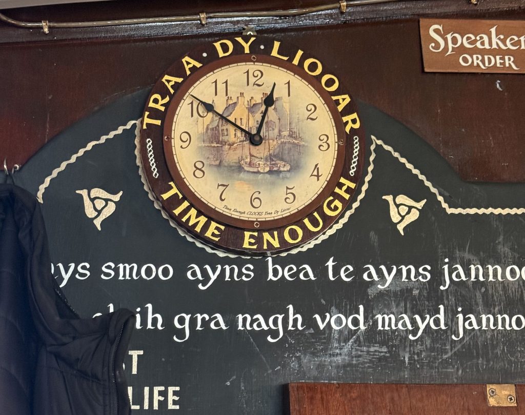
The Manx language still holds so much meaning to islanders. Credit: Francesca Donovan
Raad ny Foillan: Further Resources
Cicerone Press publishes the Isle of Man Coastal Path by Aileen Evans which breaks the circular into nine daily stages. Long-time resident Alan Cooper’s guide, Isle of Man Coastal Path Raad ny Foillan Way of the Gull, is also a worthy read. The Wild Guide Isle of Man: Great Adventures, Hidden Places and the Good Life gave me plenty of adventure inspiration for the future, from trail to water to glen, when I’ve no doubt the call of the island gulls will see me return.
For further assistance on sections and accommodation options, go to visitisleofman.com.
Discover more long distance trails as mapped by our expert contributors.


