
Richard Hartfield links these Cumbrian Tops on a high-level circuit of the Howgills 2000s.
Often overshadowed by the neighbouring Lake District and Yorkshire Dales, the Howgills offer a sense of space and remoteness that feels increasingly rare. Many readers will have driven past on the M6 without ever stopping to explore this surprisingly wild landscape of sweeping ridges and deep, secluded valleys. This high-level circuit links all of the Howgill 2000-foot tops in a single, committing journey. Traditionally, the challenge is to complete the round within nine hours. At around 27km with 1500m of ascent, this offers a satisfying adventure sitting neatly between brisk hillwalk and steady fell run. Predominantly grassy terrain allows for efficient movement, while the scale of the hills and cumulative ascent demand sound pacing and navigation.
From farmland above Longdale, the route climbs steadily over high ridges, culminating on The Calf. A memorable traverse above the falls of Cautley Spout is then followed by steep climbs over Yarlside, Kensgriff and Randygill Top. After descending into the secluded valley of Bowderdale, a final ridge traverse leads back into Longdale. With little vegetation to interrupt the views, the dramatic shapes of the hills and shifting light take centre stage throughout.
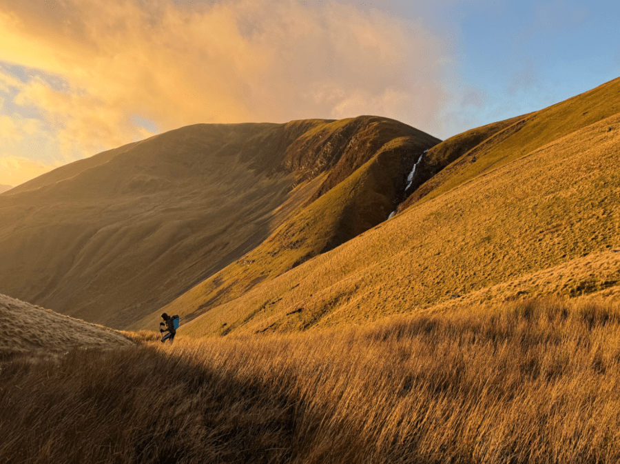
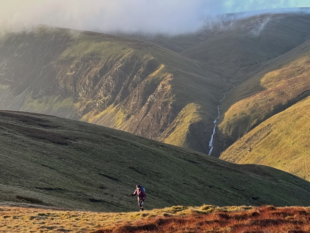
Main image: Looking back from Bowderdale Head toward Cautley Spout | Credit: Rich Hartfield
Howgills 2000s: route guide
Start/Finish: Roadside parking at the bridge in Gaisgill – please park considerately (NY640053) | Maps: OS Landrangers 98, 97, 91 (1:50k) or OS Explorer OL19 (1:25k) | Total ascent: 1500m / 5000feet | Total distance: 27km / 17 miles
1. NY640053: Follow the lane SE from Gaisgill bridge before turning right beside a barn to follow a rough track through gates into the upper fields of Longdale. Please proceed discreetly here, avoiding disturbance to livestock and be prepared to choose an alternative start if access conditions change. Follow the eastern side of Langdale Beck, ascending gently up the lightly-forested valley to reach an old stone footbridge.
2. NY647026: Cross the footbridge and climb the broad, grassy spur above, passing the trig point on Middleton before continuing easily onto the summit of Simon’s Seat. As height is gained, the full sweep of the Howgills opens out- deep valleys, smooth ridges and an immediate sense of space and solitude. A sharp dip and a climb SW leads on to Breaks Head.
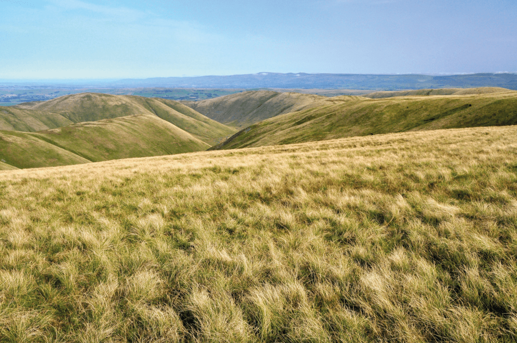
View looking north from The Calf with the North Pennines on the far skyline. Credit: Roger Butler
3. SD654985: Make a short out-and-back detour SW to the summit cairn on Fell Head. Back on the main ridge, continue easily over Bush Howe to reach The Calf – the high point of the Howgills and a superb viewpoint over the surrounding Lake District and Yorkshire Dales.
Descending from Great Dummacks towards Cautley Spout. Credit: Rich Hartfield
4. SD667970: From the trig point on The Calf, descend SE on a wide gravel path to a col. Leave the path briefly to reach the summit of Bram Rigg Top, then rejoin it and continue south to the cairn on Calders. Continue NE along the edge of the summit plateau to reach Great Dummacks.
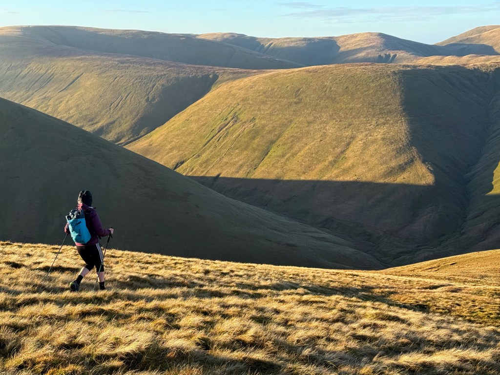
Contouring beyond Cautley Spout towards Bowderdale Head. Credit: Rich Hartfield
5. SD678963: Descend the northern spur of Great Dummacks, following the rim of a deep corrie sliced by the cascading falls of Cautley Spout. Cross the beck above the falls, then descend slightly on a well-worn path before contouring NE at around 450m to Bowderdale Head beneath the Yarlside. From here, the narrow falls of Cautley Spout finally come into view.
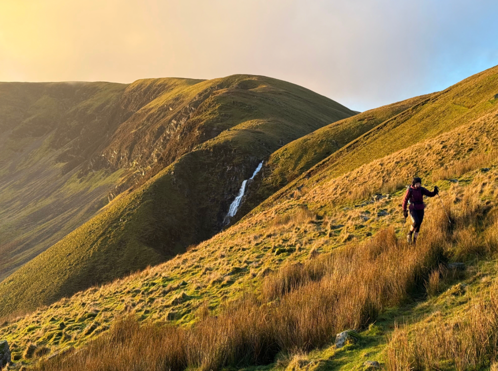
Ascending towards Yarlside. Credit: Rich Hartfield
6. SD681979: Make a steep, rising traverse NE onto the slopes of Yarlside and enter the gentle, grassy gully above. Follow the gully on a faint trod that zigzags steeply upwards. When the gully fades away, keep climbing E to a col, then ascend N to arrive on the summit of Yarlside.
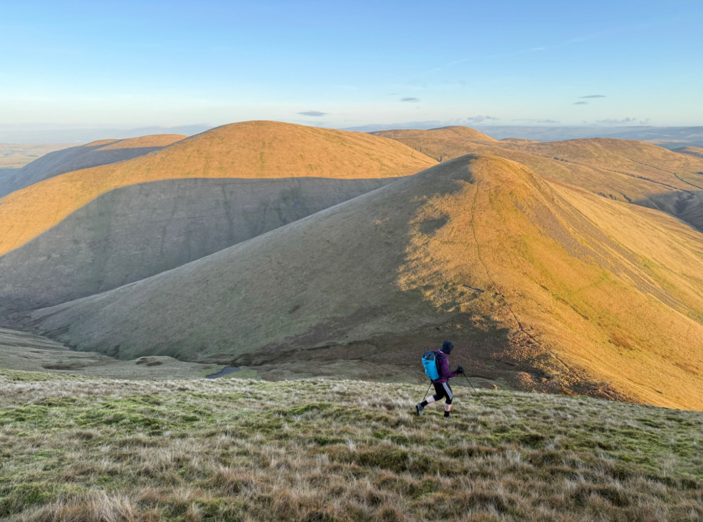
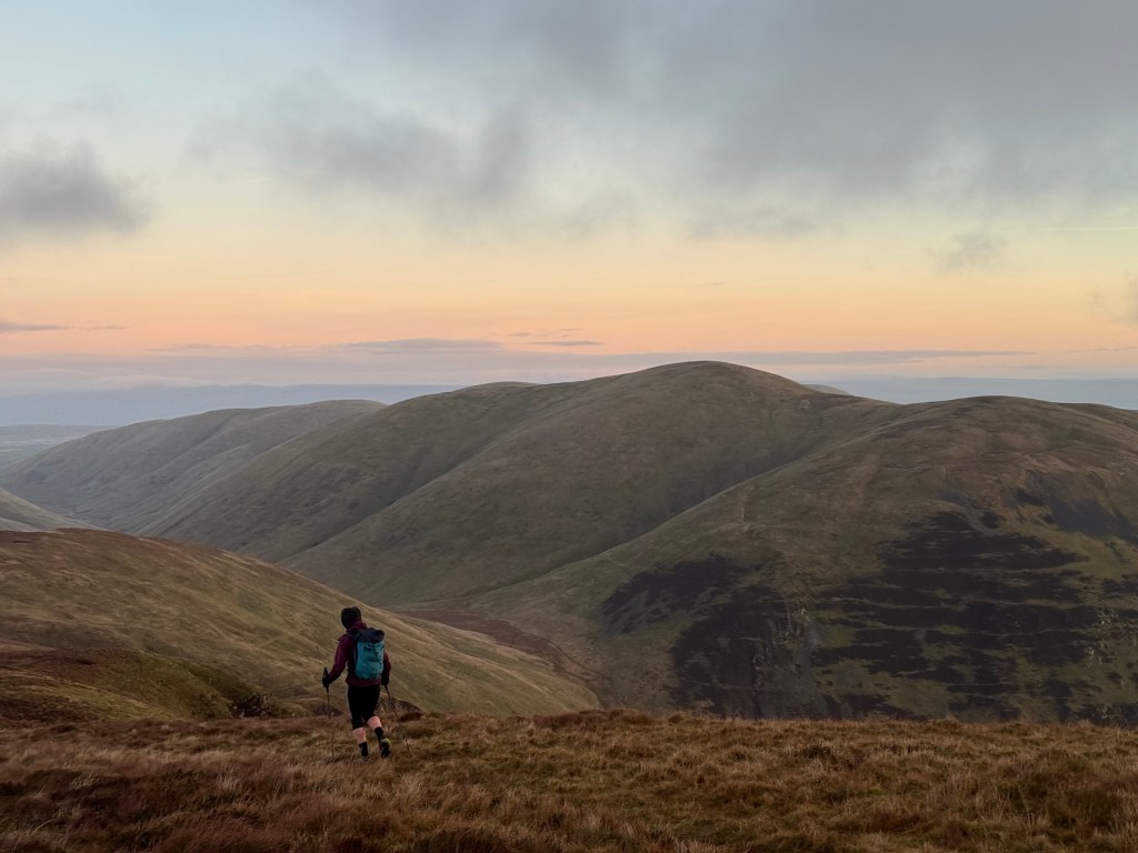
Descending from Yarlside towards Kensgriff and Randygill Top. Credit: Rich Hartfield
Descend along the summit crest NNW for about 150m. As the crest curves NW, break out right and carefully descend the steep grassy slopes NE, avoiding any scree patches to reach the saddle beneath Kensgriff. Climb Kensgriff and descend its gentle NE ridge, before tackling the next steep ascent onto Randygill Top.
Descending Randygill Top into Bowderdale. Credit: Rich Hartfield
7. NY687000: Descend the SW spur of Randygill Top, which is quite gentle initially, but soon plunges down into the wild and peaceful Bowderdale. The valley floor is reached at the confluence of three winding becks. Sheltered and seldom visited, this place feels far removed from roads or settlements. Cross the becks with care, walking upstream if necessary, then follow a rough path down the valley for around 500m. Once just beyond an old sheepfold on the opposite side of the beck, break out left and climb W past another sheepfold. Next, make a steep, rising traverse NW to gain the broad ridge above.
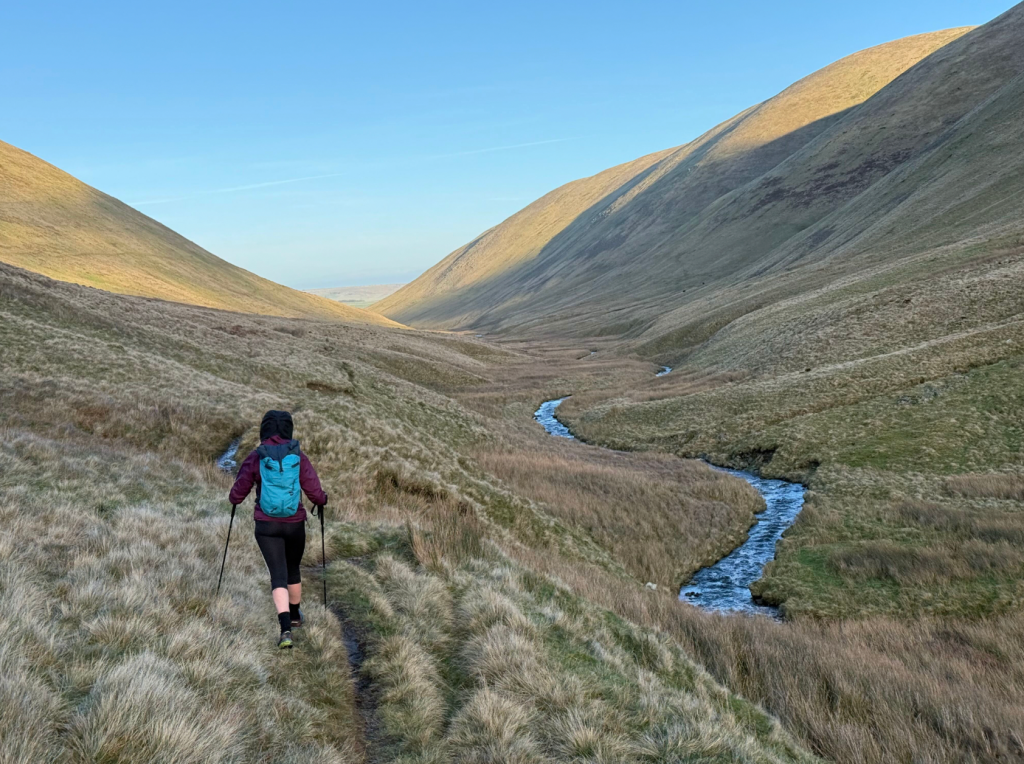
Walking beside Bowderdale Beck. Credit: Rich Hartfield
8. NY672006: Follow the Dales High Way NNW to the broad summit of West Fell. As the summit plateau begins to fall away to the north, descend SW to pick up a muddy quad-bike track beneath the eastern side of Langdale Knott. Follow this to make a gentle ascent onto the summit, where navigation could be tricky in poor visibility. Descend the widening spur, keeping NNW for 1.5km to cross a beck beneath a ruined barn. Pass the barn and follow Cowbound Lane – a vague, boggy trod across fields – back down to Longdale.
Further information
Public Transport: No public transport available.
Information: Sedbergh Information Centre (01539620125)
Our experts have mapped out more of their favourite UK mountain challenges here.


