
Here at The Great Outdoors, we often advocate for the mountains as places to walk through in harmony rather than as realms of upland to conquer and push yourself to your limits. But there’s no doubt that our peaks do present an opportunity to challenge ourselves that is sometimes irresistible. Perhaps you’re working through a tick-list of Munros or Wainwrights as a means to explore places previously beyond your radar. Perhaps you want to take on an ultra in support of Mountain Rescue. Perhaps you simply want an excuse to spend blissfully long hours in the hills. One of these big mountain challenges may just have what you’re looking for.
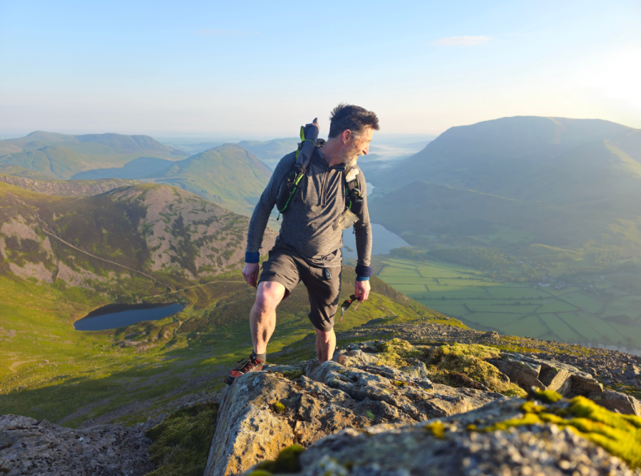
Main image: From High Stile, looking down to Bleaberry Tarn on the Lakeland 800s | Credit: Norman Hadley
Our pro-picks of the best UK mountain challenge routes
- Cairngorms 4000s
- Durham Dales 30
- Lakeland 3000s
- Lakeland 800s
- Howgills 2000s
- Peak District 9 Edges
- The Edale Skyline, Peak District
- Surrey Three Peaks
Cairngorms 4000s
Simon Stokes explores the vast plateau (plus an extra Munro!) on an epic route of the the Cairngorm 4000s.
START: Sugar Bowl car park / FINISH: Cairngorm Ski Centre | MAPS: OS Explorer OL57 (1:25k), OS Land ranger 36 – (1:50k), Harvey British Mountain Map XT40 – Cairngorms & Lochnagar (1:40k) | DISTANCE: 36km (22 mi) | ASCENT: 2586m (8484ft) | DURATION: 14-19 hours
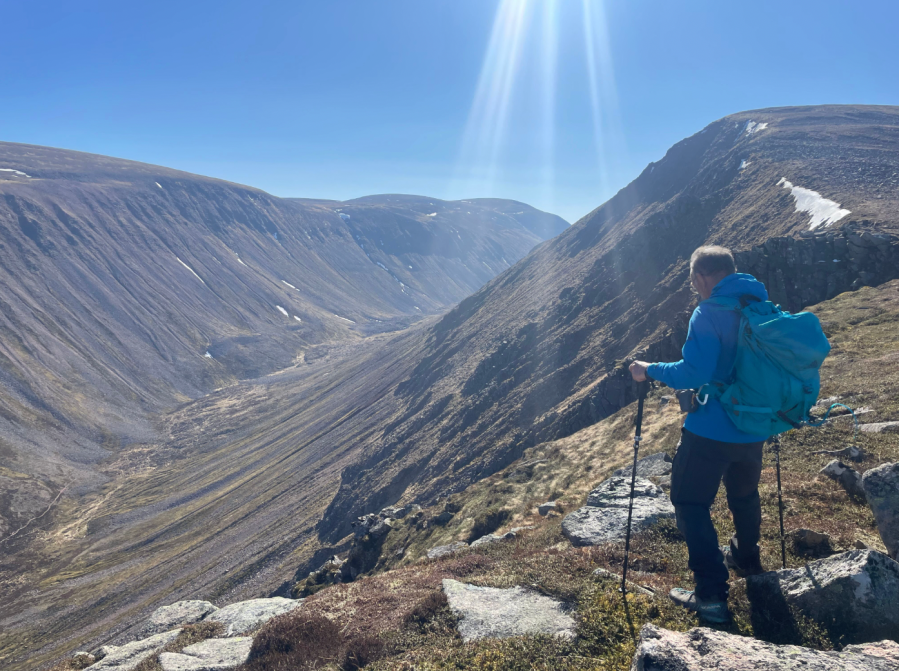
The Cairngorms plateau is one of our most magnificent upland areas. The highest ground in the UK, it is home to rare alpine creatures from snow bunting to mountain hares. Climbing the major peaks in this remote region requires a long trek. Many “Munro baggers” manage to summit only one or two in a day, pressed for time and compelled to retreat. However, with a good level of hill fitness and long daylight hours, you can feasibly climb the second, third, fourth, fifth and sixth highest mountains in Scotland – the Cairngorm 4000s – in one epic day should you be up for a challenge, checking off five Munros – Cairn Gorm, Ben Macdui, Cairn Toul, Sgòr an Lochain Uaine, and Braeriach. There is a quick detour to bag The Devils Point for a sixth Munro, if you have time and energy.
This route will appeal to tick-list efficiency seekers. After some serious milage and ascent you’ll have explored iconic peaks, colossal Coires, and breathtaking passes. Should you want to split the miles over two days, Corrour bothy is beautifully (and handily) situated close to the halfway point.
MAPPED GUIDE: get your full route guide to the Cairngorms 4000s
Durham Dales 30
Ian Battersby teases out a trial for weary legs on the Durham Dales 30.
START/FINISH: Wolsingham Bridge; GR: NZ074369 | MAPS: OS Explorer OL31 (1:25k), OS Landranger 92 (1:50k) | DISTANCE: 47.8km / 29.7 miles | ASCENT: 1,330m / 4,364ft | DURATION: Beat 12.5 hours for the certificate otherwise 14.5 hours
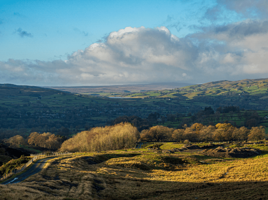
County Durham is home to a paltry handful of dales, and this route samples only two, but Teesdale and Weardale are the most prized pair in these parts. Between them lie sinews of heather and moist mounds of moss that must be crossed to connect the communes of Wolsingham and Middleton-in-Teesdale. The Long Distance Walkers Association have devised this 30-mile ordeal (shorter substitute available) and set a route that tests the mettle and a navigational sliver of brain too. They call it the Durham Dales 30 Challenge.
Though old lead mining tracks are exploited for speedy surges, these can wither to paths, which sometimes snuff it all together in the heather. Compass or GPS are vital. The upland sweep also features Durham’s foremost forest at Hamsterley, boasting 2000 hectares of conifers mixed with swathes of assorted broadleaf.
The rivers themselves are sprightly upland streams treasured by trout and grayling. Even occasional salmon and sea trout may gamble on breeding here under the scrutiny of cormorants, otters and kingfishers. Surrounding these are verdant pastures scattered with countless farmsteads and associated tiny hamlets. Self-support anytime or join the LDWA experts on 13th June 2026.
MAPPED GUIDE: get your full route guide to the Durham Dales 30
Lakeland 3000s
James Forrest bags all four of the Lakeland 3000s – Scafell, Scafell Pike, Helvellyn and Skiddaw – in a single route.
START: Seatoller National Trust car park, CA12 5XN (GR: NY245137) | FINISH: Keswick town centre, Station Road, CA12 4NA (GR: NY267234) | MAPS: OS Explorer OL04, OL05 and OL06 (1:25k), OS Landranger 89 & 90 (1:50k), Harvey Maps British Mountain Map Lake District (1:40k) | DISTANCE: 60.6km / 37.7 miles | ASCENT: 3,883m / 12,740ft | DURATION: 1-3 days
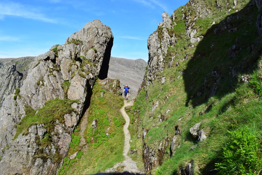
In the mighty Scottish Highlands there are 282 peaks – the iconic Munros – over 3,000ft. By comparison, England is a lowly country: there are only four 3,000fters. Let’s clarify that assessment quickly, before the naysayers claim there are more. Generally speaking, Symonds Knott, Broad Crag, Ill Crag and Helvellyn Lower Man are classed only as subsidiary tops – not mountains in their own right. So that leaves us with a famous English foursome rising above the magical 3,000ft mark: Scafell, Scafell Pike, Helvellyn and Skiddaw – the Lakeland 3000s, in other words.
Ticking them off in a single route is a bucket-list mountain challenge: a Lake District Four Peak challenge, if you like. One option is to complete a full high-level loop from Keswick, but perhaps a better option is an anti-clockwise, 60km itinerary from Seatoller to Keswick. Very fit hikers can attempt to complete the Lakeland 3000s in one extremely arduous outing. Otherwise the trip can be beautifully split into a wild camping expedition, with overnights at Angle Tarn and High Rigg. Either way, it’s a grand adventure.
MAPPED GUIDE: get your full route guide to the Lakeland 3000s
Lakeland 800s
Norman Hadley maps a long, Lakeland gaunlet and creates a new challenge for you: the Lakeland 800s, aptly dubbed the Hadley Round.
START/FINISH: Keswick Moot Hall| MAPS: OS Explorer Lake District OL4, 5, 6, 7 (1:25k), Harvey Ultra Map Lake District East and West (1:40k) | DISTANCE: 157 km / 98 miles | ASCENT: 10,200m / 33,500ft | DURATION: several days, depending on ability
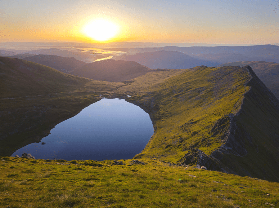
Fell-bagging challenges have been a Lakeland tradition for at least 120 years, with the Bob Graham Round still internationally famous, over ninety years on. Back when I was 14-year-old map-nerd, I devised a “Top Twenty” circuit, and there are any number of challenges, from the four three-thousanders all the way up to the full house of Wainwrights.
This route sets a metric height threshold of 800 metres, capping the number of Wainwrights at thirty-five – thus the Lakeland 800s. They’re scattered wider than Bob Graham’s tops, including a pair in the Far Eastern fells and another two in the Coniston group. Over in the northwest, High Stile, Grasmoor and Crag Hill must be visited. These hills have never felt the imprint of a Bob Graham runner’s studs. The route is a challenge on multiple levels. For mortals, it makes for a demanding few days’ walking. But the distance and altitude gain have been carefully calibrated to be just in reach of the very fastest runners in 24 hours. You, and they, can consider the gauntlet dropped.
MAPPED GUIDE: get your full route guide to the Lakeland 800s
Howgills 2000s
Richard Hartfield links these Cumbrian Tops on a high-level circuit of the Howgills 2000s.
Start/Finish: Roadside parking at the bridge in Gaisgill – please park considerately (NY640053) | Maps: OS Landrangers 98, 97, 91 (1:50k) or OS Explorer OL19 (1:25k) | Total ascent: 1500m / 5000feet | Total distance: 27km / 17 miles
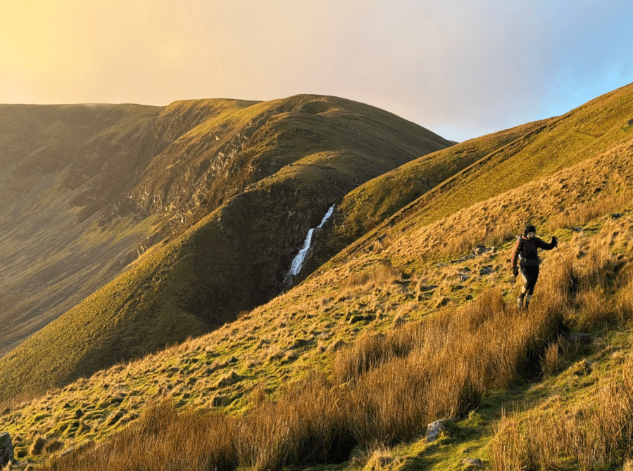
Often overshadowed by the neighbouring Lake District and Yorkshire Dales, the Howgills offer a sense of space and remoteness that feels increasingly rare. Many readers will have driven past on the M6 without ever stopping to explore this surprisingly wild landscape of sweeping ridges and deep, secluded valleys. This high-level circuit links all of the Howgill 2000-foot tops in a single, committing journey. Traditionally, the challenge is to complete the round within nine hours. At around 27km with 1500m of ascent, this offers a satisfying adventure sitting neatly between brisk hillwalk and steady fell run. Predominantly grassy terrain allows for efficient movement, while the scale of the hills and cumulative ascent demand sound pacing and navigation.
From farmland above Longdale, the route climbs steadily over high ridges, culminating on The Calf. A memorable traverse above the falls of Cautley Spout is then followed by steep climbs over Yarlside, Kensgriff and Randygill Top. After descending into the secluded valley of Bowderdale, a final ridge traverse leads back into Longdale. With little vegetation to interrupt the views, the dramatic shapes of the hills and shifting light take centre stage throughout.
MAPPED GUIDE: get your full route guide to the Howgills 2000s
Peak District 9 Edges
Chiz Dakin suggests the Peak District 9 Edges, an epic challenge route along several of the eastern Peak District gritstone icons.
START: Derwent Dam Meadow SK172896 (park at Fairholmes car park (SK172893) | FINISH: Robin Hood Inn, Baslow SK279721 (public car park at SK 280721) | MAPS: OS Explorer 01 and 24 (1:25k), OS Landranger 110 and 119 (1:50k), Harvey’s Superwalker (1:25k) Peak District Central | DISTANCE: 34 km / 21 miles | ASCENT: 785m / 2575ft | DURATION: 1 to 2 days
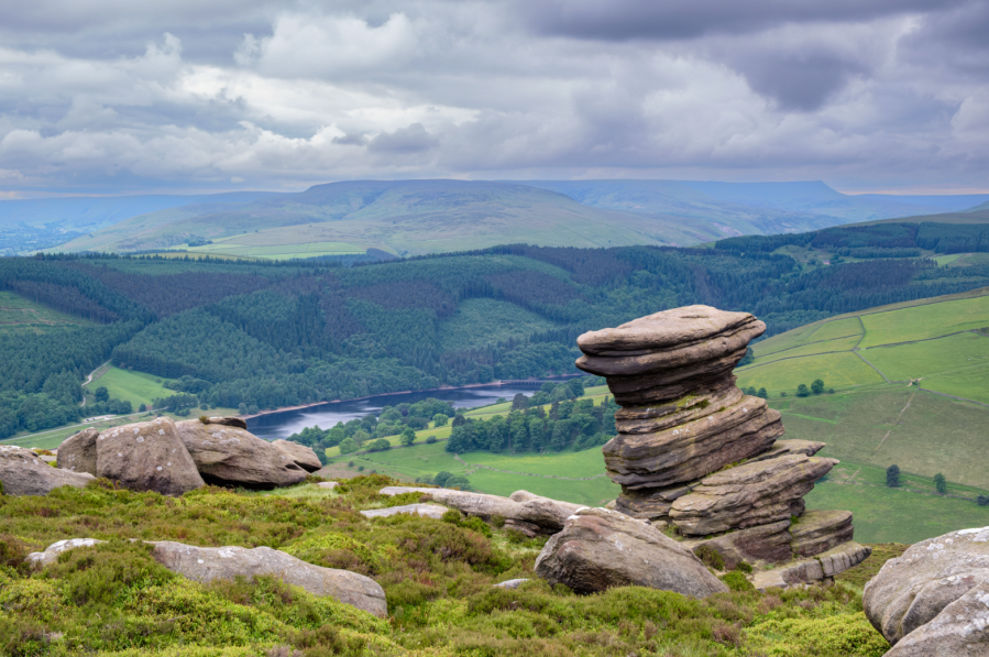
Originally devised by Edale Mountain Rescue as a challenge event which runs every September (https://edalemrt.co.uk/nine-edges/) the “Nine Edges” linear route requires excellent fitness and good navigation skills. Ideally, you’d wait for good weather and long daylight hours in order to fully appreciate the sweeping views over the Dark Peak valleys. The Peak District 9 Edges – plus a bonus tenth – respectively are Derwent, Stanage, Burbage (North and South make two edges), Froggatt, Curbar, Baslow, Blackstone, Gardom’s and Birchen. Blackstone is little-known and hidden by woodland, while Gardom’s tends to be a “climbers’ edge”. It’s mostly bypassed by challengers – unless you’re taking on the “Climber’s Nine Edges” which sees participants climb one route per edge with the exception of Blackstone.
With gritstone rock formations and resident longhorn cattle, the Peak District 9 Edges gives you a taste of the best of hillwalking in the Peak. Beware there is no public transport to the start, but there are a few refreshment options on the route including a couple of excellent pubs, such as The Grouse. If 34km is too long, it’s easy enough to split into two shorter days, breaking at The Fox House after 22km.
MAPPED GUIDE: get your full route guide to the Peak District 9 Edges
The Edale Skyline
Francesca Donovan guides you on a fine Peak District day challenge taking in the highlights of the Edale Valley.
Start/finish: Hope train station (GR: SK181832) | Maps: OS Explorer OL24 (1:25k) | Distance: 32km/20 miles | Ascent: 1096m/3596ft | Duration: 9-10 hours
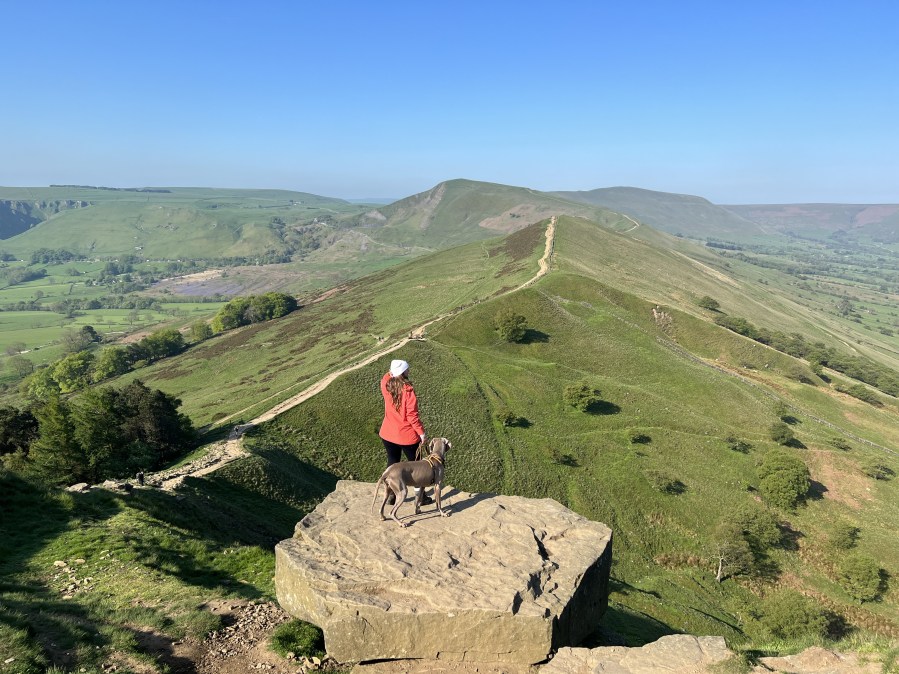
The Edale Skyline is the most fun you can have in the Peak District on two feet. That is, if you find admiring sweeping views across the most popular (read: best) hillwalking territory in our first national park fun. This route, which skirts the edges above the entire Edale valley, is a well-loved trail run; but it can be squeezed into a day of walking too. There’s only one sustained ascent and the rest of the walk involves staying high for many undulating miles.
It’s well worth the effort. On the Edale skyline, you’ll bag five trig points, enjoy views over the Ladybower Reservoir, encounter fascinating gritstone formations at the edges of the Kinder plateau, and finish along The Great Ridge. Whilst there may be more adrenaline-fuelled routes up to the Kinder Plateau – The Peak’s high point – via cloughs and falls, there are few longer full-day routes in this part of the world.
Accessible by public transport into the park, most walkers start in Hope village; but you can easily adjust the route to begin at any stop on the Manchester to Sheffield train line.
MAPPED GUIDE: get your full route guide to the Edale Skyline
Surrey Three Peaks
Want a 3 Peaks challenge without the carbon footprint? Nike Werstroh recommends her local Surrey Three Peaks – a long day through rolling hills by train.
Start/finish: Box Hill & Westhumble Train Station (GR: TQ 167 518) | Distance: 35km/21.7miles | Time: 9-10hr | Total ascent: 1030 m/3379ft | Maps: OS Explorer 146
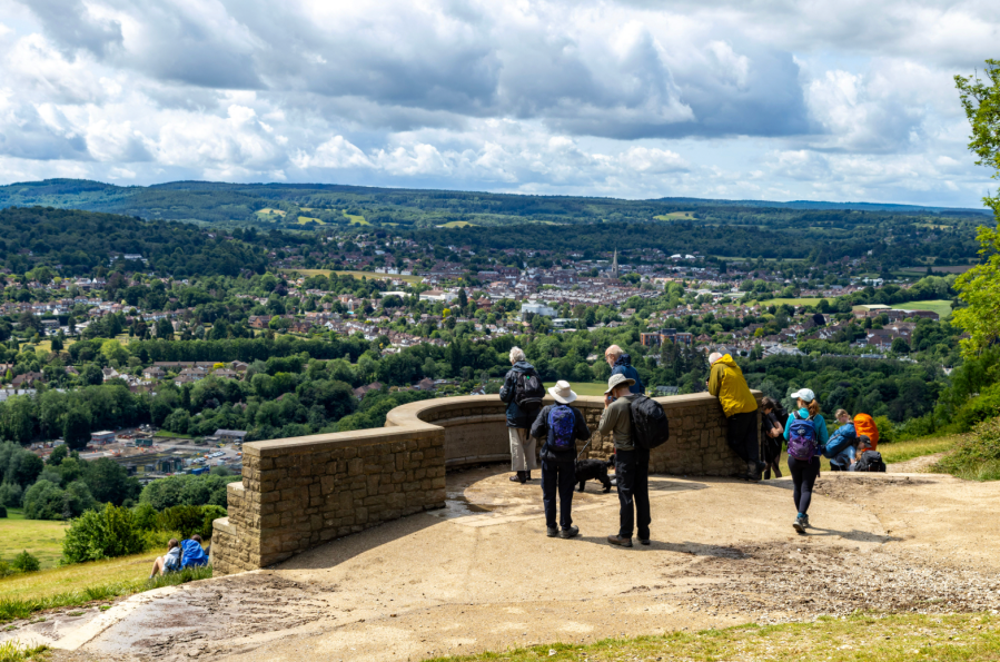
The rolling hills in Surrey might not be known for demanding terrain, but by tackling the most prominent hills in one day, you can have your very own three peaks challenge less than an hour from London. The Surrey Three Peaks Challenge takes place once or twice a year, but the network of trails and public footpaths will provide plenty of options for you to create your own route that includes these iconic hills.
The route described makes use of a section of the North Downs Way (NDW), Leith Hill Green Way as well as a section of the Greensand Way and various public footpaths and bridleways. It starts from Westhumble train station and takes you first to Box Hill and then continues to Leith Hill, where the 18th-century tower marks the highest point in the Surrey Hills. The third peak, Holmbury Hill not only offers some fine views, but it is also the site of an Iron Age fort. You can choose an alternative starting point along the circular route if you have your own transport.
MAPPED GUIDE: get your full route guide to the Surrey Three Peaks