
Ian Battersby teases out a trial for weary legs on the Durham Dales 30.
County Durham is home to a paltry handful of dales, and this route samples only two, but Teesdale and Weardale are the most prized pair in these parts. Between them lie sinews of heather and moist mounds of moss that must be crossed to connect the communes of Wolsingham and Middleton-in-Teesdale. The Long Distance Walkers Association have devised this 30-mile ordeal (shorter substitute available) and set a route that tests the mettle and a navigational sliver of brain too. They call it the Durham Dales 30 Challenge.
Though old lead mining tracks are exploited for speedy surges, these can wither to paths, which sometimes snuff it all together in the heather. Compass or GPS are vital. The upland sweep also features Durham’s foremost forest at Hamsterley, boasting 2000 hectares of conifers mixed with swathes of assorted broadleaf.
The rivers themselves are sprightly upland streams treasured by trout and grayling. Even occasional salmon and sea trout may gamble on breeding here under the scrutiny of cormorants, otters and kingfishers. Surrounding these are verdant pastures scattered with countless farmsteads and associated tiny hamlets. Self-support anytime or join the LDWA experts on 13th June 2026.
Durham Dales 30: route description
START/FINISH: Wolsingham Bridge; GR: NZ074369 | MAPS: OS Explorer OL31 (1:25k), OS Landranger 92 (1:50k) | DISTANCE: 47.8km / 29.7 miles | ASCENT: 1,330m / 4,364ft | DURATION: Beat 12.5 hours for the certificate otherwise 14.5 hours
1. NZ074369: Cross the Wear and climb lane to 174m. Take track R, heading W then S to Towdy Potts Farm. Continue W through farm to Spence Hill then climb S past conifers to junction (315m). Go W to byway junction (336m). Turn L, climbing S, soon dropping to junction. Head S on initially invisible path, following occasional posts then cairns SSW then S at North Grain Beck. Cross beck by rowan tree heading W into gill opposite. Path crosses aiming SSE above trees, then drops joining track to Meeting of the Grains.
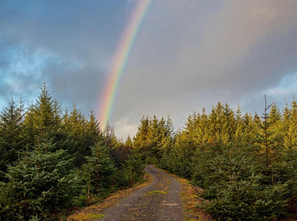
Rainbow over Hamsterley Forest. Credit: Ian Battersby
2. NZ050316: Ford and turn R on peaty track, climbing SW into Hamsterley Forest. Bridleway SW through trees, crossing one track, then dropping to second. Drop down abrupt descent and ford beck. Turn L to main track bearing SE for 100m. Turn R climbing W, then SW, and dropping SSE to bridleway at Acton Beck. Turn R climbing SSW to track junction. Continue SSW to bend.
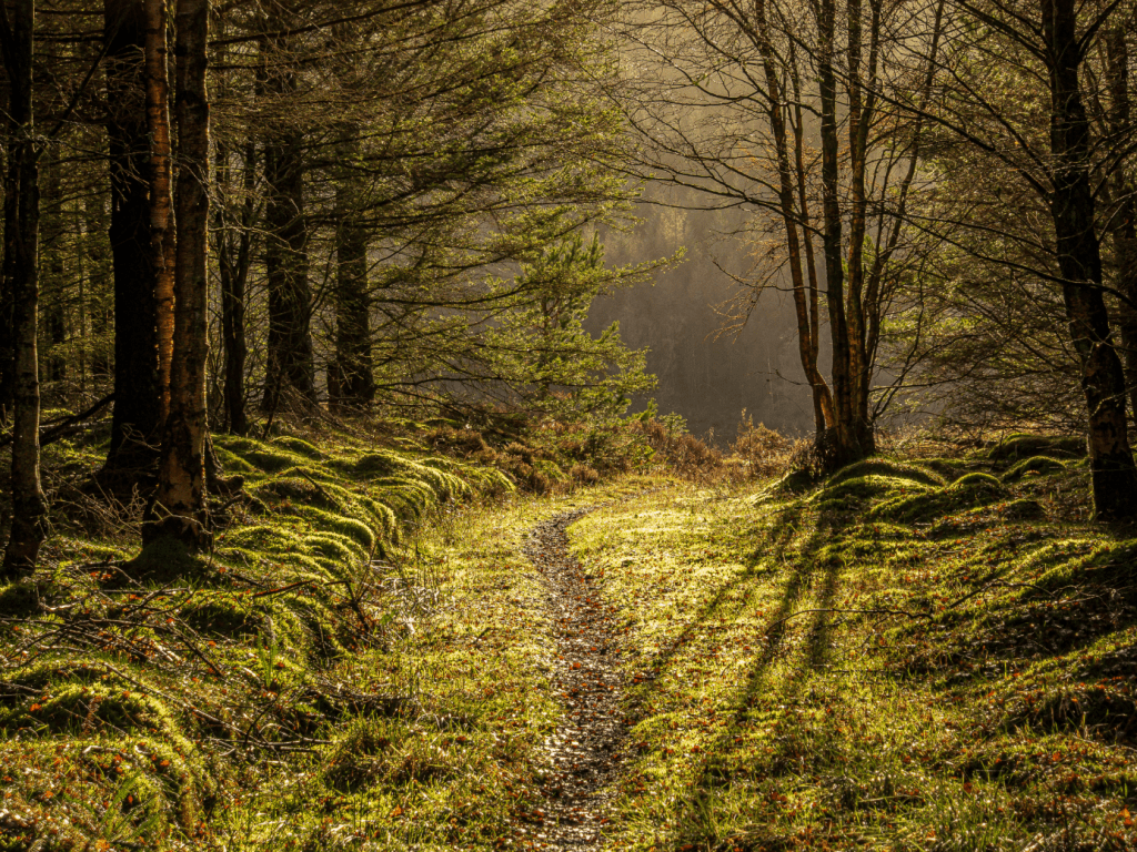
Hamsterley Forest. Credit: Ian Battersby
3. NZ022277: Follow bridleway SW, crossing footbridges, fording Quarter Burn and dropping to Black Sike. SSW to sheep wash and WSW to a road junction. Cross the B6278 dropping WSW down the lane to B6282 at Egglesburn.
Raven Seat rises beyond Great Eggleshope Beck. Credit: Ian Battersby
4. NY983245: Take bridleway bending R to track bend. Continue WNW on grass to River Tees. Turn L through gate and follow Tees to bridge. Cross W and take path SW to Low Beck Springs, then SSW to meet track. Head S to lane. Turn R, then L to B6277. Turn L, then R heading S up lane to join Tees Railway at bend. Turn R on disused railway. NW for 1.5km to concrete stile on R. Cross and drop through farm to road. Turn L then immediately R aiming NW through fields to river. Follow Tees NW to bridge. Cross Tees then take the Teesdale Way SE to waterworks. Turn L, heading NNE to B6268. Turn R along road round right hander to path on L. Climb NE to stile.
Crossthwaite Scars from Stanhope Gate. Credit: Ian Battersby
5. NY952255: Follow signs climbing NNE through Fair View Farm, then NE through Stanhope Gate Farm. Climb NNE past pines to lane. Path NNW climbs through fields then drops past tall barn to the lane at Snaisgill. Follow lane R round left hander to path on R. Climb N to stile into Access Land. Path dies but find vehicle tracks slightly W. Climb NNE through gate to Brown Dodd, where the invisible path crosses intake wall. Follow wall NNE to 495m then climb NE on improving path to Monk’s Moor (565m). Traceable path drops, bending NE. Cross wall then plunge to track.
Snaisgill Plantation. Credit: Ian Battersby
6. NY975302: Turn L over ford. Take lesser track N climbing Wire Gill as track withers. Turn R across beck (455m). Head E on improving path bending NNE past reservoir. Good track soon drops N to path junction at Candlesieve Sike. Keep on track climbing and bending E to road. Turn L on B6278 over top (511m) then drop to track on R (500m).
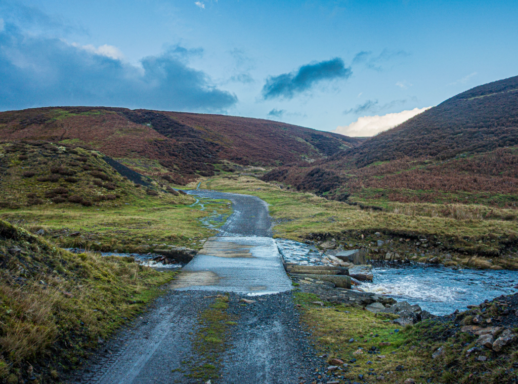
Bollihope Burn. Credit: Ian Battersby
7. NY991320: Turn R, dropping NE past reservoirs to T-junction. Turn L past pens dropping NW to mines then NNE past houses to Bollihope Burn. Keeping S of burn follow main track E through quarry and ENE to Pye Close. Turn L to cross Bollihope Burn. Turn R through gorge, re-bridging the burn, and continue NE to White Kirkley. Turn R on lane, then L, heading E across fields. 500m after Harehope Gill bend N to junction. Drop N to track junction by bridge.
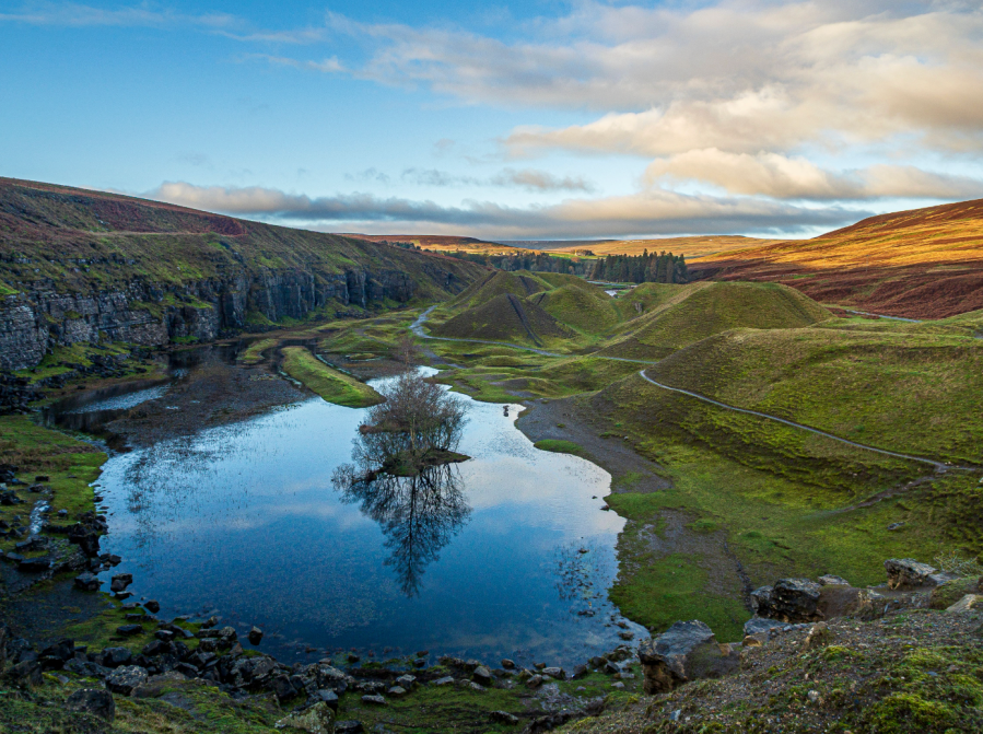
Mickle Fell from Blackton Beck. Credit: Ian Battersby
8. NZ039365: Turn R, heading NE, soon forking L. Path heads ENE across railway and follows river E then S into caravan park. Turn L on tarmac to bridge. Path heads E by railway to return.
Further information
PUBLIC TRANSPORT: Regular buses (www.traveline.info)
TOURIST INFORMATION: www.thisisdurham.com, 03000 262626
Our experts have mapped out more of their favourite UK mountain challenges here.


