
Chiz Dakin suggests the Peak District 9 Edges, an epic challenge route along several of the eastern Peak District gritstone icons.
Originally devised by Edale Mountain Rescue as a challenge event which runs every September (https://edalemrt.co.uk/nine-edges/) the “Nine Edges” linear route requires excellent fitness and good navigation skills. Ideally, you’d wait for good weather and long daylight hours in order to fully appreciate the sweeping views over the Dark Peak valleys. The Peak District 9 Edges – plus a bonus tenth – respectively are Derwent, Stanage, Burbage (North and South make two edges), Froggatt, Curbar, Baslow, Blackstone, Gardom’s and Birchen. Blackstone is little-known and hidden by woodland, while Gardom’s tends to be a “climbers’ edge”. It’s mostly bypassed by challengers – unless you’re taking on the “Climber’s Nine Edges” which sees participants climb one route per edge with the exception of Blackstone.
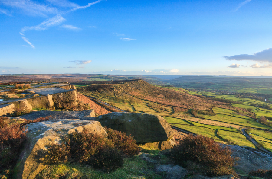
With gritstone rock formations and resident longhorn cattle, the Peak District 9 Edges gives you a taste of the best of hillwalking in the Peak. Beware there is no public transport to the start, but there are a few refreshment options on the route including a couple of excellent pubs, such as The Grouse. If 34km is too long, it’s easy enough to split into two shorter days, breaking at The Fox House after 22km.
Peak District 9 Edges: route description
START: Derwent Dam Meadow SK172896 (park at Fairholmes car park (SK172893) | FINISH: Robin Hood Inn, Baslow SK279721 (public car park at SK 280721) | MAPS: OS Explorer 01 and 24 (1:25k), OS Landranger 110 and 119 (1:50k), Harvey’s Superwalker (1:25k) Peak District Central | DISTANCE: 34 km / 21 miles | ASCENT: 785m / 2575ft | DURATION: 1 to 2 days
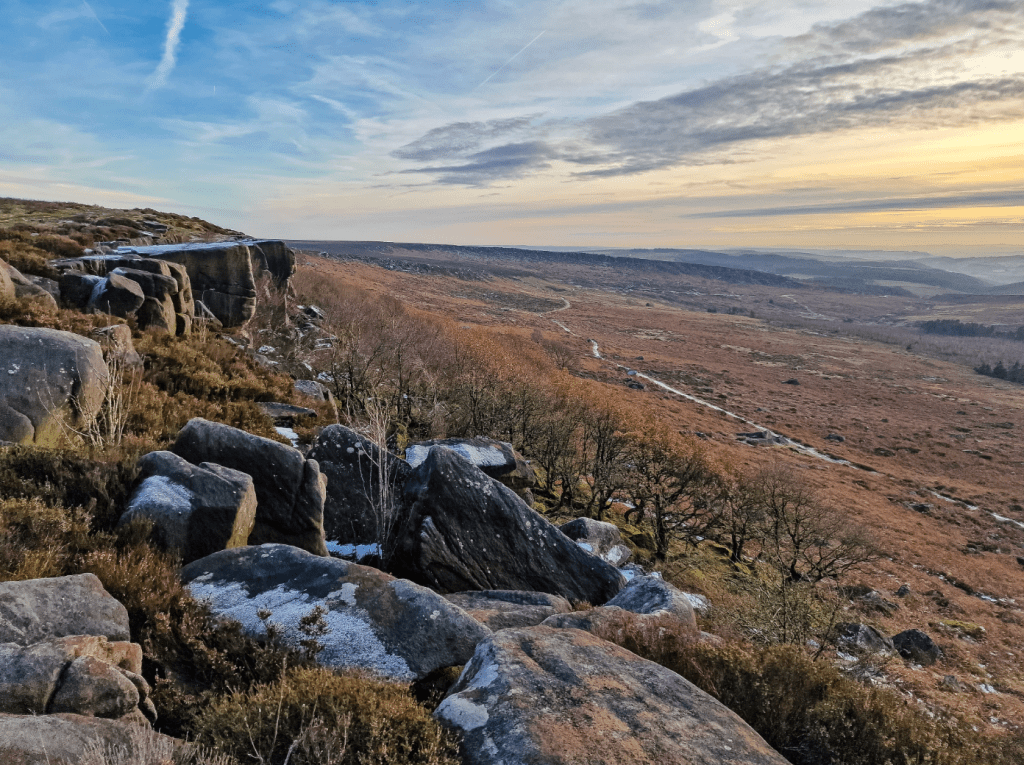
1. SK172896: Cross the meadow below Derwent Dam, then rise up steps by the East Tower. Briefly follow the reservoir’s east bank, then take a permissive footpath up Hollin Clough. Towards the top, zigzag right then left, cross some paths, then maintain your original direction by a tumbledown wall. Slant left then arc rightwards over Lost Lad and below Back Tor’s trig point. Continue south on a partially-flagged path.
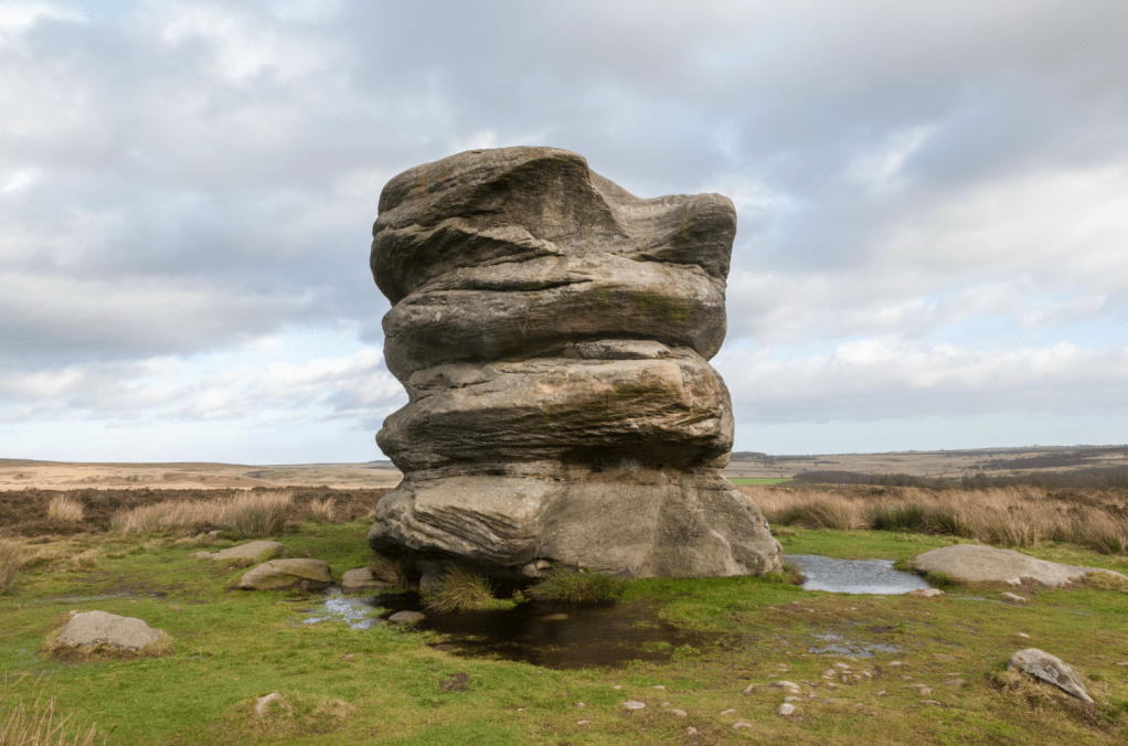
The Salt Cellar on Derwent Edge. Credit: Chiz Dakin
2. SK197907: Pass a standing stone at Bradfield Gate Head, then descend past several impressively wind-sculpted gritstone outcrops with evocative names (Cakes of Bread, Dove Stone, Salt Cellar, White Tor and Wheel Stones).
3. SK203880: Descend the public footpath from a green P&NFPS sign towards Moscar. Cross Highshaw Clough then fork left and take tracks/lane around Moscar House/Lodge.
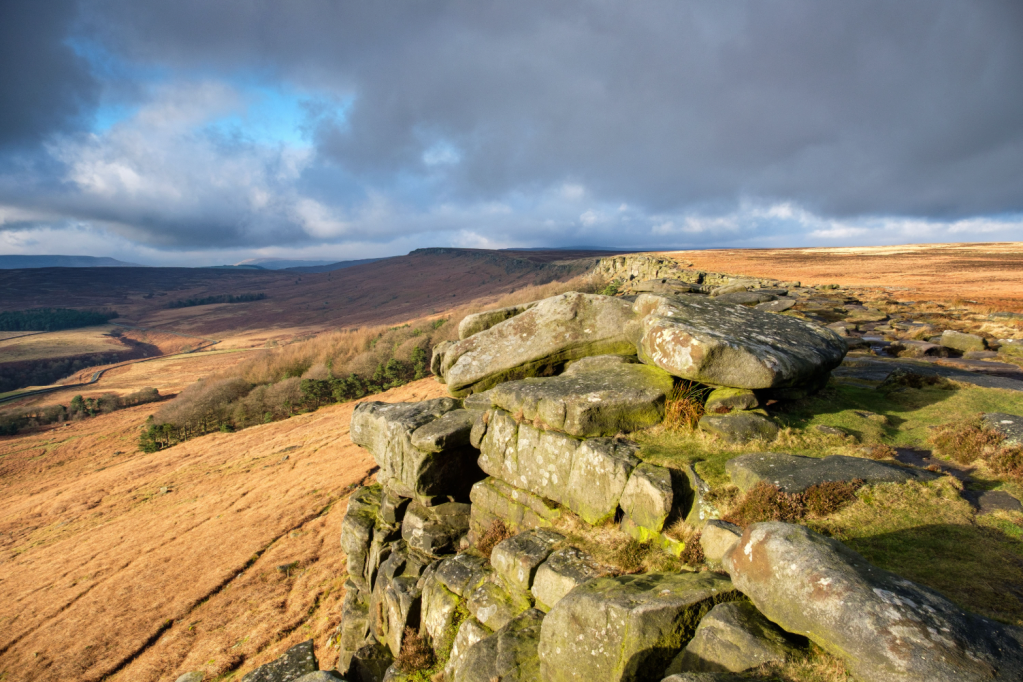
Stanage Edge lit by the sun. Credit: Chiz Dakin
4. SK230878: Cross the busy A57, then take a footpath rising just right of a heathery holloway to a tumbledown wall (initially looking like a few cairns) on the horizon ahead. Bend left through this wall, then right at a boundary stone (“WM” was William Cameron Moore of Moscar Moor and “WW” William Wilson of Hallam Moor). Head right along a boggy path on the 6km-long Stanage Edge. Pass a Stone shelter (SK225862), High Neb Trig Point (SK228853) and a second stone shelter (SK230852).
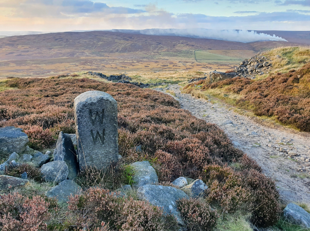
Boundary stone on Stanage Edge. Credit: Chiz Dakin
5. SK235848: The only real point of navigation here comes shortly after a stile heralding the approach of the Long Causeway. Stay on the wide main track initially, then fork right where the main track bends left, briefly on a bridleway. Stay ahead at a junction by stone pillars, turning left immediately below a wall line to regain the edge path. Continue past Robin Hood’s Cave (SK244835) and a second Trig Point (SK251830). The edge bends left, then the track drops through a break in the rocks and out to a road.
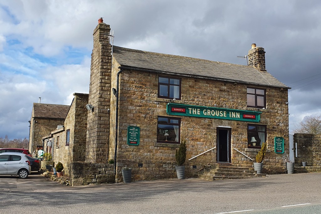
The Grouse Inn is a welcome stop roughly 2/3rds way through the route. Credit: Chiz Dakin
6. SK259830: Follow the verge leftwards, cross the Burbage valley, then descend the main wide permissive bridleway under Burbage Edge. Cross the busy A6187, and into NT Longshaw. (If splitting the route into two days, The Fox House is just up the road).
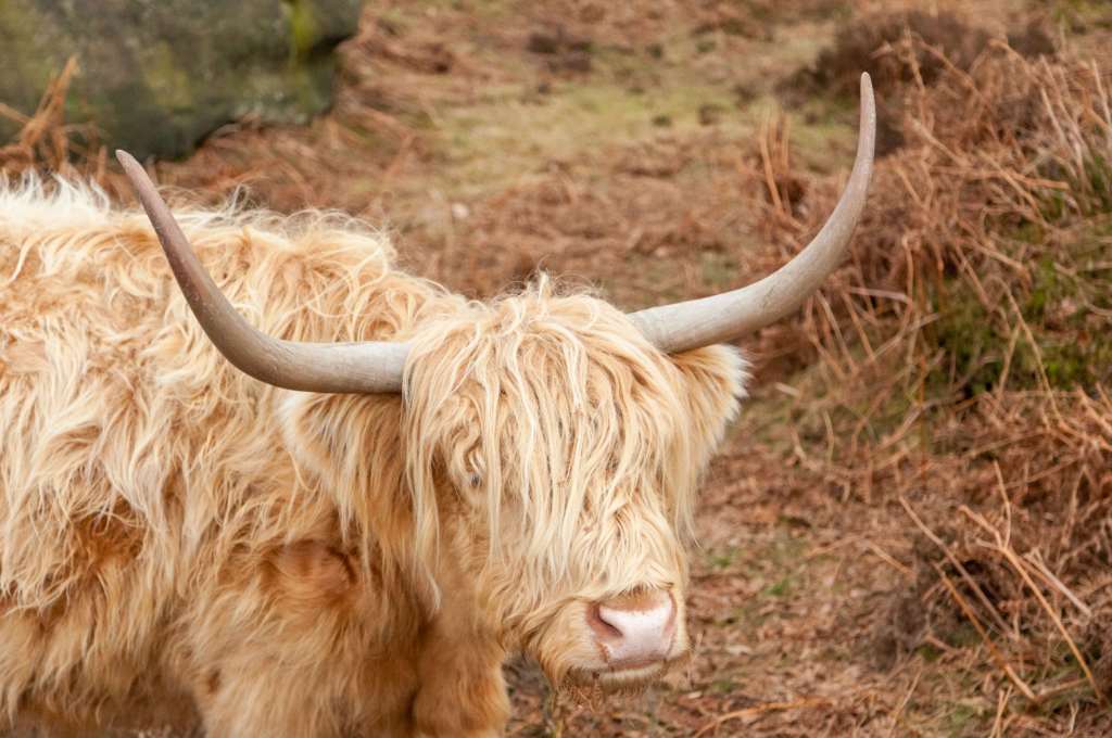
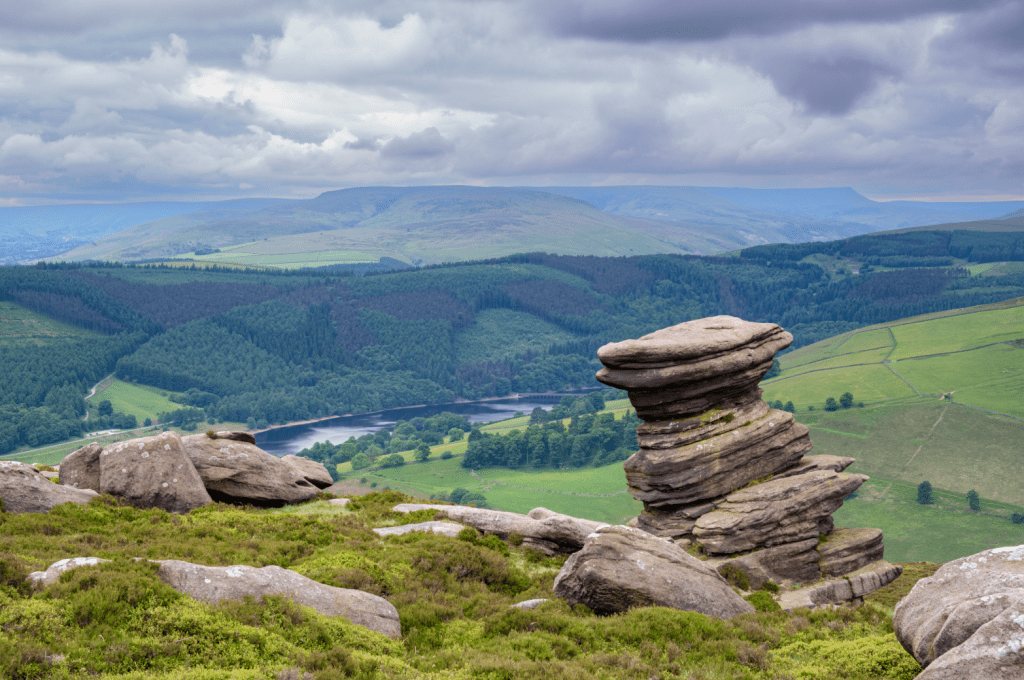
Longhorn Cattle on Blackstone Edge. Credit: Chiz Dakin
7. SK262804: Turn left along a permissive bridleway, then take Longshaw Lodge’s driveway below the café, dropping left below the Lodge. Go straight ahead at the yew trees (follow blue arrow); follow this permissive bridleway towards ‘Grouse Inn’. Go right along the A625’s narrow verge, then immediately past the inn car park, fork right on a footpath diagonally through fields.
Eagle Stone, Baslow Edge. Credit: Chiz Dakin
8. SK255778: Go left along the top of woodland, then cross stepping stones over a stream. Rise to cross A625 rightwards, then take the concessionary bridleway along Froggatt Edge. Ignore two waymarked paths leading right, then follow a yellow arrow waymarker left zigzagging uphill where Froggatt becomes Curbar. Just after a gate at the end of Curbar, fork right to cross Clodhall Lane near Curbar Gap car park.
Gardoms Edge. Credit: Chiz Dakin
9. SK261746: Continue along Baslow Edge’s main track (this is set back a little from the edge itself); pass the Eagle Stone, then turn left at a track junction to pass Wellington’s Monument. Continue left above the little-known Blackstone Edge then exit right onto Clodhall Lane (again!).
Birchen Edge at the end of day. Credit: Chiz Dakin
10. SK 278740: Cross the busy A621, then almost immediately, go right through a gate. A wide and often boggy track leads across access land, then descends below Birchen Edge to the B6050. (A longer variant, see map, runs briefly above Gardom’s Edge, but at this stage, you’ll probably want the main EdaleMRT-mapped route directly to Birchen!) Turn right along this road edge (beware of traffic) to the Robin Hood Inn for that well-earned pint!
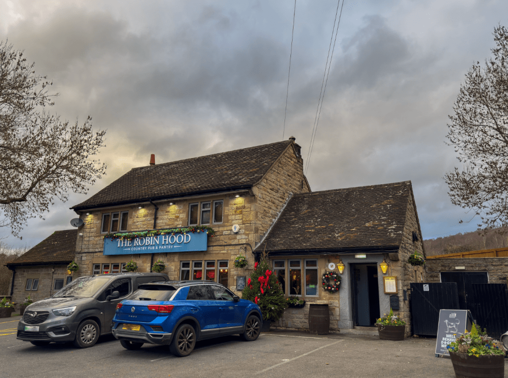
Robin Hood Pub. Credit: Chiz Dakin
Further information
PUBLIC TRANSPORT: Fairholmes has no public transport but bus 257/a/b stops along A57 (Manchester Rd – nearest at Point 4). The Robin Hood is served by buses 170/66/X66. Train station at Grindleford (2.5km from Point 7).
TOURIST INFORMATION: National Park Centres at Castleton and Bakewell
Nearest YHA: Hathersage
Our experts have mapped out more of their favourite UK mountain challenges here.


