
James Forrest bags all four of the Lakeland 3000s – Scafell, Scafell Pike, Helvellyn and Skiddaw – in a single route.
In the mighty Scottish Highlands there are 282 peaks – the iconic Munros – over 3,000ft. By comparison, England is a lowly country: there are only four 3,000fters. Let’s clarify that assessment quickly, before the naysayers claim there are more. Generally speaking, Symonds Knott, Broad Crag, Ill Crag and Helvellyn Lower Man are classed only as subsidiary tops – not mountains in their own right. So that leaves us with a famous English foursome rising above the magical 3,000ft mark: Scafell, Scafell Pike, Helvellyn and Skiddaw – the Lakeland 3000s, in other words.
Ticking them off in a single route is a bucket-list mountain challenge: a Lake District Four Peak challenge, if you like. One option is to complete a full high-level loop from Keswick, but perhaps a better option is an anti-clockwise, 60km itinerary from Seatoller to Keswick. Very fit hikers can attempt to complete the Lakeland 3000s in one extremely arduous outing. Otherwise the trip can be beautifully split into a wild camping expedition, with overnights at Angle Tarn and High Rigg. Either way, it’s a grand adventure.
Lakeland 3000s: route description
START: Seatoller National Trust car park, CA12 5XN (GR: NY245137) | FINISH: Keswick town centre, Station Road, CA12 4NA (GR: NY267234) | MAPS: OS Explorer OL04, OL05 and OL06 (1:25k), OS Landranger 89 & 90 (1:50k), Harvey Maps British Mountain Map Lake District (1:40k) | DISTANCE: 60.6km / 37.7 miles | ASCENT: 3,883m / 12,740ft | DURATION: 1-3 days
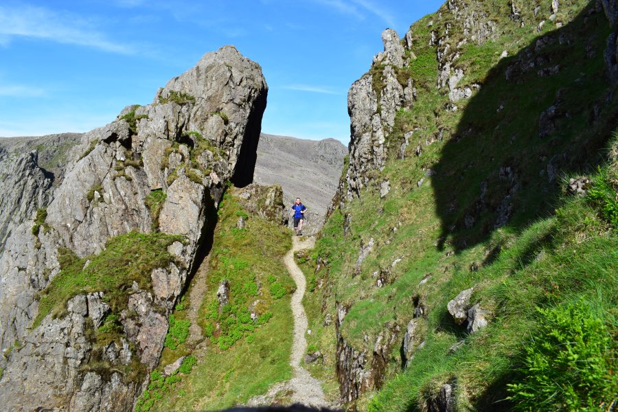
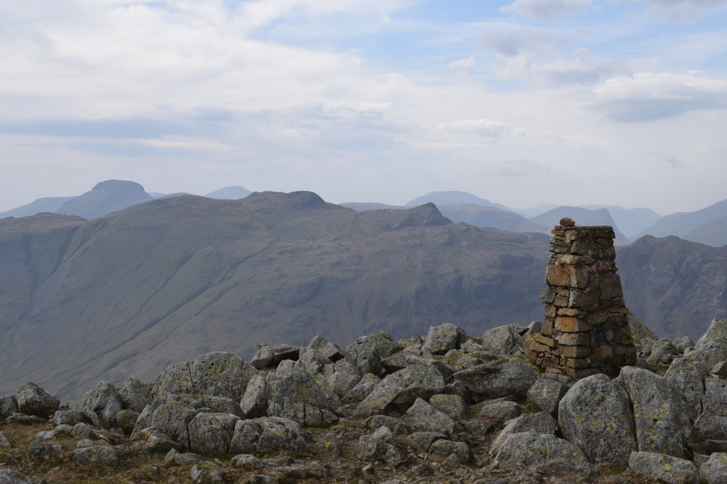
1. NY245137: Walk from Seatoller to Seathwaite and pick up footpath heading south alongside river. Turn right and cross Grains Gilll over Stockley Bridge. Climb west and south-west following Styhead Gill to Styhead Tarn. At stretcher box, turn left to start of Corridor Route. Follow rough path all way to head of Piers Gill. Head south-west to cairn located south of Lingmell Col. Descend west towards Hollow Stones. Traverse south below Pikes Crag and Pulpit Rock and emerge at path below Mickledore. A trod ahead cuts corner and arrives at start of Lord’s Rake.
Views to the Scafells from the start of the Corridor Route. Credit: James Forrest
Turn west into gully and climb over steep, shifting ground. Pass through dramatic rocky gateway and continue over ups and downs before emerging onto Symonds Knott’s western flanks. Turn left to col and veer right for Scafell’s summit. Re-trace steps to col below Symonds Knott and turn south-east over steep scree down to Foxes Tarn. Turn left and descend north-east over rocky terrain. Just beyond prominent cairn, scramble down short, steep gully. Exit gully and turn north, climbing to Mickledore. Turn right on boulder-strewn path. Continue north-east before looping sharply south for Scafell Pike.
Looking to Scafell Pike from the summit of Scafell. Credit: James Forrest
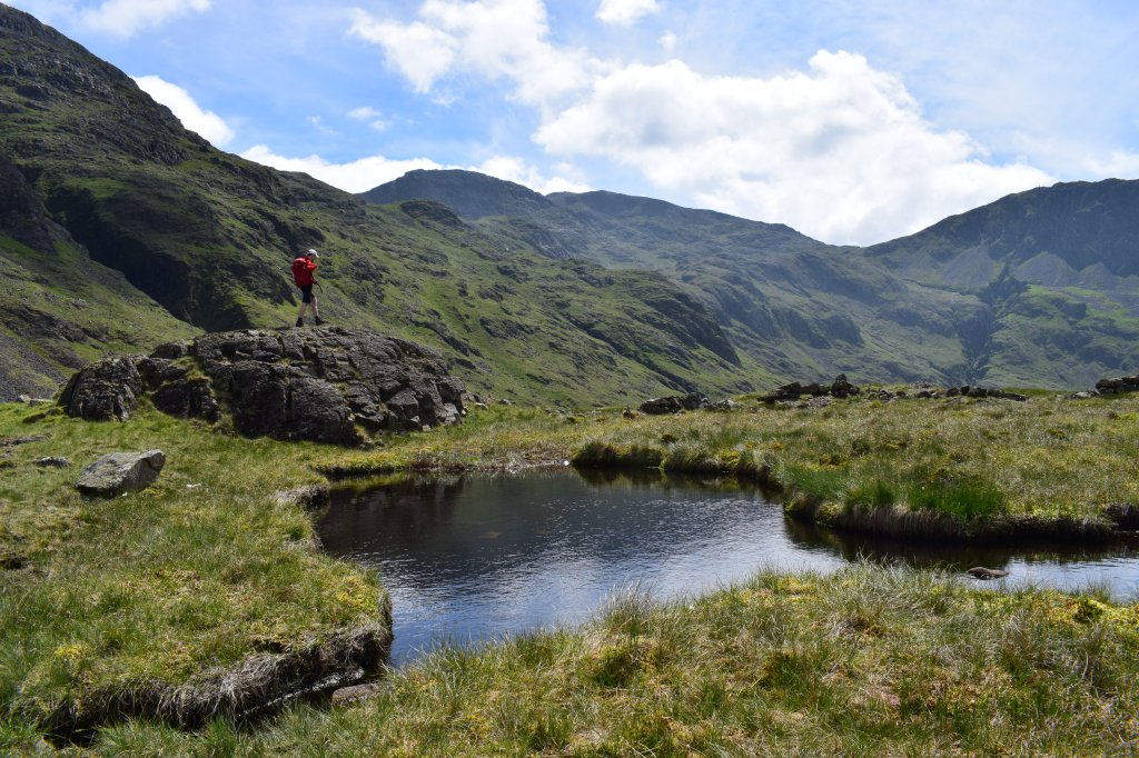
2. NY215072: Descend east off summit and veer north to col below Broad Crag. Veer east to another col before ascending briefly on red path. Stick to main path, ignoring turn-offs to Ill Crag, and head north to col below Great End. Veer north-east. Descend east and arrive at Esk Hause. Head north-east to base of Allen Crags and veer right, descending south-east to Angle Tarn.
Views of Pike o’Stickle from near Stake Pass. Credit: James Forrest
Head north-east to Stake Pass, cross Stake Beck and climb east and north-east to High Raise. Head north-north-east to col at Greenup Edge. Head east to Calf Crag. Take main path north and east to Steel Fell. Head north briefly before turning right on steep path dropping east through Ash Crags, slightly to north of stream, to reach A591 at Dunmail Raise. Cross road and ascend east to saddle above Grisedale Tarn. Turn left and climb steeply north up Dollywaggon Pike. Join main ridge path and follow it north over Nethermost Pike and beyond to Helvellyn’s summit.
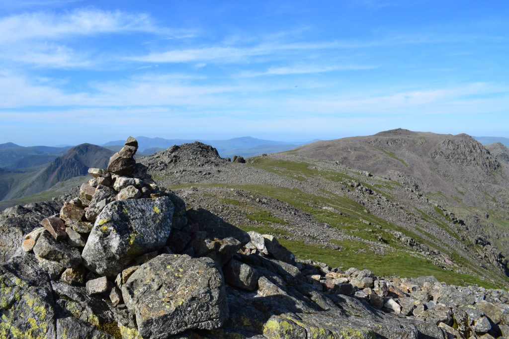
Views of a distant Great Gable (far left) from the summit of High Raise. Credit: James Forrest
3. NY342151: Head north-west towards Lower Man. Fork left and take descent path north-west via Browncove Crags. Veer right on faint grassy trod, cross Helvellyn Gill and follow path north-north-west all way to Legburthwaite. Walk north along A591, cross bridge over St John’s Beck, turn right over ladder stile, fork left and left again to climb north up main path to High Rigg.
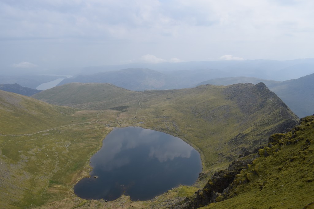
Red Tarn as seen from Helvellyn. Credit: James Forrest
Descend grassy paths north and west to road. Turn right, pass youth centre and church, and follow minor road north. Where road turns sharply right, fork left on track. Pass Row End and walk north to Shundraw. Turn left and follow road north and north-west to A66. Descend north-east to join Keswick to Threlkeld Railway Path. Turn left over bridge and then right, bearing for Brundholme and base of Latrigg’s long eastern spur. Head west and then north-west to Latrigg car park. From here pick up main tourist path climbing steeply towards Jenkin Hill and skirting to right of Little Man, before final push to Skiddaw’s summit.
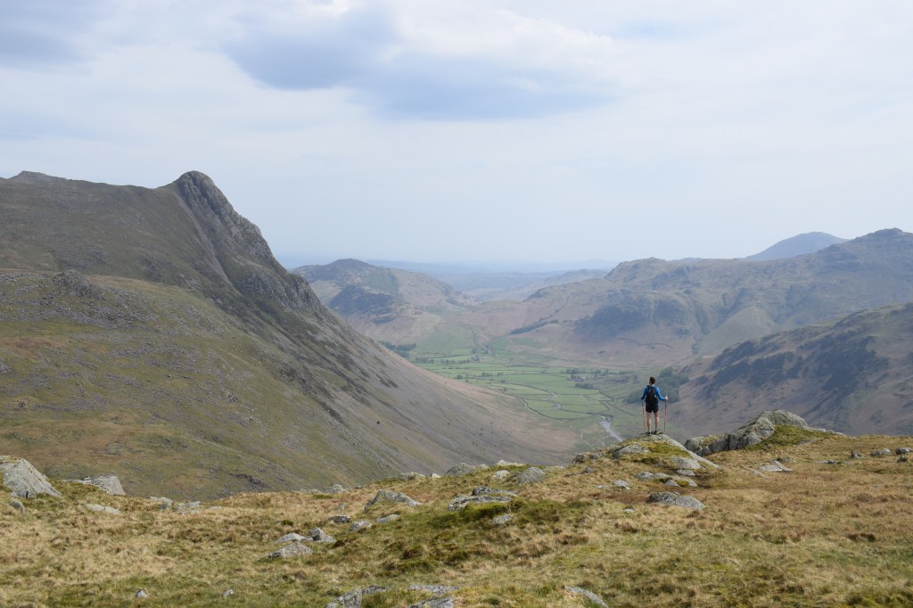
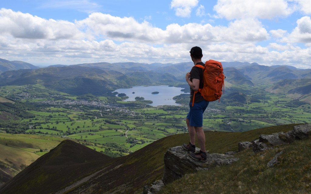
Views to the north-western fells from the descent of Skiddaw into Keswick. Credit: James Forrest
4. NY260290: Re-trace your steps south briefly before veering right at large cairn, taking steep path south-west to Carlside Tarn. Ascend south briefly to Carl Side’s summit and then pick up main path descending south via White Stones and Benny Crag to road. Turn left and walk south-east along road from Millbeck to Applethwaite and Ormathwaite. Head south-east through fields to join Cumbria Way path on Latrigg.
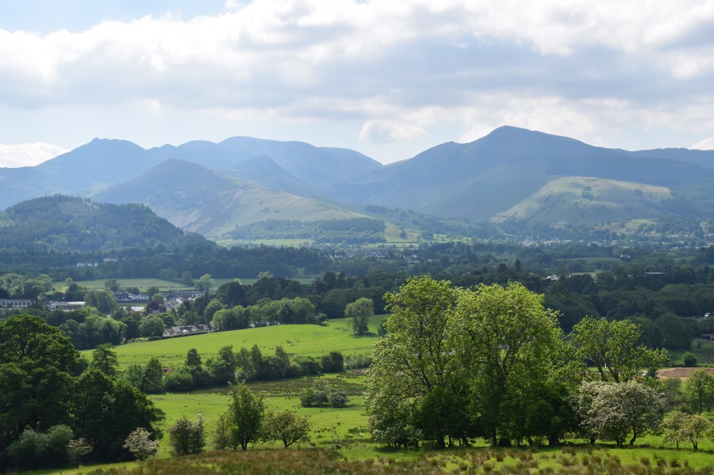
Gazing over Derwent Water from Carl Side. Credit: James Forrest
Take Spooneygreen Lane south-west over A66 bridge and beyond to Brundholme Road. Walk back to Keswick town centre via Keswick Leisure Pool.
Further information
PUBLIC TRANSPORT: Take a train to Penrith North Lakes and then Stagecoach’s X4/X5 bus to Keswick, before changing to Stagecoach’s 78 bus to Seatoller.
Our experts have mapped out more of their favourite UK mountain challenges here.


