
A classic day out in the mountains: Emily Woodhouse leads us through this Grade 1 ridge scramble to Scotland’s highest summit.
It is a truth universally acknowledged that a hillwalker, who has climbed Ben Nevis at least twice, must be in want of a scramble. As impressive as it is to stand on top of the highest point in the UK, there are only so many times you can walk the Pony Track without wondering about the other side of the mountain. The Càrn Mòr Dearg (pronounced like ‘caarn more jerrack’) arête, the CMD arête to its friends, is a sweeping arc of a ridge that swoops up to the east side of Ben Nevis.
It’s a slightly quieter side of the mountain – although the North Face car park will be full of climbers by 8:30 am most of the year round. But you’ll get a much more varied and interesting ascent, both visually and underfoot, than the west side of Ben Nevis.
Ben Nevis via the CMD arête: route description
START/FINISH: North Face Car park near Torlundy; NN 145 762 | MAPS: OS 392 Ben Nevis & Fort William (1:25k), OS 41 Fort William & Glen Coe (1:50k), Harvey British Mountain Map Ben Nevis & Glen Coe (1:40k) | DISTANCE: 16.5km/10 miles | ASCENT: 1500m/4,900ft | DURATION: 10 hours
1. NN 145 762: From the north face car park, follow the dirt track up through the forest and out onto the fells. Head south east, with the river on your right, over a stile and onto a well-used dirt track. Follow this track up the valley with the imposing face of Ben Nevis rising in front to your right and the ridge slowly starting to your left.

Ben Nevis from the ascent to first peak before CMD
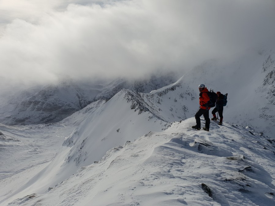
2. NN 154 738: At the track, junction bear left and make your way up onto the start of the ridge. This isn’t always obvious, especially in winter, so you may end up heather-bashing your own route. The first peak is Càrn Beag Dearg. Weather willing, you’ll have a great view of climbers on the North Face of Ben Nevis to your left and the start of the ridge rising up ahead.
Views south from CMD ridge with ridge on the right.
Credit: Emily Woodhouse
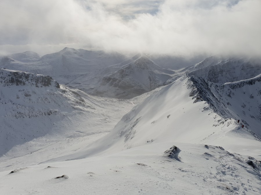
3. NN 176 726: Following along the obvious ridge, you’ll arrive at Carn Mor Dearg summit, a Munro. There is a short descent before the arcing curve of the CMD arete. Stay on top of the ridge, or just to the right of it, and enjoy the view! The technical aspect of this route is, of course, the CMD arête itself. It is a summer Grade 1 scrambling ridge, also rated Grade 1 in winter, although its character can change a lot depending on snow levels. In summer, expect a rocky – and in places loose – knife-edge ridge with a lot of exposure. In winter you may be walking on a crest of snow, being wary of cornices, or on a more mixed route, with jagged rocks poking through the snow.
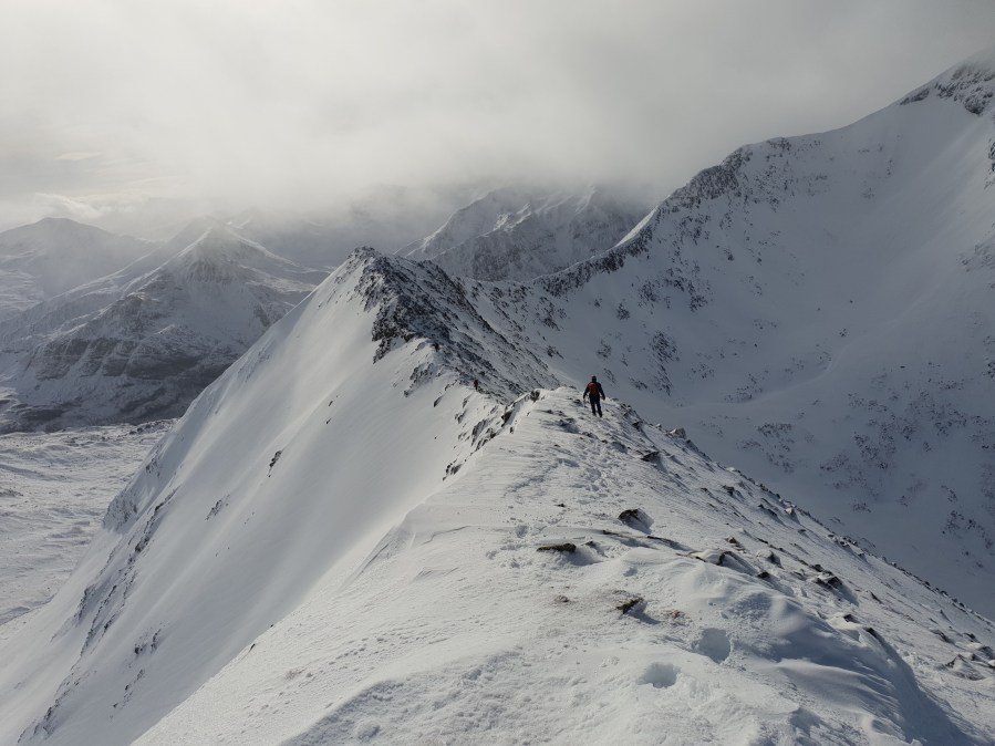
Scrambling along the CMD.
Credit: Emily Woodhouse
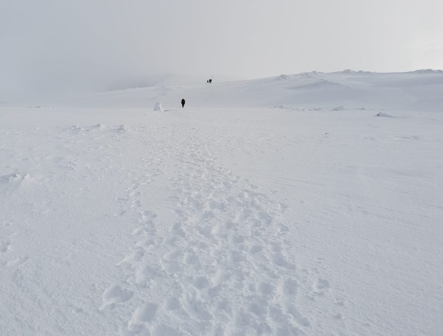
4. NN 170 710: After about 1km of scrambling, you’ll find yourself on the south east flank of Ben Nevis with some 500m of pathless ascent to the summit. In any season, the final section up to Ben Nevis and down the other side should not be underestimated once the scrambling is over. The plateau is easily disorientating and your navigation needs to be on point to avoid the steep cliffs on either side, especially when you can have a perfect day on the ridge only to ascend into thick cloud on top. With Ben Nevis being a hot spot for mountain rescue incidents, do yourself a favour and be prepared to find your way safely in all weather. Be wary of crags to your right in less than perfect viz. After a celebration at the summit trig, it’s time to start your descent west by following the long line of cairns.
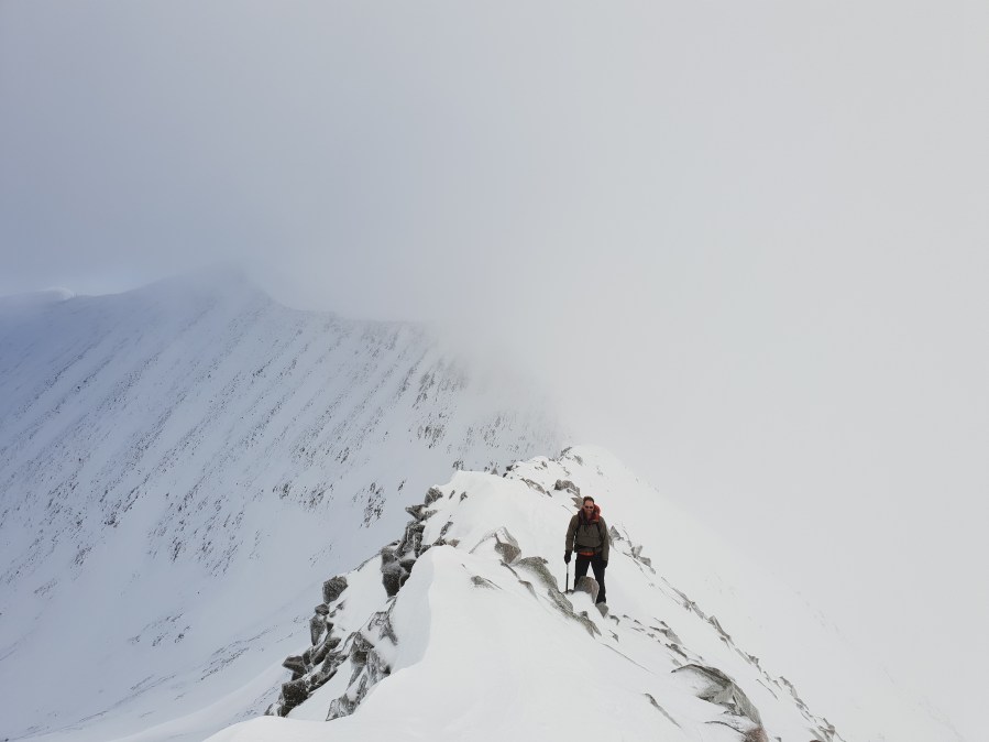
Looking back at CMD as cloud comes in.
Credit: Emily Woodhouse
This is easier said than done in fog and you’ll need a compass to make sure you don’t fall off a cliff (very easily done) in all but perfect conditions. The cairns are 50m apart, so you can check your pacing too.
Descent from Ben Nevis.
Credit: Emily Woodhouse
5. NN 157 713: The cairns lead off the plateau and down to Red Burn and the friendly zig-zags of the Pony Track. Cross the stream and bear round to the right (north) above the lochain. Follow the path until it starts to turn west, then cut off due north down the boggy hillside and back towards your start point. There is a bridge further down the last river if it proves un-fordable.
Further information
PUBLIC TRANSPORT: Trains to Fort William between Glasgow Queen Street and Mallaig, regular 919 bus from Fort William to Torlundy.
TOURIST INFORMATION: Ben Nevis Visitor Centre, 01349 781401


