

Andrew Galloway scrambles the Nantlle ridge to the most westerly mountain in Wales.
For many years Mynydd Graig Goch languished in obscurity at the far western end of one of the finest ridge walks in Parc Eryri. Popular guidebooks recommended an about-turn on Garnedd-goch, the “final” summit of the Nantlle Ridge, to avoid the dilemma of having to arrange return transport. This all changed in 2008 when a group of enthusiast hillwalkers carried out a detailed GPS survey of the hill. The official height was recorded as 609.75 meters, thus confirming the craggy eminence not merely as a mountain, but the most westerly mountain in Wales.
Having successfully negotiated the rollercoaster challenge of the Nantlle Ridge, it was a pleasure to sit among the frost-shattered tors of Mynydd Graig Goch, bathed in the diffuse light of evening, and watch the sun sink into the shimmering waters of Caernarfon Bay. For this moment alone, the taxi fare from Nebo to Rhyd Ddu was a small price to pay.
The Nantlle Ridge route is classified in guidebooks as a three-star grade one scramble. In good weather, there are excellent views across Parc Eryri with good paths traversing grassy slopes punctuated by a few sections of rocky scrambling. Exposure is never critical but may be unnerving in places to the uninitiated. Previous experience of grade-one scrambles is recommended.
The Nantlle Ridge: route guide
Start/finish: Car Park at Rhyd Ddu Welsh Highland Railway station (GR: SH709525)/Crossroads in the centre of the village of Nebo (GR: SH478505) | Distance: 13.6 km / 8.5 miles | Ascent: 983m / 3,225ft | Duration: 7 hours | Maps: Ordnance Survey 1:25,000 Yr Wyddfa/Snowdon OL17
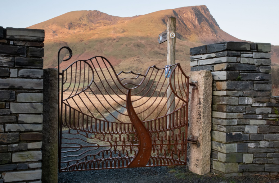
1. SH571525: From the car park at Rhyd Ddu Welsh Highland Railway station cross the road (with care) and pass through an ornate iron gate where a finger post gives the distance to Beddgelert.
Y Garn from Lon Gwyrfai.
Credit: Andrew Galloway
2. SH568525: Walk along the broad track – Lôn Gwyrfai – for 300m. Cross the footbridge then take the path to the right to the minor road B4418.
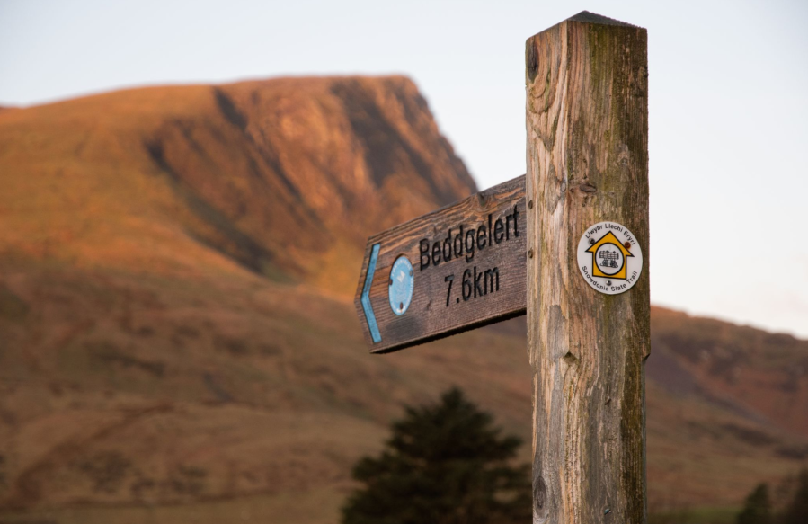
Y Garn – Beddgelert 7.6km.
Credit: Andrew Galloway
3. SH566526: Take the path to the left heading SW for 400m to a stile. Follow the path across rough ground for a further 300m to a second stile.
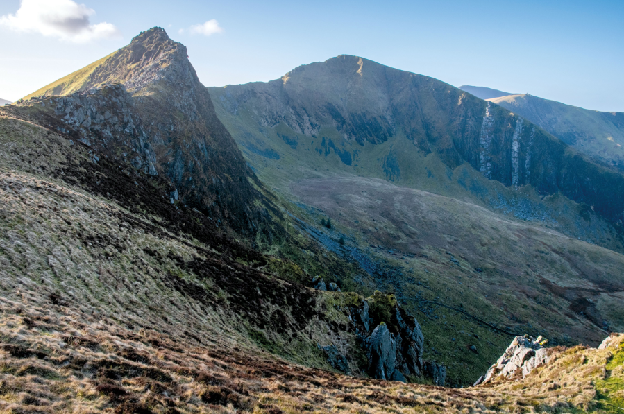
Yr Wyddfa and Yr Aran from Mynydd Drws-y-coed.
Credit: Andrew Galloway
4. SH560524: Once over the stile, climb the steep path W for 1km to reach the cairn on the summit of Y Garn (633m).

Clogwynygarreg and Llyn Dywarchen from Y Garn.
Credit: Andrew Galloway
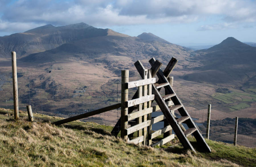
5. SH551526: From Y Garn follow the ridge S for 600m climbing to the rock step below the summit of Mynydd Drws-y-Coed. This is the crux of the entire route, involving a relatively simple manoeuvre up an inclined slab. The volcanic rock offers good grip when dry but can be greasy when wet. Once beyond the rock step cross the ladder stile to reach the summit, relax and enjoy the views.
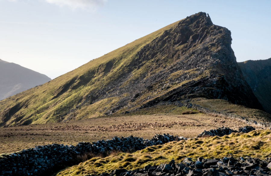
A prospect of fine scrambling on Mynydd Drws-y-coed.
Credit: Andrew Galloway
6. SH549518: Descend from Mynydd Drws-y-Coed to a col where the ground to the North falls away dramatically. Here there is a choice: continue along the obvious path that traverses below Trum y Ddysgl (spot height of 709m) or climb the ridge, requiring the use of hands for confidence in places, to the cairnless summit.
Mynydd Drws-y-coed, Trum y Ddysgl.
Credit: Andrew Galloway
7. SH544516: In good weather the way ahead is now clear. Descend SW to the narrow col, in the centre of which a small rock step requires careful negotiation. The ground now rises steeply westwards for 500m to reach the stone obelisk on the summit of Mynydd Tal-y-mignedd (653m).
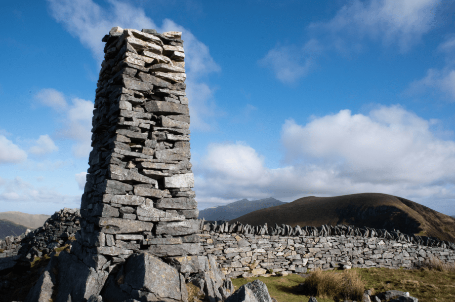
Obelisk on Mynydd Tal-y-mignedd.
Credit: Andrew Galloway
8. SH535513: Head SSW for 500m then descend a rocky path to the col of Bwlch Dros-bern.
9. SH529507: Beyond the col the northern flank of Craig Pennant presents the final scramble of the day, which can be avoided altogether 100m to the West. For those wishing to keep to the crag, ample foot and hand holds soon concede to less steep ground, from where a well-defined path leads to the cairned summit of Craig Cwm Silyn (734m).
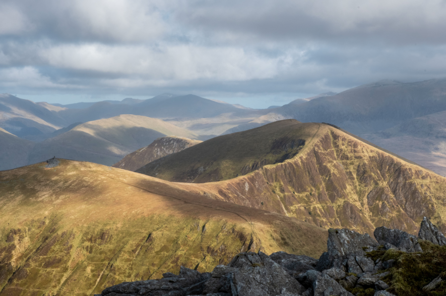
The Nantlle Ridge seen from Craig Cwm Silyn.
Credit: Andrew Galloway
10. SH525503: In contrast to the undulations of the ridge so far, to the SW of Criag Cwm Silyn there is little variation in height for 1.7km until the cluttered crown of Garnedd-goch is reached (700m).
11. SH511495: Continue SW as the ground drops away once again to an obvious breach in the stone wall.
12. SH507491: Head SE for 450m to Bwlch Cwmdulyn. From here set your sights on the tors upon Mynydd Graig Goch 1.2km to the SW (610m).
13. SH496485: Follow a path marked by wooden stakes NW for 1km to the shores of Llyn Cwm Dulyn.
14. SH488498: At the outflow of the reservoir follow the lane for 1.2km to the crossroads at the centre of the village of Nebo.
Further information
Public transport: The village of Nebo is a kilometre from the A487 along which an infrequent bus service operated by Dilwyn’s Coaches runs between Porthmadog and Caernarfon. As this was a linear walk I arranged for a local taxi firm (Ivan’s Taxis, 01286 881590 / 07771 677199) to meet me in the village of Nebo.
Tourist information: Parc Eryri, 01766 770274
Nearest YHA: Snowdon Ranger


