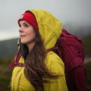
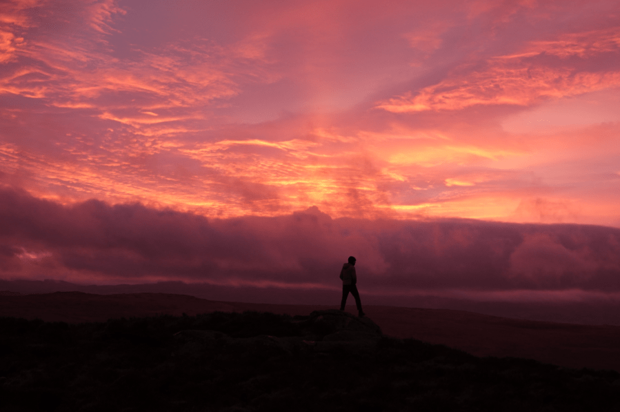
The popularity of hillwalking in Eryri/Snowdonia National Park has been much publicised – and often maligned – in recent years. It is certainly home to a few honeypot hotspots for hillwalkers but there is so much more to North Wales. From quiet cwms and pretty peaks, rarely-trodden ridges and secluded swim spots, our contributors have gone off the beaten track to share their favourite secluded high places. Here, we share some of the best off-the-beaten track hikes in Snowdonia where you stand a good chance of walking in solitude.
Some of the best quiet hikes in Snowdonia/Eryri – plus route maps
- Gyrn Ddu & Gyrn Goch from Trefor
- The Tarrens
- Dyffryn Ardudwy & Moelfre
- Drum & Carnedd y Ddelw
- Nantlle Ridge
- Arenig Fawr
- Yr Eifl
- Foel-goch
- Cnicht
- Cwm Caseg
- Pen yr Ole Wen and the Carneddau
- The Yr Wyddfa Girdle
Gyrn Ddu & Gyrn Goch from Trefor
Andrew Galloway walks a Welsh beast in Eryri with two horns; one red, one black – Gyrn Ddu & Gyrn Goch.
Start/Finish: The free public car park at Traeth Trefor Beach (GR: SH376472) | Distance: 11 km (7 miles) | Ascent: 625 meters (2,050 feet) | Duration: 5 hours | Maps: Ordnance Survey 1:25,000 OS Explorer Map 254 of the Lleyn Peninsula East/ Pen Llŷn Ardal Ddwyreiniol
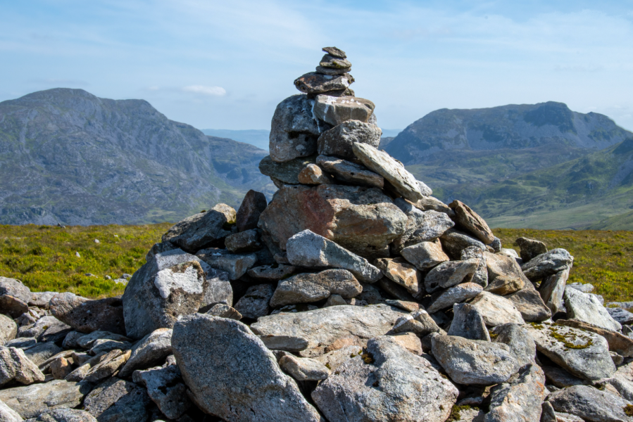
Many of the hills and mountains of Eryri/Snowdonia owe their existence to an episode of volcanic activity in a period of geological time known as the Ordovician, some four hundred and fifty million years ago. Back then Wales was part of a shallow tropical sea on the margins of what geologists refer to as a subduction zone, where part of the earth’s crust was forced beneath an opposing part. The ensuing friction resulted in a chain of volcanoes aligned roughly south-west to north-east. Some of these volcanoes erupted under the surface of the sea, whilst others rose up to become the classic volcano cone shape, spewing ash and lava into the Ordovician sky. The rocks that form the twin horns of Gyrn Ddu and Gyrn Goch, overlooking Caernarfon Bay, are examples of both. The andesitic tuffs of Gyrn Ddu weather to grey, whereas the granite of Gyrn Goch weathers with a russet hue. Hence the origin of the Welsh names, “ddu” meaning black and “goch” meaning red. During the nineteenth century these rocks were extensively quarried, their toughness making them the ideal building material.
Read more: the full route description for Gyrn Ddu & Gyrn Goch from Trefor
The Tarrens
Fiona Barltrop recommends a fine ridge-top walk over the unfrequented Tarrens in Southern Eryri.
START: Pennal bus stop, GR: SH698004 | FINISH: Aberdovey/Aberdyfi (car park – GR: SN612959, or nearby railway station) or Tywyn | MAPS: OS Explorer OL23; Landranger 135 | DISTANCE: 19.5km/12 miles (+ 7.2km/4½ miles to Tywyn – railway station) | DURATION: 6 – 7 hours (+ 2 hours for extension to Tywyn) | ASCENT: 945m/3100ft
Situated in the southernmost part of Eryri National Park are the lovely, little walked Tarren hills that run down to the sea at Aberdovey. Separated from Cadair Idris by the Dysynni Valley and Tal-y-llyn Lake and from Plynlimon by the Dovey (Dyfi in Welsh), this compact range of hills provides some excellent crowd-free walking, notably along the fine ridge that extends for several miles in a south west direction from the Tarrens’ highest point, Tarren y Gesail (667m/2188ft). The only other 2000ft plus top is Tarrenhendre, to the north east of which the slopes are largely swathed in forest, while to the south west the terrain is mostly grassy and smooth rolling.
The popular seaside resort of Aberdovey is served by the scenic Cambrian coast line, with trains every two hours in each direction. From here it’s just a short bus ride to Pennal, the start of this exhilarating linear route, which ascends Tarrenhendre then follows the ridge back to Aberdovey. On a fine day the extensive views are superb. On days of low cloud, there’s a good alternative route following the Wales Coast Path along the foothills of the Tarrens.
Read more: the full route description for The Tarrens, Eryri/Snowdonia
Dyffryn Ardudwy & Moelfre
Andrew Galloway crosses a river in Snowdonia then crosses it again on this Dyffryn Ardudwy hike via Moelfre.
Start/Finish: Car Park by Tal-y-bont Bridge on the A496 Harlech to Barmouth Road. GR: SH589218 | Distance: 15.5 km (9.6 miles) | Ascent: 600m Time: 5 hours | Maps: Ordnance Survey 1:25,000 OL18 Harlech, Portmadog & Y Bala
Llyn Bodlyn, a lake at the head of the valley of Dyffryn Ardudwy, was enlarged in 1894 to supply the seaside town of Barmouth with water. It is the source of the Afon Ysgethin. In its short journey to the sea the river passes beneath two bridges of historical significance. The first is Pont Scethin, a stone packhorse bridge dating from the eighteenth century. The second is Pont Fadog, a single arch road bridge of masonry construction, more or less concealed within the wooded gorge of the river.
A slab of stone on the parapet of the bridge is notably inscribed with the year 1762 and the initials WV, standing for William Vaughan, the wealth inhabitant of nearby Cors y Gedol hall and benefactor of the eighteenth century structure. Among a glade of Howthorn trees, not four hundred meters from the bridge, stand the ruins of a Neolithic burial chamber. Covered in sun-bleached lichen, these stones may be the final resting place of the ancient ancestors of William Vaughan.
Read more: the full route description for Dyffryn Ardudwy & Moelfre
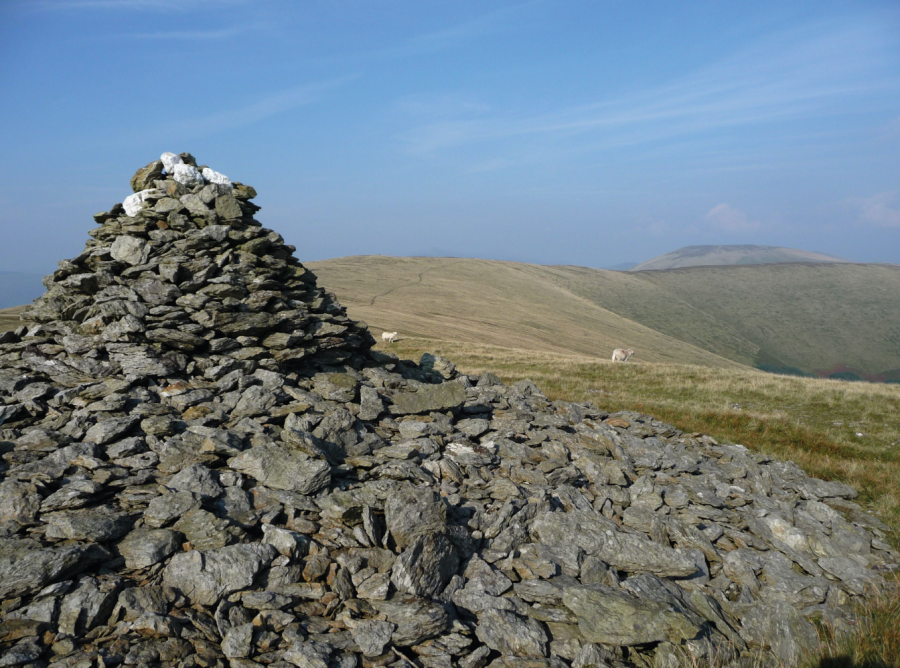
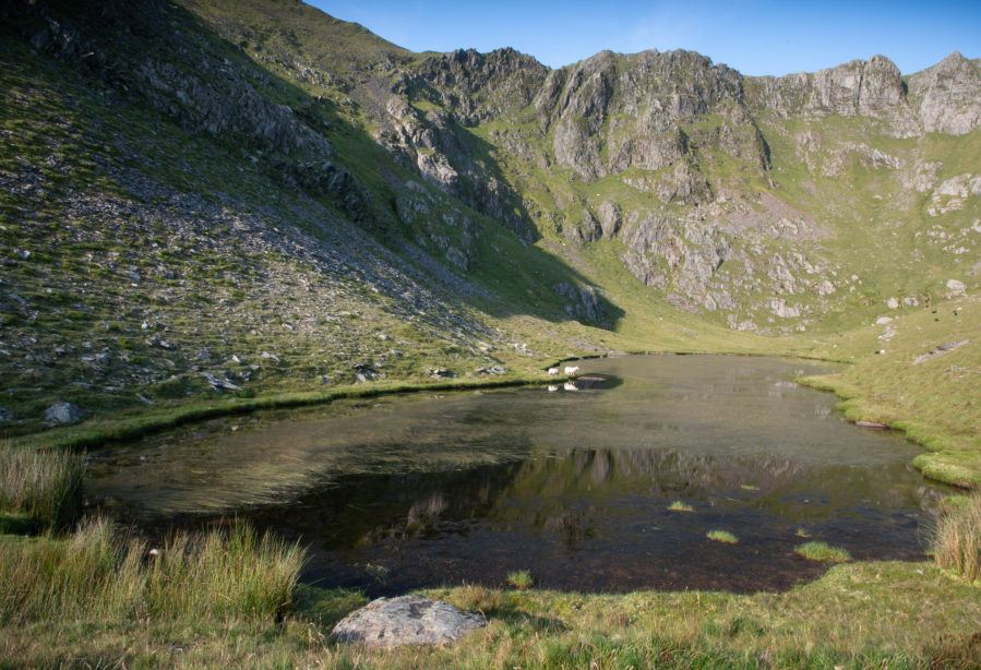
Drum & Carnedd y Ddelw
Andrew Galloway discovers two standing stones that lead to two ancient cairns.
Start/Finish: Public Car Park at Llanfairfechan promenade, LL33 0BY (Grid Ref: SH678754) | Distance: 16 km (10 miles) | Ascent: 817m / 2680ft | Time: 5 hours | Maps: Ordnance Survey 1:25,000 Yr Wyddfa/Snowdon OL17
The highest point on the old Roman Road between Rowen and Abergwyngregyn is known in Welsh as Bwlch y Ddeufaen, which roughly translates into English as the Pass of the Two Stones. The Stones, prehistoric monoliths of indeterminate age, stand, as they have for thousands of years, just to the east of the boundary wall that transects the pass. I followed this wall for a mile or so to the South as it climbed the flank of Blaen y Ddalfa. On Carnedd y Ddelw I discovered the eponymous cairn. Substantial in size, the hollowed-out resting place of some long-forgotten hero. It seemed like a good place to shelter and take stock.
Having recovered composure, I continued southwards along the undulating ridge to the summit of Drum, where rime had locked the catch on the gate. Here I found a second cairn of similar size and construction to the first, recorded by the Ordnance Survey as Carnedd Penyborth-goch. Two stones, two cairns, all of similar antiquity. Before turning about to head for crossroads above Llanfairfechan, I paused in the biting wind to pondered whether the construction of the former wasn’t related to the latter.
Read more: detailed route description for Drum & Carnedd y Ddelw
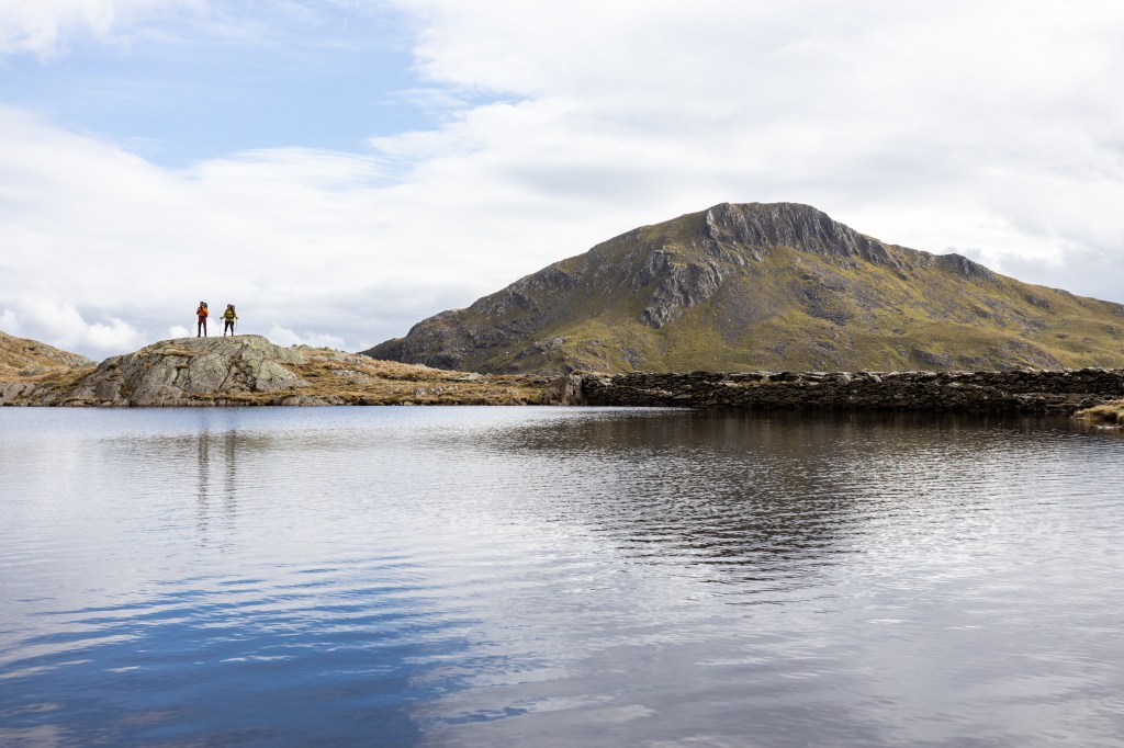
Pen yr Ole Wen and the Carneddau
Francesca Donovan takes a walk on the quiet plateaus of Eryri to the Carneddau via the famous stile of Pen yr Ole Wen.
Start/Finish: A5 layby parking (GR: SH 668605) | Maps: OS Explorer OL17 Snowdon/Yr Wyddfa (1:25k) | Ascent: 2,925ft/1008m | Distance: 9.1 miles/14.7km | Duration: 6 hours
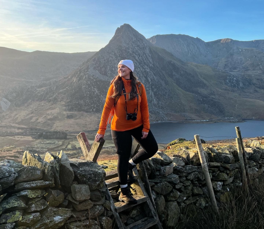
Here’s my unpopular opinion: I think Tryfan is best experienced from the “other” side of the Nant Ffrancon. If you’re looking for a big mountain day with space to roam, reach out and touch the sky, the Carneddau mountain range offers a charming, if less rugged, alternative just a stone’s throw away from the Glyderau’s imposing crags. And yet, ascending via Pen yr Ole Wen from the east (avoiding the relentless scree of its south face) still offers a decent little scramble up to those high, wide plateaus.
Here, on a calm, bluebird day you’ll be treated to views north out to sea as well as the summit of Yr Wyddfa to the south, beyond layer upon layer of mountain magnificence. Towering above Ffynnon Lloer, the Cambrian Way paves an expanse that allows you to stay high for longer. Passing the Ffynnon Llugwy reservoir on your return, you might even catch a glimpse of your altitude-induced grin in a mirror reflection as you descend back down into the crowds along the A5 and towards Ogwen Cottage after one of the best quiet hikes in Snowdonia/Eryri.
Read more: detailed route description for Pen yr Ole Wen and the Carneddau
Nantlle Ridge
Andrew Galloway scrambles the Nantlle ridge to the most westerly mountain in Wales.
Start/finish: Car Park at Rhyd Ddu Welsh Highland Railway station (GR: SH709525)/Crossroads in the centre of the village of Nebo (GR: SH478505) | Distance: 13.6 km / 8.5 miles | Ascent: 983m / 3,225ft | Duration: 7 hours | Maps: Ordnance Survey 1:25,000 Yr Wyddfa/Snowdon OL17
For many years Mynydd Graig Goch languished in obscurity at the far western end of one of the finest ridge walks in Parc Eryri. Popular guidebooks recommended an about-turn on Garnedd-goch, the “final” summit of the Nantlle Ridge, to avoid the dilemma of having to arrange return transport. This all changed in 2008 when a group of enthusiast hillwalkers carried out a detailed GPS survey of the hill. The official height was recorded as 609.75 meters, thus confirming the craggy eminence not merely as a mountain, but the most westerly mountain in Wales.
Having successfully negotiated the rollercoaster challenge of the Nantlle Ridge, it was a pleasure to sit among the frost-shattered tors of Mynydd Graig Goch, bathed in the diffuse light of evening, and watch the sun sink into the shimmering waters of Caernarfon Bay. For this moment alone, the taxi fare from Nebo to Rhyd Ddu was a small price to pay.
The Nantlle Ridge route is classified in guidebooks as a three-star grade one scramble. In good weather, there are excellent views across Parc Eryri with good paths traversing grassy slopes punctuated by a few sections of rocky scrambling. Exposure is never critical but may be unnerving in places to the uninitiated. Previous experience of grade-one scrambles is recommended.
Read more: detailed route description for Nantlle Ridge
Arenig Fawr
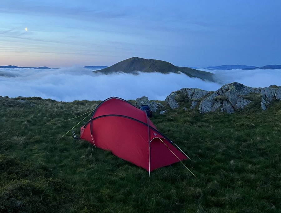
Featuring an overnight stay in the dinky-but-delightful Arenig Fawr bothy, this hike up Arenig Fawr is a quiet antidote to the crowds of the rest of Eryri National Park (Snowdonia), says James Forrest.
START/FINISH: The car park and layby off the A4212, at the western end of Llyn Celyn (GR: SH845403) | MAPS: OS Explorer OL18 (1:25k), OS Landranger 125 (1:50k), Harvey British Mountain Map Snowdonia South (1:40k) | DISTANCE: 16.5km / 10.3 miles | ASCENT: 682m / 2,238ft | DURATION: 5.5 hours
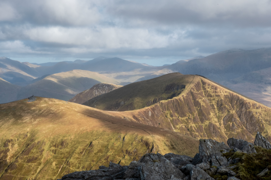
A night in a quaint bothy, a quiet hill to climb in the morning, escapism from the mayhem of Snowdonia’s honey-pot areas – this walk has a lot to offer. The Arenigs are a disparate mountain range to the north and west of Bala, a mix of grassy hills, vast bogs and sudden rocky terrain. They feel quiet and wild, and that is their appeal. Day hike options include a two-peak loop of extinct volcano Rhobell Fawr and its remote neighbour Dduallt, or an ascent of pudding-shaped Arenig Fach from Llyn Celyn, but perhaps the Arenigs’ best route is this one up Arenig Fawr.
The highest of the two Arenigs, 854m Fawr is the range’s grandest mountain, with a scenic ascent up its eastern ridge from the shores of Llyn Arenig Fawr. But this route’s real highlight is spending a night in Arenig Fawr bothy. Believed to have been built as a shelter for reservoir construction workers, this tiny stone structure can only sleep two (or three at a push), yet what it lacks in size it makes up for in charm. With the fire roaring and soup bubbling in your pot, it’s a place to relish in the back-to-basics magic of night in the heart of the mountains.
Read more: detailed route description for Arenig Fawr
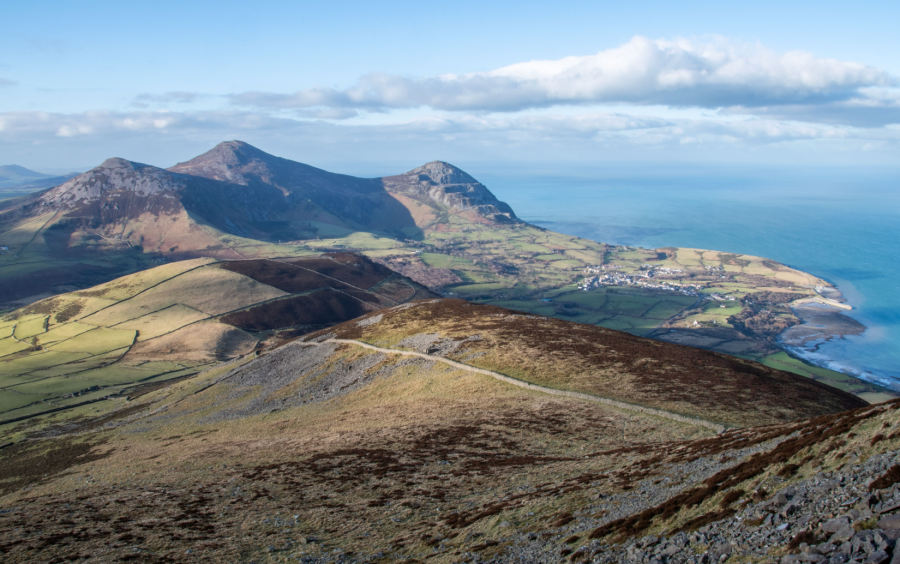
Yr Eifl
Roger Butler enjoys memorable views on the sunny Lleyn Peninsula walking Tre’r Ceiri, Garn Ganol and Garn Fôr – the three tops of Yr Eifl.
Start/Finish: Llithfaen, grid ref SH357431 | Map: OS Explorer 253 and 254 (1:25k), OS Landranger 123 (1:50k) | Distance: 9.25km/5¾ miles | Ascent: 570m/1875ft | Duration: 5 hours
Credit: Roger Butler
We all know what it’s like to be stuck in Snowdonia when it’s raining: the windscreen wipers whip back and forth as you peer into those blankets of grey cloud. But, just half an hour away, the sun could well be shining on the lesser-known Lleyn Peninsula, where the sea-girt panorama from a trio of prominent hills, often known as The Rivals, will always rival any view in the National Park. These three tops, rising steeply above the north coast, are collectively named Yr Eifl.
Tre’r Ceiri (‘the town of the giants’) is capped by a spectacular Iron Age fort with huge stone walls and clusters of hut circles. Garn Ganol (‘centre cairn’) is the highest summit whilst Garn Fôr (‘sea cairn’) is perched above vertical cliffs. Joyful choughs wheel over the crags and on a fine day the views stretch all the way from the Isle of Man to the Wicklow Mountains.
Read more: detailed route description for Yr Eifl
Foel-goch
Nick Livesey is our guide to a bus-enabled linear walk away from the crowds onto Foel-goch, an Eryri hidden gem.
Start/Finish: Ogwen Visitor Centre (GR: SH649693) | Distance: 6 miles/9.7km | Ascent: 518m/1,700ft | Duration: 4 to 5 hours | Maps: OS Explorer OL17 – Snowdon/Yr Wyddfa (1:25k), OS Landranger 115 – Snowdon/Yr Wyddfa (1:50k)
In recent years the Ogwen Valley has become almost as well known for its parking issues as it is for its incredible mountains. This is a shame, as it can put people off – especially those who seek solitude or want to avoid adding to the stresses on local infrastructure. A simple solution is to utilise public transport, and with a little imagination a full-blooded Ogwen adventure away from the crowds can be yours!
This route, which links the Ogwen Valley and Llanberis Pass, is sublime and visits three deserted cwms before topping out on an imposing but seldom-trodden peak. The return journey is similarly bereft of visitors and as you ride the bus back to Capel Curig you can feel smug – or at least content – in the knowledge that you’ve enjoyed some of Snowdonia’s hidden gems and had them all to yourself whilst at the same time avoiding the car park lottery and saving yourself a few quid in petrol as well.
Read more: detailed route description for Foel-goch
Cnicht
Francesca Donovan goes on a circular wander up to the ‘Welsh Matterhorn’, Cnicht, and finds a spectacularly underrated mountain.
Start/finish: Croesor car park (GR: SH631446) | Distance: 6.8 miles / 11km | Ascent: 2,093ft / 683m | Duration: 5 hours | Maps: OS Explorer OL17 (Snowdon/Yr Wyddfa)
Dare I say it? Cnicht is the finest peak in Eryri/Snowdonia. Despite its relatively modest 689m (2260ft), it offers spectacular panoramic views down to the Irish Sea and northwest to Yr Wyddfa/Snowdon itself on a short and sweet excursion. But here, despite the spoils, you’ll find far less foot traffic. Cnicht’s two tops and prominence of just 104m might mean it forgoes true mountain status. Yet, this peak – a perky pyramid befitting its nickname of ‘the Welsh Matterhorn’ – does allow you to get high in relative solitude.
While there are number of routes up Cnicht, this is especially true if you take a circular route from Croesor avoiding the major trails in favour of quieter footpaths where possible rather than taking a there-and-back option. In doing so, you will also experience much of what the Moelwynion has to offer: an abundance of flora and fauna, waterfalls trickling down slick slate, a short scramble, vast mountain llyns tucked behind tussocky ground, edge-of-your-seat walking along high ridges towards sea-to-sky views and incredible artefacts of recent mining history. Indeed, this route takes in a few miles of the Snowdonia Slate trail and The Cambrian Way – parts of which you may have to share with other walkers before you re-route on your own adventure.
Read more: detailed route description for Cnicht
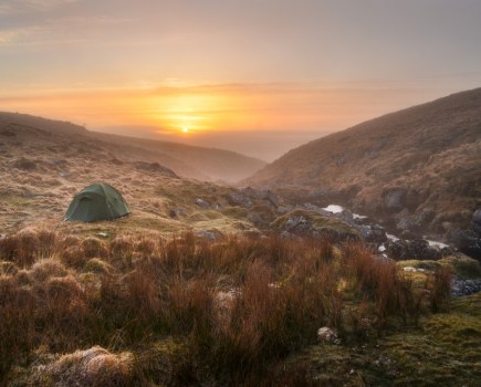
Cwm Caseg
Andrew Galloway seeks a secluded camp spot under Yr Elen alongside the mountain lake within Cwm Caseg.
Start/Finish: Bethesda Pay & Display Car Park GR: SH622667 | Distance: 17 km (10.5 miles) | Ascent: 710m | Time: 3 hours in – 3 hours out | Maps: Ordnance Survey 1:25,000 Yr Wyddfa/Snowdon OL17
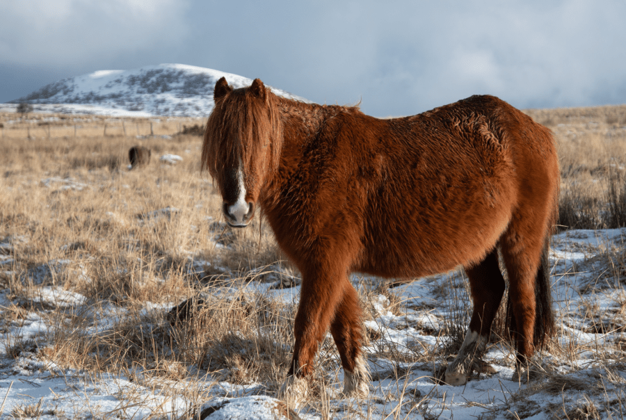
The Welsh word Caseg translates into English as ‘mare’ as in a female horse. The etymology of the name Cwm Caseg no doubt originates in the families of wild ponies that have made their home in this post-glacial valley for many hundreds of years. It feels like many hundreds of years since I studied glacial geomorphology. At the risk of leaping to conclusions I think it’s fair to say that there are a number of phases of glacial erosion visible at Cwm Caseg.
The secluded mountain lake of Ffynnon Caseg – one of the best quiet hikes in Snowdonia/Eryri – marks the location of a cirque glacier that twelve thousand years ago would have carved into the volcanic rocks below the summit of the Carneddau peak of Yr Elen. This late blooming of glacial activity in the British Isles is known to geomorphologists as the Loch Lomond re-advance. By the end of this period almost all permanent glacial ice had disappeared from the mountains of England, Scotland and Wales.
Read more: detailed route description for Cwm Caseg
Yr Wyddfa/Snowdon Girdle
See the highlights of the Yr Wyddfa/Snowdon massif without having to queue for the top by taking the Snowdon Girdle, says Francesca Donovan.
Start/finish: Rhyd-ddu car park (GR: SH571526) | Distance: 21km/13 miles | Ascent: 1647m/5,404ft | Duration: 10 hours or two days | Maps: OS Explorer OL17 (1:25k) – Snowdon/Yr Wyddfa
Yr Wyddfa (Snowdon) is the UK’s most popular mountain, attracting hundreds of thousands of people a year – but even here, there is still ample solitude to be found if you know where to look. Go in search of the mountain’s quiet cwms and sleepy waterfalls by circling the entire massif – and not once touching the busy summit on the Yr Wyddfa/Snowdon Girdle, one of the most challenging long day routes in Eryri (Snowdonia).
The concept, a route devised by the late Showell Styles and first published in his book Mountains of North Wales in 1973, is simple: see the best of the massif without ever summiting the titular peak itself. This might sound counter-productive, especially to peak ‘baggers’, but anyone who has queued to tap Wales’ crowded top spot in recent years will understand the appeal instantly.
The 13-mile walk crosses the paths of the six popular routes up to the summit, but never lingers along them too long. Instead, it takes the scenic – read: technical – route around the mighty mother mountain by way of its crevices and cwms. Here, in these quiet corners, you can absorb the true atmosphere and character of this beautiful mountain without having to make the obligatory hikers’ greetings every few minutes, or shuffle past stag party groups. But beyond the aim of ‘seeking solitude’, you also get to see majestic parts of the massif which you would otherwise miss on the main trails.
Read more: detailed route description for the Yr Wyddfa/Snowdon Girdle
Discover more of Wales’ best walking routes, as mapped by The Great Outdoors’ expert contributors.