
Fiona Barltrop recommends a fine ridge-top walk over the unfrequented Tarrens in Southern Eryri.
Situated in the southernmost part of Eryri National Park are the lovely, little walked Tarren hills that run down to the sea at Aberdovey. Separated from Cadair Idris by the Dysynni Valley and Tal-y-llyn Lake and from Plynlimon by the Dovey (Dyfi in Welsh), this compact range of hills provides some excellent crowd-free walking, notably along the fine ridge that extends for several miles in a south west direction from the Tarrens’ highest point, Tarren y Gesail (667m/2188ft). The only other 2000ft plus top is Tarrenhendre, to the north east of which the slopes are largely swathed in forest, while to the south west the terrain is mostly grassy and smooth rolling.
The popular seaside resort of Aberdovey is served by the scenic Cambrian coast line, with trains every two hours in each direction. From here it’s just a short bus ride to Pennal, the start of this exhilarating linear route, which ascends Tarrenhendre then follows the ridge back to Aberdovey. On a fine day the extensive views are superb. On days of low cloud, there’s a good alternative route following the Wales Coast Path along the foothills of the Tarrens.
The Tarrens, Eryri/Snowdonia: route description
START: Pennal bus stop, GR: SH698004 | FINISH: Aberdovey/Aberdyfi (car park – GR: SN612959, or nearby railway station) or Tywyn | MAPS: OS Explorer OL23; Landranger 135 | DISTANCE: 19.5km/12 miles (+ 7.2km/4½ miles to Tywyn – railway station) | DURATION: 6 – 7 hours (+ 2 hours for extension to Tywyn) | ASCENT: 945m/3100ft
1. SH698004: Aberdovey (Aberdyfi in Welsh) is a pretty village resort, facing south across the Dyfi estuary and sheltered by the Tarren hills to the north. With its clean golden sands and variety of watersports it’s duly popular with visitors.
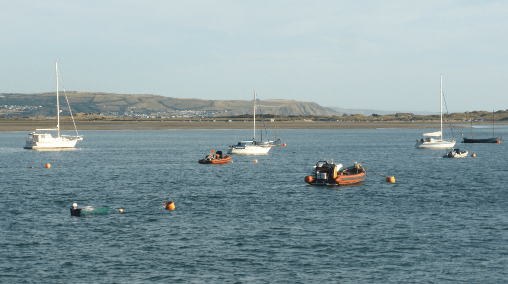
Boats moored off Aberdovey. Credit: Fiona Barltrop
If you’ve arrived at the train station, a short walk from the village, there’s a nearby bus stop. Take the bus to Pennal. From the bus stop/shelter on the north side of the road walk back along the main road a short distance and take the first right, Tower Road, just before the bridge, following the route of the waymarked Wales Coast Path (WCP). (NB For the WCP route back to Aberdovey, continue along the main road a bit further to the entrance drive to Plas Talgarth holiday resort and turn left here.) Continue to the first junction, leaving the WCP and forking left. The lane descends to cross the Afon Pennal, then climbs steadily northwards to Pennal-isaf.
View from Pennal-isaf, pt 2. Credit: Fiona Barltrop
2. SH701018: Turn left at the fence (the track continues to a large white house, Esgair-isaf ahead) and follow the waymarks. The path climbs quite steeply up grassy slopes in a roughly northerly direction via Mynydd Cefn-caer to meet an extension of a forest road (SH701038). Bear left along the track which curves round the head of a valley and leads you up to the skyline and ridge-top path (with a fence running alongside). Turn left to continue the ascent to the summit of Tarrenhendre and a crossing fence.
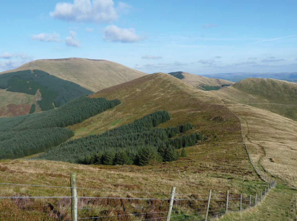
View back twds Tarren y Gesail on ascent to Tarrenhendre, between pts 2&3. Credit: Fiona Barltrop
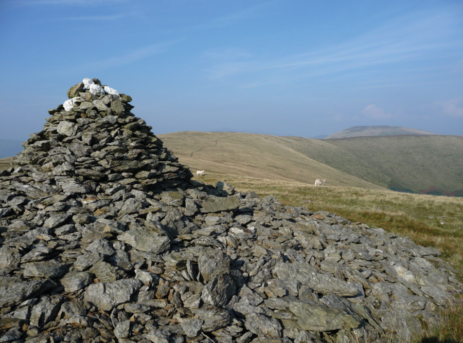
3. SH684040: Turn left, keeping the fence on your right and continue along the ridge to Trum Gelli, marked by two substantial cairns.
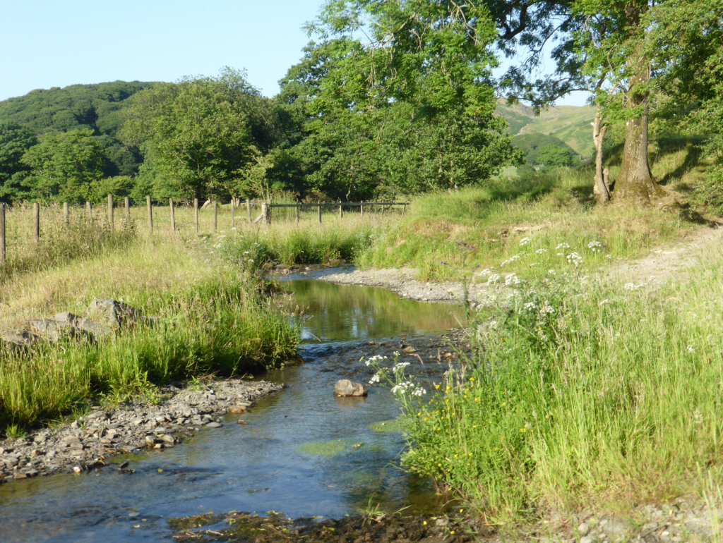
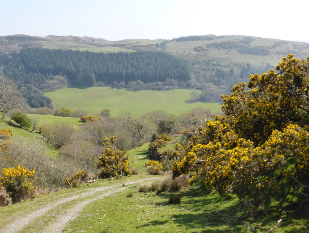
Afon Dyffryn-gwyn, Happy Valley (Cwm Maethlon), nr pt 5. Credit: Fiona Barltrop
4. SH656015: The path now keeps well to the east of the ridge and fence-line as it continues its descent to reach a crossing track. Carry on in the same direction over Bryn Dinas down to the Happy Valley/Cwm Maethlon road.

View back NE twds Tarrenhendre (top L) from S of Happy Valley (Cwm Maethlon), beyond pt 5. Credit: Fiona Barltrop
5. SN629985: Turn left along the road, then first right past some dwellings and across Afon Dyffryn-gwyn. Follow the track up through a wood and once clear of the trees continue in the same direction uphill until you reach a small road that will lead you down to Aberdovey. On a fine evening, it’s worth continuing along the beach (WCP) to Tywyn to enjoy sunset.
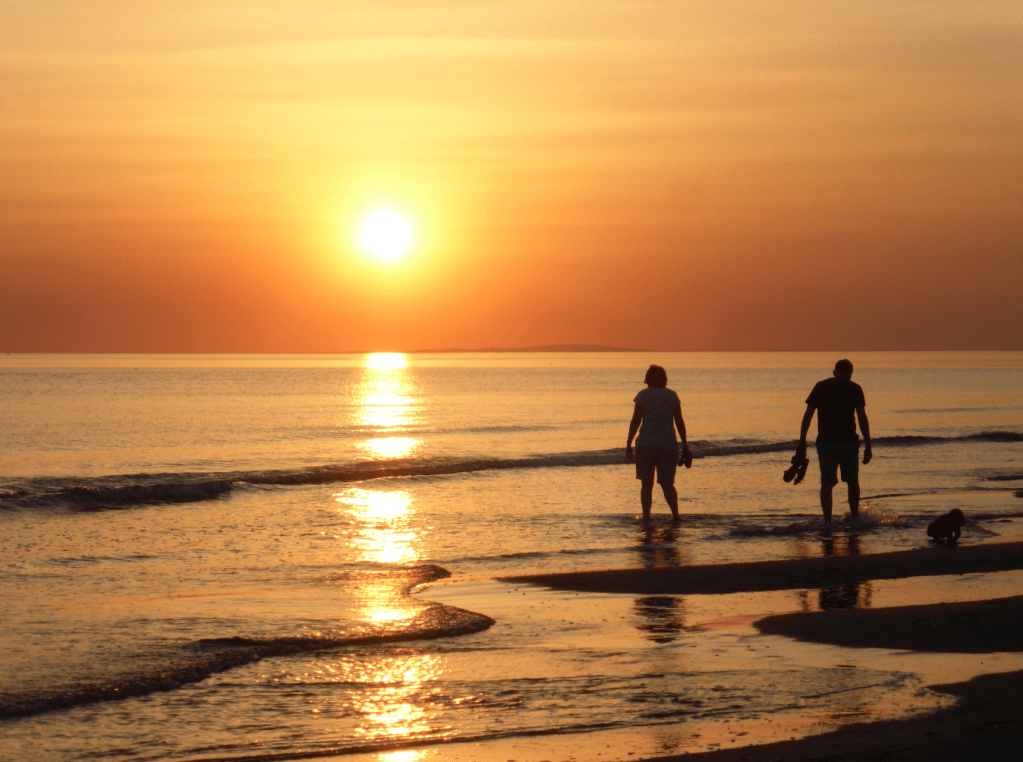
Sunset strollers along beach between Aberdovey & Tywyn. Credit: Fiona Barltrop
Wales Coast Path alternative
As will be noticed from the map, the Wales Coast Path (WCP), which has to detour well inland via Machynlleth, to get round the Dyfi estuary, follows a route along the foothills of the Tarrens, also linking Pennal and Aberdovey – a good option on days of low cloud. With the A493 hugging the riverside, the WCP instead makes use of tracks and quiet lanes to the north. Though hardly a ‘coast’ path, like other upland stretches of the WCP it provides some lovely views. The track named Panorama Walk on the OS Explorer map is called that for good reason!
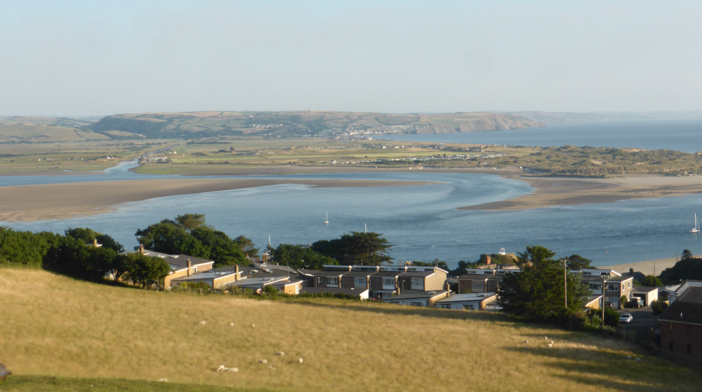
View over Dovey (Dyfi) estuary on descent to Aberdovey, nr end. Credit: Fiona Barltrop
The initial stretch of the WCP from Pennal loops to the south of the main road, taking you through the grounds of a holiday resort. Beyond the bungalows there are some lovely views over the River Dyfi. Once back across the A493, the route heads uphill along a quiet no-through road, continuing along a track (which becomes the Panorama Walk), in due course affording more fine views over the Dyfi estuary. Beyond Bwlch Farm the WCP continues along a quiet lane again, this time the beautiful views to the north, rather than south, over Cwm Maethlon, aka Happy Valley. This can be followed all the way down to Aberdovey (arguably better views than the WCP, although follow that if preferred).
Further information
PUBLIC TRANSPORT: Trains from Machynlleth to Pwllheli via Aberdovey & Tywyn; Lloyds Coaches bus service G21 from Dolgellau to Machynlleth via Tywyn, Aberdovey (nearest bus stop to station: Parc yr Ysgol) and Pennal
TOURIST INFORMATION: Aberdovey TIC (01654 767321)
Walk more routes in Wales, as mapped by our experts.


