
Andrew Galloway discovers two standing stones that lead to two ancient cairns.
The highest point on the old Roman Road between Rowen and Abergwyngregyn is known in Welsh as Bwlch y Ddeufaen, which roughly translates into English as the Pass of the Two Stones. The Stones, prehistoric monoliths of indeterminate age, stand, as they have for thousands of years, just to the east of the boundary wall that transects the pass. I followed this wall for a mile or so to the South as it climbed the flank of Blaen y Ddalfa. On Carnedd y Ddelw I discovered the eponymous cairn. Substantial in size, the hollowed-out resting place of some long-forgotten hero. It seemed like a good place to shelter and take stock.
Having recovered composure, I continued southwards along the undulating ridge to the summit of Drum, where rime had locked the catch on the gate. Here I found a second cairn of similar size and construction to the first, recorded by the Ordnance Survey as Carnedd Penyborth-goch. Two stones, two cairns, all of similar antiquity. Before turning about to head for crossroads above Llanfairfechan, I paused in the biting wind to pondered whether the construction of the former wasn’t related to the latter.
Drum & Carnedd y Ddelw: route description
Start/Finish: Public Car Park at Llanfairfechan promenade, LL33 0BY (Grid Ref: SH678754) | Distance: 16 km (10 miles) | Ascent: 817m / 2680ft | Time: 5 hours | Maps: Ordnance Survey 1:25,000 Yr Wyddfa/Snowdon OL17
1. SH678754: Start in the car park by the boating lake on the promenade at Llanfairfechan. From here you can see across the Menai Straight to the Island of Ynys Môn Anglesey. Walk along Station Road to the crossroads. Cross the road and continue along Village Road, passing the Town Hall to the bridge at Pentre Uchaf.
2. SH683746: Do not cross the bridge. Follow Valley Road for 1.2km to where it splits into two. Continue ahead along Newry Drive for 200m to a hairpin bend. At a gate enter the Nant y Coed Nature Reserve. Through the trees to the left you can see a small hill known as Dinas. Recent archeological excavation undertaken by Ymddiriedolaeth Archaeolegol Gwynedd Archaeological Trust has provided evidence that the hill was a site of stone axe production during the neolithic period.
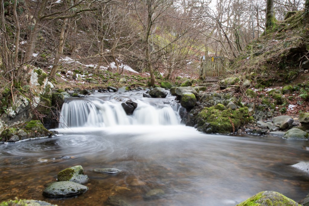
Afon Llanfairfechan. Credit: Andrew Galloway
3. SH694740: Follow the riverside path for 600m through the nature reserve, keeping to the north bank of the river. Where the river tumbles over a cascade, cross to the south bank by means of stepping stones. Pass through a wooden gate to a small parking area. Exit the parking area, turning to the left onto a narrow lane. After less than 100m a gate on the left leads to a well defined track that climbs beside the wooded banks of the river for 200m. On the right a gate leads onto open pasture.
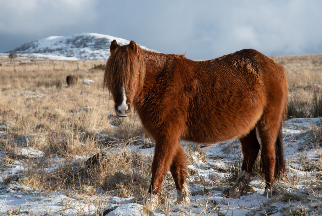
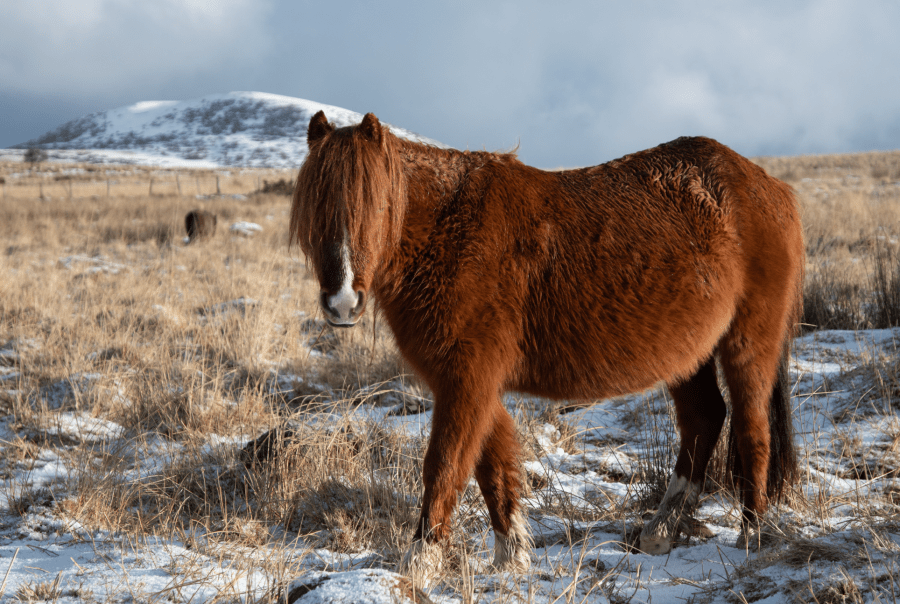
Carneddau pony on the Ffridd. Credit: Andrew Galloway
4. SH700735: Pass through the gate and continue across rough pasture for 600m. A further gate leads onto open moorland. Here you will most likely find Carneddau ponies grazing. Recent research by the University of Manchester has shown that the Carneddau ponies are some of the healthiest (and quite possibly happiest) semi-feral ponies in the United Kingdom. Follow a path SE across boggy ground for 1.3km.
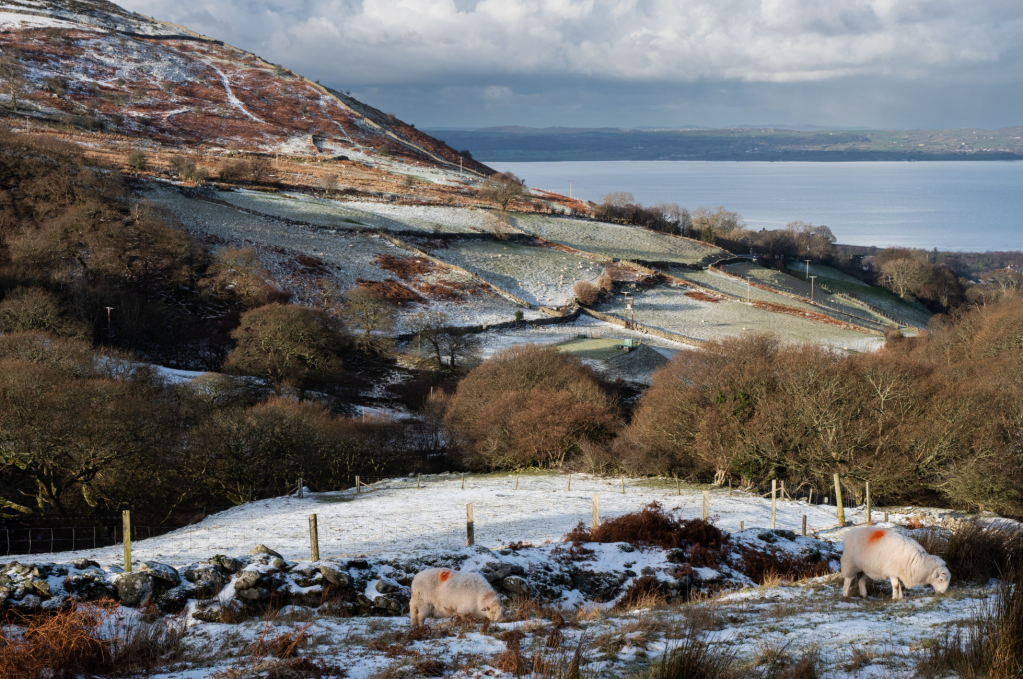
Bwlch y Ddeufaen on the Roman Road. Credit: Andrew Galloway
5. SH714719: Beneath power cables follow a stone wall SW for 200m to a large iron gate on the old Roman Road at Bwlch y Ddeufaen, which translates from Welsh into English as the pass of the two stones.
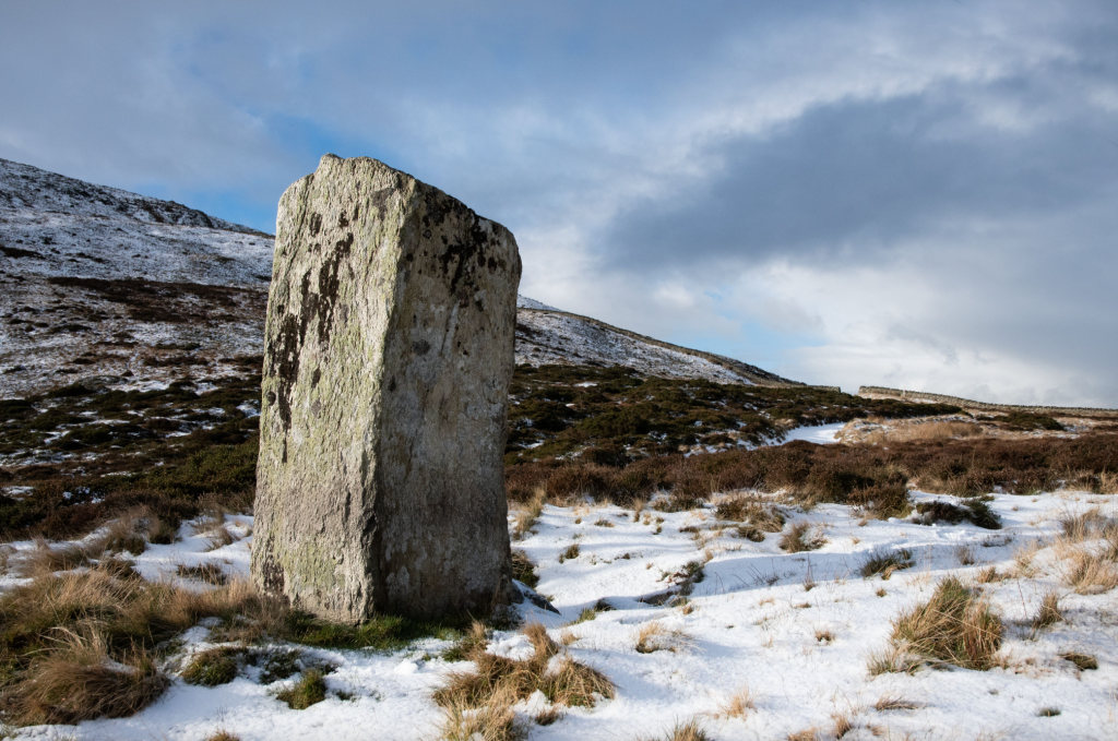
Standing stone at Bwlch y Ddeufaen. Credit: Andrew Galloway
6. SH712718: Keeping the wall on your left, climb the slope SW for 1.3km to a small cairn on Blaen y Ddalfa (665m). The boundary, now marked by a wire fence, continues SE for 450m to a second cairn Carnedd y Ddelw (688m).
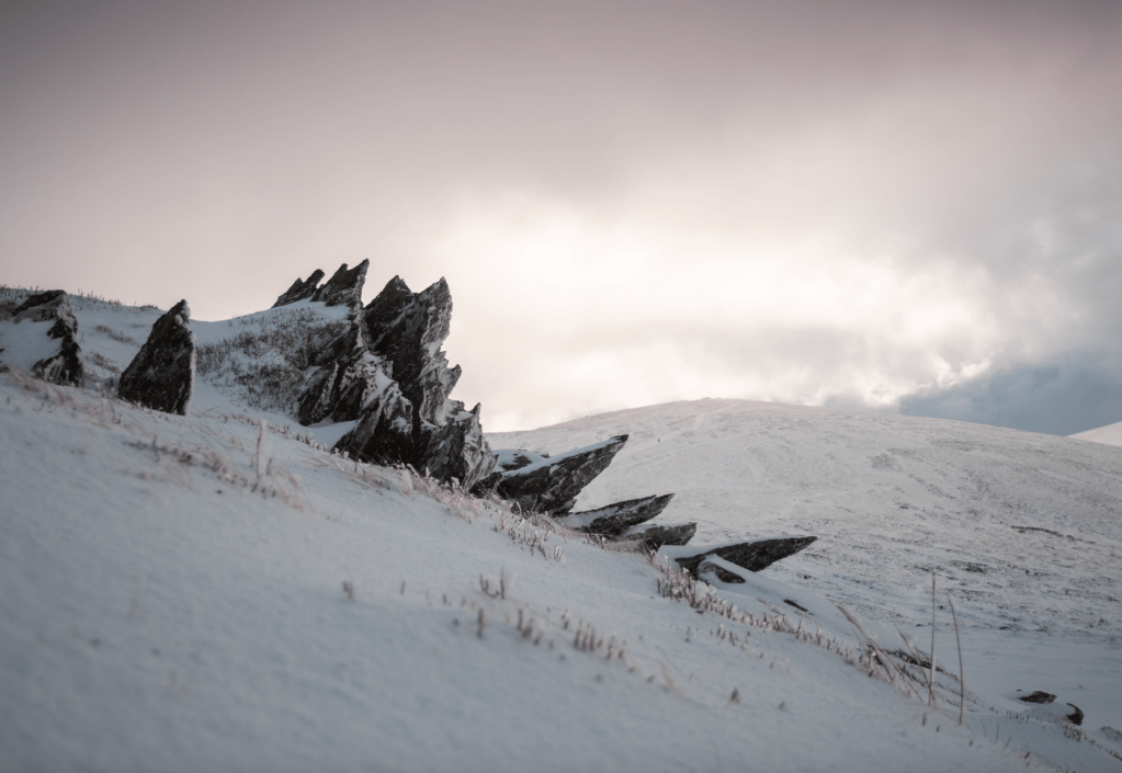
Rocky outcrop on Carnedd y Ddelw. Credit: Andrew Galloway
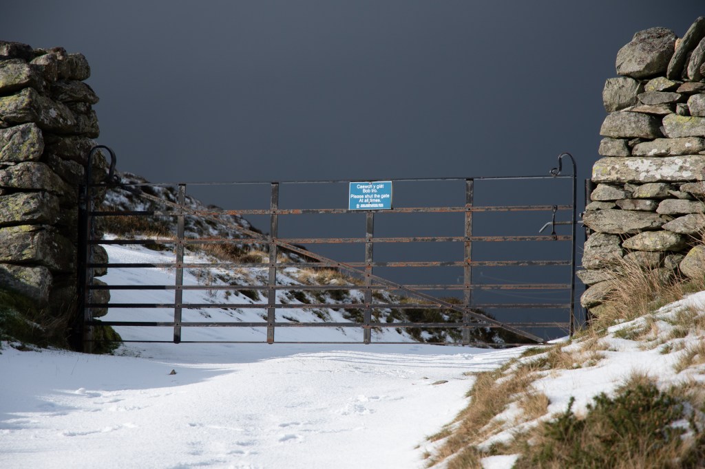
7. SH707705: Now head S for 1km keeping the fence to your left to reach the top of Drum. A metal gate allows access to the summit cairn named Carnedd Pen y Borth-Goch. (NB. In Welsh place names ‘u’ is usually pronounced as ‘ee’ sometimes as ‘uugh’).
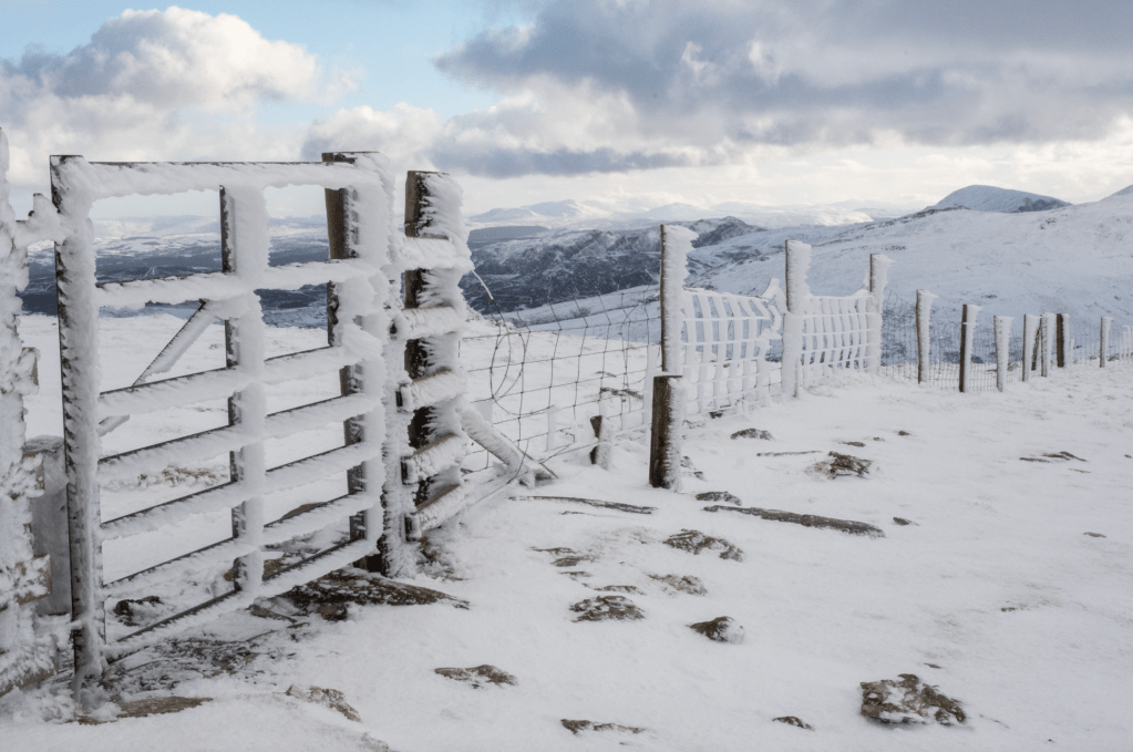
Gate on the top of Drum. Credit: Andrew Galloway
8. SH708695: Return through the gate. 100m to the NNW of the gate a track descends northwards across the higher slopes of Cwm Anafon for 700m then NW for 2.2km, passing to the east of the minor peaks of Pen Bryn Du and Yr Orsedd.
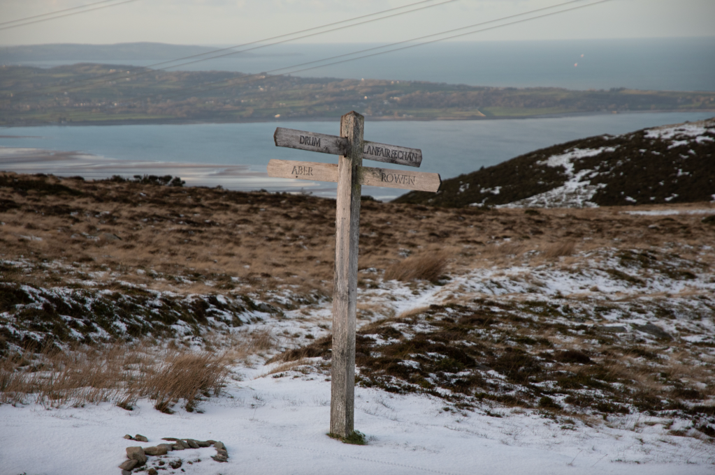
Fingerpost at the Crossroads on the Roman Road. Credit: Andrew Galloway
9. SH693722: A four fingered post marks the crossroads on the old Roman Road. Continue northwards for 900m across the heather of Garreg Fawr to where paths divide.
Nant y Pandy. Credit: Andrew Galloway
10. SH688731: Follow the path along a wall heading NW for 1.1km to a narrow lane. Follow the lane to the W for 150m. At the junction turn right. Follow the lane for 800m on the outskirts of Llanfairfechan to the Aber Road.
11. SH680745: Walk along the Aber Road in the direction of Conwy (NNE) for 300m to the traffic lights in the centre of Llanfairfechan. Turn left and follow Station Road to return to the promenade. If the Beach Pavilion Cafe is open why not treat yourself to a coffee of an ice cream?
Further information
Public Transport: Transport for Wales Trains on the Chester to Holyhead line stop regularly at Llanfairfechan station.
Information: Eryri National Park
Discover more walks in Wales as mapped by our expert contributors.


