
Andrew Galloway seeks a secluded camp spot under Yr Elen alongside the mountain lake within Cwm Caseg.
The Welsh word Caseg translates into English as ‘mare’ as in a female horse. The etymology of the name Cwm Caseg no doubt originates in the families of wild ponies that have made their home in this post-glacial valley for many hundreds of years. It feels like many hundreds of years since I studied glacial geomorphology. At the risk of leaping to conclusions I think it’s fair to say that there are a number of phases of glacial erosion visible at Cwm Caseg.
The secluded mountain lake of Ffynnon Caseg marks the location of a cirque glacier that twelve thousand years ago would have carved into the volcanic rocks below the summit of the Carneddau peak of Yr Elen. This late blooming of glacial activity in the British Isles is known to geomorphologists as the Loch Lomond re-advance. By the end of this period almost all permanent glacial ice had disappeared from the mountains of England, Scotland and Wales.
Cwm Caseg: route description
Start/Finish: Bethesda Pay & Display Car Park GR: SH622667 | Distance: 17 km (10.5 miles) | Ascent: 710m | Time: 3 hours in – 3 hours out | Maps: Ordnance Survey 1:25,000 Yr Wyddfa/Snowdon OL17
1. SH622667: Ogwen Street leads from Bethesda car park to the High Street (A5) in less than 50 metres. Turn right onto the High Street walking in a Southwesterly direction.
2. SH622668: After 100m you will see a war memorial set in the garden of the Presbyterian Capel Jeriwsalem (this is how Jerusalem is spelt in Welsh). Just beyond the war memorial is a side street. The path here passes between the chapel and Christ Church, the parish church built in 1856.
3. SH624666: Turn right onto Pant Glas Road and walk 200m to the crossroads.
4. SH626667: Now follow Gerlan New Road for a further 250m to a second crossroads.
5. SH629666: Continue ahead along Gerlan New Road, passing Caban Cysgu on the left.
6. SH632664: At Gerlan hamlet turn left onto Morgan Street for 100m to where a cinder track leads to the right. After a further 100m a path leads to the right then divides into two.
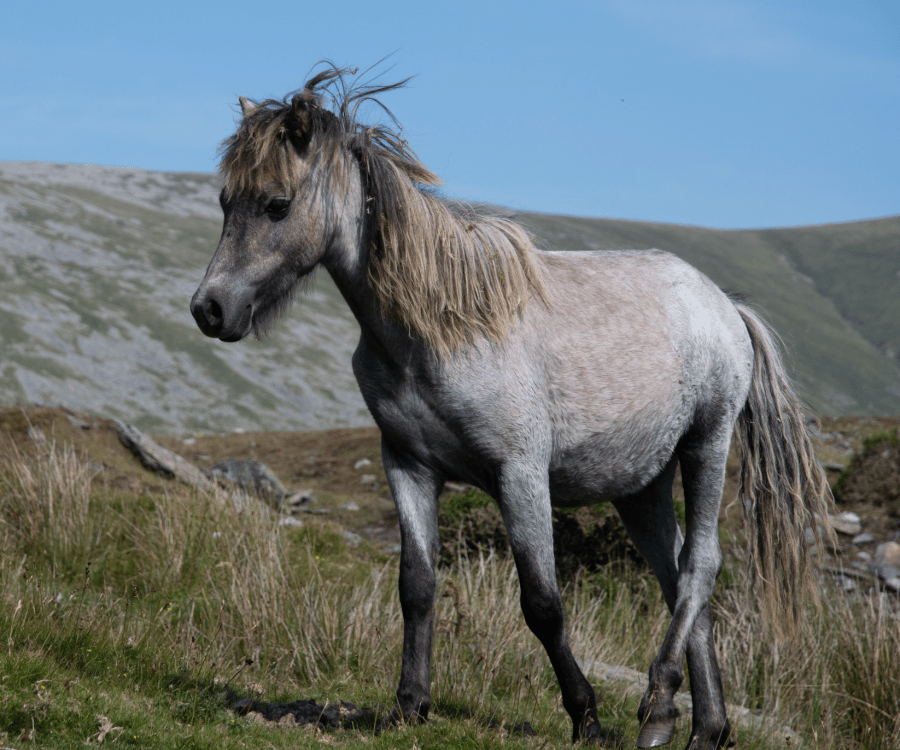
A Carneddau Pony.
Credit: Andrew Galloway
7. SH634665: Take the footpath on the left for 300m crossing three fields of grazing pasture to the farm buildings at Tan y Garth.
8. SH637667: Take the track to the right passing behind the farmhouse buildings. It heads south for 200m then swings around rocky undergrowth to head east for a further 100m. Cross the stile by a water pumping station.
9. SH639665: The footpath now follows the boundary between open moorland and grazing pasture, know in Welsh as ‘Ffridd’ for 1km.
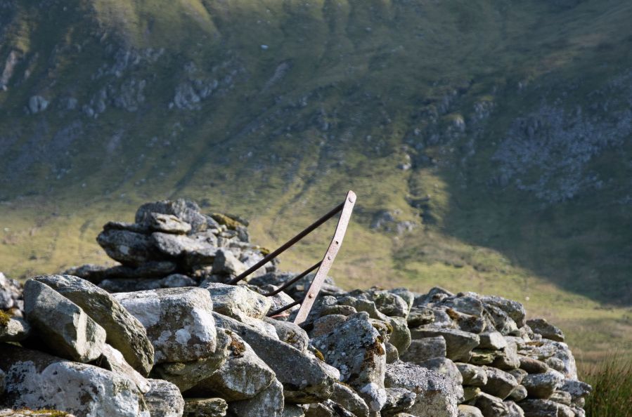
Sheepfold on Carreg y Gath.
Credit: Andrew Galloway
10. SH646667: Cross a stile close by a small quarry. From here the path beings to gain height incrementally for a further kilometre until sheepfolds clustered within the ruins of an Iron Age settlement are reached. Though much of this ancient settlement has sadly been lost, the outline of some buildings can still be identified.
11. SH657669: Beyond the sheepfolds the path becomes less distinct. Continue along the valley for a further 1.8km, crossing a number of small streams, to a second cluster of sheep folds clustered beside a brook known as Afon Wen in Welsh.
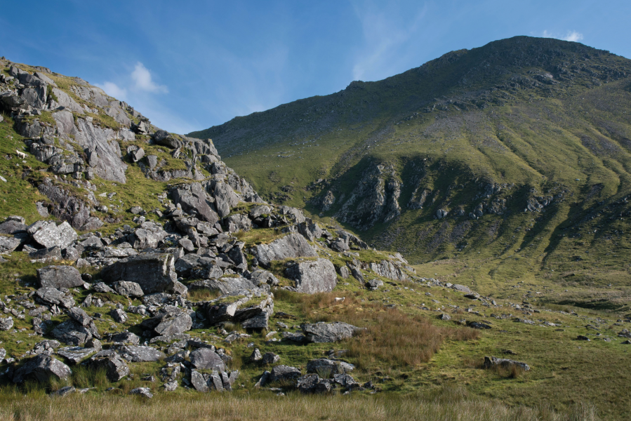
Yr Elen from Carreg y Gath.
Credit: Andrew Galloway
12. SH673663: East of the sheepfolds an old mining track, missing from the OS map, contours around the foot of the crags at Careg y Garth.
13. SH674658: Beyond the crags the track loses definition. Follow the stream on its north bank for 500m to where a cascade falls from Cwm Bychan.
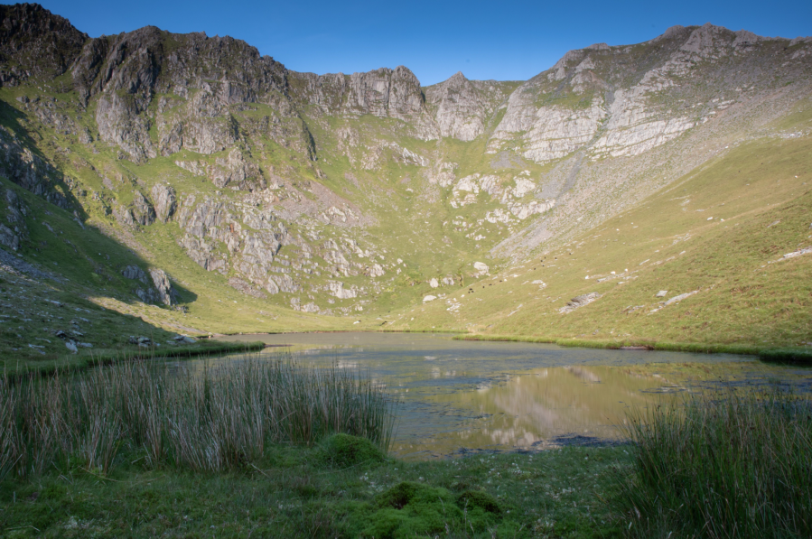
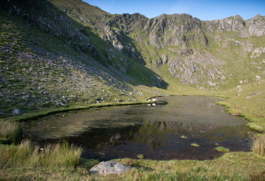
Ffynnon Caseg in the early morning light.
Credit: Andrew Galloway
14. SH679656: Cross the stream. There is no discernible path from this point so head S into the Cwm, keeping to the east of the stream to avoid the most boggy ground. As the ground steepens move diagonally across the slope to reach the lip of the Corrie.
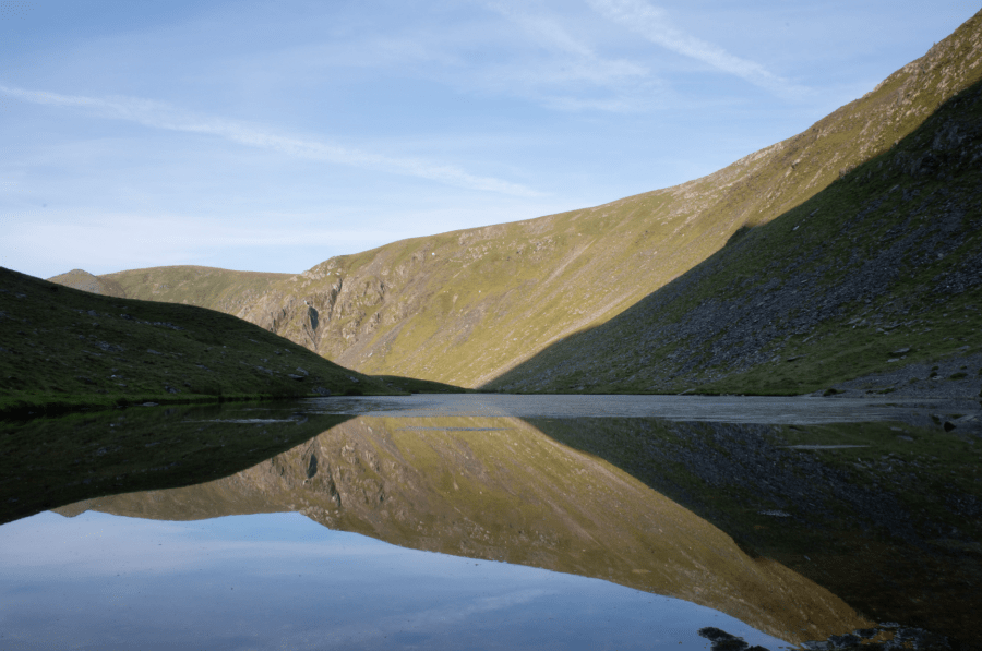
Reflections in Ffynnon Caseg.
Credit: Andrew Galloway
15. SH679650: Ffynnon Caseg lies cradled between the steep walls of the cirque. A faint path leads along the southern edge of the lake to a small area as grass, ideal for making camp. A little further to the West you will find the ruined entrance to a small mine, dug into the crag beneath Yr Elen. Return to Bethesda by the same route.
Further information
Public transport: Bus number 67 & 67C run from Bangor bus station to Bethesda. For a timetable check Arriva Bus.
Further information: www.snowdonia.gov.wales
Nearest YHA: Idwal Cottage
Discover more of the best walking routes in Wales, as mapped by The Great Outdoors’ expert contributors.


