
Andrew Galloway walks a Welsh beast in Eryri with two horns; one red, one black – Gyrn Ddu & Gyrn Goch.
Many of the hills and mountains of Eryri/Snowdonia owe their existence to an episode of volcanic activity in a period of geological time known as the Ordovician, some four hundred and fifty million years ago. Back then Wales was part of a shallow tropical sea on the margins of what geologists refer to as a subduction zone, where part of the earth’s crust was forced beneath an opposing part. The ensuing friction resulted in a chain of volcanoes aligned roughly south-west to north-east. Some of these volcanoes erupted under the surface of the sea, whilst others rose up to become the classic volcano cone shape, spewing ash and lava into the Ordovician sky. The rocks that form the twin horns of Gyrn Ddu and Gyrn Goch, overlooking Caernarfon Bay, are examples of both. The andesitic tuffs of Gyrn Ddu weather to grey, whereas the granite of Gyrn Goch weathers with a russet hue. Hence the origin of the Welsh names, “ddu” meaning black and “goch” meaning red. During the nineteenth century these rocks were extensively quarried, their toughness making them the ideal building material.
Gyrn Ddu & Gyrn Goch from Trefor: route guide
Start/Finish: The free public car park at Traeth Trefor Beach (GR: SH376472) | Distance: 11 km (7 miles) | Ascent: 625 meters (2,050 feet) | Duration: 5 hours | Maps: Ordnance Survey 1:25,000 OS Explorer Map 254 of the Lleyn Peninsula East/ Pen Llŷn Ardal Ddwyreiniol
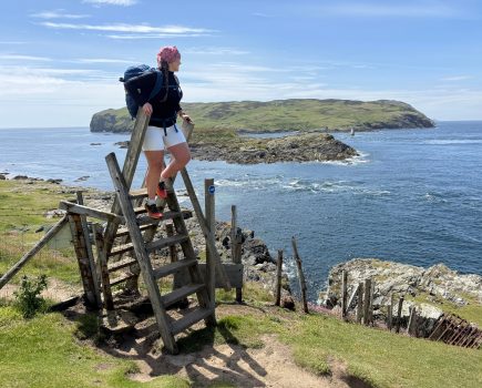
A word about walls: although Gyrn Ddu and Gyrn Goch are located on access land there are no footpaths to the tops. The only path with stiles provided continues eastwards to the south of Bwlch Mawr. In places the walls have suffered from weathering and natural decline. I have recommended a route where this has made passage across the walls possible. Please always treat the access land with respect.
1. SH376472: From the beach car park turn left and follow the minor road, also the route of the North Wales Pilgrim’s Way, for 400m to the bus stop and turning point. Turn left and walk along the pavement beside the road due east for 900m to the A499. Cross the A499 with care.
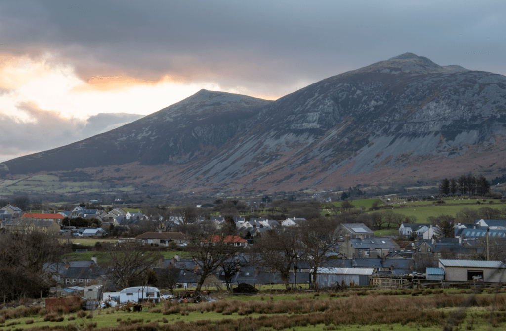
Gyrn Ddu & Gyrn Goch above Trefor. Credit: Andrew Galloway
2. SH384466: Look for a short footpath on the right leading to the old Caernarfon road, now designated a footpath/cycle track. Walk to the north-east for 200m to the entrance to Rock Cottage. A kissing-gate on the left provides access. Walk along the drive for 200m to a second kissing-gate, marked with a footpath sign, on the left.
3. SH387466: Walk through the meadow for 150m, passing Rock Cottage on the right, to reach a further kissing-gate leading into a small copse of trees. The land owner has thoughtfully provided a large aluminium hand to point walkers in the correct direction! Once through the gate immediately turn to the left and follow the old quarry track north-east for 300m.
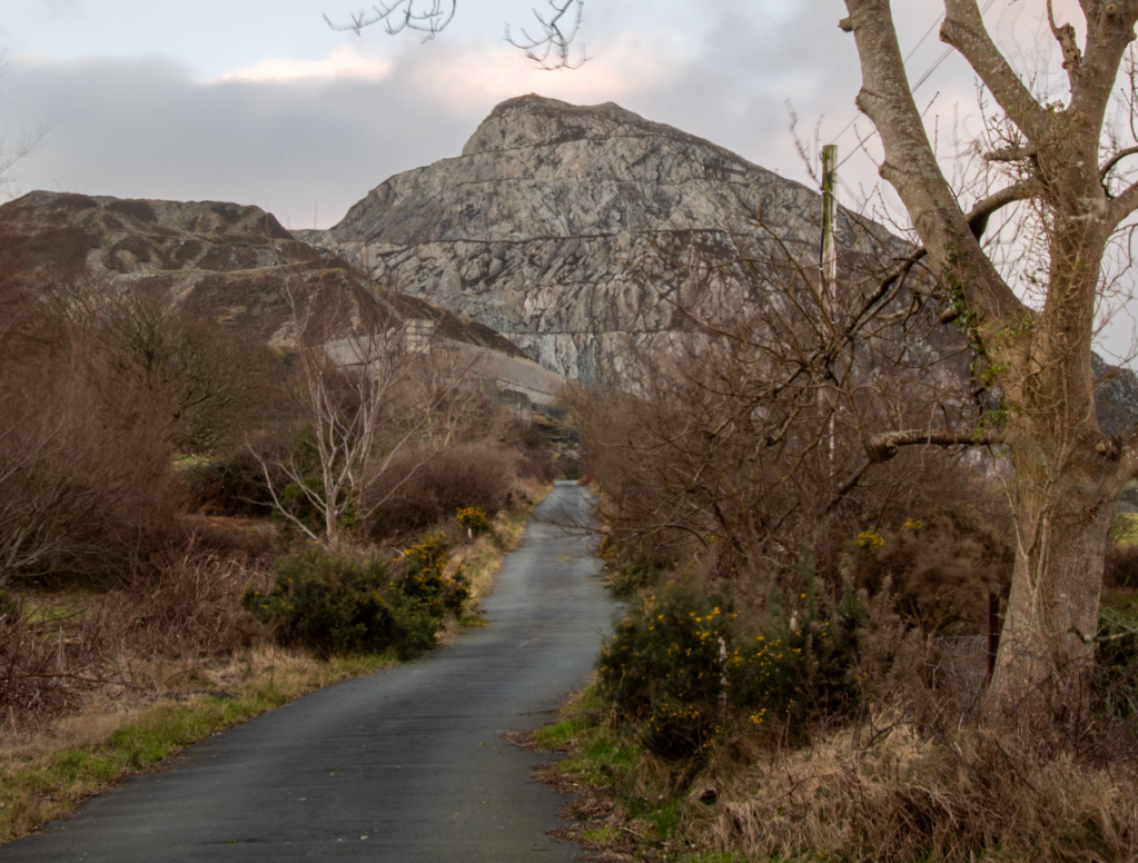
The old incline leading to Trefor Quarry. Credit: Andrew Galloway
4. SH391467: At an intersection of paths, turn to the right and continue along the quarry track due south for a further 500m. Keep to the track as it turns left to the east for a further 300m to a field gate and sheepfold beside the abandoned farmstead of Pen-y-Bwlch. Here a well-constructed stone wall extends northwards over the moor.
5. SH395462: Keeping the first wall on your right, head northwards uphill for 150m to where it intersects with a second wall. Cross the second wall with care and head over the moor to the north-east for 300m towards the foundations of an ancient settlement, marked on the OS map, using the first wall as a guide. Just beyond the settlement there is a break in the wall.
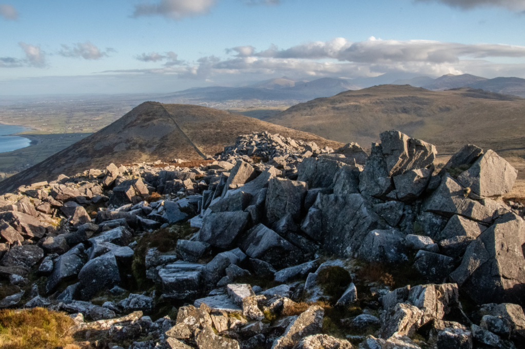
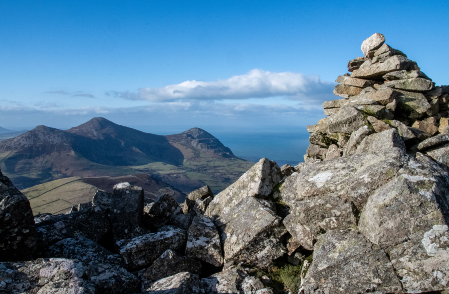
Gyrn Goch & Bwlch Mawr from the top of Gyrn Ddu. Credit: Andrew Galloway
6. SH398467: Beyond the wall head north-east over open moorland towards Gyrn Ddu. The top of the hill is a boulder field of frost shattered rocks. Scramble with care over the rocks to reach the cairn on the summit.
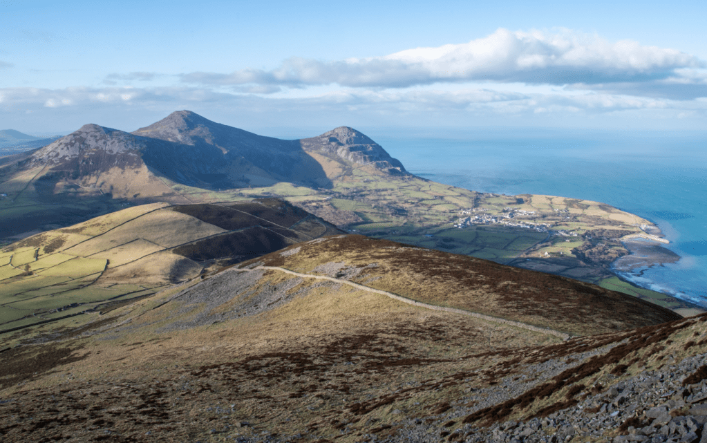
Tre’r Ceiri & Yr Eifl from the top of Gyrn Ddu. Credit: Andrew Galloway
7. SH401467: From the top of Gyrn Ddu head north-east, at first over boulders then open moorland, for 480m to where the remains of walls intersect. Keeping the wall to your left continue north-east for 500m to the top of Gyrn Goch.
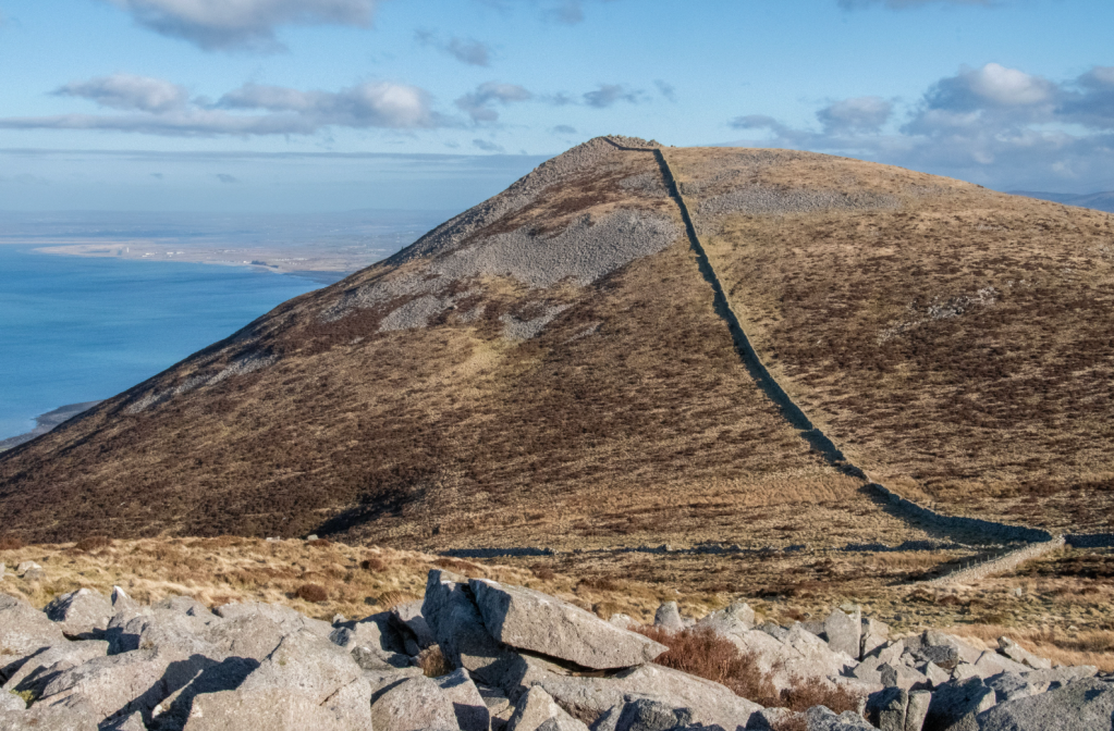
Gyrn Goch with Dinas Dinlle and Caernarfon Airfield in the distance. Credit: Andrew Galloway
8. SH407475: From the top of Gyrn Goch, walk south-south-east across the open moor for 600m to the corner of a wall. Keep the wall on your left and head due south for 250m to where a second wall intersects east-west. Pass through the obvious gap in the wall and continue due south across access land for 500m to reach a ladder stile by a sheep fold.
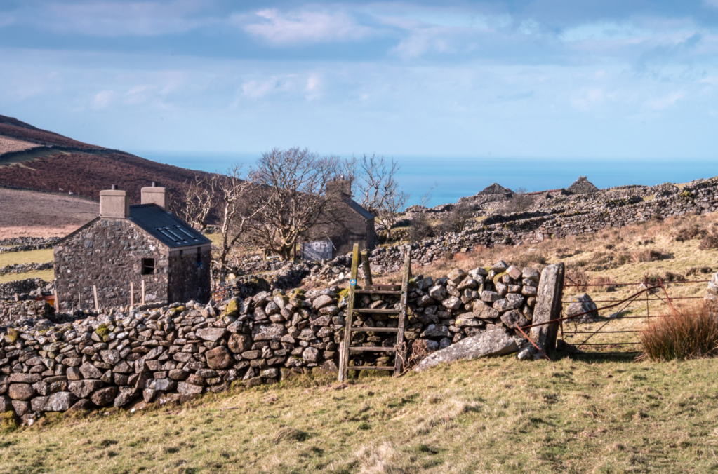
Fron-heulog homestead. Credit: Andrew Galloway
9. SH408461: Cross the stile and head along the obvious track towards the west for 1.3km to reach the abandoned homestead of Fron-heulog, the name of which translates delightfully into English as “sunny-hillside.”
10. SH396461: Continue along the track westwards for a further 160m to return to the sheepfold at Pen-y-Bwlch. Continue to the west along the track as it descends by the old quarry, eventually returning to the meadow beside Rock Cottage. From the old Caernarfon road cross the A499 again with care and follow the route of the North Wales Pilgrim’s Way to the village of Trefor and the car park beside the beach.
Further information
Public Transport: There are two bus operators serving Trefor from Caernarfon and Pwllheli: Berwyn Garage & Coaches and Clynnog & Trefor Motor Co Ltd.
Information: eryri.gov.wales