
Roger Butler enjoys memorable views on the sunny Lleyn Peninsula walking Tre’r Ceiri, Garn Ganol and Garn Fôr – the three tops of Yr Eifl.
We all know what it’s like to be stuck in Snowdonia when it’s raining: the windscreen wipers whip back and forth as you peer into those blankets of grey cloud. But, just half an hour away, the sun could well be shining on the lesser-known Lleyn Peninsula, where the sea-girt panorama from a trio of prominent hills, often known as The Rivals, will always rival any view in the National Park. These three tops, rising steeply above the north coast, are collectively named Yr Eifl.
Tre’r Ceiri (‘the town of the giants’) is capped by a spectacular Iron Age fort with huge stone walls and clusters of hut circles. Garn Ganol (‘centre cairn’) is the highest summit whilst Garn Fôr (‘sea cairn’) is perched above vertical cliffs. Joyful choughs wheel over the crags and on a fine day the views stretch all the way from the Isle of Man to the Wicklow Mountains.
Yr Eifl: route description
Start/Finish: Llithfaen, grid ref SH357431 | Map: OS Explorer 253 and 254 (1:25k), OS Landranger 123 (1:50k) | Distance: 9.25km/5¾ miles | Ascent: 570m/1875ft | Duration: 5 hours
1. SH357431: Just east of the crossroads in Llithfaen, take the lane leading north. Walk uphill for 0.5km to the gate by a white cottage – a rough track now continues ahead over the moor. Walk north-east to a kissing gate in a fence, with National Nature Reserve sign. A rocky path continues north-east to a wall with another kissing gate and reserve sign.
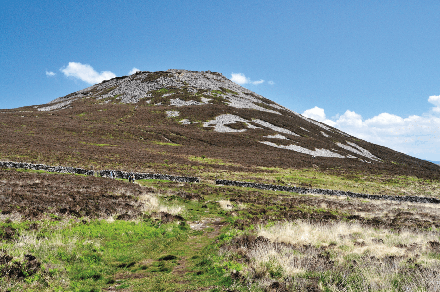
View towards Tre’r Ceiri from the path above Llithfaen.
Credit: Roger Butler
2. SH368443: Keep ahead and follow the path up to the dramatic wall which marks the start of the hill fort on Tre’r Ceiri. Continue to the top, past hut circles on L, and walk around the northern perimeter – on the west side, take the second exit in the wall.
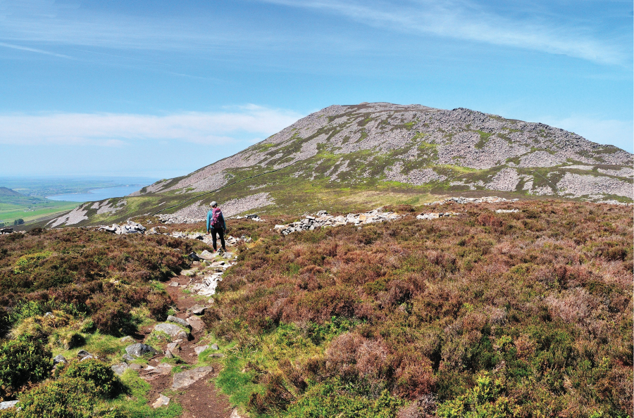
3: Looking west to Garn Ganol , the highest summit of the Ye Eifl group, from the path to Tre’r Ceiri.
Credit: Roger Butler
3. SH372446: Follow the path across the valley, proceed to a small gate in a fence and continue, climbing west, to the top of Garn Ganol. (Note: Garn Ganol and Garn Fôr aren’t specifically named on the OS map).
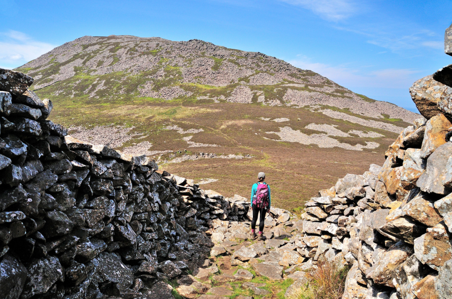
6: Leaving Tre’r Ceiri via an ancient entrance in the high defensive wall, with Garn Goch beyond.
Credit: Roger Butler
4. SH365447: Leave the summit on a well-established path which descends steeply north to a broad track at Bwlch yr Eifl. Go straight over onto a rough track and fork L towards a gap between two old quarry buildings. Stone steps, by an isolated telegraph pole, lead to the top of Garn Fôr.
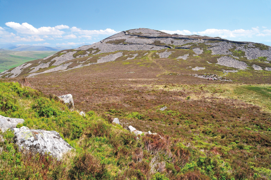
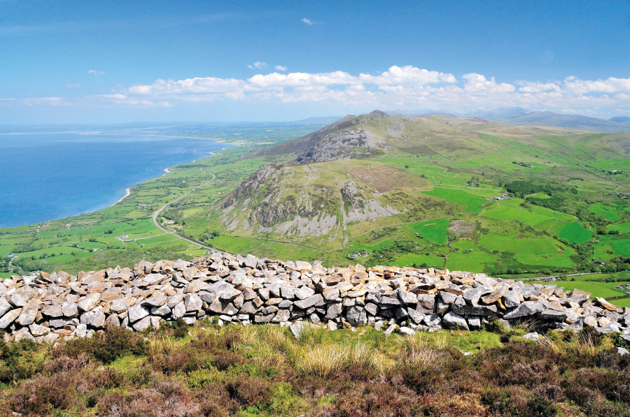
7: View looking back to Tre’r Ceiri on the climb to Garn Goch – the protective stone walls are clearly seen and this is one of the finest Iron Age forts in Europe.
Credit: Roger Butler
5. SH361457: Retrace steps to Bwlch yr Eifl, turn R and go through gate on R after 300m. Follow grass track out to promontory/viewpoint on the north side of Nant Gwrtheyrn – a steep unexpected valley tumbling down to the sea. Return to the gate and turn R on the main track.
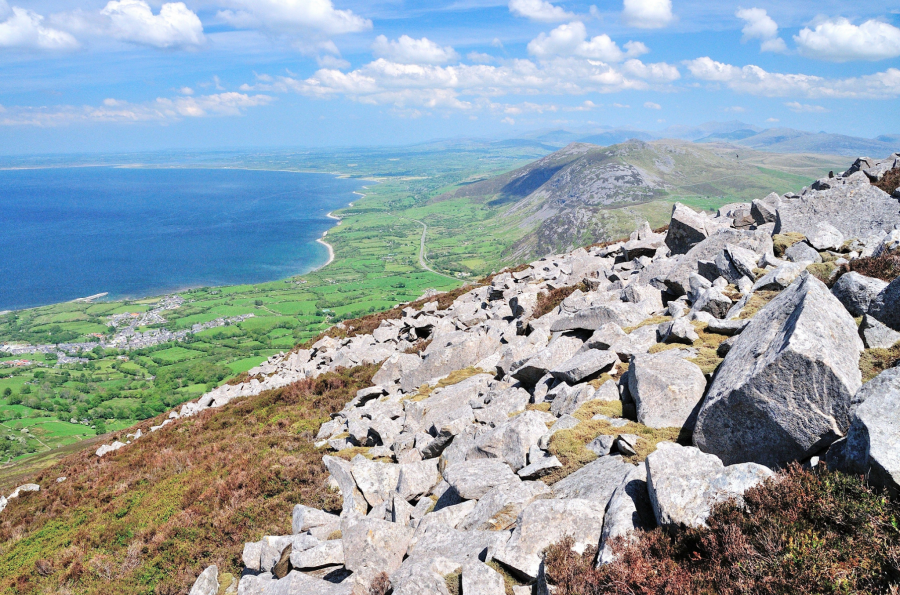
Glorious panorama looking east from the top of Garn Goch with the old quarrying village of Trevor on the left.
Credit: Roger Butler
6. SH357445: After 0.5km fork L on path across the moor. Keep ahead, then south-east, for 1km to return to the cottage above Llithfaen. Take the lane back into the village.
Further information
Public transport: Nearest station Pwllheli, with regular buses to Llithfaen – call 01758 720904 for times
Tourist Information: Pwllheli TIC, [email protected], 01758 612089
Discover more walks in Wales as mapped by The Great Outdoors’ expert contributors.


