
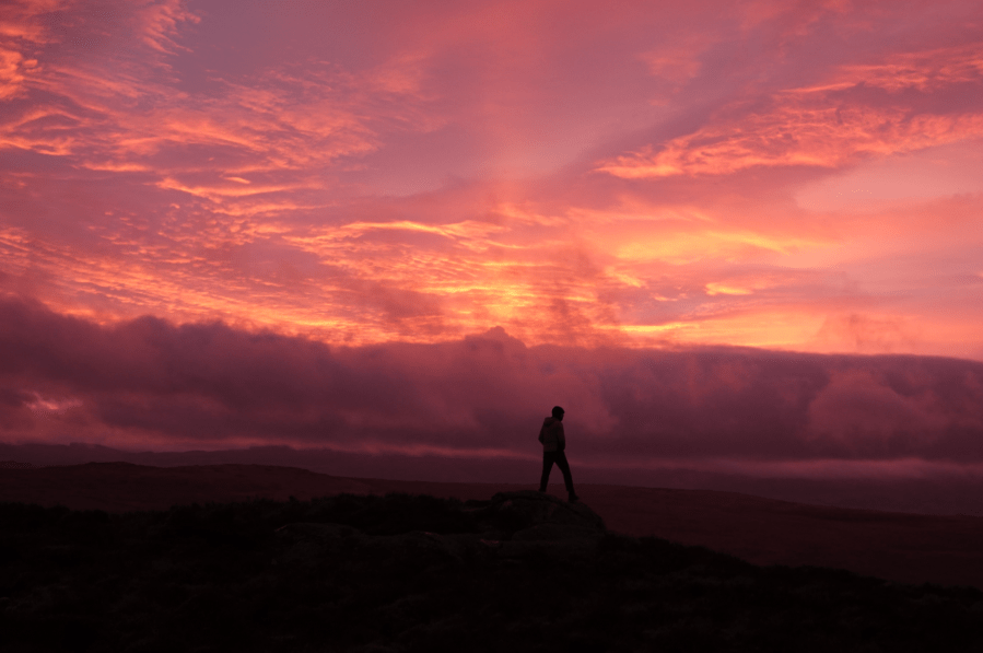
Featuring an overnight stay in the dinky-but-delightful Arenig Fawr bothy, this hike up Arenig Fawr is a quiet antidote to the crowds of the rest of Eryri National Park (Snowdonia), says James Forrest.
A night in a quaint bothy, a quiet hill to climb in the morning, escapism from the mayhem of Snowdonia’s honey-pot areas – this walk has a lot to offer. The Arenigs are a disparate mountain range to the north and west of Bala, a mix of grassy hills, vast bogs and sudden rocky terrain. They feel quiet and wild, and that is their appeal. Day hike options include a two-peak loop of extinct volcano Rhobell Fawr and its remote neighbour Dduallt, or an ascent of pudding-shaped Arenig Fach from Llyn Celyn, but perhaps the Arenigs’ best route is this one up Arenig Fawr.
The highest of the two Arenigs, 854m Fawr is the range’s grandest mountain, with a scenic ascent up its eastern ridge from the shores of Llyn Arenig Fawr. But this route’s real highlight is spending a night in Arenig Fawr bothy. Believed to have been built as a shelter for reservoir construction workers, this tiny stone structure can only sleep two (or three at a push), yet what it lacks in size it makes up for in charm. With the fire roaring and soup bubbling in your pot, it’s a place to relish in the back-to-basics magic of night in the heart of the mountains.
Arenig Fawr: route description
START/FINISH: The car park and layby off the A4212, at the western end of Llyn Celyn (GR: SH845403) | MAPS: OS Explorer OL18 (1:25k), OS Landranger 125 (1:50k), Harvey British Mountain Map Snowdonia South (1:40k) | DISTANCE: 16.5km / 10.3 miles | ASCENT: 682m / 2,238ft | DURATION: 5.5 hours
1. SH845403: From the car park, which has a toilet block, head to the A4212 and turn left. Walk south-west along the busy road, taking care to stick to the verge. At a fingerpost sign, turn left through a metal gate. Turn immediately right and, at a wider track, turn left. Pass a small outbuilding and cross the Afon Tryweryn at a grassy bridge. Beyond the bridge’s gate, head south on a good path following yellow arrow waymarks. Turn right on a grassy path heading south-west and go through a metal gate. Continue under pylons, following the waymarks, and arrive at the minor road at a gate. Turn left and take the road for 1km past a few houses. Turn sharply right and head south-west and then south-east on a wide, grassy track, which runs to the east of Llyn Arenig Fawr reservoir. Go through a gap in a wall and descend briefly to the small bothy next to the reservoir dam.
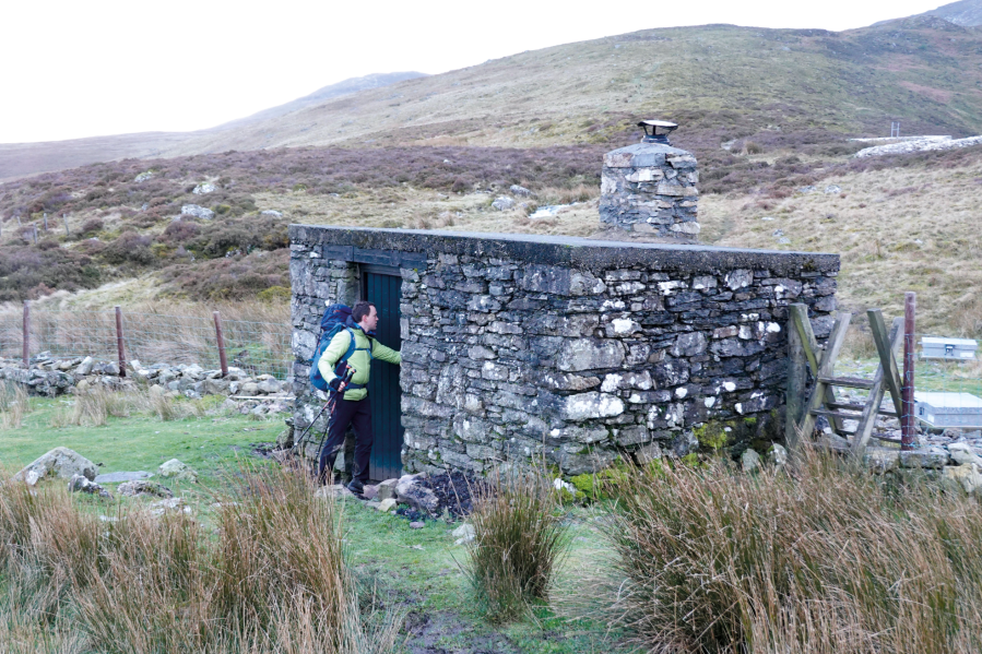
Arenig Fawr Bothy.
Credit: James Forrest
2. SH850379: Cross the ladder stile to the right of the bothy and pick up the path heading south-west. Cross the reservoir outflow at a plank conveniently placed across the stream and begin to ascend south-west towards Carreg Lefain. The good path is clear underfoot. Follow it as it veers west to Y Castell. Continue ascending west and then north-west, crossing a couple of fences as you go, and arrive at the col of Bwlch Blaen-y-nant to the west of a 684m spot height. Take the main, traversing path that ascends south-west, to the left of higher ground. The terrain is rocky and rugged, but never technical or exposed. Follow the path all the way to the trig pillar and war memorial plaque at the summit of Arenig Fawr.
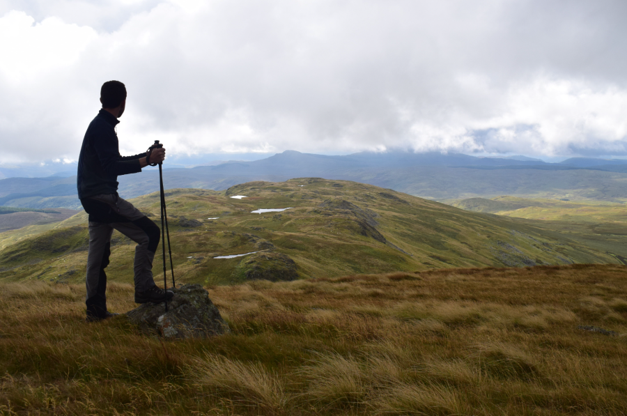
Looking south from near the summit of Arenig Fawr.
Credit: James Forrest
3. SH827369: Descend south to the col before Arenig Fawr’s south top. Cross a fence at a ladder stile and climb on the left of the fence to the cairned subsidiary summit. Ahead the fence-line provides an excellent handrail, especially in poor conditions, for the descent. Follow the fence south and south-west, passing a couple of small tarns and a 712m subsidiary top, and then cross the fence to pick up a better path on its right-hand side. As the fence swings south at SH824359, veer right away from it on a good path descending gently south-west. Cross an old dry stone wall and descend right to arrive at the col between Arenig Fawr and Moel LLyfnant.
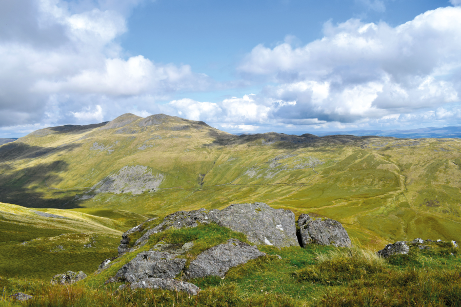
Views of Arenig Fawr from near Moel Llyfnant.
Credit: James Forrest
4. SH819354: Turn right on a wide grassy track and go through a gap in a dry stone wall. Descend gently north on the track, crossing a couple of small streams. Cross a ladder stile next to Nant y Pysgod stream and a ruined building. Continue north on the track, above the forest to the left, and arrive at the ruins at Amnodd-wen. Take the track, still bearing north, past a number of further ruins. Cross another ladder stile over a wall, pass a disused quarry and cross a further stile over a fence to arrive at the disused railway line next to a sheep pen. Turn right on a wide track, which runs parallel to the railway line, and head north-east to arrive at the minor road.
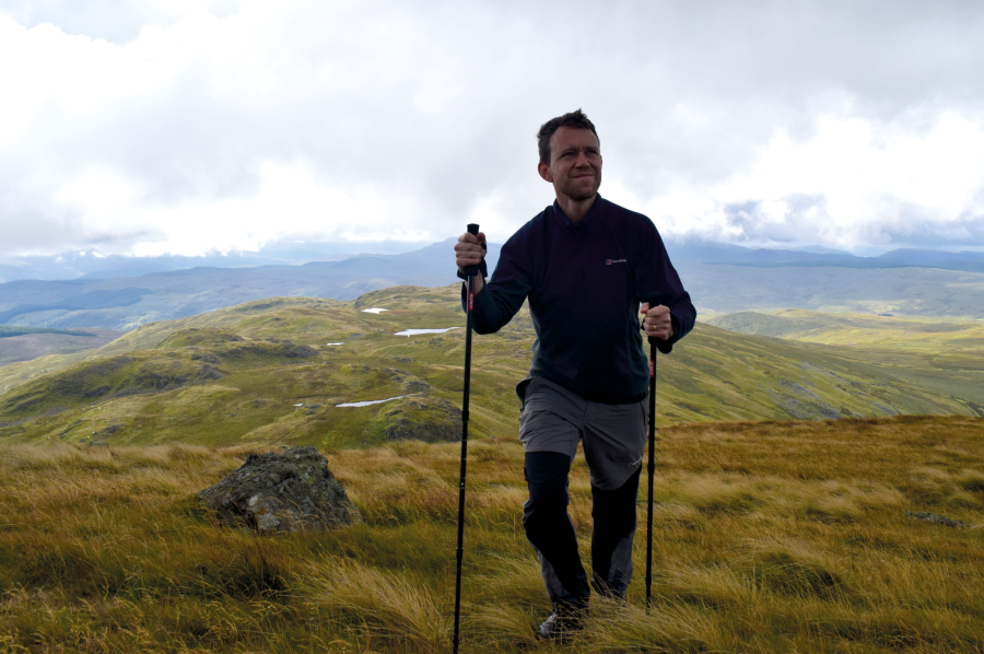
Hiking on Arenig Fawr.
Credit: James Forrest
5. SH822392: Turn right on the road heading due east. Pass Arenig Quarry and, beyond a few houses, reach a red telephone box. Continue east on the road and, just before the next house, turn left through a gate. Cross the old railway line, go under electricity pylons and head north across fields. Follow the yellow waymarks to re-trace your steps back towards the main road. Cross the grassy bridge and arrive at the A4212 beyond a gate. Turn right and walk north-east on the wide grassy verge back to the car park.
Further information
PUBLIC TRANSPORT: None
TOURIST INFORMATION: www.visitsnowdonia.info
Discover more walking routes in Wales, as mapped by The Great Outdoors’ expert contributors.


